Search results
Jump to navigation
Jump to search
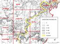
File:C605-Figure-08.jpg ...Coal reserves of southeastern Illinois: Illinois State Geological Survey, Circular 431, 25 p., 2 pl.</ref>) superimposed. ...f Pennsylvanian sand bodies in Illinois: Illinois State Geological Survey, Circular 339, 36 p., 3 pls.<br>(2,350 × 1,736 (1.52 MB)) - 16:42, 21 August 2023- ..., Sangamon County, district (Shaw and Savage, 1913, p. 3). The Harrisburg (No. 5) Coal Member (Shaw and Savage, 1912, p. 7) is named for Harrisburg, Sali ...ringfield Coal Member (V), and in western Kentucky, where it is called the No. 9 (Mulford) coal. It is correlated with the Summit coal in Missouri.3 KB (457 words) - 22:44, 18 February 2021
- ...is, the "Second Vein" (No. 5) coal in the La Salle area, and the Streator (No. 7) coal in the Streator area. ...ber. It is extensively mined in western Kentucky, where it is known as the No. 11 coal, and it is correlated with the Lexington coal in Missouri and the4 KB (600 words) - 16:20, 25 January 2017
- The Danville (No. 7) Coal Member of the Carbondale Formation (Bradley, 1870, p. 250-252), th ...called the Sparland (No. 7) coal in western Illinois and the "First Vein" (No. 7) coal in northern Illinois.2 KB (328 words) - 22:04, 24 January 2017
- ...nty. It was also applied incorrectly by Worthen (1870) to the Springfield (No. 5) Coal in parts of Fulton County. ...ssouri and Kansas, the Houchin Creek Coal Member (IVa) in Indiana, and the No. 8b coal in western Kentucky.2 KB (302 words) - 22:00, 25 January 2017
- ...the same exposure as the Hegeler Till Member, in the Harmattan Strip Mine No. 2 (SE SW SW 34, 20N-12W). ...ld glacial drift near Danville, Illinois: Illinois State Geological Survey Circular 457, 16 p.<br>1 KB (213 words) - 16:08, 4 January 2017
- ...nd southern Morgan and Sangamon Counties: Illinois State Geological Survey Circular 88,46 p.<br> ...nnsylvanian rocks of Illinois as of 1956: Illinois State Geological Survey Circular 217, 14 p.2 KB (203 words) - 20:10, 24 January 2017
- .... One sandstone is below the Herrin Coal, another is below the Briar Hill (No. 5A) Coal, and a third is associated with the Dykersburg Shale. The Vermil ...nnsylvanian rocks of Illinois as of 1956: Illinois State Geological Survey Circular 217, 14 p.2 KB (325 words) - 21:44, 25 January 2017
- ...the DeWitt-McLean County area, Illinois: Illinois State Geological Survey Circular 369, 16 p.<br> ...entral Illinois and its regional relationships: Journal of Geology, v. 53, no. 5, p. 349-359.<br>3 KB (461 words) - 16:15, 4 January 2017
- ...cuts through several underlying stratigraphic units, including the Herrin (No. 6) Coal. Some channels are only a few hundred feet across, but the major o ...nvil Rock Sandstone of southern Illinois: Illinois State Geological Survey Circular 256, 49 p.<br>3 KB (397 words) - 15:56, 25 January 2017
- ...LINSON and, H. V. LELAND, 1970, Studies of Lake Michigan bottom sediments- No. 1. Preliminary stratigraphy of unconsolidated sediments from the southwest ...R. RUCH, and N. F. SHIMP, 1971, Studies of Lake Michigan bottom sediments- No. 7. Distribution of mercury in unconsolidated sediments from southern Lake5 KB (681 words) - 21:23, 2 March 2018
- ...he Missourian Series, is named for Graham Chapel, Peoria County. The name "No. 8" was first given to this coal by Lesquereux (1866, p. 213) for an exposu It previously was called Trivoli (No. 8) coal (Wanless, 1931a, p. 181-182, 190, 192).2 KB (338 words) - 17:30, 24 January 2017
- ...uced the name “Summum cyclical formation” for the cycle that includes coal No. 4 in western Illinois. Through time, the name Summum became attached to th ...n as the No. 4 coal in Illinois, although the bed originally designated as No. 4 by Worthen (1868) probably is the Springfield Coal.3 KB (473 words) - 16:17, 9 February 2022
- The Danville (No. 7) Coal Member of the Carbondale Formation (Bradley, 1870, p. 250-252). ...called the Sparland (No. 7) coal in western Illinois and the "First Vein" (No. 7) coal in northern Illinois.3 KB (405 words) - 22:43, 24 January 2017
- The type section is in the Harmattan Strip Mine No. 2 (SE SW SW 34, 20N-12W). ...ld glacial drift near Danville, Illinois: Illinois State Geological Survey Circular 457, 16 p.1 KB (159 words) - 16:17, 4 January 2017
- ...9a, p. 20; 1926, p. 255). In Kentucky, this coal is now referred to as the No. 10 coal. ...nnsylvanian rocks of Illinois as of 1956: Illinois State Geological Survey Circular 217, 14 p.2 KB (297 words) - 21:46, 25 January 2017
- ...inois, but a sandstone commonly present a short distance below the Summum (No. 4) Coal throughout the Illinois Basin is probably equivalent to the Pleasa ...nnsylvanian rocks of Illinois as of 1956: Illinois State Geological Survey Circular 217, 14 p.<br>2 KB (293 words) - 16:15, 26 January 2017
- ...Coal Member of the Carbondale Formation, the lowest member, was designated No. 2 by Worthen (1866, p. 59) for the coal in a mine shaft at Highland, Madis The coal has also been called the La Salle (No. 2) Coal or the "Third Vein" coal in northern Illinois.3 KB (418 words) - 20:52, 26 January 2017
- ...ck Island (Worthen and Shaw, 1873, p. 221, 229-232), the name Rock Island (No. 1) Coal came into general use. In western Illinois the Rock Island (No. 1) Coal occurs only in widely scattered areas. It attains a maximum thickn3 KB (410 words) - 20:01, 27 January 2017
- ...cretion-gley, and the weathering profile: Illinois State Geological Survey Circular 295, 39 p.<br> ...eathered zones of the drift-sheets of Illinois: Journal of Geology, v. 38, no. 1, p. 28-53.<br>3 KB (484 words) - 22:23, 3 January 2017
- ...ege Section and adjacent exposures and Northwest Tollway borings No. 2 and No. 5 (Kempton, 1963, p. 38). The type section is in the Rock Valley College S ..., Glacial Tills of Northwestern Illinois: Illinois State Geological Survey Circular 437, 47 p.<br>5 KB (697 words) - 20:55, 12 January 2017
- ...utheastern Illinois and western Kentucky, it is continuous but is commonly no more than a few inches of very fossiliferous calcareous shale or impure lim ...ulinids. It is almost invariably present where the Springfield-Harrisburg (No. 5) Coal occurs, although the limestone and coal are generally separated by2 KB (346 words) - 21:49, 25 January 2017
- ...the DeWitt-McLean County area, Illinois: Illinois State Geological Survey Circular 369, 16 p.<br> ...entral Illinois and its regional relationships: Journal of Geology, v. 53, no. 5, p. 349-359.<br>4 KB (528 words) - 22:46, 12 January 2017
- ...nd southern Morgan and Sangamon Counties: Illinois State Geological Survey Circular 88, 46 p.1 KB (197 words) - 20:20, 24 January 2017
- The sandstone occurs above the Chapel (No. 8) Coal and below the Womac Coal (Andresen, 1961). ...Trivoli Sandstone in the Illinois Basin: Illinois State Geological Survey Circular 316, 31 p.<br>2 KB (211 words) - 17:25, 24 January 2017
- It is overlain by the underclay of the Danville (No. 7) Coal and underlain by a few feet of greenish gray shale that separates ...nnsylvanian rocks of Illinois as of 1956: Illinois State Geological Survey Circular 217, 14 p.2 KB (206 words) - 22:06, 24 January 2017
- ...) Coal reserves of southeastern Illinois: Illinois State Geological Survey Circular 431, 25 p.2 KB (238 words) - 21:50, 25 January 2017
- ...cuts through several underlying stratigraphic units, including the Herrin (No. 6) Coal. Some channels are only a few hundred feet across, but the major o ...nvil Rock Sandstone of southern Illinois: Illinois State Geological Survey Circular 256, 49 p.<br>4 KB (474 words) - 16:56, 25 January 2017
- ...nd southern Morgan and Sangamon Counties: Illinois State Geological Survey Circular 88,46 p.<br> ...nnsylvanian rocks of Illinois as of 1956: Illinois State Geological Survey Circular 217, 14 p.2 KB (276 words) - 20:48, 24 January 2017
- ...the same exposure as the Hegeler Till Member, in the Harmattan Strip Mine No. 2 (SE SW SW 34, 20N-12W). ...ld glacial drift near Danville, Illinois: Illinois State Geological Survey Circular 457, 16 p.<br>2 KB (287 words) - 22:42, 12 January 2017
- The Chapel (No. 8) Coal Member of the Modesto Formation (Kosanke et al., 1960, p. 38). It previously was called Trivoli (No. 8) coal (Wanless, 1931a, p. 181-182, 190, 192).3 KB (413 words) - 18:14, 24 January 2017
- ...nodules in the type locality, but in many exposures it exhibits little or no chert. ...n northeastern and northwestern Illinois: Illinois State Geological Survey Circular 479, 55 p.2 KB (249 words) - 20:42, 4 January 2017
- ...Coal of western Illinois, the Upper Block Coal Member of Indiana, and the No. 3 (Ice House) coal of western Kentucky. ...nnsylvanian rocks of Illinois as of 1956: Illinois State Geological Survey Circular 217, 14 p.<br>2 KB (266 words) - 16:05, 27 January 2017
- ...cretion-gley, and the weathering profile: Illinois State Geological Survey Circular 295, 39 p.<br> ...eathered zones of the drift-sheets of Illinois: Journal of Geology, v. 38, no. 1, p. 28-53.<br>4 KB (546 words) - 21:15, 12 January 2017
- ...e part of southern Illinois, but it is seldom over 2 feet thick, generally no more than a few inches. ...nnsylvanian rocks of Illinois as of 1956: Illinois State Geological Survey Circular 217, 14 p.2 KB (230 words) - 15:43, 27 January 2017
- ...widely present in Illinois 10-30 feet below the top of the formation, but no outcrops have been found (Meents and Swann, 1965), except recently in a qua ...imestone (Devonian) of southern Illinois: Illinois State Geological Survey Circular 389, 34 p.2 KB (265 words) - 17:34, 9 January 2017
- ...Coal of southern Illinois, the Upper Block Coal Member of Indiana, and the No. 3 (Ice House) coal of western Kentucky. ...nnsylvanian rocks of Illinois as of 1956: Illinois State Geological Survey Circular 217, 14 p.<br>2 KB (262 words) - 19:51, 27 January 2017
- ...coal” or “No. 6.” In addition, Lee revised the Dekoven to Western Kentucky No. 7, which is the current informal usage. Butts (1925) was the first author ...ucky. In Illinois, some authors called the Davis and Dekoven the No. 2 and No. 3 coals, respectively.8 KB (1,170 words) - 16:31, 9 February 2022
- ...in most of the state. It generally occurs immediately above the Danville (No. 7) Coal Member, but in several places a dark gray, very impure limestone, ...nnsylvanian rocks of Illinois as of 1956: Illinois State Geological Survey Circular 217, 14 p.2 KB (268 words) - 22:00, 24 January 2017
- ...Member (VI), which is an important commercial coal in Indiana, and to the No. 12 coal in western Kentucky. ...nnsylvanian rocks of Illinois as of 1956: Illinois State Geological Survey Circular 217, 14 p.2 KB (268 words) - 16:14, 25 January 2017
- The Modesto Formation includes strata from the top of the Danville (No. 7) Coal to the base of the Shoal Creek Limestone Member or the La Salle Li ...nd southern Morgan and Sangamon Counties: Illinois State Geological Survey Circular 88, 46 p.3 KB (469 words) - 15:44, 24 January 2017
- The Summum (No. 4) Coal, which also thickens in the same unfilled channels as the Kerton C ...nnsylvanian rocks of Illinois as of 1956: Illinois State Geological Survey Circular 217, 14 p.<br>2 KB (265 words) - 21:25, 15 February 2021
- ...optically stimulated luminescence dating: Illinois State Geological Survey Circular 580, 15 p. ...ege Section and adjacent exposures and Northwest Tollway borings No. 2 and No. 5 (Kempton, 1963, p. 38). The type section is in the Rock Valley College S7 KB (989 words) - 19:34, 12 October 2018
- ...ween two tills, subsequently correlated with the Kansan and Nebraskan, but no well developed zonal soil occurs between them. <br> No Afton Soil accretion-gleys have been observed in Illinois. Deposits of orga5 KB (797 words) - 16:19, 4 January 2017
- ...found, it is 15 feet above the Herrin Coal and 9 feet below the Danville (No. 7) Coal. ...nnsylvanian rocks of Illinois as of 1956: Illinois State Geological Survey Circular 217, 14 p.<br>2 KB (274 words) - 16:00, 25 January 2017
- ...ck Island (Worthen and Shaw, 1873, p. 221, 229-232), the name Rock Island (No. 1) Coal came into general use. In western Illinois the Rock Island (No. 1) Coal occurs only in widely scattered areas. It attains a maximum thickn4 KB (496 words) - 20:00, 27 January 2017
- ...ved to have been estuaries, and in those areas the underlying Rock Island (No. 1) Coal is also thicker than elsewhere. ...nnsylvanian rocks of Illinois as of 1956: Illinois State Geological Survey Circular 217, 14 p.<br>2 KB (295 words) - 16:24, 27 January 2017
- ...pted here as formal members. In extreme southern and southeastern Illinois no subdivision into members has as yet been proposed, but the Berry Clay Membe ..., Glacial Tills of Northwestern Illinois: Illinois State Geological Survey Circular 437, 47 p.<br>11 KB (1,564 words) - 22:23, 3 January 2017
- ...d and is commonly found throughout the same area as the underlying Chapel (No. 8) Coal, from which it is commonly separated by 1-2 feet of black fissile ...nnsylvanian rocks of Illinois as of 1956: Illinois State Geological Survey Circular 217, 14 p.<br>2 KB (277 words) - 17:28, 24 January 2017
- ...te. Macon, Sangamon, and Shelby Counties: Illinois State Geological Survey Circular 105, 57 p.<br>2 KB (303 words) - 15:52, 23 January 2017
- ...f southwestern Illinois the Piasa lies only a few feet above the Danville (No. 7) Coal and is separated from it by either variegated claystone, gray shal ...nnsylvanian rocks of Illinois as of 1956: Illinois State Geological Survey Circular 217, 14 p.2 KB (289 words) - 22:39, 24 January 2017
- No coal equivalent to the Hermon Coal has been recognized in southern Illinois ...nnsylvanian rocks of Illinois as of 1956: Illinois State Geological Survey Circular 217, 14 p.<br>2 KB (295 words) - 16:21, 27 January 2017
- ...he Beaverton, Byron West, Dixon Northwest, Grand Detour, and Meridian Road No. 3 Sections (Frye et al., 1969). ..., Glacial Tills of Northwestern Illinois: Illinois State Geological Survey Circular 437, 47 p.2 KB (299 words) - 20:56, 12 January 2017
- ...y of the Wisconsinan loesses of Illinois: Illinois State Geological Survey Circular 334, 55 p.<br> ...ation of Woodfordian loesses of Illinois: Illinois State Geological Survey Circular 427, 44 p.<br>6 KB (860 words) - 05:31, 28 December 2016
- ...tern part of its area the West Franklin is closely overlain by the Chapel (No. 8) Coal. ...nnsylvanian rocks of Illinois as of 1956: Illinois State Geological Survey Circular 217, 14 p.<br>2 KB (328 words) - 20:13, 24 January 2017
- ...k Railroad Cut Section, located 9.6 kilometers (6 mi) northwest of Morton. No longer exposed. ...Stage in the Lake Michigan Glacial Lobe: Illinois State Geological Survey Circular 285, 16 p.<br>5 KB (790 words) - 22:20, 3 January 2017
- ...by the Brereton Limestone or, locally, by either the Anna Shale or Herrin (No. 6) Coal. ...nnsylvanian rocks of Illinois as of 1956: Illinois State Geological Survey Circular 217, 14 p.<br>2 KB (314 words) - 15:58, 25 January 2017
- ...Roodhouse, in the NW¼ of sec. 21, T 12 N, R 11 W, Greene County, Illinois. No description has heretofore appeared in print. A composite section from the ...ly dull—with only fine bright streaks. Either cannel or very high in ash.” No details are available on the upper Roodhouse, which averaged about 2 ft (606 KB (894 words) - 16:17, 9 February 2022
- ...pted here as formal members. In extreme southern and southeastern Illinois no subdivision into members has as yet been proposed, but the Berry Clay Membe ..., Glacial Tills of Northwestern Illinois: Illinois State Geological Survey Circular 437, 47 p.<br>11 KB (1,623 words) - 21:14, 12 January 2017
- No type section was designated, but a quarry 0.8 mile east of Salem is conside ...Salem Limestone in southwestern Illinois: Illinois State Geological Survey Circular 284, 32p.<br>4 KB (576 words) - 15:27, 18 January 2017
- Friedman did not identify the borehole, and no record matching its location appears in the well-log database of the Indian ...le and Thompson 2004) and the Floris Formation in Iowa (Ravn et al. 1984). No formal names are used for such sandstone in the Appalachian Basin.9 KB (1,306 words) - 16:35, 9 February 2022
- The type section is in the Harmattan Strip Mine No. 2 (SE SW SW 34, 20N-12W). ...ld glacial drift near Danville, Illinois: Illinois State Geological Survey Circular 457, 16 p.2 KB (232 words) - 22:47, 12 January 2017
- ...th the identity of the Davis and Wiley Coals solidly established, there is no need to continue using two names for the same member. Because Davis has pri ...an stages in Iowa: Iowa Geological and Water Survey, Special Report Series No. 5, 140 p.<br>5 KB (713 words) - 16:31, 9 February 2022
- ...ian glacial boundary in western Illinois: Illinois State Geological Survey Circular 364, p. 28.<br> ...eology of the Vandalia, Illinois, region: Illinois State Geological Survey Circular 442, 24 p.<br>10 KB (1,522 words) - 22:46, 3 January 2017
- ...tan at the base, gray tan in the middle, and pink tan at the top. Although no changes in these members are made in this report (except removal of genetic ...miles (6.4 km) southeast of Roxana; good for lithology and lower contact. No longer available, has been mined out for fill.12 KB (1,822 words) - 22:20, 3 January 2017
- ...ween two tills, subsequently correlated with the Kansan and Nebraskan, but no well developed zonal soil occurs between them. <br> No Afton Soil accretion-gleys have been observed in Illinois. Deposits of orga6 KB (858 words) - 17:09, 4 January 2017
- ...Edgewood Formation, northeastern Illinois: Journal of Paleontology, v. 36, no. 6, p. 1383-1386; Illinois State Geological Survey Reprint 1963-A.<br> ...n northeastern and northwestern Illinois: Illinois State Geological Survey Circular 479, 55 p.3 KB (399 words) - 23:47, 4 January 2017
- ...trata from the base of the Pennsylvanian up to the base of the Colchester (No. 2) Coal, a widely recognized key member that has been traced throughout th ...issippian) surface in the Illinois Basin: Illinois State Geological Survey Circular 458, 14 p.<br>7 KB (1,108 words) - 21:46, 27 January 2017
- ...astern Illinois is bright-banded coal having a moderate sulfur content and no consistent clastic layers. ...he Robinson Branch Coal Bed of Missouri and Kansas (Figure 4-12). There is no named correlative in Iowa or the Appalachian Basin.7 KB (1,000 words) - 16:31, 9 February 2022
- ...st of these the till is distorted, and the quantity so small that there is no assurance that the till has not been transported. The high-level outwash gr ...near Winchester, Illinois: Geological Society of America Bulletin, v. 40, no. 2, p. 481-489.<br>4 KB (650 words) - 16:23, 4 January 2017
- ...e mine was active. However, upon closure, all the pits were backfilled and no bedrock exposures remain. ...et Mine (SW¼ NE¼ NE¼ sec. 6, T 10 S, R 4 E, Williamson County, ISGS county no. 23996, Crab Orchard 7.5' quadrangle). In the Morris core, the Will Scarlet8 KB (1,230 words) - 16:35, 9 February 2022
- ...A photograph on page 29 bears the caption, “The heavy sandstone below coal No. 5 (Vermilionville sandstone) outcropping along the big bend in Vermilion R Wanless (1956) and Kosanke et al. (1960) listed the locality. No description has been published, and none exists in ISGS field notes. In fac12 KB (1,630 words) - 16:15, 9 February 2022
- ...nd southern Morgan and Sangamon Counties: Illinois State Geological Survey Circular 88, 46 p.2 KB (270 words) - 21:27, 24 January 2017
- No longer exposed. ...Stage in the Lake Michigan Glacial Lobe: Illinois State Geological Survey Circular 285, 16 p.<br>6 KB (848 words) - 17:05, 1 January 2017
- The Modesto Formation includes strata from the top of the Danville (No. 7) Coal to the base of the Shoal Creek Limestone Member or the La Salle Li ...nd southern Morgan and Sangamon Counties: Illinois State Geological Survey Circular 88, 46 p.4 KB (541 words) - 16:53, 24 January 2017
- It is overlain by the underclay of the Danville (No. 7) Coal and underlain by a few feet of greenish gray shale that separates ...nnsylvanian rocks of Illinois as of 1956: Illinois State Geological Survey Circular 217, 14 p.2 KB (279 words) - 22:46, 24 January 2017
- ...tan at the base, gray tan in the middle, and pink tan at the top. Although no changes in these members are made in this report (except removal of genetic No longer available, has been mined out for fill.13 KB (1,881 words) - 17:23, 1 January 2017
- ...he partings become thicker and are shaly. In places the formation contains no chert, but scattered nodules are not rare, and in a zone 3-5 feet thick 15- ...n northeastern and northwestern Illinois: Illinois State Geological Survey Circular 479, 55 p.3 KB (418 words) - 22:30, 4 January 2017
- ...the granite and the rhyolite; it contains an abundance of micropegmatite. No mafic igneous rocks or metasediments have been encountered in the basement ..., 1965, Precambrian basement of Illinois: Illinois State Geological Survey Circular 382, 13 p.<br>6 KB (888 words) - 15:06, 30 September 2019
- The sandstone occurs above the Chapel (No. 8) Coal and below the Womac Coal (Andresen, 1961). ...Trivoli Sandstone in the Illinois Basin: Illinois State Geological Survey Circular 316, 31 p.<br>2 KB (285 words) - 18:01, 24 January 2017
- ...trata in northern Illinois have been correlated with the Guelph Formation, no Cayugan age strata are recognized in that area. However, the generally acce ...Cairo, La Center, and Thebes Quadrangles: Illinois State Geological Survey Circular 332, 39 p.<br>3 KB (416 words) - 19:57, 4 January 2017
- ...ian glacial boundary in western Illinois: Illinois State Geological Survey Circular 364, p. 28.<br> ...eology of the Vandalia, Illinois, region: Illinois State Geological Survey Circular 442, 24 p.<br>11 KB (1,578 words) - 22:33, 12 January 2017
- ..., Glacial tills of northwestern Illinois; Illinois State Geological Survey Circular 437, 47 p.<br> ...ian glacial boundary in western Illinois: Illinois State Geological Survey Circular 364, p. 28.<br>5 KB (773 words) - 22:14, 3 January 2017
- ...92) showed the Isabel sandstone lying directly below the underclay of coal No. 2 [Colchester] and filling a channel that cuts through several underlying No specific information has been published. The lower contact may be sharp but8 KB (1,087 words) - 16:30, 9 February 2022
- ...r thick deposits of the silty gray shale that locally overlies the Herrin (No. 6) Coal. In parts of southwestern, western, and eastern Illinois, the Brer ...nnsylvanian rocks of Illinois as of 1956: Illinois State Geological Survey Circular 217, 14 p.<br>3 KB (427 words) - 16:17, 25 January 2017
- ...criptions that include part or all of the Walshville Member are available, no core suitable for a type section has been preserved.<br> Moreover, no single well log fully characterizes the Walshville Member because the Walsh13 KB (2,002 words) - 16:39, 9 February 2022
- ...Coal of western Illinois, the Upper Block Coal Member of Indiana, and the No. 3 (Ice House) coal of western Kentucky. ...nnsylvanian rocks of Illinois as of 1956: Illinois State Geological Survey Circular 217, 14 p.<br>3 KB (340 words) - 17:31, 27 January 2017
- ...nodules in the type locality, but in many exposures it exhibits little or no chert. ...n northeastern and northwestern Illinois: Illinois State Geological Survey Circular 479, 55 p.2 KB (331 words) - 18:33, 11 January 2017
- ...bout 16 in. (39 cm) thick (Weller et al. 1942; Wanless 1957). The coal has no economic significance and has not been mapped. The coal is probably absent ...position of the Abingdon in the Midcontinent Basin is closely constrained, no exact equivalent has been identified (Figure 4-12).9 KB (1,279 words) - 16:30, 9 February 2022
- ...e part of southern Illinois, but it is seldom over 2 feet thick, generally no more than a few inches. ...nnsylvanian rocks of Illinois as of 1956: Illinois State Geological Survey Circular 217, 14 p.2 KB (308 words) - 16:59, 27 January 2017
- ...y, Illinois. Kosanke et al. (1960) formalized the unit name as the Summum (No. 4) Coal Member (of Carbondale Formation). Jacobson et al. (1985) adopted t ...the Indiana Geological Survey core facility in Bloomington under core file no. 609.13 KB (1,879 words) - 16:37, 9 February 2022
- ...Coal of southern Illinois, the Upper Block Coal Member of Indiana, and the No. 3 (Ice House) coal of western Kentucky. ...nnsylvanian rocks of Illinois as of 1956: Illinois State Geological Survey Circular 217, 14 p.<br>3 KB (335 words) - 20:50, 27 January 2017
- ...in most of the state. It generally occurs immediately above the Danville (No. 7) Coal Member, but in several places a dark gray, very impure limestone, ...nnsylvanian rocks of Illinois as of 1956: Illinois State Geological Survey Circular 217, 14 p.3 KB (341 words) - 22:21, 24 January 2017
- ...he Beaverton, Byron West, Dixon Northwest, Grand Detour, and Meridian Road No. 3 Sections (Frye et al., 1969). ..., Glacial Tills of Northwestern Illinois: Illinois State Geological Survey Circular 437, 47 p.3 KB (349 words) - 21:10, 12 January 2017
- Although the Neda rests sharply on the underlying Brainard Shale, there is no evidence of an unconformity. The upper contact, however, is sharp and erosi ...Science Transactions, v. 43, p. 176-182; Illinois State Geological Survey Circular 170, p. 176-182.3 KB (455 words) - 18:08, 7 December 2016
- ...Member (VI), which is an important commercial coal in Indiana, and to the No. 12 coal in western Kentucky. ...nnsylvanian rocks of Illinois as of 1956: Illinois State Geological Survey Circular 217, 14 p.3 KB (344 words) - 17:28, 25 January 2017
- ...to mention the Kerton Creek coal in print was Ekblaw (1931), who presented no details. Wanless (1957) made the first detailed description of the Kerton C6 KB (839 words) - 16:18, 9 February 2022
- ...found, it is 15 feet above the Herrin Coal and 9 feet below the Danville (No. 7) Coal. ...nnsylvanian rocks of Illinois as of 1956: Illinois State Geological Survey Circular 217, 14 p.<br>3 KB (346 words) - 17:19, 25 January 2017
- ...widely present in Illinois 10-30 feet below the top of the formation, but no outcrops have been found (Meents and Swann, 1965), except recently in a qua ...imestone (Devonian) of southern Illinois: Illinois State Geological Survey Circular 389, 34 p.3 KB (342 words) - 17:52, 11 January 2017
- No type section was designated. ...Salem Limestone in southwestern Illinois: Illinois State Geological Survey Circular 284, 32p.<br>5 KB (647 words) - 16:08, 18 January 2017
