Search results
Jump to navigation
Jump to search
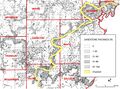
File:C605-Figure-08.jpg ...Coal reserves of southeastern Illinois: Illinois State Geological Survey, Circular 431, 25 p., 2 pl.</ref>) superimposed. ...f Pennsylvanian sand bodies in Illinois: Illinois State Geological Survey, Circular 339, 36 p., 3 pls.<br>(2,350 × 1,736 (1.52 MB)) - 16:42, 21 August 2023- ..., Sangamon County, district (Shaw and Savage, 1913, p. 3). The Harrisburg (No. 5) Coal Member (Shaw and Savage, 1912, p. 7) is named for Harrisburg, Sali ...ringfield Coal Member (V), and in western Kentucky, where it is called the No. 9 (Mulford) coal. It is correlated with the Summit coal in Missouri.3 KB (457 words) - 22:44, 18 February 2021
- ...is, the "Second Vein" (No. 5) coal in the La Salle area, and the Streator (No. 7) coal in the Streator area. ...ber. It is extensively mined in western Kentucky, where it is known as the No. 11 coal, and it is correlated with the Lexington coal in Missouri and the4 KB (600 words) - 16:20, 25 January 2017
- The Danville (No. 7) Coal Member of the Carbondale Formation (Bradley, 1870, p. 250-252), th ...called the Sparland (No. 7) coal in western Illinois and the "First Vein" (No. 7) coal in northern Illinois.2 KB (328 words) - 22:04, 24 January 2017
- ...nty. It was also applied incorrectly by Worthen (1870) to the Springfield (No. 5) Coal in parts of Fulton County. ...ssouri and Kansas, the Houchin Creek Coal Member (IVa) in Indiana, and the No. 8b coal in western Kentucky.2 KB (302 words) - 22:00, 25 January 2017
- ...the same exposure as the Hegeler Till Member, in the Harmattan Strip Mine No. 2 (SE SW SW 34, 20N-12W). ...ld glacial drift near Danville, Illinois: Illinois State Geological Survey Circular 457, 16 p.<br>1 KB (213 words) - 16:08, 4 January 2017
- ...nd southern Morgan and Sangamon Counties: Illinois State Geological Survey Circular 88,46 p.<br> ...nnsylvanian rocks of Illinois as of 1956: Illinois State Geological Survey Circular 217, 14 p.2 KB (203 words) - 20:10, 24 January 2017
- .... One sandstone is below the Herrin Coal, another is below the Briar Hill (No. 5A) Coal, and a third is associated with the Dykersburg Shale. The Vermil ...nnsylvanian rocks of Illinois as of 1956: Illinois State Geological Survey Circular 217, 14 p.2 KB (325 words) - 21:44, 25 January 2017
- ...the DeWitt-McLean County area, Illinois: Illinois State Geological Survey Circular 369, 16 p.<br> ...entral Illinois and its regional relationships: Journal of Geology, v. 53, no. 5, p. 349-359.<br>3 KB (461 words) - 16:15, 4 January 2017
- ...cuts through several underlying stratigraphic units, including the Herrin (No. 6) Coal. Some channels are only a few hundred feet across, but the major o ...nvil Rock Sandstone of southern Illinois: Illinois State Geological Survey Circular 256, 49 p.<br>3 KB (397 words) - 15:56, 25 January 2017
- ...LINSON and, H. V. LELAND, 1970, Studies of Lake Michigan bottom sediments- No. 1. Preliminary stratigraphy of unconsolidated sediments from the southwest ...R. RUCH, and N. F. SHIMP, 1971, Studies of Lake Michigan bottom sediments- No. 7. Distribution of mercury in unconsolidated sediments from southern Lake5 KB (681 words) - 21:23, 2 March 2018
- ...he Missourian Series, is named for Graham Chapel, Peoria County. The name "No. 8" was first given to this coal by Lesquereux (1866, p. 213) for an exposu It previously was called Trivoli (No. 8) coal (Wanless, 1931a, p. 181-182, 190, 192).2 KB (338 words) - 17:30, 24 January 2017
- ...uced the name “Summum cyclical formation” for the cycle that includes coal No. 4 in western Illinois. Through time, the name Summum became attached to th ...n as the No. 4 coal in Illinois, although the bed originally designated as No. 4 by Worthen (1868) probably is the Springfield Coal.3 KB (473 words) - 16:17, 9 February 2022
- The Danville (No. 7) Coal Member of the Carbondale Formation (Bradley, 1870, p. 250-252). ...called the Sparland (No. 7) coal in western Illinois and the "First Vein" (No. 7) coal in northern Illinois.3 KB (405 words) - 22:43, 24 January 2017
- The type section is in the Harmattan Strip Mine No. 2 (SE SW SW 34, 20N-12W). ...ld glacial drift near Danville, Illinois: Illinois State Geological Survey Circular 457, 16 p.1 KB (159 words) - 16:17, 4 January 2017
- ...9a, p. 20; 1926, p. 255). In Kentucky, this coal is now referred to as the No. 10 coal. ...nnsylvanian rocks of Illinois as of 1956: Illinois State Geological Survey Circular 217, 14 p.2 KB (297 words) - 21:46, 25 January 2017
- ...inois, but a sandstone commonly present a short distance below the Summum (No. 4) Coal throughout the Illinois Basin is probably equivalent to the Pleasa ...nnsylvanian rocks of Illinois as of 1956: Illinois State Geological Survey Circular 217, 14 p.<br>2 KB (293 words) - 16:15, 26 January 2017
- ...Coal Member of the Carbondale Formation, the lowest member, was designated No. 2 by Worthen (1866, p. 59) for the coal in a mine shaft at Highland, Madis The coal has also been called the La Salle (No. 2) Coal or the "Third Vein" coal in northern Illinois.3 KB (418 words) - 20:52, 26 January 2017
- ...ck Island (Worthen and Shaw, 1873, p. 221, 229-232), the name Rock Island (No. 1) Coal came into general use. In western Illinois the Rock Island (No. 1) Coal occurs only in widely scattered areas. It attains a maximum thickn3 KB (410 words) - 20:01, 27 January 2017
- ...cretion-gley, and the weathering profile: Illinois State Geological Survey Circular 295, 39 p.<br> ...eathered zones of the drift-sheets of Illinois: Journal of Geology, v. 38, no. 1, p. 28-53.<br>3 KB (484 words) - 22:23, 3 January 2017
- ...ege Section and adjacent exposures and Northwest Tollway borings No. 2 and No. 5 (Kempton, 1963, p. 38). The type section is in the Rock Valley College S ..., Glacial Tills of Northwestern Illinois: Illinois State Geological Survey Circular 437, 47 p.<br>5 KB (697 words) - 20:55, 12 January 2017
- ...utheastern Illinois and western Kentucky, it is continuous but is commonly no more than a few inches of very fossiliferous calcareous shale or impure lim ...ulinids. It is almost invariably present where the Springfield-Harrisburg (No. 5) Coal occurs, although the limestone and coal are generally separated by2 KB (346 words) - 21:49, 25 January 2017
- ...the DeWitt-McLean County area, Illinois: Illinois State Geological Survey Circular 369, 16 p.<br> ...entral Illinois and its regional relationships: Journal of Geology, v. 53, no. 5, p. 349-359.<br>4 KB (528 words) - 22:46, 12 January 2017
- ...nd southern Morgan and Sangamon Counties: Illinois State Geological Survey Circular 88, 46 p.1 KB (197 words) - 20:20, 24 January 2017
- The sandstone occurs above the Chapel (No. 8) Coal and below the Womac Coal (Andresen, 1961). ...Trivoli Sandstone in the Illinois Basin: Illinois State Geological Survey Circular 316, 31 p.<br>2 KB (211 words) - 17:25, 24 January 2017
- It is overlain by the underclay of the Danville (No. 7) Coal and underlain by a few feet of greenish gray shale that separates ...nnsylvanian rocks of Illinois as of 1956: Illinois State Geological Survey Circular 217, 14 p.2 KB (206 words) - 22:06, 24 January 2017
- ...) Coal reserves of southeastern Illinois: Illinois State Geological Survey Circular 431, 25 p.2 KB (238 words) - 21:50, 25 January 2017
- ...cuts through several underlying stratigraphic units, including the Herrin (No. 6) Coal. Some channels are only a few hundred feet across, but the major o ...nvil Rock Sandstone of southern Illinois: Illinois State Geological Survey Circular 256, 49 p.<br>4 KB (474 words) - 16:56, 25 January 2017
- ...nd southern Morgan and Sangamon Counties: Illinois State Geological Survey Circular 88,46 p.<br> ...nnsylvanian rocks of Illinois as of 1956: Illinois State Geological Survey Circular 217, 14 p.2 KB (276 words) - 20:48, 24 January 2017
- ...the same exposure as the Hegeler Till Member, in the Harmattan Strip Mine No. 2 (SE SW SW 34, 20N-12W). ...ld glacial drift near Danville, Illinois: Illinois State Geological Survey Circular 457, 16 p.<br>2 KB (287 words) - 22:42, 12 January 2017
- The Chapel (No. 8) Coal Member of the Modesto Formation (Kosanke et al., 1960, p. 38). It previously was called Trivoli (No. 8) coal (Wanless, 1931a, p. 181-182, 190, 192).3 KB (413 words) - 18:14, 24 January 2017
- ...nodules in the type locality, but in many exposures it exhibits little or no chert. ...n northeastern and northwestern Illinois: Illinois State Geological Survey Circular 479, 55 p.2 KB (249 words) - 20:42, 4 January 2017
- ...Coal of western Illinois, the Upper Block Coal Member of Indiana, and the No. 3 (Ice House) coal of western Kentucky. ...nnsylvanian rocks of Illinois as of 1956: Illinois State Geological Survey Circular 217, 14 p.<br>2 KB (266 words) - 16:05, 27 January 2017
- ...cretion-gley, and the weathering profile: Illinois State Geological Survey Circular 295, 39 p.<br> ...eathered zones of the drift-sheets of Illinois: Journal of Geology, v. 38, no. 1, p. 28-53.<br>4 KB (546 words) - 21:15, 12 January 2017
- ...e part of southern Illinois, but it is seldom over 2 feet thick, generally no more than a few inches. ...nnsylvanian rocks of Illinois as of 1956: Illinois State Geological Survey Circular 217, 14 p.2 KB (230 words) - 15:43, 27 January 2017
- ...widely present in Illinois 10-30 feet below the top of the formation, but no outcrops have been found (Meents and Swann, 1965), except recently in a qua ...imestone (Devonian) of southern Illinois: Illinois State Geological Survey Circular 389, 34 p.2 KB (265 words) - 17:34, 9 January 2017
- ...Coal of southern Illinois, the Upper Block Coal Member of Indiana, and the No. 3 (Ice House) coal of western Kentucky. ...nnsylvanian rocks of Illinois as of 1956: Illinois State Geological Survey Circular 217, 14 p.<br>2 KB (262 words) - 19:51, 27 January 2017
- ...coal” or “No. 6.” In addition, Lee revised the Dekoven to Western Kentucky No. 7, which is the current informal usage. Butts (1925) was the first author ...ucky. In Illinois, some authors called the Davis and Dekoven the No. 2 and No. 3 coals, respectively.8 KB (1,170 words) - 16:31, 9 February 2022
- ...in most of the state. It generally occurs immediately above the Danville (No. 7) Coal Member, but in several places a dark gray, very impure limestone, ...nnsylvanian rocks of Illinois as of 1956: Illinois State Geological Survey Circular 217, 14 p.2 KB (268 words) - 22:00, 24 January 2017
- ...Member (VI), which is an important commercial coal in Indiana, and to the No. 12 coal in western Kentucky. ...nnsylvanian rocks of Illinois as of 1956: Illinois State Geological Survey Circular 217, 14 p.2 KB (268 words) - 16:14, 25 January 2017
- The Modesto Formation includes strata from the top of the Danville (No. 7) Coal to the base of the Shoal Creek Limestone Member or the La Salle Li ...nd southern Morgan and Sangamon Counties: Illinois State Geological Survey Circular 88, 46 p.3 KB (469 words) - 15:44, 24 January 2017
- The Summum (No. 4) Coal, which also thickens in the same unfilled channels as the Kerton C ...nnsylvanian rocks of Illinois as of 1956: Illinois State Geological Survey Circular 217, 14 p.<br>2 KB (265 words) - 21:25, 15 February 2021
- ...optically stimulated luminescence dating: Illinois State Geological Survey Circular 580, 15 p. ...ege Section and adjacent exposures and Northwest Tollway borings No. 2 and No. 5 (Kempton, 1963, p. 38). The type section is in the Rock Valley College S7 KB (989 words) - 19:34, 12 October 2018
- ...ween two tills, subsequently correlated with the Kansan and Nebraskan, but no well developed zonal soil occurs between them. <br> No Afton Soil accretion-gleys have been observed in Illinois. Deposits of orga5 KB (797 words) - 16:19, 4 January 2017
- ...found, it is 15 feet above the Herrin Coal and 9 feet below the Danville (No. 7) Coal. ...nnsylvanian rocks of Illinois as of 1956: Illinois State Geological Survey Circular 217, 14 p.<br>2 KB (274 words) - 16:00, 25 January 2017
- ...ck Island (Worthen and Shaw, 1873, p. 221, 229-232), the name Rock Island (No. 1) Coal came into general use. In western Illinois the Rock Island (No. 1) Coal occurs only in widely scattered areas. It attains a maximum thickn4 KB (496 words) - 20:00, 27 January 2017
- ...ved to have been estuaries, and in those areas the underlying Rock Island (No. 1) Coal is also thicker than elsewhere. ...nnsylvanian rocks of Illinois as of 1956: Illinois State Geological Survey Circular 217, 14 p.<br>2 KB (295 words) - 16:24, 27 January 2017
- ...pted here as formal members. In extreme southern and southeastern Illinois no subdivision into members has as yet been proposed, but the Berry Clay Membe ..., Glacial Tills of Northwestern Illinois: Illinois State Geological Survey Circular 437, 47 p.<br>11 KB (1,564 words) - 22:23, 3 January 2017
- ...d and is commonly found throughout the same area as the underlying Chapel (No. 8) Coal, from which it is commonly separated by 1-2 feet of black fissile ...nnsylvanian rocks of Illinois as of 1956: Illinois State Geological Survey Circular 217, 14 p.<br>2 KB (277 words) - 17:28, 24 January 2017
- ...te. Macon, Sangamon, and Shelby Counties: Illinois State Geological Survey Circular 105, 57 p.<br>2 KB (303 words) - 15:52, 23 January 2017
