Search results
Jump to navigation
Jump to search
Page title matches
File:Figure M-37.jpg (1,089 × 1,609 (256 KB)) - 14:20, 4 April 2016
File:Figure M-29.jpg (1,794 × 3,419 (687 KB)) - 14:12, 4 April 2016
File:Figure M-8.jpg (1,085 × 1,561 (400 KB)) - 13:30, 4 April 2016
File:Figure M-40.jpg (1,065 × 1,454 (235 KB)) - 14:22, 4 April 2016
File:Figure M-19.jpg (1,088 × 1,279 (285 KB)) - 14:02, 4 April 2016
File:Figure M-1A.jpg (2,000 × 1,481 (736 KB)) - 18:44, 4 April 2016
File:Figure M-30.jpg (3,272 × 1,753 (891 KB)) - 14:14, 4 April 2016
File:Figure M-9.jpg (1,089 × 1,515 (259 KB)) - 13:53, 4 April 2016
File:Figure M-41.jpg (1,080 × 1,422 (249 KB)) - 14:23, 4 April 2016
File:Figure M-20.jpg (1,077 × 1,431 (248 KB)) - 14:03, 4 April 2016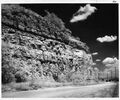
File:Figure M-1B.jpg (2,000 × 1,664 (653 KB)) - 18:47, 4 April 2016
File:Figure M-31.jpg (1,075 × 1,459 (219 KB)) - 14:15, 4 April 2016
File:Figure M-10.jpg (1,094 × 1,585 (362 KB)) - 13:54, 4 April 2016
File:Figure M-42.jpg (1,074 × 1,408 (226 KB)) - 14:24, 4 April 2016
File:Figure M-21.jpg (1,068 × 1,361 (253 KB)) - 14:04, 4 April 2016
File:Figure M-1C.jpg (1,588 × 2,000 (902 KB)) - 18:50, 4 April 2016
File:Figure M-32.jpg (1,108 × 2,288 (299 KB)) - 14:17, 4 April 2016
File:Figure M-11.jpg (1,084 × 1,301 (182 KB)) - 13:55, 4 April 2016
File:Figure M-43.jpg (1,057 × 1,411 (228 KB)) - 14:24, 4 April 2016
File:Figure M-22.jpg (1,085 × 1,630 (378 KB)) - 14:05, 4 April 2016


Page text matches
- ...ther information. A revised map of the channel ([[:File:C605-Figure-35.jpg|Figure 35]]) is based on newly available data from active mines and boreholes. In ...style="display: inline-block;">[[File:C605-Figure-34.jpg|500px|{{File:C605-Figure-34.jpg}}|thumb]]</li>10 KB (1,463 words) - 19:24, 23 August 2023
File:C605-Figure-09.jpg |File name=C605-Figure-09.jpg |image_no=Figure 9(1,578 × 1,585 (969 KB)) - 15:54, 11 July 2020
File:Penn caseyville 2-6.jpg Figure 2-6. Graphic section at the Sellers Landing locality. Compiled from field n(1,587 × 2,727 (886 KB)) - 16:19, 20 July 2020
File:C605-Figure-27.jpg |File name=C605-Figure-27.jpg |image_no=Figure 27(1,418 × 1,307 (196 KB)) - 15:59, 17 August 2023- ...ay: inline-block;"> [[File:C605-Figure-04.jpg|thumb|left|500px|{{File:C605-Figure-04.jpg}}]]</li> ...profile is characteristic on resistivity logs ([[:File:C605-Figure-05a.jpg|Figure 5a]]). The Houchin Creek evidently represents an ''in situ'' peat deposit t2 KB (312 words) - 20:47, 23 August 2023
- ...resented a schematic representation of the “Mazonian delta complex” (their figure 15) showing what appears to be thick peat filling an abandoned distributary A generalized columnar section of the Cardiff area (Figure 4-37) is based on drilling records from the Cardiff Coal Company, circa 1989 KB (1,304 words) - 16:30, 9 February 2022
- ...ified by very high readings on gamma-ray logs ([[:File:C605-Figure-05b.jpg|Figure 5]]) and low readings on density and neutron logs. ...style="display: inline-block;">[[File:C605-Figure-04.jpg|500px|{{File:C605-Figure-04.jpg}}|thumb]]</li>3 KB (509 words) - 20:54, 23 August 2023
- The Danville (Figures [[:File:C605-Figure-02.jpg|2]] and [[:File:C605-Figure-40.jpg|40]]) is the next major coal bed above the Baker. It is the youngest ...style="display: inline-block;">[[File:C605-Figure-02.jpg|500px|{{File:C605-Figure-02.jpg}}|thumb]]</li>3 KB (494 words) - 15:11, 23 August 2023
File:Penn carbondale 4-13.jpg |Caption=Figure 4-13. Graphic log of the upper part of the Kentucky Geological Survey’s(1,059 × 3,660 (466 KB)) - 21:07, 26 January 2021- ...h lies near its course. Comparing Potter’s map ([[:File:C605-Figure-30.jpg|Figure 30]]) with those of Hopkins (1968)<ref>Hopkins, M.E., 1968, Harrisburg (No. ...style="display: inline-block;">[[File:C605-Figure-01.jpg|500px|{{File:C605-Figure-01.jpg}}|thumb]]</li>7 KB (979 words) - 19:20, 23 August 2023
- ...Oraville channel (Figures [[:File:C605-Figure-39.jpg|39]] and [[:File:C605-Figure-47.jpg|47]]). In fact, coal of mineable thickness (up to 8.2 ft [2.5 m]) is ...style="display: inline-block;">[[File:C605-Figure-39.jpg|500px|{{File:C605-Figure-39.jpg}}|thumb]]</li>3 KB (504 words) - 20:15, 23 August 2023
- ...nklin, Hamilton, Saline, and Gallatin Counties ([[:File:C605-Figure-08.jpg|Figure 8]]). Widths are in the range of 0.6 to 1.9 mi (1 to 3 km). Portions appear ...style="display: inline-block;">[[File:C605-Figure-08.jpg|500px|{{File:C605-Figure-08.jpg}}|thumb]]</li>3 KB (493 words) - 19:38, 23 August 2023
File:Penn caseyville 2-8.jpg Figure 2-8. Photograph of the Pounds Sandstone in Garden of the Gods State Park (S(2,201 × 2,002 (4.3 MB)) - 21:37, 24 November 2020- Figure M-1B.jpg|{{file:Figure M-1B.jpg}} Figure M-1D.jpg|{{file:Figure M-1D.jpg}}3 KB (473 words) - 15:25, 18 January 2017
File:Penn carbondale 4-80.jpg |Caption=Figure 4-80. Thin lens of Energy Shale truncated with an angular contact by the o(2,441 × 1,741 (1.54 MB)) - 21:38, 4 January 2021- Figure P-2.jpg|{{file:Figure P-2.jpg}} Figure P-5.jpg|{{file:Figure P-5.jpg}}3 KB (397 words) - 21:41, 2 March 2018
- Figure P-16.jpg|{{file:Figure P-16.jpg}} Figure P-2.jpg|{{file:Figure P-2.jpg}}3 KB (441 words) - 22:23, 19 January 2017
- ...ay: inline-block;"> [[File:C605-Figure-04.jpg|thumb|left|500px|{{File:C605-Figure-04.jpg}}]]</li> ...grades downward to siltstone or silty mudstone ([[:File:C605-Figure-09.jpg|Figure 9]]). All except the uppermost 1.0 to 2.0 ft (0.3 to 0.6 m) is generally ca4 KB (633 words) - 16:27, 23 August 2023
File:Penn carbondale 4-20.jpg |Caption=Figure 4-20. Field sketch by W.J. Nelson (1983) illustrating apparent splitting o(2,391 × 1,614 (778 KB)) - 21:44, 22 December 2020- Figure 14.jpg|{{file:Figure 14.jpg}} Figure P-3D.jpg|{{file:Figure P-3D.jpg}}3 KB (482 words) - 22:16, 19 January 2017


