Historical:Mifflin Formation
Lithostratigraphy: Ottawa Limestone Megagroup >>Platteville Group >>Plattin Subgroup >>Mifflin Formation
Chronostratigraphy: Paleozoic Erathem >>Ordovician System >>Champlainian Series >>Blackriveran Stage
Allostratigraphy: Tippecanoe Sequence
Authors
H. B. Willman and T. C. Buschbach
Name Origin
The Mifflin Formation (Bays, 1938, p. 269) is named for Mifflin, Iowa County, Wisconsin, just west of the type section.
Type Section
The type section of the Mifflin Formation consists of a roadcut and bluff on the east side of the Pecatonica River (NE NE NE 34, 5N-1E), where it is 17.8 feet thick.
Correlation
The Mifflin Formation is the lower, shaly part of the McGregor Limestone north of Illinois, and is correlated with strata in the upper part of the Camp Nelson Formation in Kentucky, the lower part of the Lebanon Limestone in Tennessee, and with the upper part of the lower division of the Lowville Limestone in New York.
Extent and Thickness
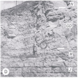
The Mifflin Formation is exposed widely in north-central Illinois and in a small area at West Point Landing in Calhoun County (fig. O-2D). It is commonly 15-25 feet thick in the northern area, but it thickens to 120 feet in subsurface in southern Illinois.
Description
The Mifflin is a widespread. thin-bedded, relatively shaly limestone overlying the thick-bedded, generally more dolomitic Pecatonica Formation and underlying the medium-bedded, less shaly Grand Detour Formation. The Mifflin Formation is dominantly gray, lithographic limestone, most of it thin bedded and shaly. Locally it grades to shaly fine-grained dolomite in the northern outcrop area and to sandy shale and sandstone in extreme western Illinois. The shale partings in the Mifflin are gray to green, in contrast to the generally brownish gray to red-brown partings in the Grand Detour. In the northern outcrop area the Mifflin is characterized by a persistent, massive, middle unit, and in Calhoun County and farther south it has a distinctive oolite in the lower part that is widely recognized in subsurface. The oolite forms the top of the Rock Levee Formation in Missouri. The Mifflin is differentiated into five members: the Blomeyer (at the base), is argillaceous; the Brickeys is pure; the Establishment is argillaceous: the Hazelwood is pure; and the Briton (at the top) is argillaceous. In the northern outcrop area the Blomeyer, Brickeys, and Establishment Members are thin and differ only slightly in claycontent. Where these units are not differentiated, they are combined as the lower shaly unit and assigned to the Establishment Member. The Mifflin then consists of a three fold (shaly, massive, shaly) sequence.
Fossils
The Mifflin is the most fossiliferous formation in the Platteville Group, containing an abundant and varied brachiopod, molluscan, and bryozoan fauna.
References
BAYS, C. A., 1938, Stratigraphy of the Platteville Formation (abstract): Geological Society of America Proceedings, 1937, p. 269.
ISGS Codes
| Stratigraphic Code | Geo Unit Designation |
|---|---|

