Historical:Chapin Soil
Lithostratigraphy: Chapin Soil
Chronostratigraphy: Cenozoic Erathem >>Quaternary System >>Pleistocene Series
Authors
H. B. Willman and John C. Frye
Name origin
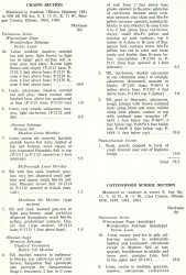
The Chapin Soil is herein named for Chapin, Morgan County, from its occurrence in the Chapin Section (table 6), NW SE NE Sec. 8, T. 15 N., R. 11 W.
Stratigraphic relationships
The Chapin Soil is the first soil above the Sangamon Soil and is developed in the thin Markham Silt Member of the Roxana Silt. Along the Illinois (Ancient Mississippi) Valley, the Markham Member contains some contemporaneous loess, which makes the Chapin Soil distinguishable mineralogically as well as morphologically from the underlying Sangamon Soil. However, along the Mississippi Valley of west-central Illinois (as well as in eastern Iowa where it has been called "upper story Sangamon"), the Markham Member is composed largely of colluvium derived from the surface of the Sangamon Soil and there is no mineralogical differentiation (only morphologic and color differences) between the Chapin and the Sangamon Soil below.
At most localities the B2-zone of the Chapin rests upon the Sangamon Soil.
Extent and thickness
Although the Markham Silt Member is commonly less than 1.5 feet thick, the Chapin Soil is strongly developed, and in some places the B2-zone rests on the A-zone or truncated B2-zone of the Sangamon Soil below.
Lithology
It is an in-situ profile developed in silt and colluvium overlying the Sangamon Soil, and the mineralogy has been described in the Chapin and Cottonwood School Sections (table 6) and in the Browns Mound, Hillview, Hipple School, Literberry, Reliance Whiting Quarry, Varna (table 7), and other sections. It generally is distinctly less red than the underlying Sangamon Soil, but at no locality has a calcareous zone been observed between the Chapin Soil and the Sangamon Soil.
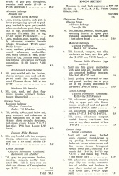
| Table 6 -- Stratigraphic Sections (partial) The following 21 stratigraphic sections describe exposures in Illinois and illustrate many of the aspects of Pleistocene stratigraphy. These sections contain the type localities for 21 rock-stratigraphic units, 4 soil-stratigraphic units, and 3 time-stratigraphic units and include paratypes for several other units. The sample numbers preceded by "P" are the numbers used in the Illinois State Geological Survey collections. Analytical data on many of these samples are on file at the Survey. The sections are arrange alphabetically by name. |
Age and correlation
Even though the rock-stratigraphic unit in which the Chapin Soil is developed is quite thin, this soil has stratigraphic significance because it furnishes the only datum for correlation within the early part of the Altonian Substage. It is also the most strongly developed soil within the Wisconsinan Stage, and it serves as an important paleoecological indicator for early Altonian time.
ISGS Codes
| Stratigraphic Code | Geo Unit Designation |
|---|---|


