Radnor Till Member
Lithostratigraphy: Glasford Formation >>Radnor Till Member
Chronostratigraphy: Cenozoic Erathem >>Quaternary System >>Pleistocene Series
Primary source
Willman, H. B., and John C. Frye, 1970, Pleistocene Stratigraphy of Illinois: Illinois State Geological Survey Bulletin 94, 204 p.
Contributing author(s)
H. B. Willman and John C. Frye
Name
Original description
Radnor Till Member, Glasford Formation (William and Frye 1970).
Derivation
The Radnor Till Member of the Glasford Formation is named for Radnor Township, Peoria County.
Other names
History/background
Type section
Type location
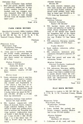
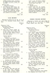
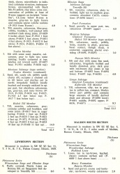
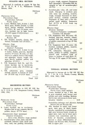
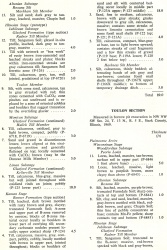
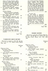
The Radnor Till is described from roadcut exposures in the Jubilee College Section (table 6), SW SW SW Sec. 7, T. 10 N., R. 7 E. It is also described in the Farm Creek, Tindall School, and Toulon Sections (table 6).
| Table 6 -- Stratigraphic Sections (partial) The following 21 stratigraphic sections describe exposures in Illinois and illustrate many of the aspects of Pleistocene stratigraphy. These sections contain the type localities for 21 rock-stratigraphic units, 4 soil-stratigraphic units, and 3 time-stratigraphic units and include paratypes for several other units. The sample numbers preceded by "P" are the numbers used in the Illinois State Geological Survey collections. Analytical data on many of these samples are on file at the Survey. The sections are arrange alphabetically by name. |
Type author(s)
Type status
Reference section
Reference location
Reference author(s)
Reference status
Stratigraphic relationships
In the type section the Radnor Till is bounded at the top by the top of the Sangamon Soil. It is overlain by Roxana Silt and it rests on the Toulon Member. The Radnor Till Member may be a stratigraphic equivalent of the Sterling Till Member of northern Illinois but is geographically separated from it by the Green River Lobe.
Extent and thickness
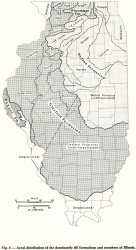
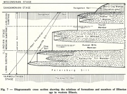
Its geographic distribution is shown in figure 6 and its spatial relations are shown diagrammatically in figure 7.
Lithology
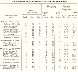
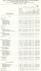
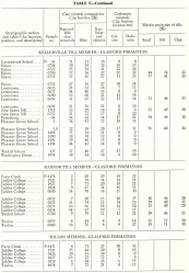
The Radnor Till is gray, compact, silty, and high in illite content. Its matrix grain size and composition of clay minerals are given in tables 2 and 5, and its heavy mineral analyses are summarized in table 4.
|
Core(s)
Photograph(s)
Contacts
Well log characteristics
Fossils
Age and correlation
It is in the Jubileean Substage of the Illinoian Stage and was deposited by the Lake Michigan Lobe.
Environments of deposition
Economic importance
Remarks
References
ISGS Codes
| Stratigraphic Code | Geo Unit Designation |
|---|---|
