File:C605-Figure-08.jpg
Jump to navigation
Jump to search

Size of this preview: 800 × 591 pixels. Other resolution: 2,350 × 1,736 pixels.
Original file (2,350 × 1,736 pixels, file size: 1.52 MB, MIME type: image/jpeg)
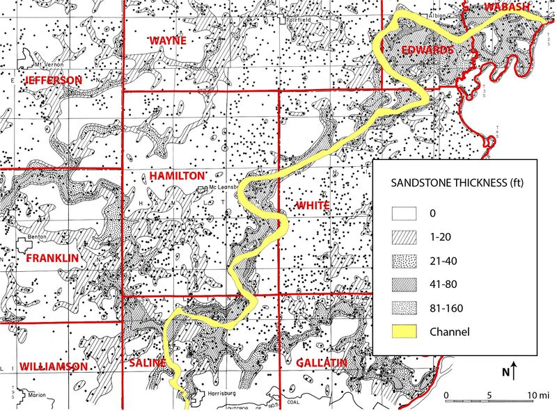
Figure 8 Map from Potter (1962)[1], showing the thickness (in feet) of sandstone between the Houchin Creek and Springfield Coals, with the Galatia channel (from Hopkins 1968[2]) superimposed.
- ↑ Potter, P.E., 1962, Shape and distribution patterns of Pennsylvanian sand bodies in Illinois: Illinois State Geological Survey, Circular 339, 36 p., 3 pls.
- ↑ Hopkins, M.E., 1968, Harrisburg (No. 5) Coal reserves of southeastern Illinois: Illinois State Geological Survey, Circular 431, 25 p., 2 pl.
File history
Click on a date/time to view the file as it appeared at that time.
| Date/Time | Thumbnail | Dimensions | User | Comment | |
|---|---|---|---|---|---|
| current | ★ Approved revision 14:28, 9 July 2020 | | 2,350 × 1,736 (1.52 MB) | Alan.Myers (talk | contribs) |
You cannot overwrite this file.
File usage
The following 5 pages use this file: