File:Penn carbondale 4-65.jpg
Jump to navigation
Jump to search

Size of this preview: 448 × 599 pixels. Other resolution: 2,078 × 2,779 pixels.
Original file (2,078 × 2,779 pixels, file size: 766 KB, MIME type: image/jpeg)
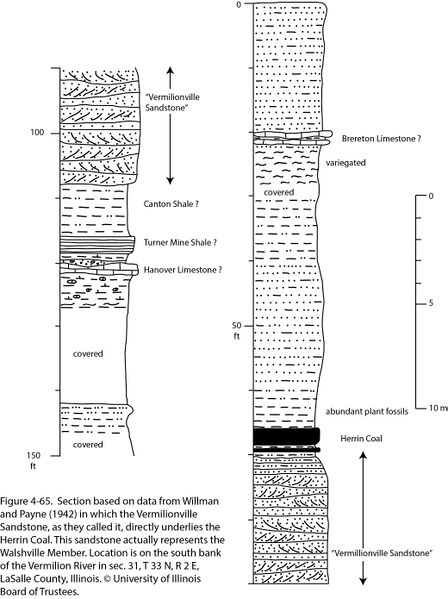
Figure 4-65. Section based on data from Willman and Payne (1942) in which the Vermilionville Sandstone, as they called it, directly underlies the Herrin Coal. This sandstone actually represents the Walshville Member. Location is on the south bank of the Vermilion River in sec. 31, T 33 N, R 2 E, LaSalle County, Illinois. © University of Illinois Board of Trustees.
File history
Click on a date/time to view the file as it appeared at that time.
| Date/Time | Thumbnail | Dimensions | User | Comment | |
|---|---|---|---|---|---|
| current | ★ Approved revision 22:02, 23 December 2020 | | 2,078 × 2,779 (766 KB) | Jennifer.Obrad (talk | contribs) |
You cannot overwrite this file.
File usage
The following 2 pages use this file: