File:Penn caseyville 2-1.jpg
Jump to navigation
Jump to search

Size of this preview: 463 × 599 pixels. Other resolution: 2,551 × 3,300 pixels.
Original file (2,551 × 3,300 pixels, file size: 10.33 MB, MIME type: image/jpeg)
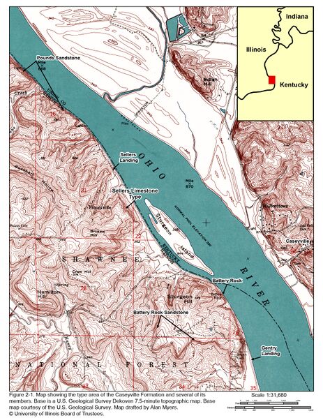
Figure 2-1. Map showing the type area of the Caseyville Formation and several of its members. Base is a U.S. Geological Survey Dekoven 7.5-minute topographic map. Base map courtesy of the U.S. Geological Survey. Map drafted by Alan Myers. © University of Illinois Board of Trustees.
File history
Click on a date/time to view the file as it appeared at that time.
| Date/Time | Thumbnail | Dimensions | User | Comment | |
|---|---|---|---|---|---|
| current | ★ Approved revision 16:12, 20 July 2020 | | 2,551 × 3,300 (10.33 MB) | Jennifer.Obrad (talk | contribs) |
You cannot overwrite this file.
File usage
The following 4 pages use this file: