File:Penn carbondale 4-57.jpg
Jump to navigation
Jump to search


Size of this preview: 451 × 599 pixels. Other resolution: 2,483 × 3,300 pixels.
Original file (2,483 × 3,300 pixels, file size: 2.85 MB, MIME type: image/jpeg)
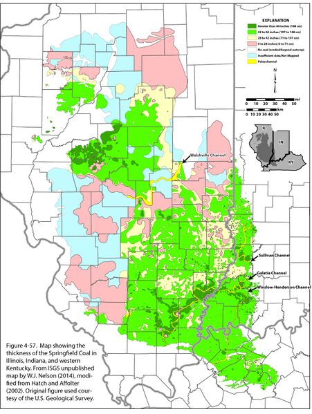
Figure 4-57. Map showing the thickness of the Springfield Coal in Illinois, Indiana, and western Kentucky. From ISGS unpublished map by W.J. Nelson (2014), modified from Hatch and Affolter (2002). Original figure used courtesy of the U.S. Geological Survey.
File history
Click on a date/time to view the file as it appeared at that time.
| Date/Time | Thumbnail | Dimensions | User | Comment | |
|---|---|---|---|---|---|
| current | ★ Approved revision 21:02, 23 December 2020 | | 2,483 × 3,300 (2.85 MB) | Jennifer.Obrad (talk | contribs) |
You cannot overwrite this file.
File usage
The following 2 pages use this file: