File:Figure M-30.jpg
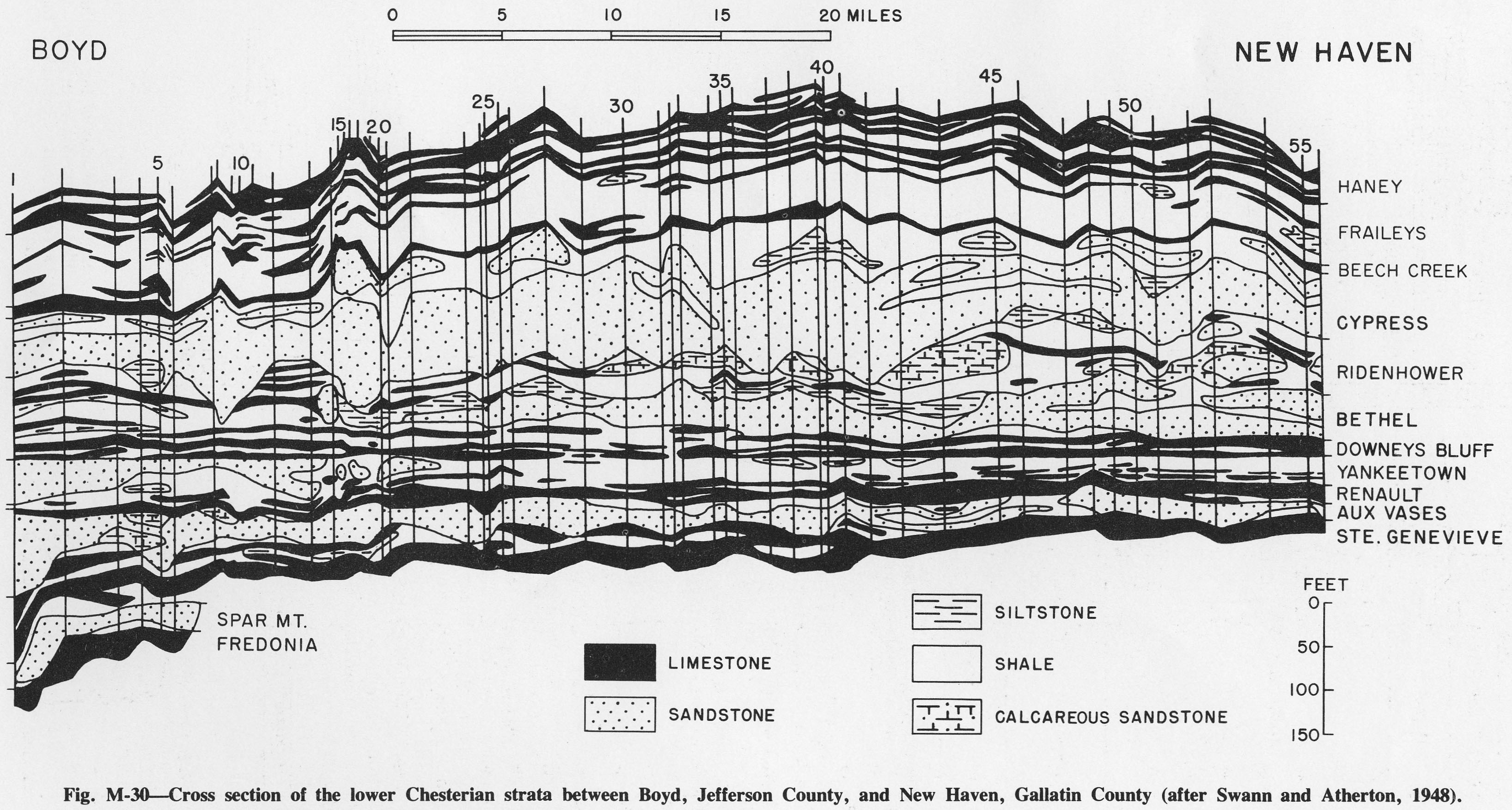
Revision as of 14:14, 4 April 2016 by Alan.Myers (talk | contribs) (Fig. M-30 -- Cross section of the lower Chesterian strata between Boyd, Jefferson County, and New Haven, Gallatin County (after Swann and Atherton, 1948).)
Size of this preview: 800 × 429 pixels. Other resolution: 3,272 × 1,753 pixels.
Original file (3,272 × 1,753 pixels, file size: 891 KB, MIME type: image/jpeg)
Fig. M-30 -- Cross section of the lower Chesterian strata between Boyd, Jefferson County, and New Haven, Gallatin County (after Swann and Atherton, 1948).
File history
Click on a date/time to view the file as it appeared at that time.
| Date/Time | Thumbnail | Dimensions | User | Comment | |
|---|---|---|---|---|---|
| current | ★ Approved revision 14:14, 4 April 2016 | | 3,272 × 1,753 (891 KB) | Alan.Myers (talk | contribs) | Fig. M-30 -- Cross section of the lower Chesterian strata between Boyd, Jefferson County, and New Haven, Gallatin County (after Swann and Atherton, 1948). |
You cannot overwrite this file.
File usage
The following 2 pages use this file: