File:C605-Plate 6 - Leslie Cemetery Channel Xsec map.jpg: Difference between revisions
Jump to navigation
Jump to search
Alan.Myers (talk | contribs) No edit summary |
Alan.Myers (talk | contribs) m (ILSTRAT moved page File:Plate 6 - Leslie Cemetery Channel Xsec map.jpg to File:C605-Plate 6 - Leslie Cemetery Channel Xsec map.jpg without leaving a redirect) |
||
| (One intermediate revision by the same user not shown) | |||
| Line 1: | Line 1: | ||
{{Galatia Channel Image | |||
|File name=Plate 6 - Leslie Cemetery Channel Xsec map.jpg | |||
|image_no=Plate 6 - Map overview | |||
|caption=Cross section of the Leslie Cemetery channel in Gibson and Warrick Counties, Indiana | |||
|Map hires=https://wikiimage.isgs.illinois.edu/ilstrat/galatia_channel/Plate_6_-_Leslie_Cemetery_Channel_Xsec_map.pdf | |||
|page1=Other_Channels_Related_to_the_Galatia_Channel | |||
}} | |||
Latest revision as of 20:12, 10 July 2020
Plate 6 - Map overview Cross section of the Leslie Cemetery channel in Gibson and Warrick Counties, Indiana
Download Full Resolution Image: HERE
File history
Click on a date/time to view the file as it appeared at that time.
| Date/Time | Thumbnail | Dimensions | User | Comment | |
|---|---|---|---|---|---|
| current | ★ Approved revision 20:03, 10 July 2020 | 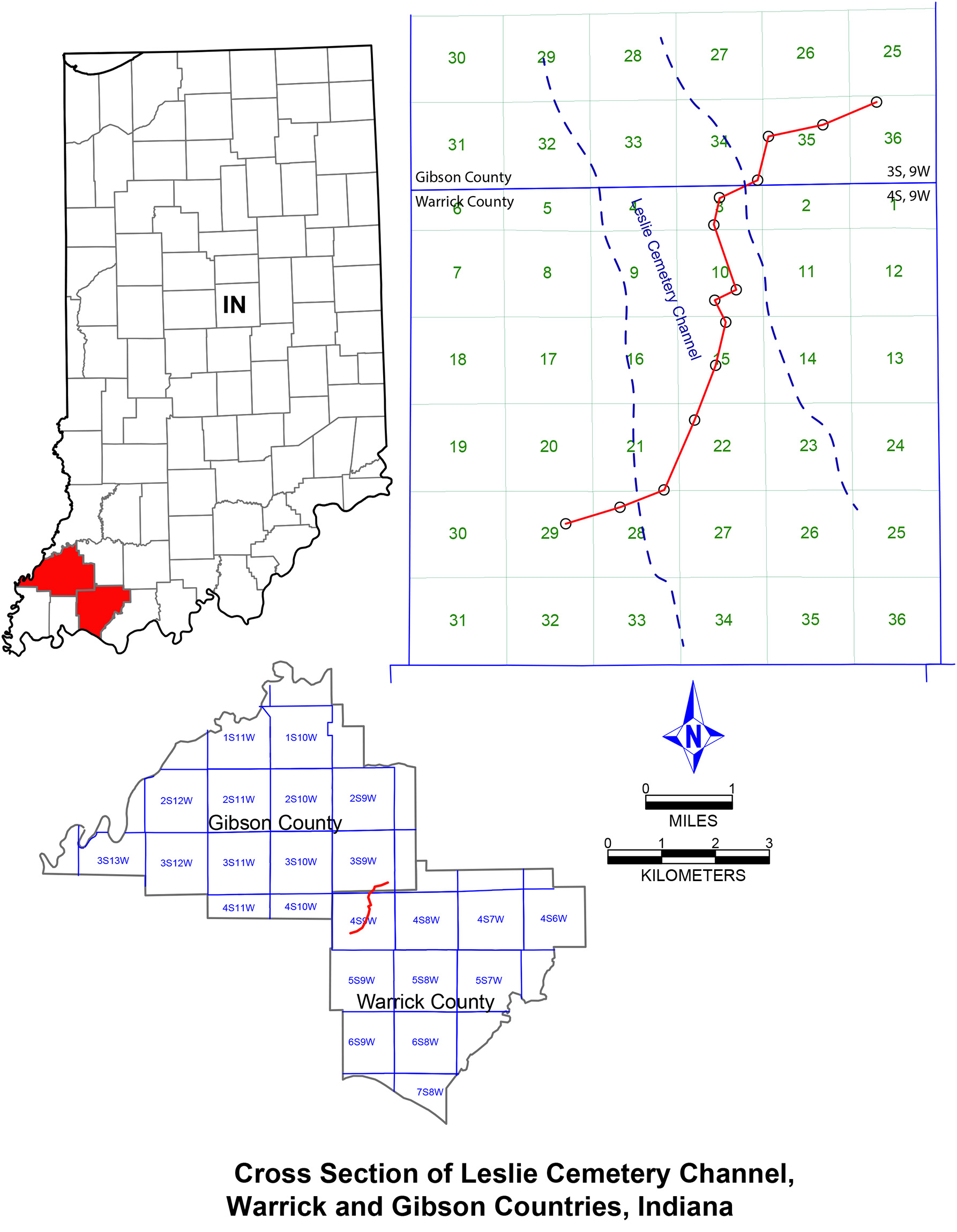 | 1,786 × 2,300 (540 KB) | Alan.Myers (talk | contribs) |
You cannot overwrite this file.
File usage
The following 2 pages use this file: