File:C605-Figure-43.jpg
Jump to navigation
Jump to search
Size of this preview: 411 × 599 pixels. Other resolution: 1,812 × 2,639 pixels.
Original file (1,812 × 2,639 pixels, file size: 555 KB, MIME type: image/jpeg)
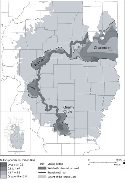
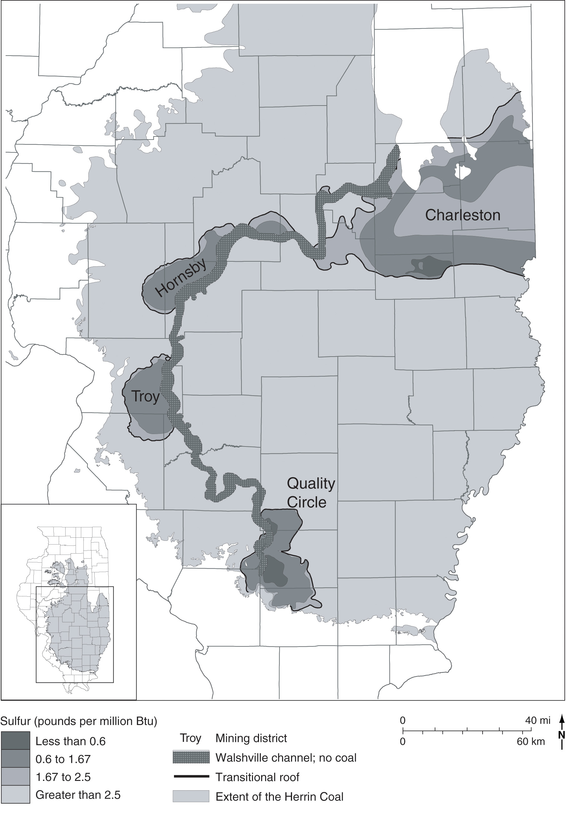
Figure 43 Map showing the Walshville channel and sulfur content of the Herrin Coal. After Treworgy et al. (2000)[1]. The four named areas of low-sulfur coal are all associated with thick Energy Shale adjacent to the channel.
- ↑ Treworgy, C.G., C.P. Korose, C.A. Chenoweth, and D.L. North, 2000, Availability of the Springfield Coal for mining in Illinois, map summary of Illinois Minerals 118: Illinois State Geological Survey, 1 sheet, 1:500,000.
File history
Click on a date/time to view the file as it appeared at that time.
| Date/Time | Thumbnail | Dimensions | User | Comment | |
|---|---|---|---|---|---|
| current | ★ Approved revision 15:34, 11 July 2020 | | 1,812 × 2,639 (555 KB) | Alan.Myers (talk | contribs) |
You cannot overwrite this file.
File usage
The following 2 pages use this file: