File:C605-Figure-38.jpg
Revision as of 16:04, 17 August 2023 by Alan.Myers (talk | contribs)
Size of this preview: 306 × 598 pixels. Other resolution: 1,300 × 2,541 pixels.
Original file (1,300 × 2,541 pixels, file size: 523 KB, MIME type: image/jpeg)
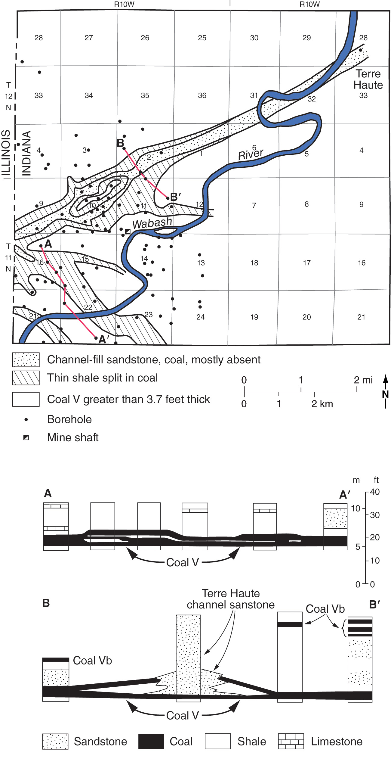
Figure 38 Map and cross section of the Terre Haute channel. From Friedman (1960). Courtesy of the Indiana Geological and Water Survey. Lines of cross section are shown on the map.
File history
Click on a date/time to view the file as it appeared at that time.
| Date/Time | Thumbnail | Dimensions | User | Comment | |
|---|---|---|---|---|---|
| current | ★ Approved revision 19:41, 10 July 2020 | | 1,300 × 2,541 (523 KB) | Alan.Myers (talk | contribs) |
You cannot overwrite this file.
File usage
The following 3 pages use this file: