Merom Sandstone Member
Lithostratigraphy: McLeansboro Group >>Mattoon Formation >>Merom Sandstone Member
Chronostratigraphy: Paleozoic Erathem >>Pennsylvanian Subsystem >>Missourian Series
Allostratigraphy: Absaroka Sequence
Primary source
Willman, H. B., Elwood Atherton, T. C. Buschbach, Charles Collinson, John C. Frye, M. E. Hopkins, Jerry A. Lineback, and Jack A. Simon, 1975, Handbook of Illinois Stratigraphy: Illinois State Geological Survey Bulletin 95, 261 p.
Contributing author(s)
M. E. Hopkins and J. A. Simon
Name
Original description
The Merom Sandstone Member of the Mattoon Formation (Collett, 1871, p. 199).
Derivation
Named for Merom Hill, Sullivan County, Indiana.
Other names
History/background
Type section
Type location
The type section is along the Wabash River Bluff near the town of Merom (7, 7N-10W).
Type author(s)
Type status
Reference section
Reference location
Reference author(s)
Reference status
Stratigraphic relationships
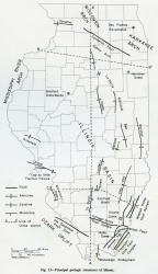
At the type locality the Merom Sandstone occurs directly below glacial drift and has a maximum observed thickness of approximately 55 feet. It lies directly on top of a limestone 2-4 feet thick, which is correlated with the Livingston Limestone of eastern Illinois. The Merom Sandstone is the uppermost named member of the Pennsylvanian System in the Marshall Syncline (fig. 12), where it is approximately 100 feet thick. The stratigraphic position of the Merom Sandstone has not been definitely determined.
Extent and thickness
Lithology
Core(s)
Photograph(s)
Contacts
Well log characteristics
Fossils
Age and correlation
Environments of deposition
The sandstone is dominantly a fluvial channel deposit, and at its type locality it has eroded the Cohn Coal, which normally lies 20-30 feet above the Livingston Limestone.
Economic importance
Remarks
References
COLLETT, JOHN, 1871, Geology of Sullivan County, Indiana: Indiana Geological Survey, 2nd Annual Report, p. 190-240.
ISGS Codes
| Stratigraphic Code | Geo Unit Designation |
|---|---|
