File:Penn carbondale 4-18.jpg
Jump to navigation
Jump to search
Size of this preview: 424 × 600 pixels. Other resolution: 2,352 × 3,327 pixels.
Original file (2,352 × 3,327 pixels, file size: 5.71 MB, MIME type: image/jpeg)
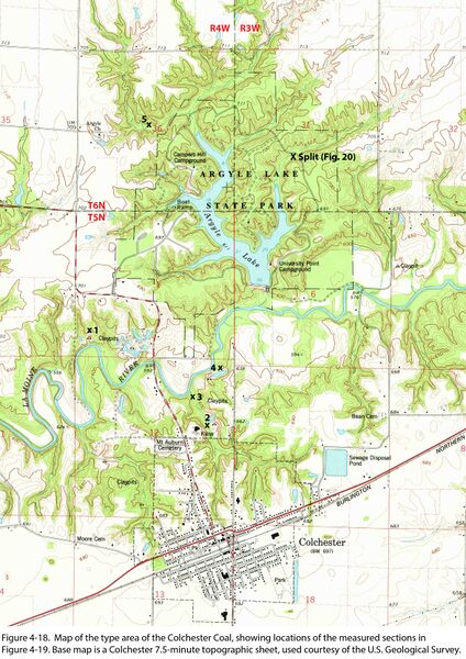
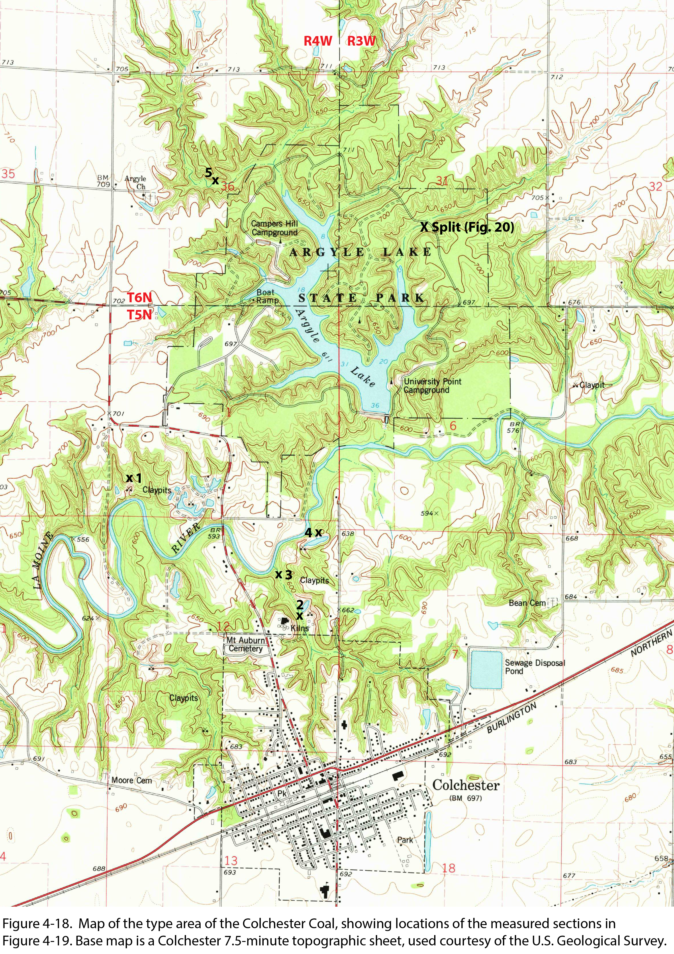
Figure 4-18. Map of the type area of the Colchester Coal, showing locations of the measured sections in Figure 4-19. Base map is a Colchester 7.5-minute topographic sheet, used courtesy of the U.S. Geological Survey.
File history
Click on a date/time to view the file as it appeared at that time.
| Date/Time | Thumbnail | Dimensions | User | Comment | |
|---|---|---|---|---|---|
| current | ★ Approved revision 21:13, 26 January 2021 | | 2,352 × 3,327 (5.71 MB) | Jennifer.Obrad (talk | contribs) |
You cannot overwrite this file.
File usage
The following page uses this file: