Uploads by Alan.Myers
Jump to navigation
Jump to search
This special page shows all uploaded files.
| Date | Name | Thumbnail | Size | Description | Versions |
|---|---|---|---|---|---|
| 18:39, 29 September 2020 | Logo.gif (file) | 743 bytes | 1 | ||
| 17:30, 14 July 2020 | Right-Arrow.png (file) | 3 KB | 1 | ||
| 17:30, 14 July 2020 | Left-Arrow.png (file) | 6 KB | 1 | ||
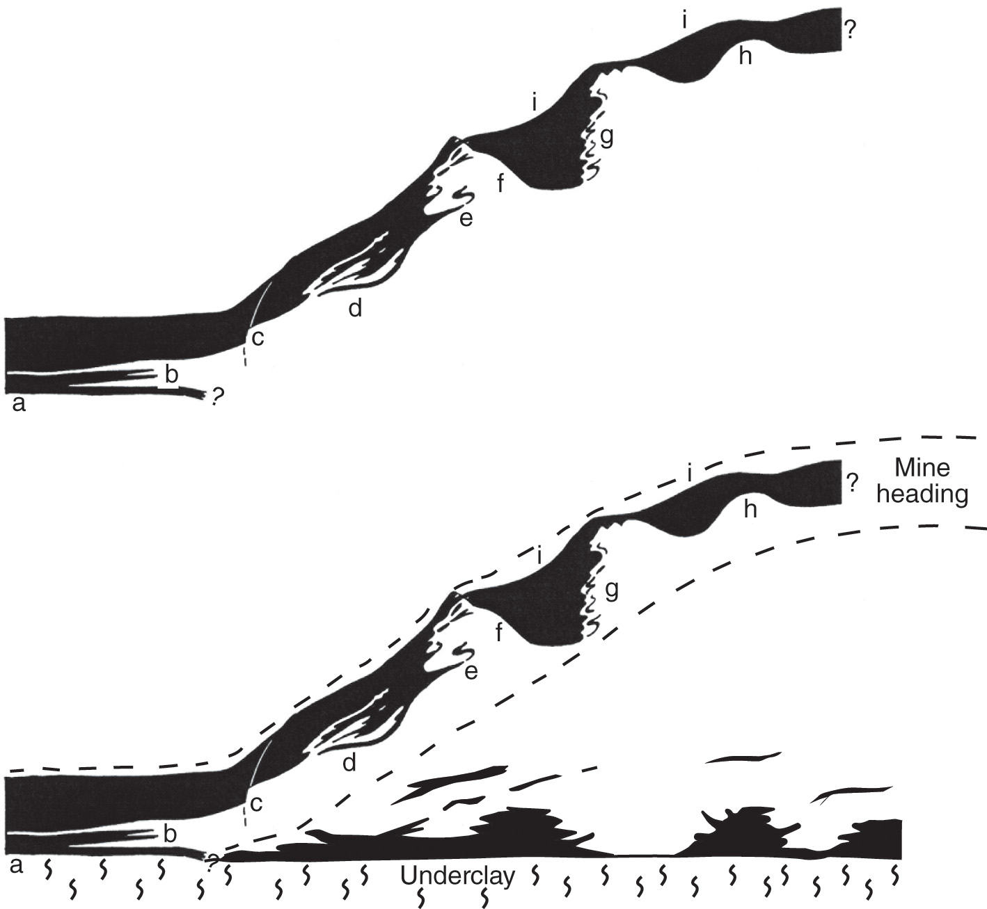
| 15:49, 13 December 2016 | Howto edit move page code.jpg (file) |  |
15 KB | How to edit move page code | 1 |
| 19:38, 13 August 2015 | B95.jpg (file) |  |
20 KB | 1 | |
| 16:48, 4 January 2017 | Mesozoic search.jpg (file) |  |
27 KB | for the imagepage on the Mesozoic search page | 1 |
| 15:43, 13 December 2016 | Howto edit move page settings.jpg (file) |  |
32 KB | How to edit move page settings | 1 |
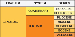
| 17:27, 3 March 2017 | Cenozoic search.jpg (file) |  |
45 KB | 2 | |
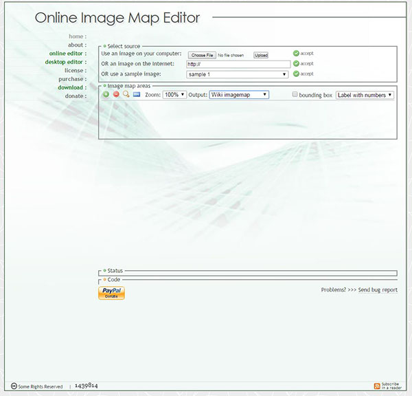
| 13:42, 2 December 2016 | Imagemap 1.JPG (file) |  |
62 KB | image for image map howto | 1 |
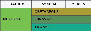
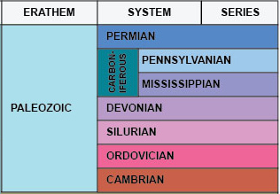
| 19:32, 29 December 2016 | Paleozoic imagemap.jpg (file) |  |
63 KB | 1 | |
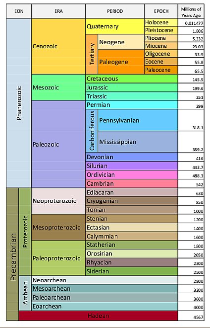
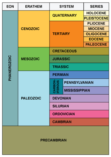
| 17:54, 10 August 2015 | Geologic-time-scale1.jpg (file) |  |
67 KB | 1 | |
| 19:49, 15 November 2016 | Figure K-2 imagemap.jpg (file) |  |
71 KB | 1 | |
| 15:28, 10 January 2017 | Silurian imagemap 3.jpg (file) |  |
76 KB | Silurian Imagemap for Western Illinois | 1 |
| 19:56, 13 December 2016 | Howto edit sections.JPG (file) |  |
90 KB | 1 | |
| 13:51, 10 January 2017 | Devonian imagepage.jpg (file) |  |
94 KB | Devonian imagemap | 1 |
| 19:28, 20 September 2017 | Mainpagetime.jpg (file) |  |
97 KB | 2 | |
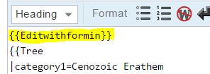
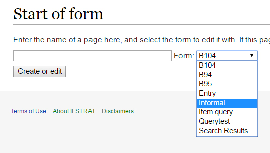
| 16:55, 13 December 2016 | Howto start of form.jpg (file) |  |
99 KB | Howto start of form | 1 |
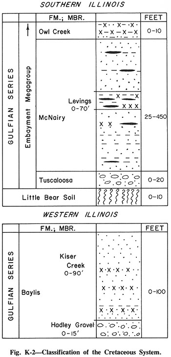
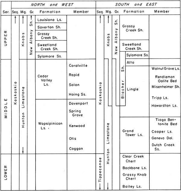
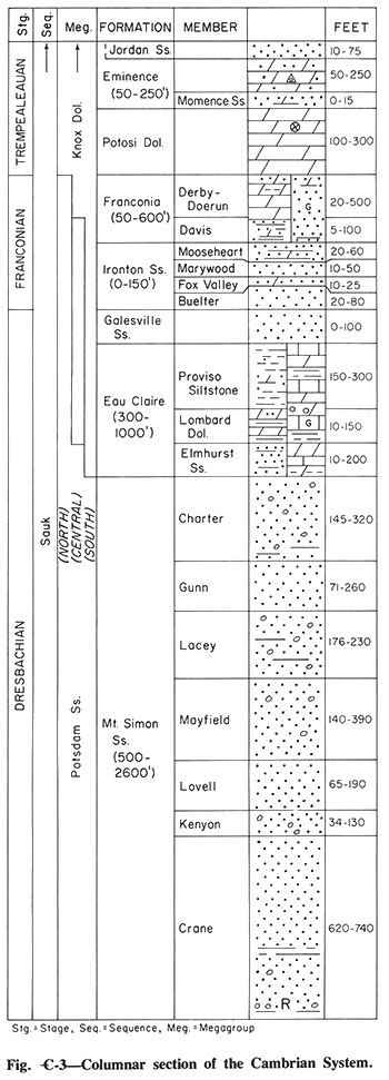
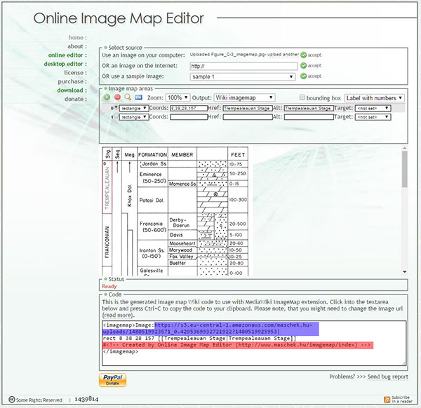
| 15:08, 30 November 2016 | Figure C-3 imagemap.jpg (file) |  |
100 KB | Cambrian image map | 1 |
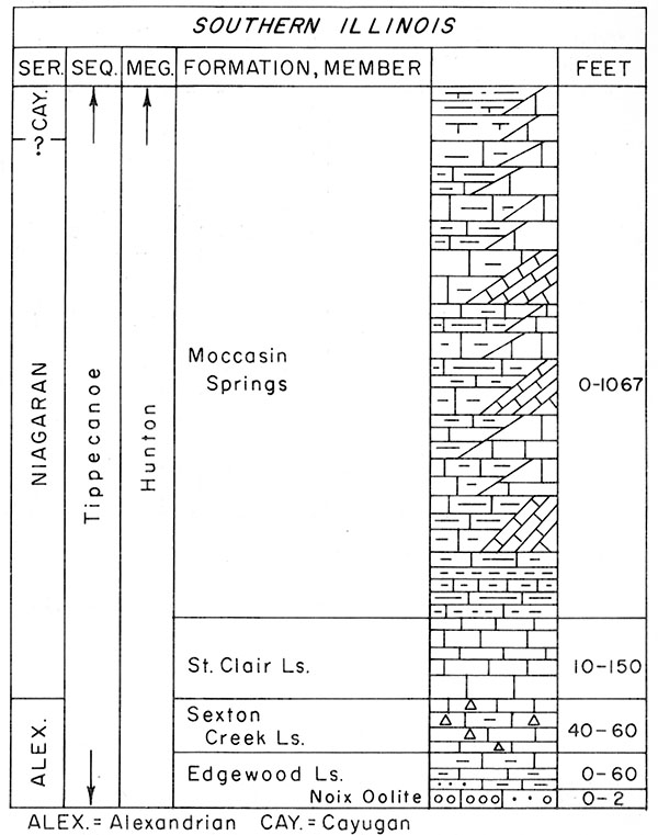
| 15:29, 10 January 2017 | Silurian imagemap 4.jpg (file) |  |
101 KB | Silurian Imagemap for Southern Illinois | 1 |
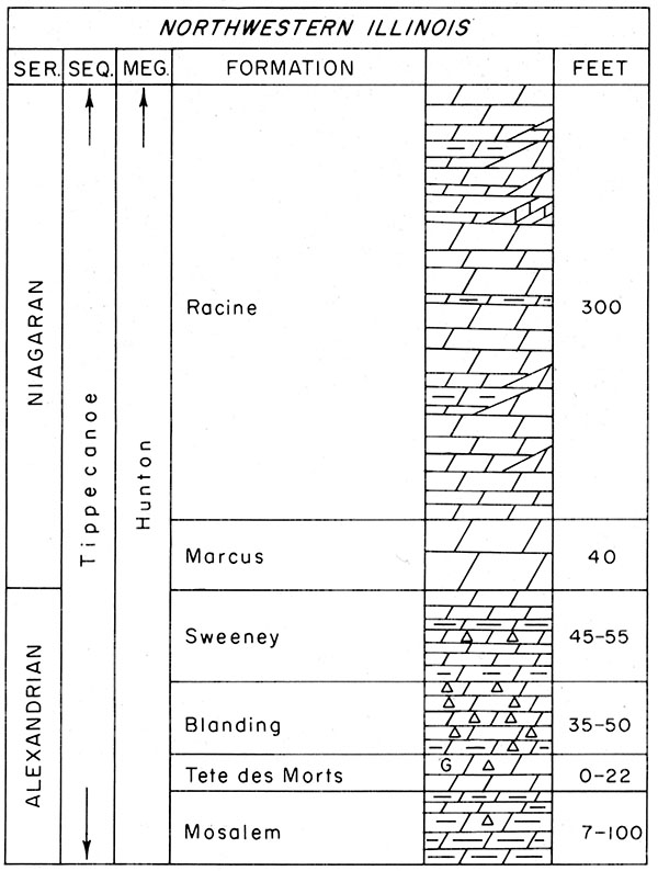
| 15:27, 10 January 2017 | Silurian imagemap 2.jpg (file) |  |
103 KB | Silurian Imagemap for Northwestern Illinois | 1 |
| 13:44, 2 December 2016 | Imagemap 2.JPG (file) |  |
103 KB | image for imagemap howto | 1 |
| 16:17, 21 September 2016 | Banner.jpg (file) | 104 KB | 2 | ||
| 16:39, 10 January 2017 | Tertiary imagemap.jpg (file) |  |
121 KB | Tertiary imagemap | 1 |
| 15:26, 10 January 2017 | Silurian imagemap 1.jpg (file) |  |
131 KB | Silurian Imagemap for Northeastern Illinois | 1 |
| 15:58, 22 December 2016 | Figure O-4 imagemap.jpg (file) |  |
140 KB | Image map for the Ordovician System | 1 |
| 17:34, 22 December 2016 | Figure O-4 imagemap2.jpg (file) |  |
140 KB | <msu-comment> | 1 |
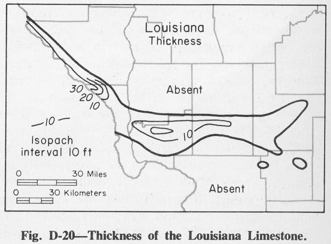
| 20:17, 1 April 2016 | Figure D-20.jpg (file) |  |
152 KB | Fig. D-20 -- Thickness of the Louisiana Limestone. | 1 |
| 14:27, 20 January 2017 | Figure M-3 imagemap.jpg (file) |  |
162 KB | Image map for the Mississippian subsystem | 1 |
| 20:09, 5 August 2015 | ISGS logo.jpg (file) | 178 KB | 1 | ||
| 13:55, 4 April 2016 | Figure M-11.jpg (file) |  |
182 KB | Fig. M-11 -- Columnar section of the Valmeyeran Series in western Illinois. | 1 |
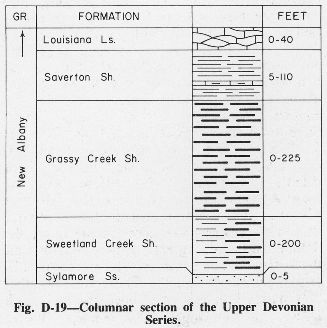
| 20:17, 1 April 2016 | Figure D-19.jpg (file) |  |
194 KB | Fig. D-19 -- Columnar section of the Upper Devonian Series. | 1 |
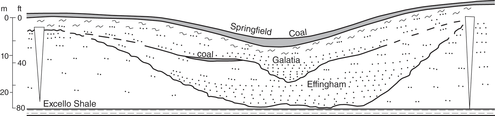
| 15:26, 9 July 2020 | C605-Figure-27.jpg (file) |  |
196 KB | 1 | |
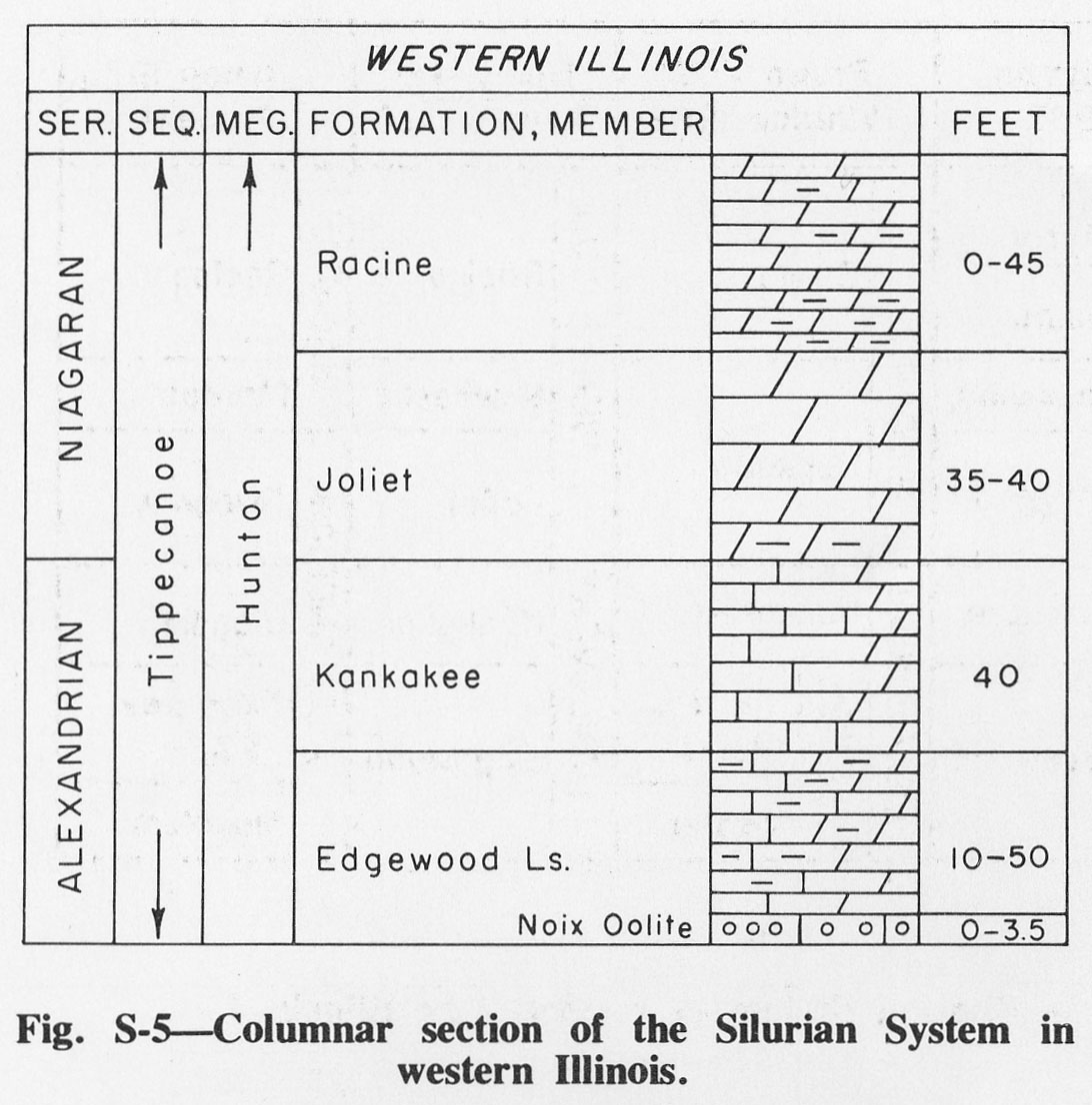
| 17:11, 4 April 2016 | Figure S-5.jpg (file) |  |
198 KB | Fig. S-5 -- Columnar section of the Silurian System in western Illinois. | 1 |
| 19:23, 10 July 2020 | C605-Figure-33.jpg (file) | 198 KB | 1 | ||
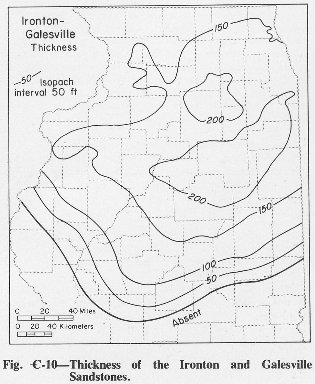
| 19:48, 1 April 2016 | Figure C-10.jpg (file) |  |
204 KB | Fig. C-10 -- Thickness of the Ironton and Galesville Sandstones. | 1 |
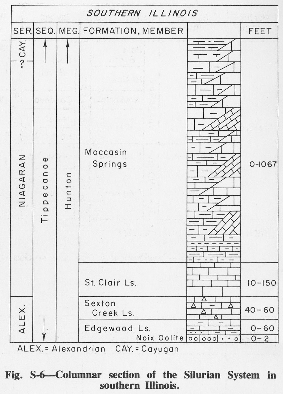
| 17:52, 4 April 2016 | Figure S-6.jpg (file) |  |
209 KB | Fig. S-6 -- Columnar section of Silurian System in southern Illinois. | 1 |
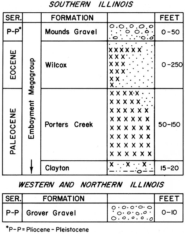
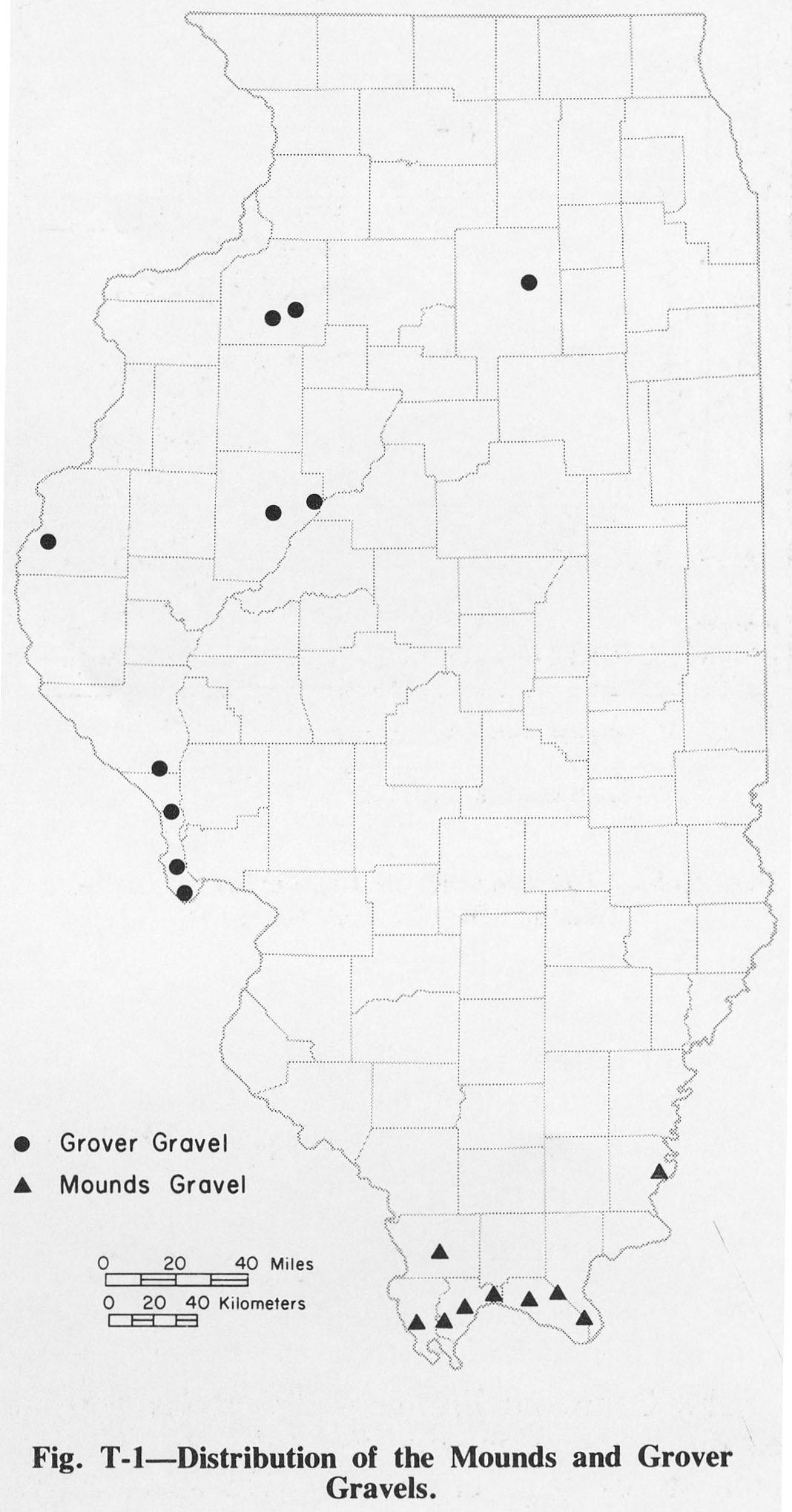
| 18:04, 4 April 2016 | Figure T-1.jpg (file) |  |
209 KB | Fig. T-1 -- Distribution of the Mounds and Grover Gravels. | 1 |
| 14:22, 4 April 2016 | Figure M-39.jpg (file) |  |
210 KB | Fig. M-39 -- Thickness of the Fraileys Shale. | 1 |
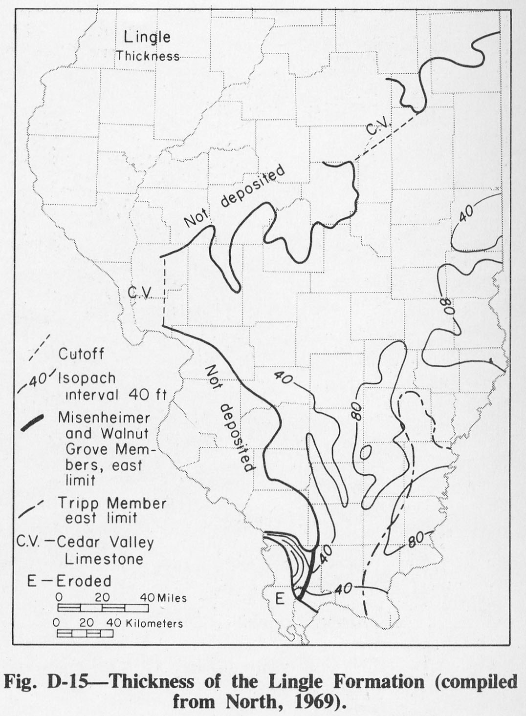
| 20:10, 1 April 2016 | Figure D-15.jpg (file) |  |
211 KB | Fig. D-15 -- Thickness of the Lingle Formation (compliled from North, 1969). | 1 |
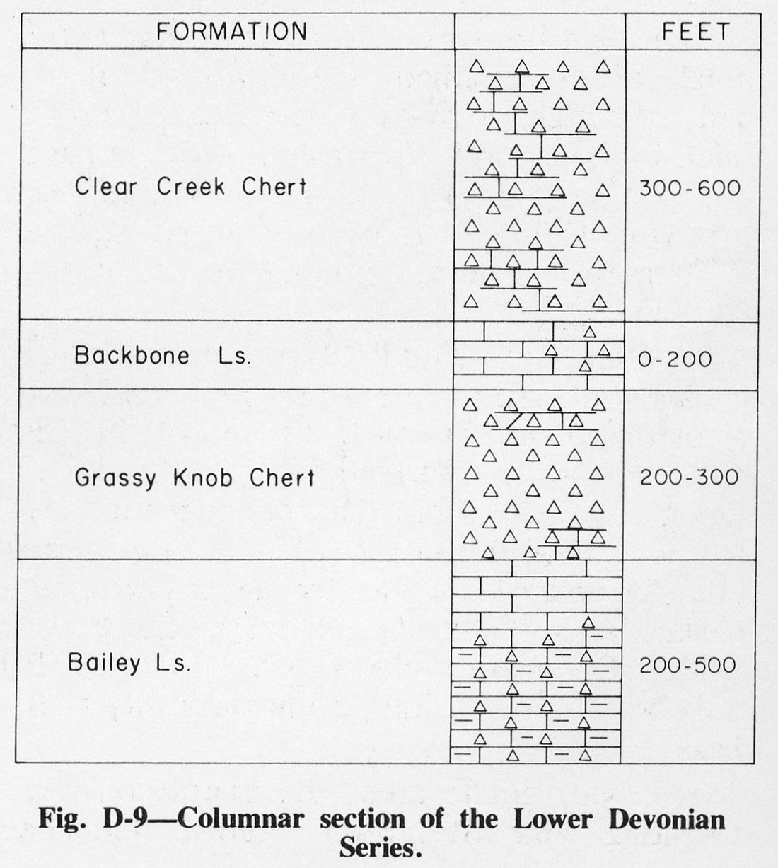
| 20:03, 1 April 2016 | Figure D-9.jpg (file) |  |
211 KB | Fig. D-9 -- Columnar section of the Lower Devonian Series. | 1 |
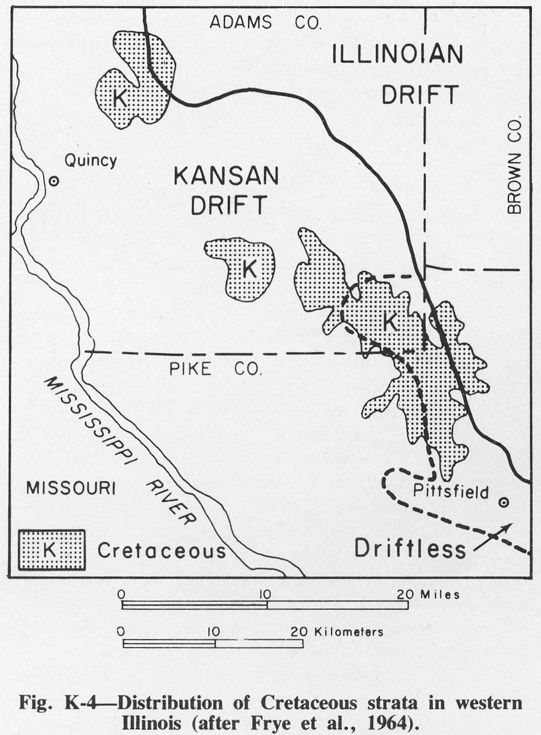
| 20:20, 1 April 2016 | Figure K-4.jpg (file) |  |
216 KB | Fig. K-4 -- Distribution of Cretaceous strata in western Illinois (after Frye et al., 1964). | 1 |
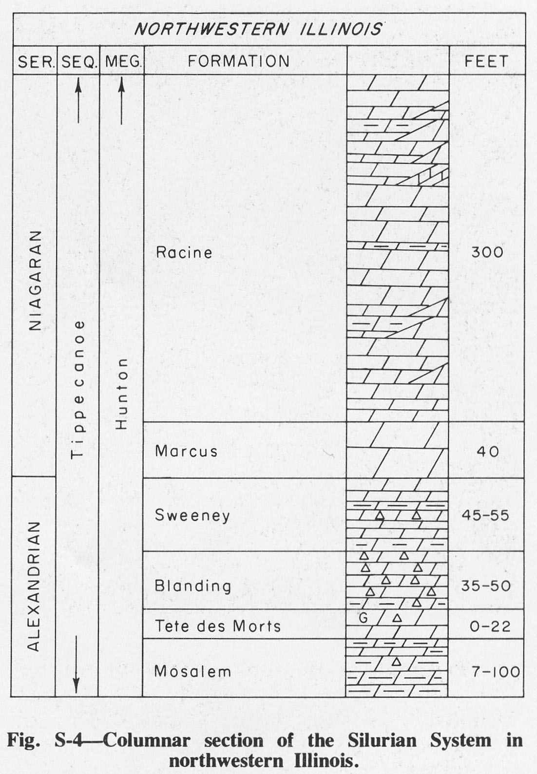
| 17:03, 4 April 2016 | Figure S-4.jpg (file) |  |
219 KB | Fig. S-4 -- Columnar section of the Silurian System in northwestern Illinois. | 1 |
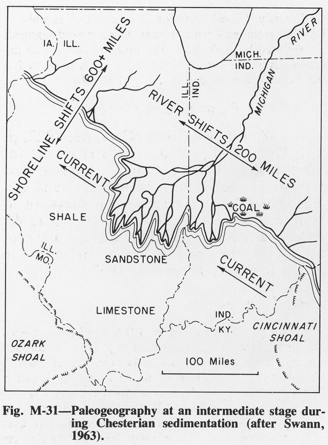
| 14:15, 4 April 2016 | Figure M-31.jpg (file) |  |
219 KB | Fig. M-31 -- Paleogeography at an intermediate state during the Chesterian sedimentation (after Swann, 1963). | 1 |
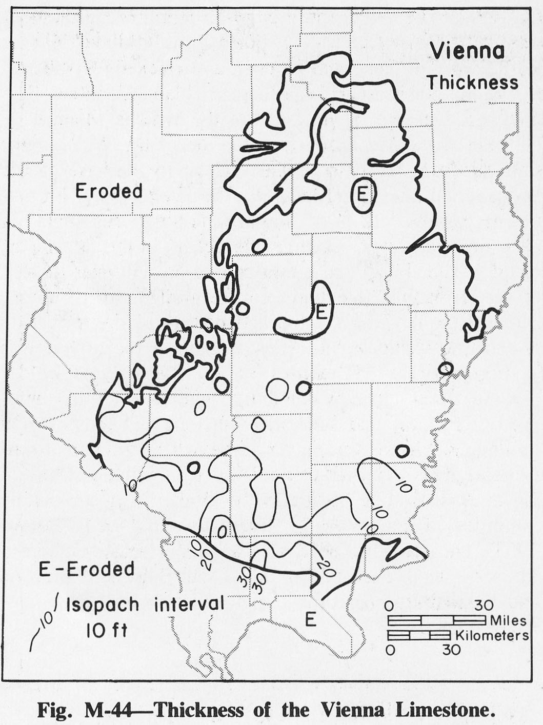
| 14:25, 4 April 2016 | Figure M-44.jpg (file) |  |
220 KB | Fig. M-44 -- Thickness of the Vienna Limestone. | 1 |
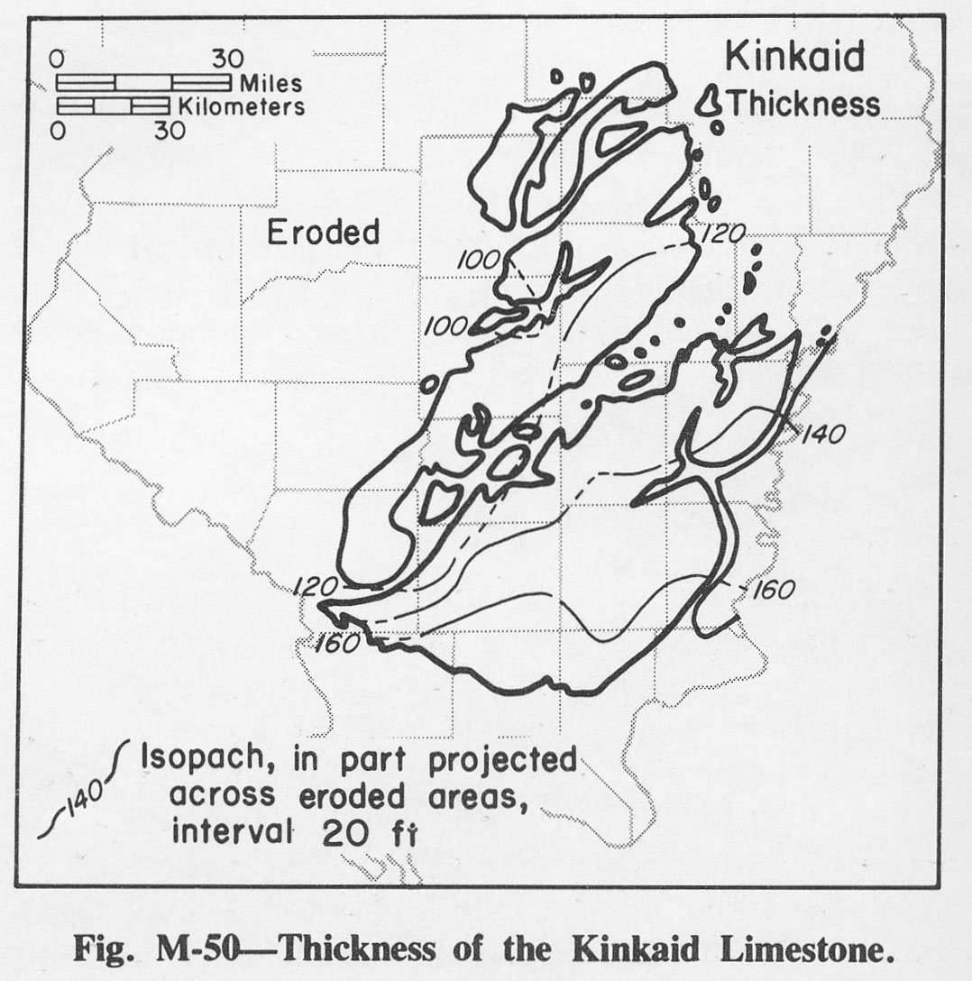
| 14:29, 4 April 2016 | Figure M-50.jpg (file) |  |
223 KB | Fig. M-50 -- Thickness of the Kinkaid Limestone. | 1 |
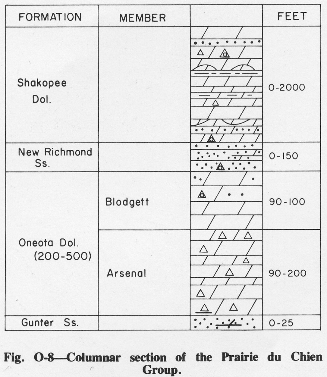
| 14:49, 4 April 2016 | Figure O-8.jpg (file) |  |
225 KB | Fig. O-8 -- Columnar section of the Prairie du Chien Group. | 1 |
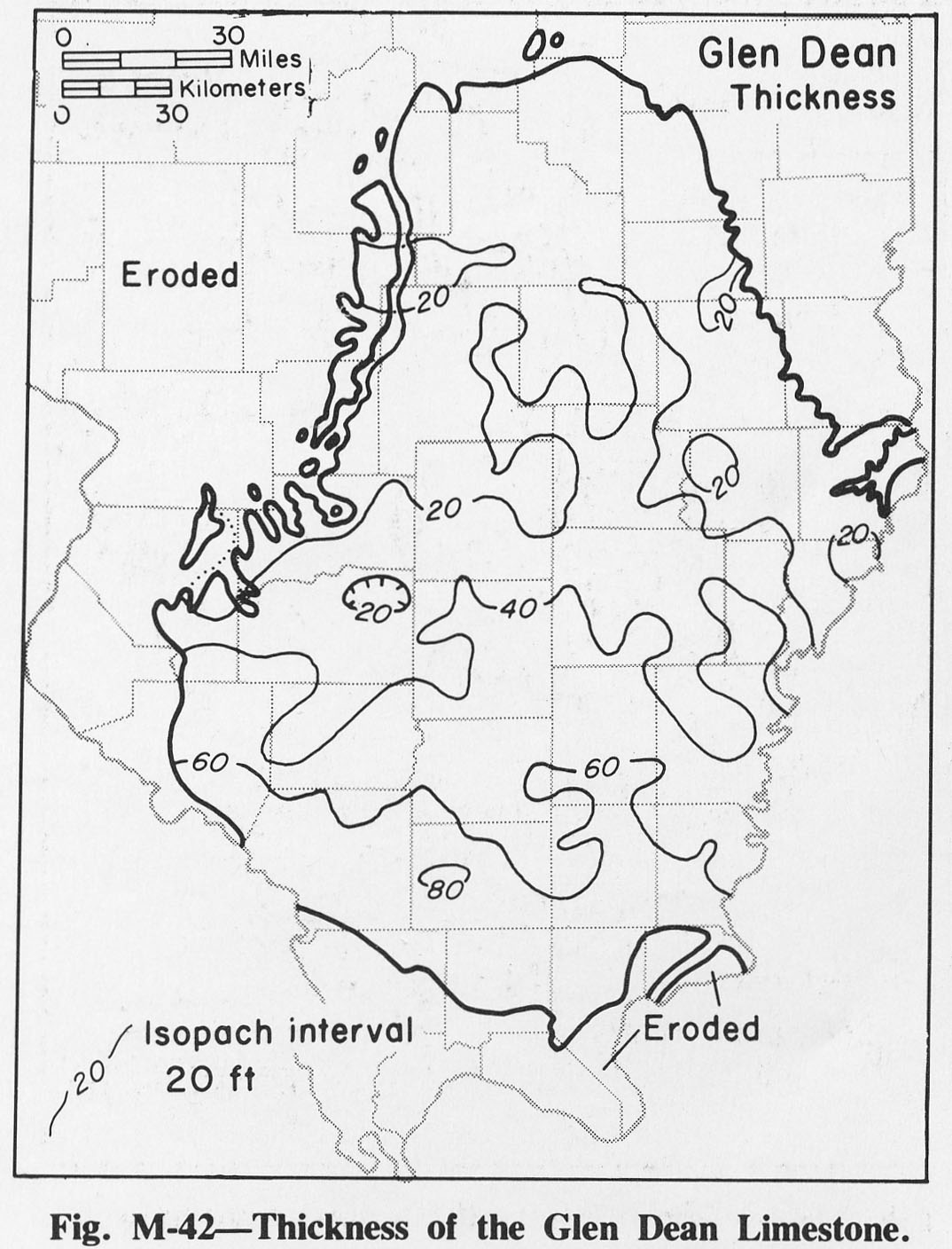
| 14:24, 4 April 2016 | Figure M-42.jpg (file) |  |
226 KB | Fig. M-42 -- Thickness of the Glen Dean Limestone. | 1 |
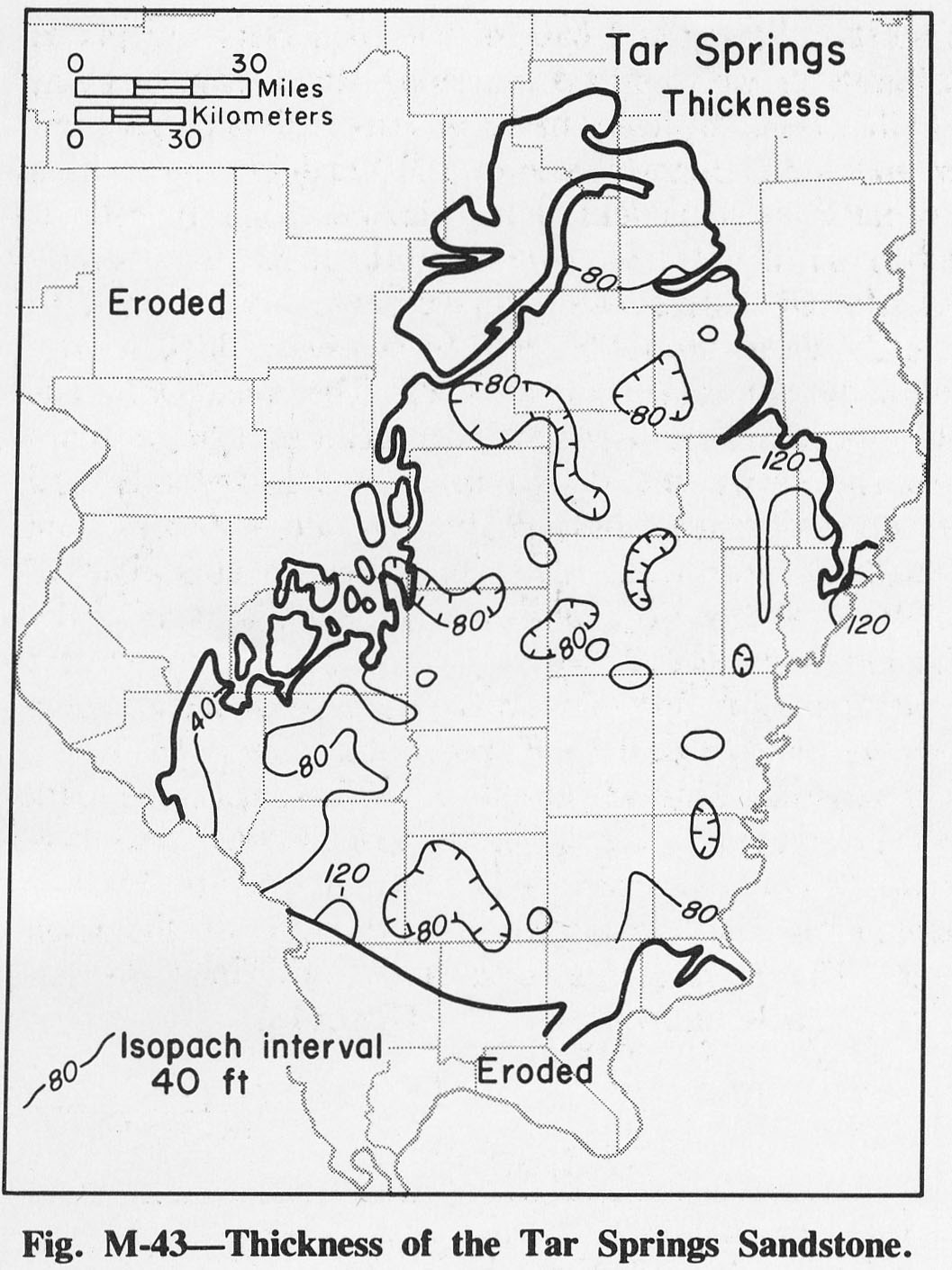
| 14:24, 4 April 2016 | Figure M-43.jpg (file) |  |
228 KB | Fig. M-43 -- Thickness of the Tar Springs Sandstone. | 1 |
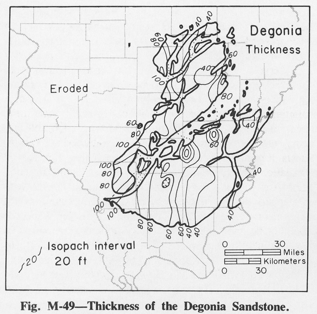
| 14:29, 4 April 2016 | Figure M-49.jpg (file) |  |
228 KB | Fig. M-49 -- Thickness of the Degonia Sandstone. | 1 |
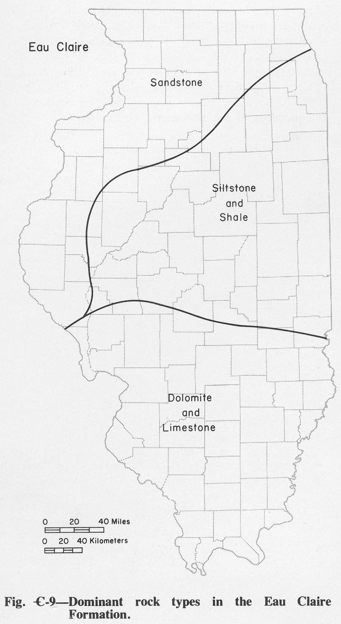
| 19:47, 1 April 2016 | Figure C-9.jpg (file) |  |
231 KB | Fig. C-9 -- Dominant rock types in the Eau Claire Formation. | 1 |