File list
Jump to navigation
Jump to search
This special page shows all uploaded files.
| Date | Name | Thumbnail | Size | User | Description | Versions |
|---|---|---|---|---|---|---|
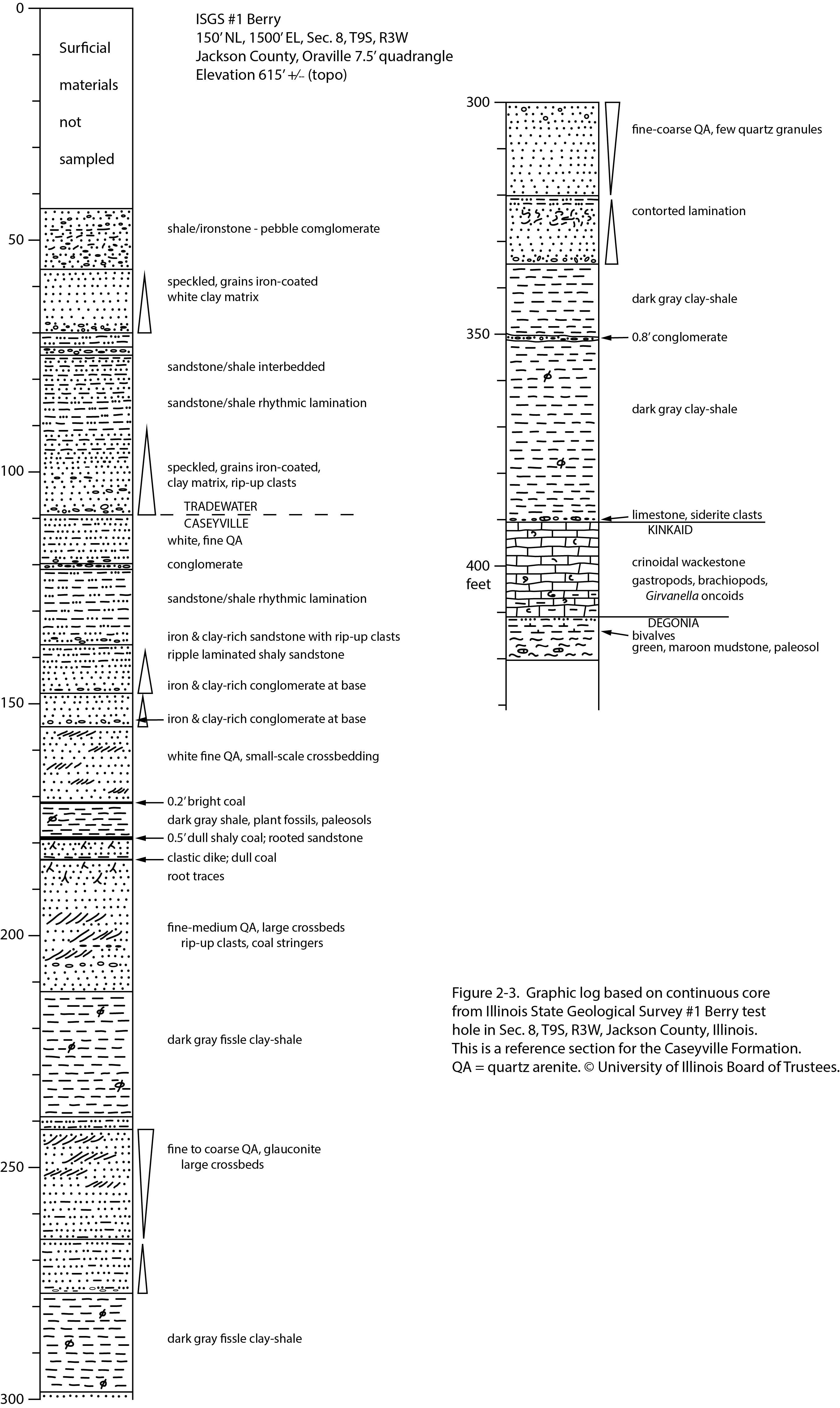
| 16:12, 20 July 2020 | Penn caseyville 2-1.jpg (file) |  |
10.33 MB | Jennifer.Obrad | 1 | |
| 21:55, 23 December 2020 | Penn carbondale 4-62.jpg (file) |  |
7.43 MB | Jennifer.Obrad | 1 | |
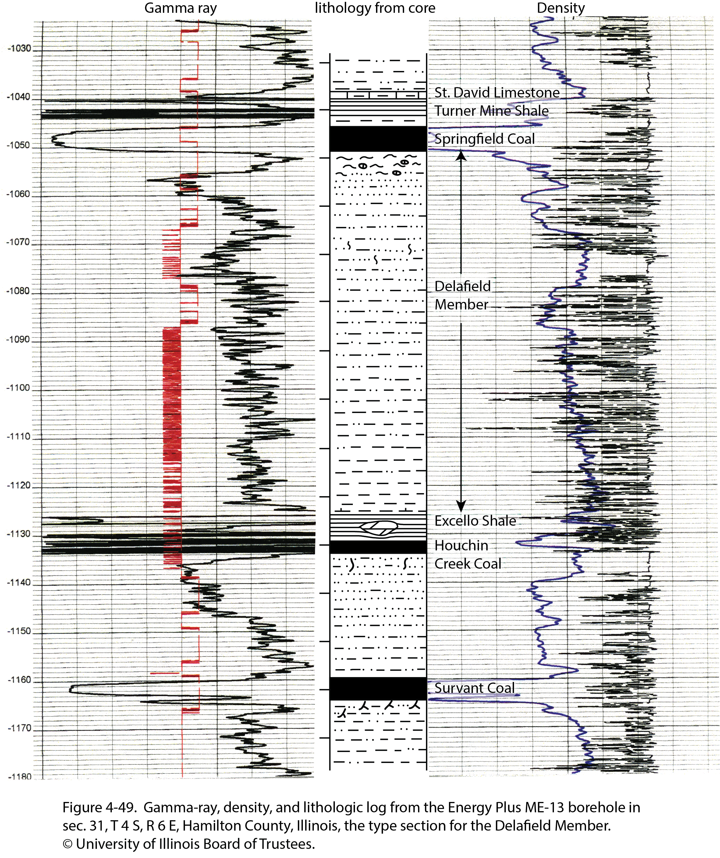
| 20:00, 23 December 2020 | Penn carbondale 4-49.jpg (file) |  |
6.8 MB | Jennifer.Obrad | 1 | |
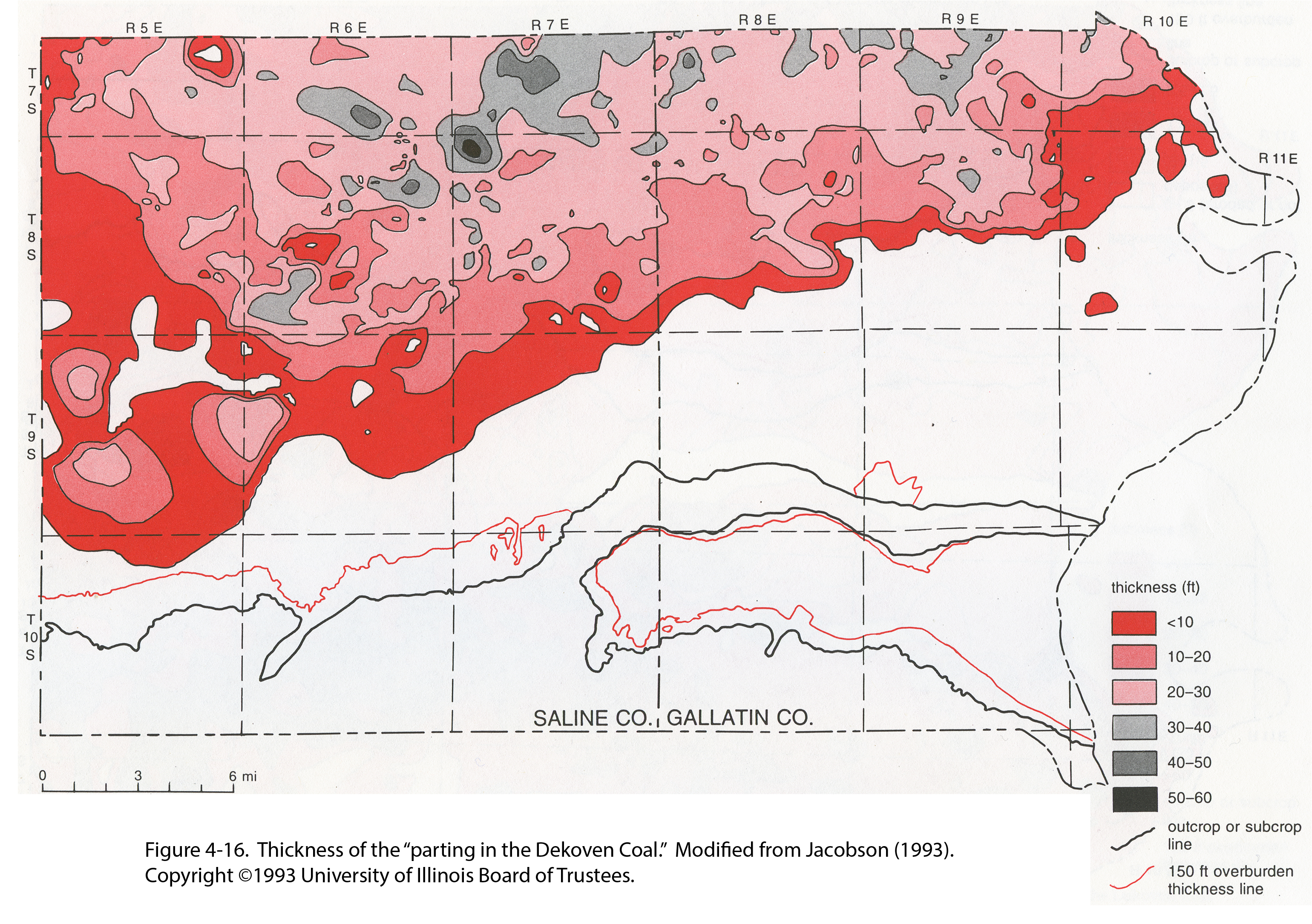
| 21:11, 26 January 2021 | Penn carbondale 4-16.jpg (file) |  |
6.02 MB | Jennifer.Obrad | 1 | |
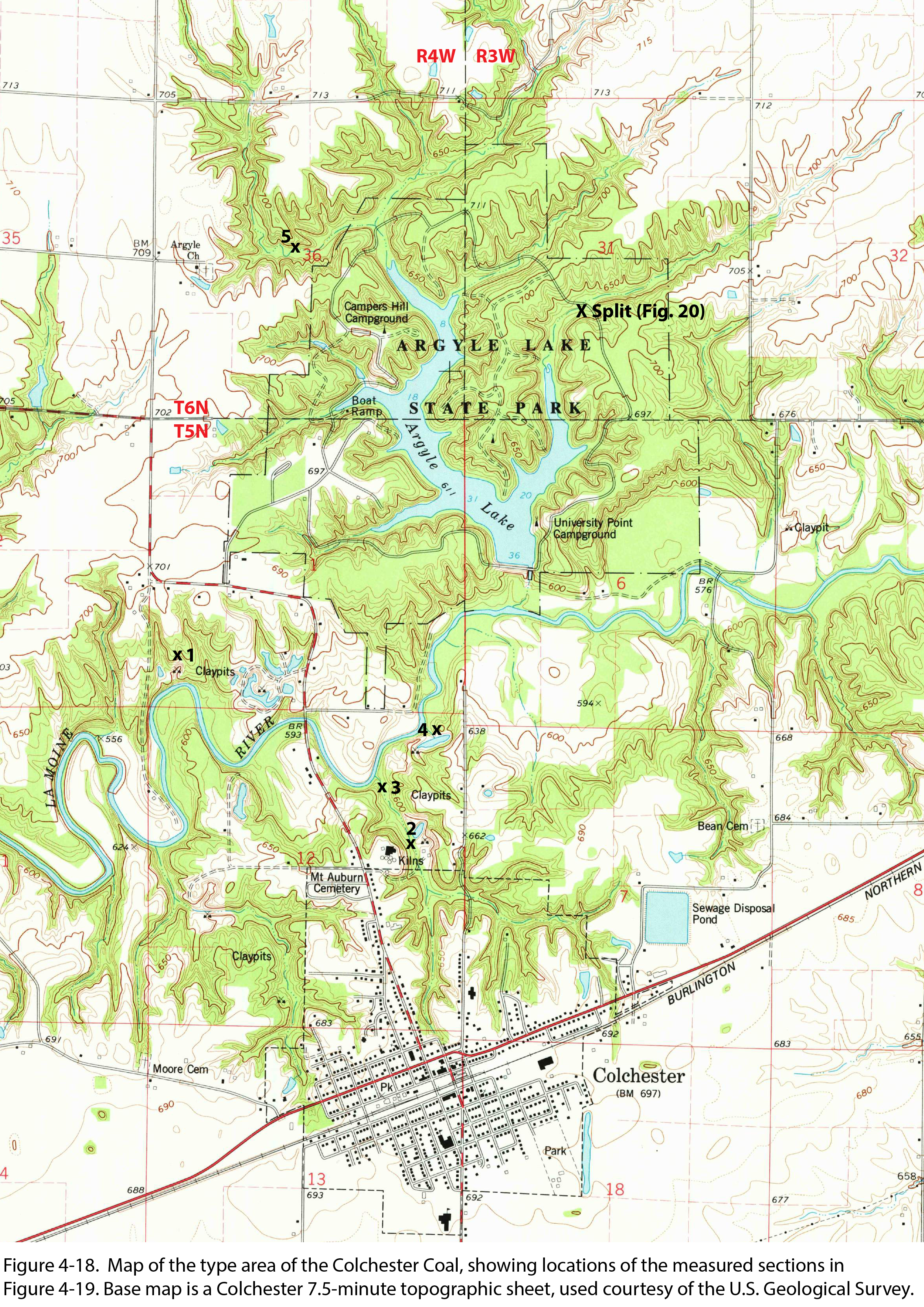
| 21:13, 26 January 2021 | Penn carbondale 4-18.jpg (file) |  |
5.71 MB | Jennifer.Obrad | 1 | |
| 19:23, 15 November 2022 | Fig 1440 photographs 002.jpg (file) |  |
5.49 MB | Francesca.Burkett | 1 | |
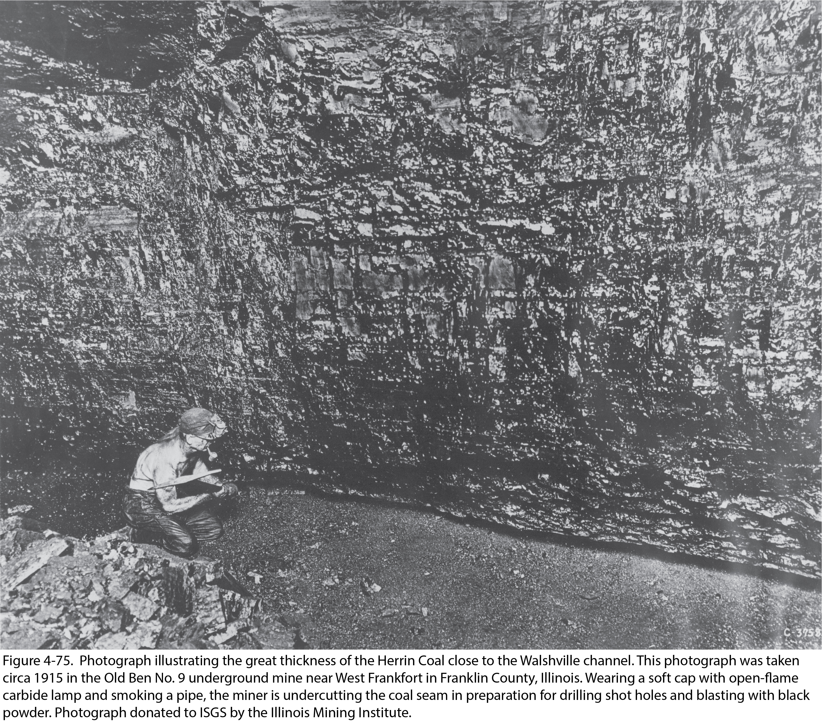
| 21:25, 4 January 2021 | Penn carbondale 4-75.jpg (file) |  |
4.66 MB | Jennifer.Obrad | 1 | |
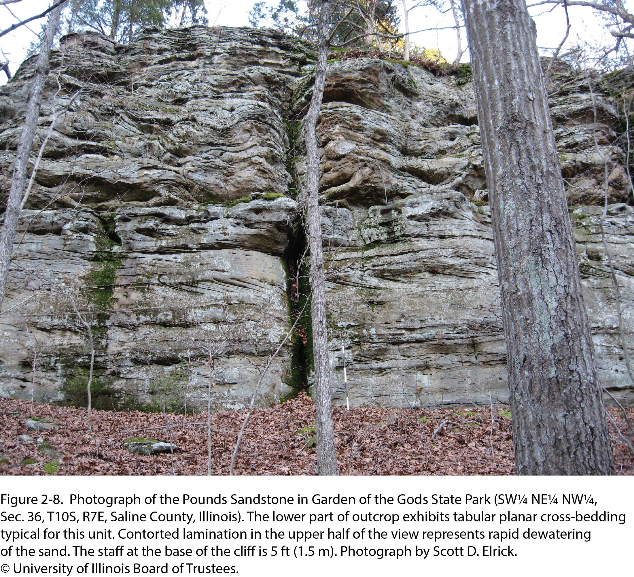
| 16:21, 20 July 2020 | Penn caseyville 2-8.jpg (file) |  |
4.3 MB | Jennifer.Obrad | 1 | |
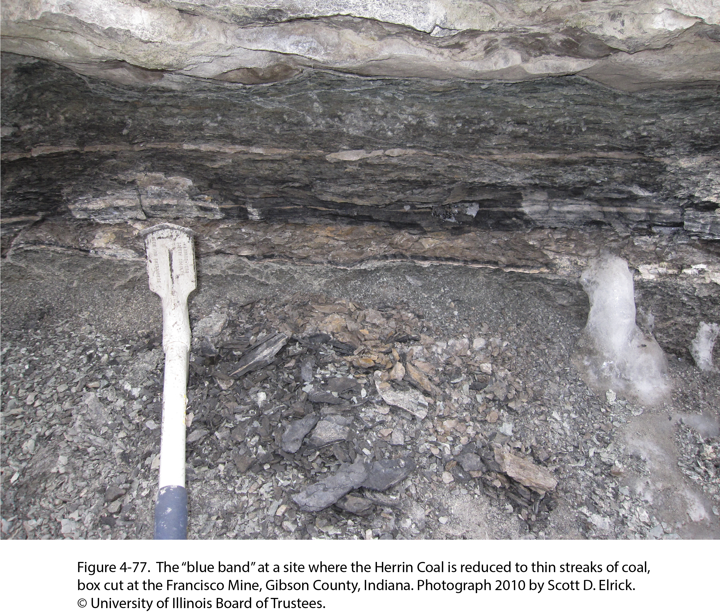
| 21:28, 4 January 2021 | Penn carbondale 4-77.jpg (file) |  |
4.22 MB | Jennifer.Obrad | 1 | |
| 20:54, 22 December 2020 | Penn carbondale 4-3.jpg (file) |  |
3.5 MB | Jennifer.Obrad | 1 | |
| 21:42, 4 January 2021 | Penn carbondale plate4-1.jpg (file) |  |
3.12 MB | Jennifer.Obrad | 1 | |
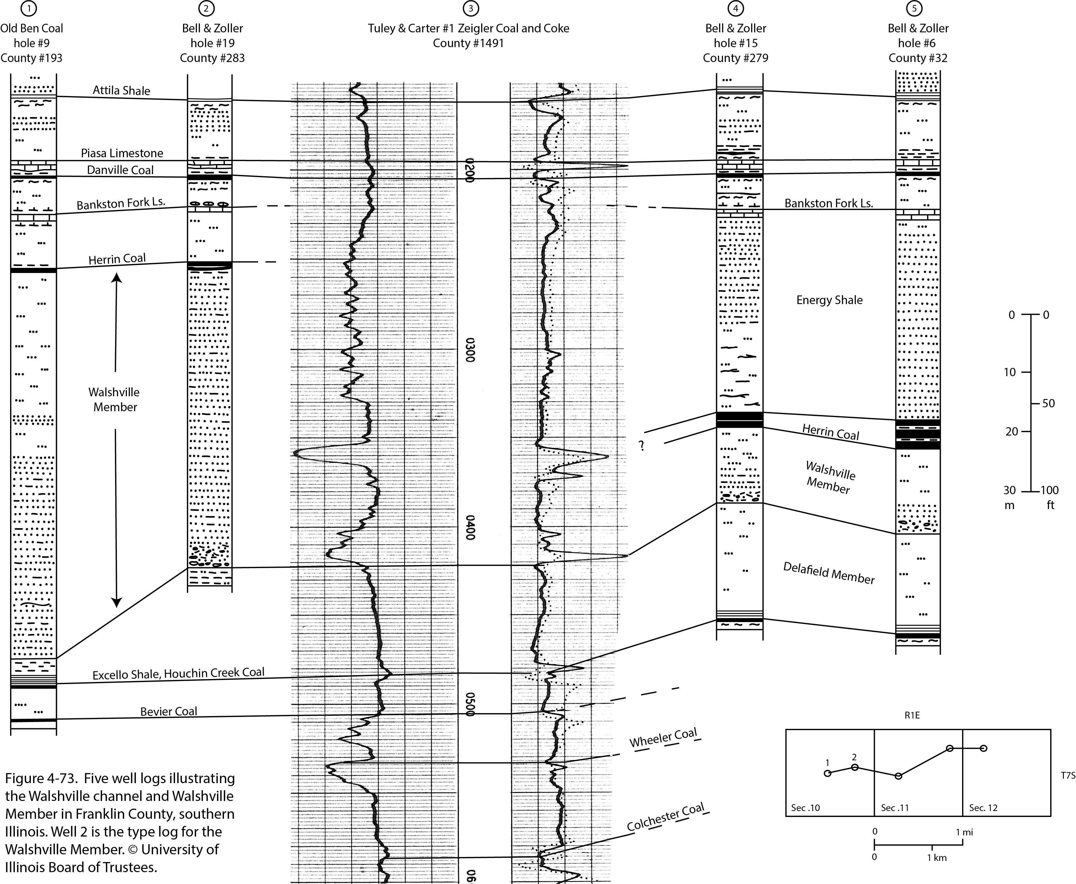
| 21:15, 4 January 2021 | Penn carbondale 4-73.jpg (file) |  |
3.05 MB | Jennifer.Obrad | 1 | |
| 21:52, 23 December 2020 | Penn carbondale 4-61.jpg (file) |  |
2.93 MB | Jennifer.Obrad | 1 | |
| 21:02, 23 December 2020 | Penn carbondale 4-57.jpg (file) |  |
2.85 MB | Jennifer.Obrad | 1 | |
| 20:37, 23 December 2020 | Penn carbondale 4-53.jpg (file) |  |
2.49 MB | Jennifer.Obrad | 1 | |
| 16:14, 20 July 2020 | Penn caseyville 2-2.jpg (file) |  |
2.38 MB | Jennifer.Obrad | 1 | |
| 22:04, 15 September 2022 | Fig 0870 Photos 001.JPG (file) |  |
2.35 MB | Jennifer.Obrad | 1 | |
| 21:34, 4 January 2021 | Penn carbondale 4-79.jpg (file) |  |
2.27 MB | Jennifer.Obrad | 1 | |
| 16:56, 17 November 2022 | Fig 1440 photographs 001.jpg (file) |  |
2.19 MB | Francesca.Burkett | 1 | |
| 18:30, 14 October 2015 | Figure P-3B.jpg (file) |  |
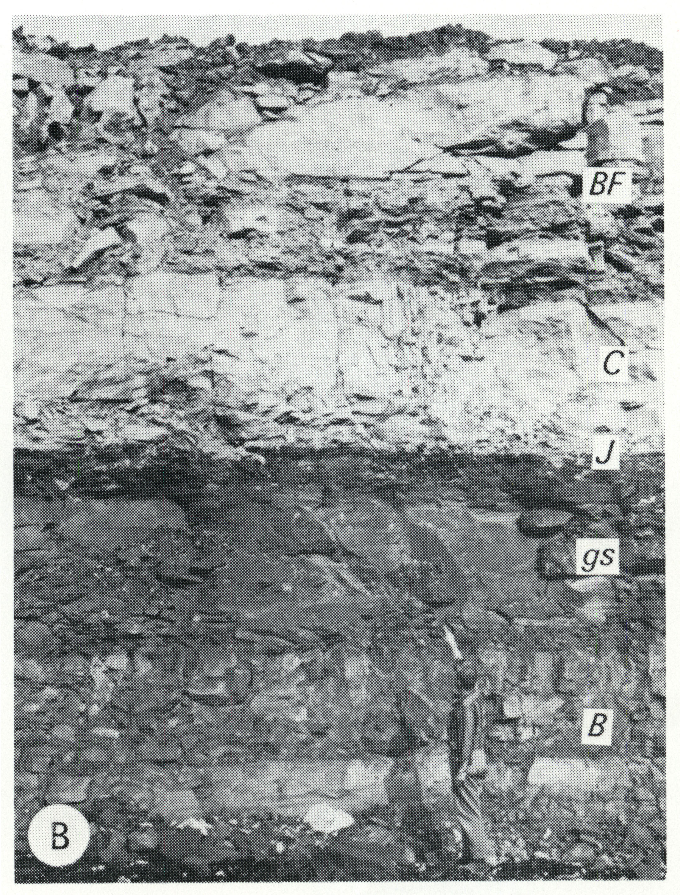
2.11 MB | Jennifer.Obrad | P-3B -- Strata overlying the Herrin (No. 6) Coal Member of the Carbondale Formation (at the man's feet), including the Bankston Fork Limestone Member (BF), Conant Limestone Member (C), Jamestown Coal Member (J, 1 inch thick), gray calcareous shale (gs)... | 1 |
| 21:27, 4 January 2021 | Penn carbondale 4-76.jpg (file) |  |
2.04 MB | Jennifer.Obrad | 1 | |
| 17:33, 23 December 2020 | Penn carbondale 4-36.jpg (file) |  |
1.96 MB | Jennifer.Obrad | 1 | |
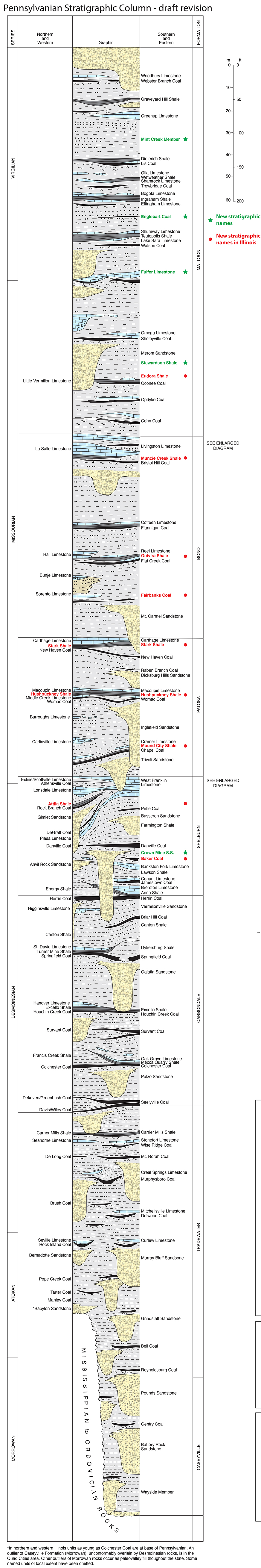
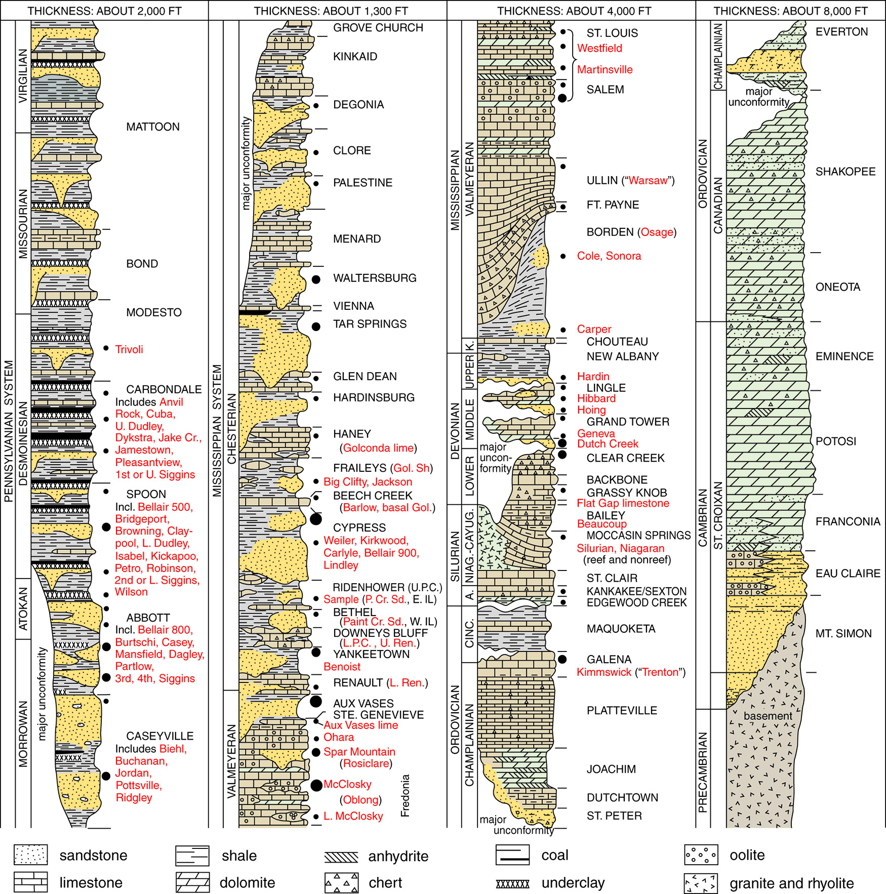
| 16:57, 10 August 2015 | Pennsylvanian column update.jpg (file) |  |
1.91 MB | Alan.Myers | 1 | |
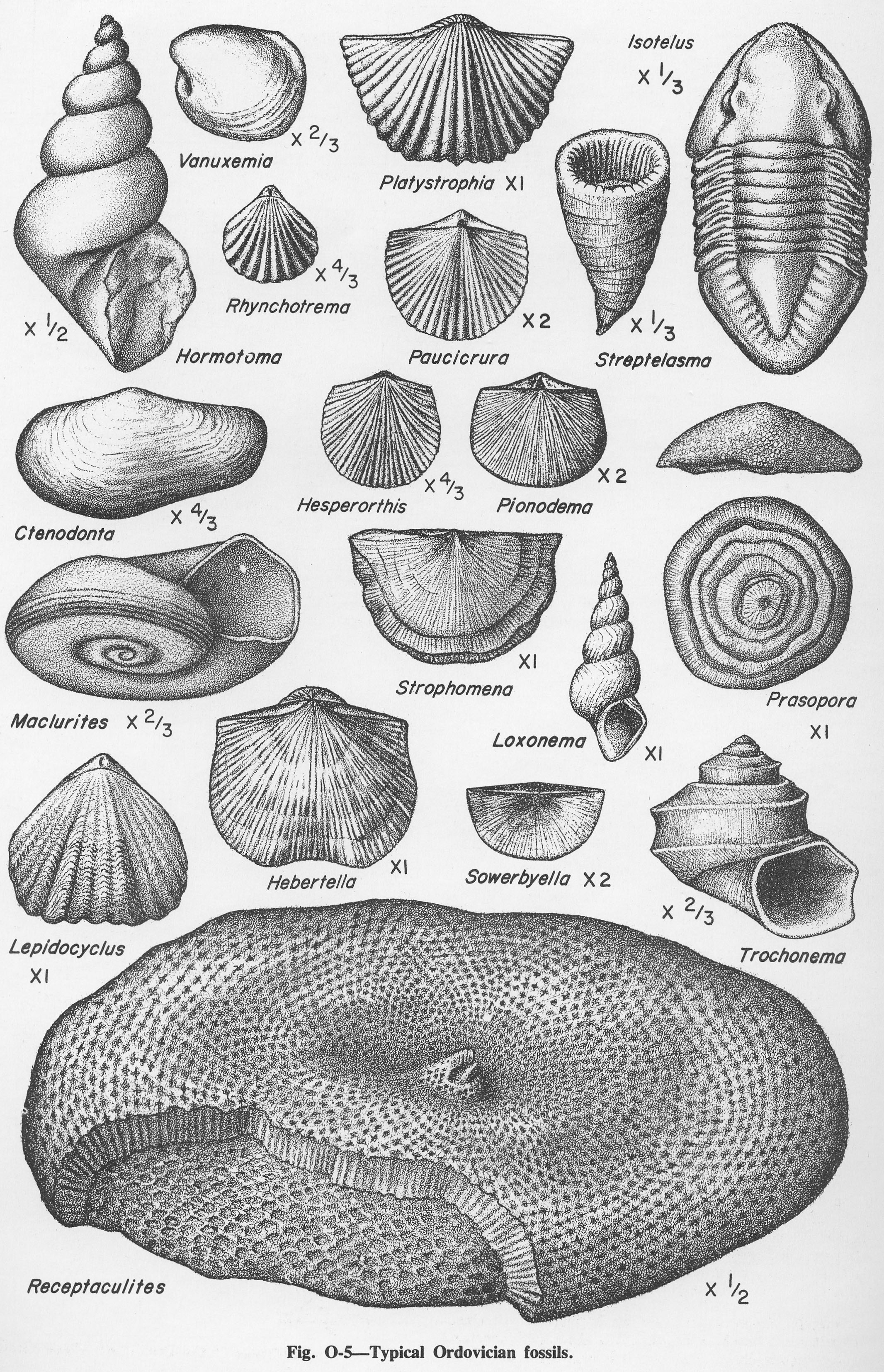
| 14:46, 4 April 2016 | Figure O-5.jpg (file) |  |
1.9 MB | Alan.Myers | Fig. O-5 -- Typical Ordovician fossils | 1 |
| 15:57, 1 April 2016 | Figure 11.jpg (file) |  |
1.89 MB | Alan.Myers | Fig. 11 -- Generalized surficial geology of Illinois. In uneroded areas the loess thins from 25-100 feet thick in the bluffs of the major valleys to 1-2 feet in areas farthest from valleys. | 1 |
| 13:32, 16 October 2019 | GOI-ch15-fig15.jpg (file) |  |
1.88 MB | Alan.Myers | 1 | |
| 18:39, 14 October 2015 | Figure P-3E.jpg (file) |  |
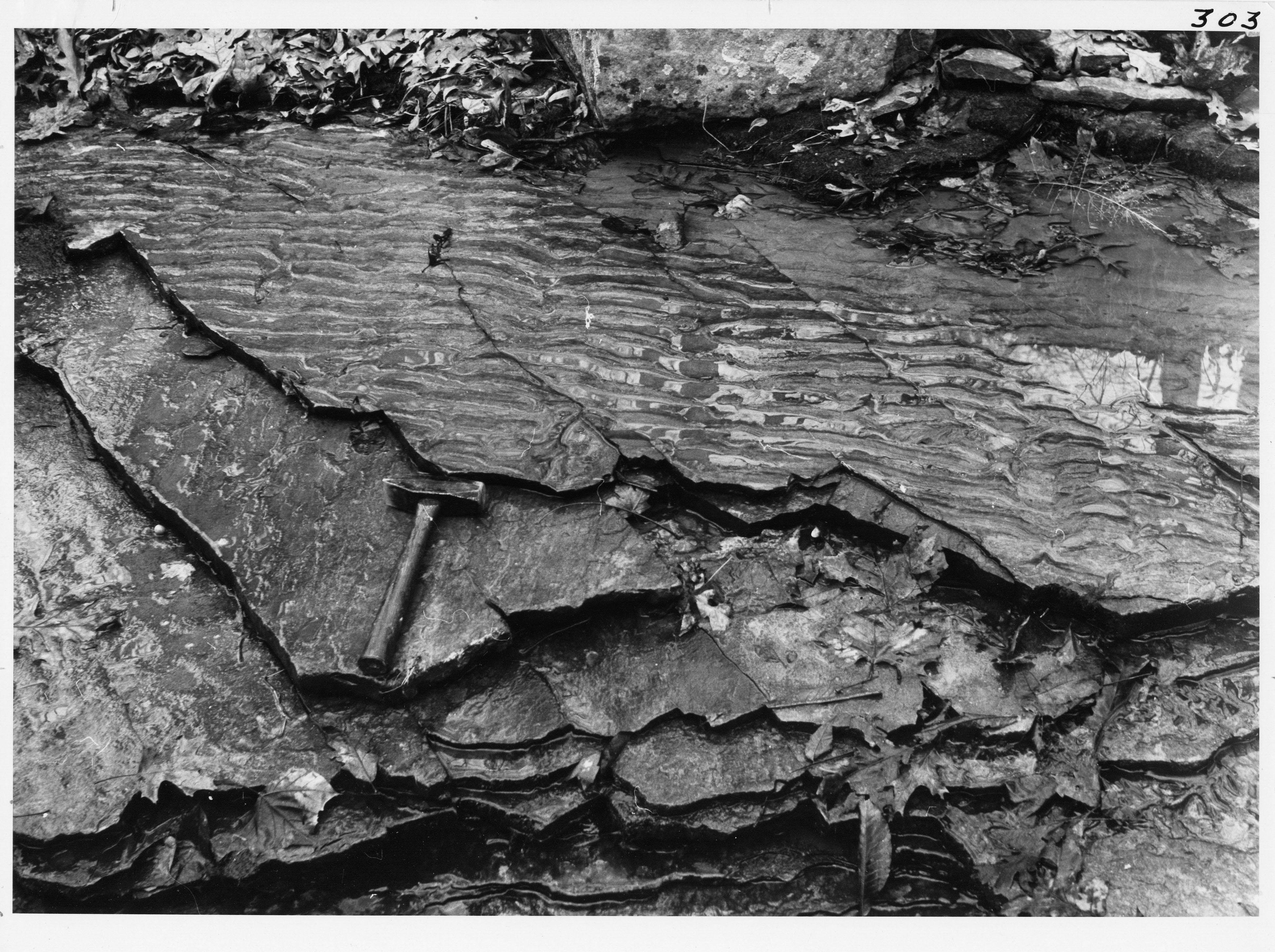
1.82 MB | Jennifer.Obrad | P-3E -- Asymmetrical current ripple marks and weak current laminations (parallel to hammer) in thin-bedded sandstone in the Caseyville Formation, near Pomona, Jackson County. | 1 |
| 15:41, 4 April 2016 | Figure Q-2.jpg (file) |  |
1.76 MB | Alan.Myers | Fig. Q-2 -- Glacial map of Illinois (after Willman and Frye, 1970). | 1 |
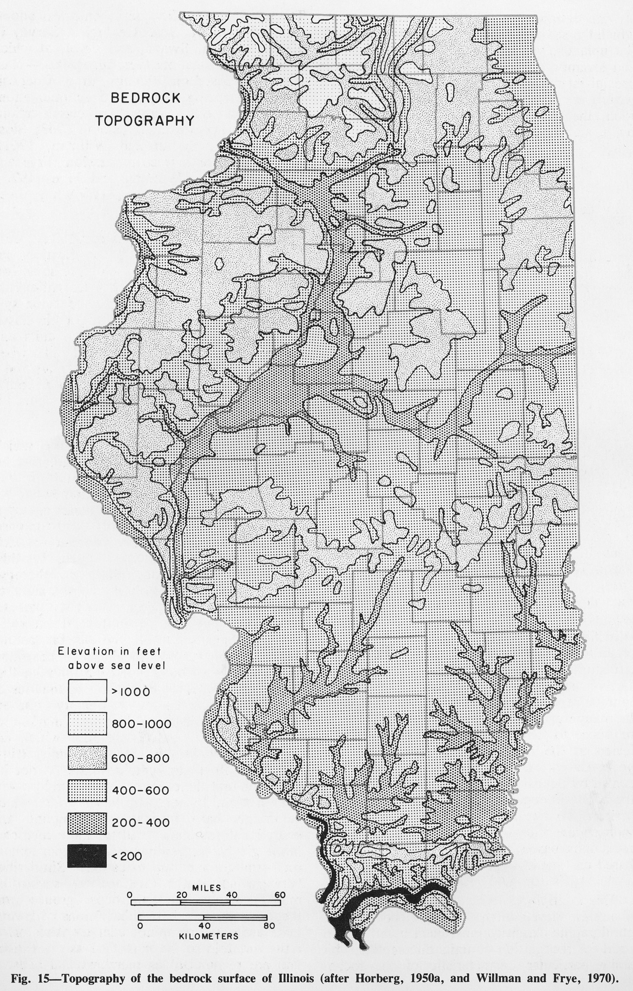
| 19:38, 1 April 2016 | Figure 15.jpg (file) |  |
1.73 MB | Alan.Myers | Fig. 15 -- Topography of the bedrock surface of Illinois (after Horberg, 1950a and Willman and Frye, 1970). | 1 |
| 17:26, 23 December 2020 | Penn carbondale 4-33.jpg (file) |  |
1.68 MB | Jennifer.Obrad | 1 | |
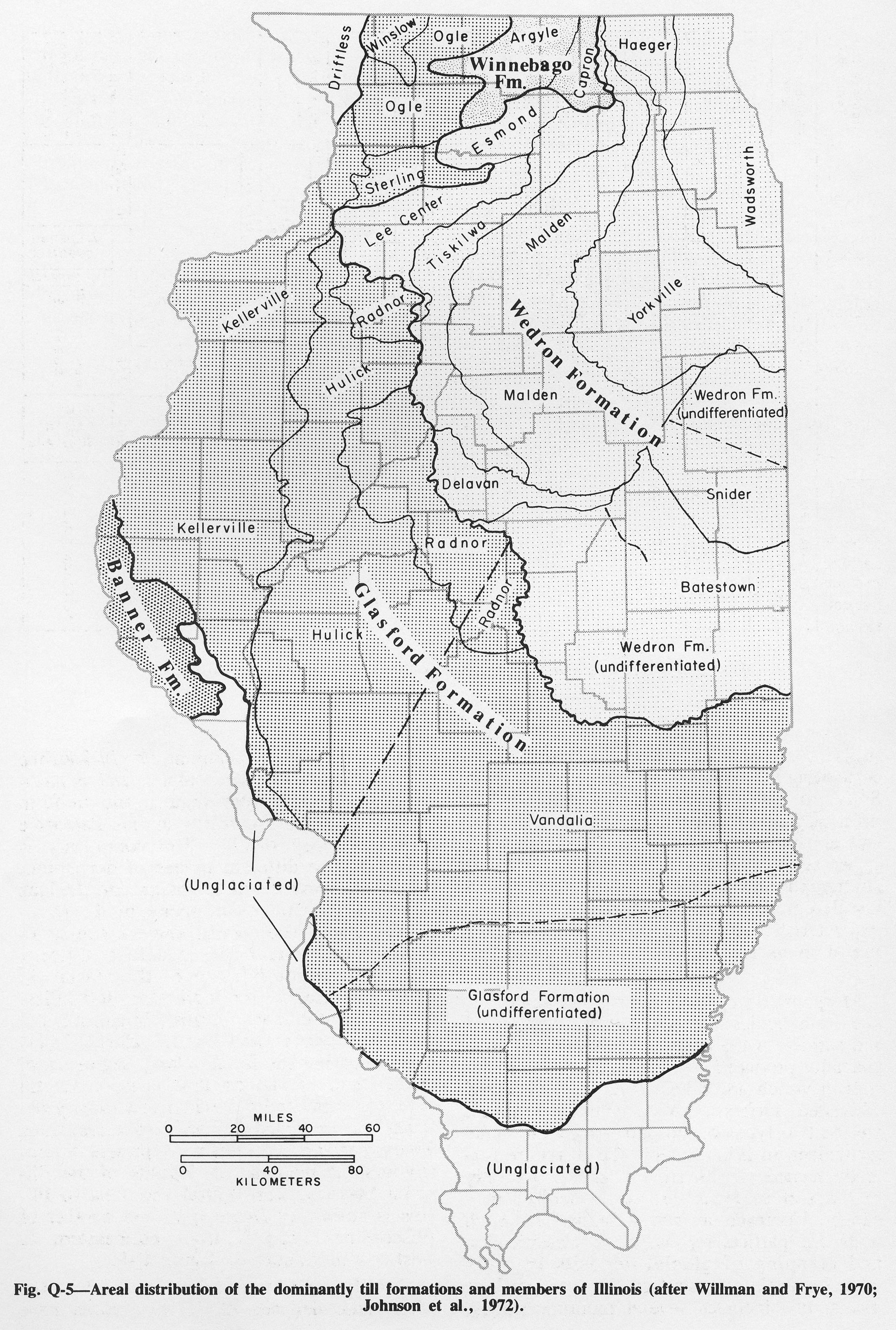
| 15:53, 4 April 2016 | Figure Q-5.jpg (file) |  |
1.68 MB | Alan.Myers | Fig. Q-5 -- Areal distribution of the dominantly till formations and members of Illinois (after Willman and Frye, 1970; Johnson et al., 1972). | 1 |
| 19:16, 10 July 2020 | C605-Figure-30.jpg (file) |  |
1.64 MB | Alan.Myers | 1 | |
| 16:15, 20 July 2020 | Penn caseyville 2-3.jpg (file) |  |
1.64 MB | Jennifer.Obrad | 1 | |
| 16:36, 23 December 2020 | Penn carbondale 4-26.jpg (file) |  |
1.63 MB | Jennifer.Obrad | 1 | |
| 18:40, 14 October 2015 | Figure P-3F.jpg (file) |  |
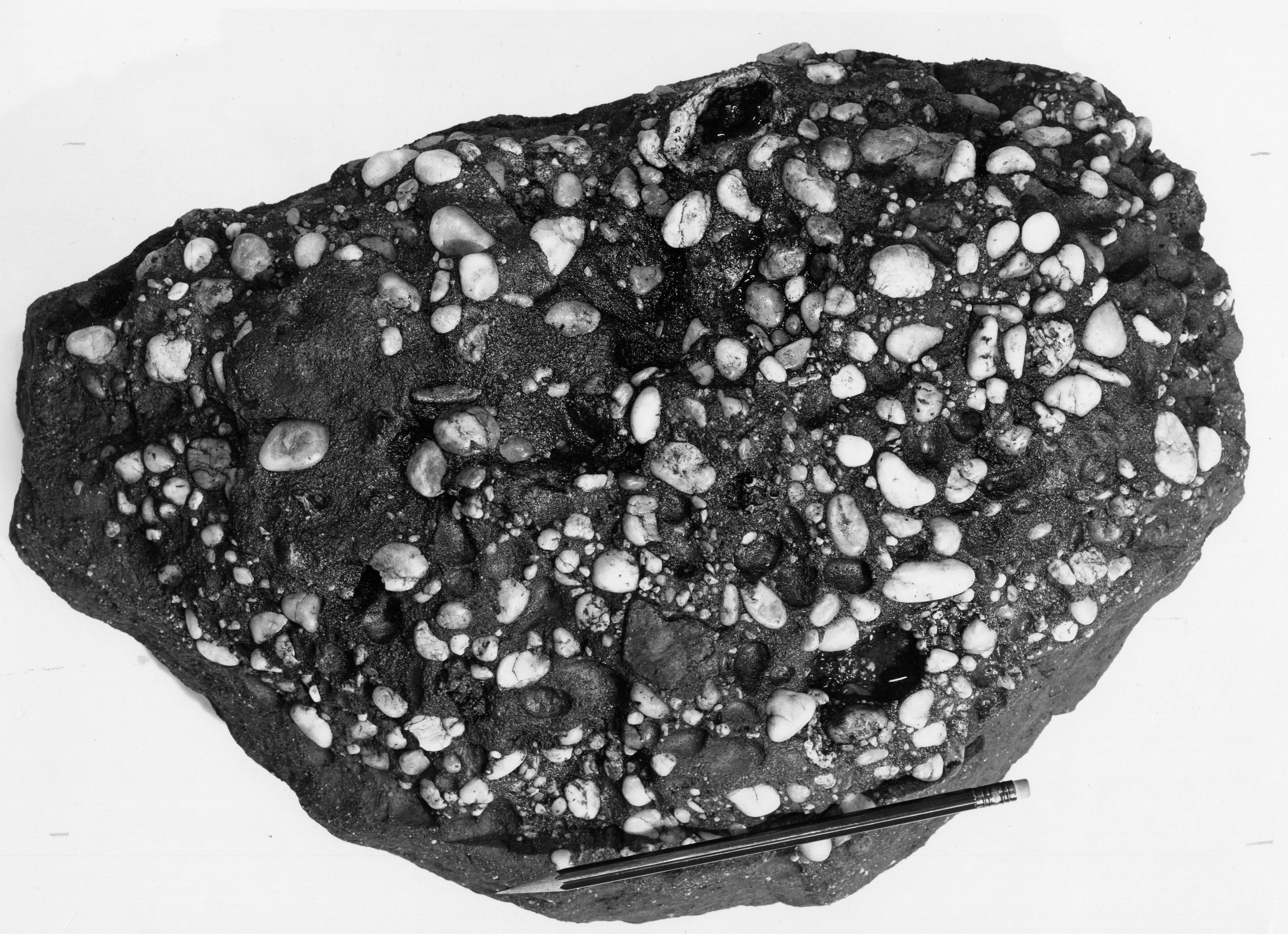
1.61 MB | Jennifer.Obrad | P-3F -- Quartz-pebble conglomerate in the Caseyville Formation near Shiloh Hill, Randolph County. | 1 |
| 19:35, 14 October 2015 | Figure 10.jpg (file) |  |
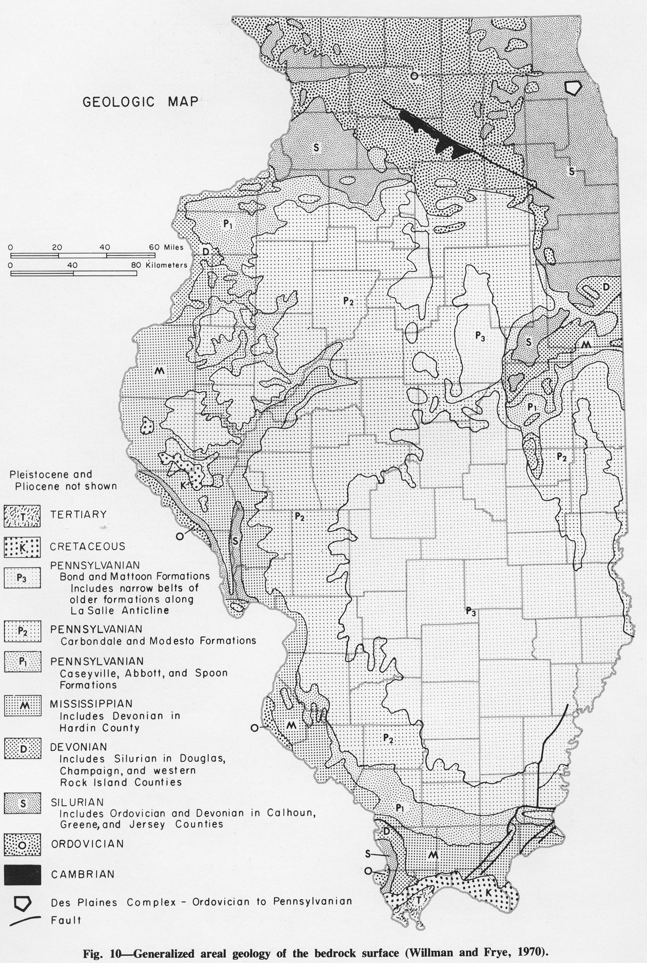
1.61 MB | Jennifer.Obrad | Fig. 10 -- Generalized areal geology of the bedrock surface (Willman and Frye, 1970) | 1 |
| 13:23, 4 April 2016 | Figure M-4.jpg (file) |  |
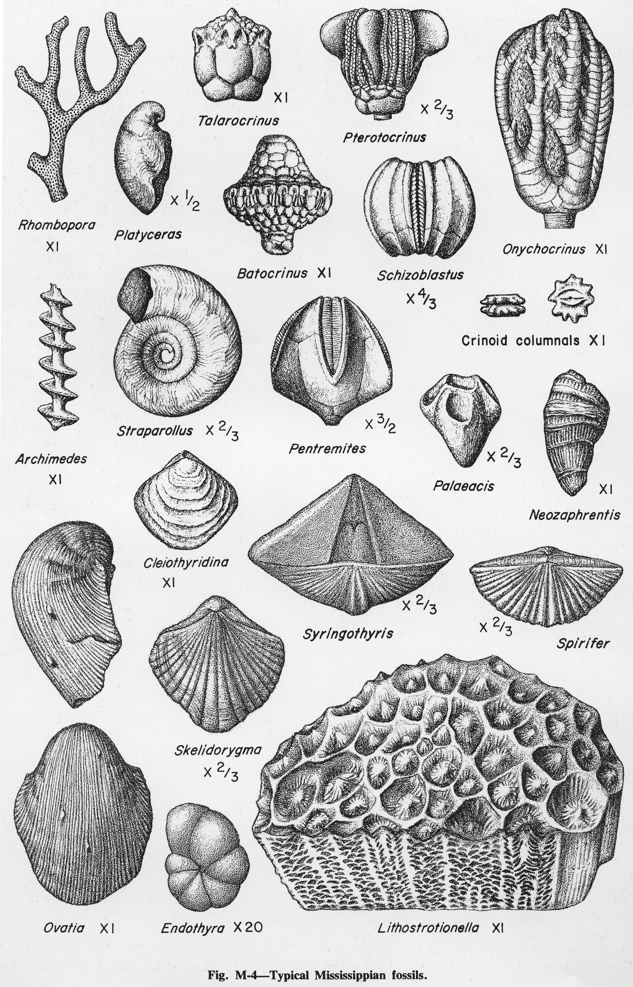
1.57 MB | Alan.Myers | Fig. M-4 -- Typical Mississippian fossils. | 1 |
| 19:58, 1 April 2016 | Figure D-6.jpg (file) |  |
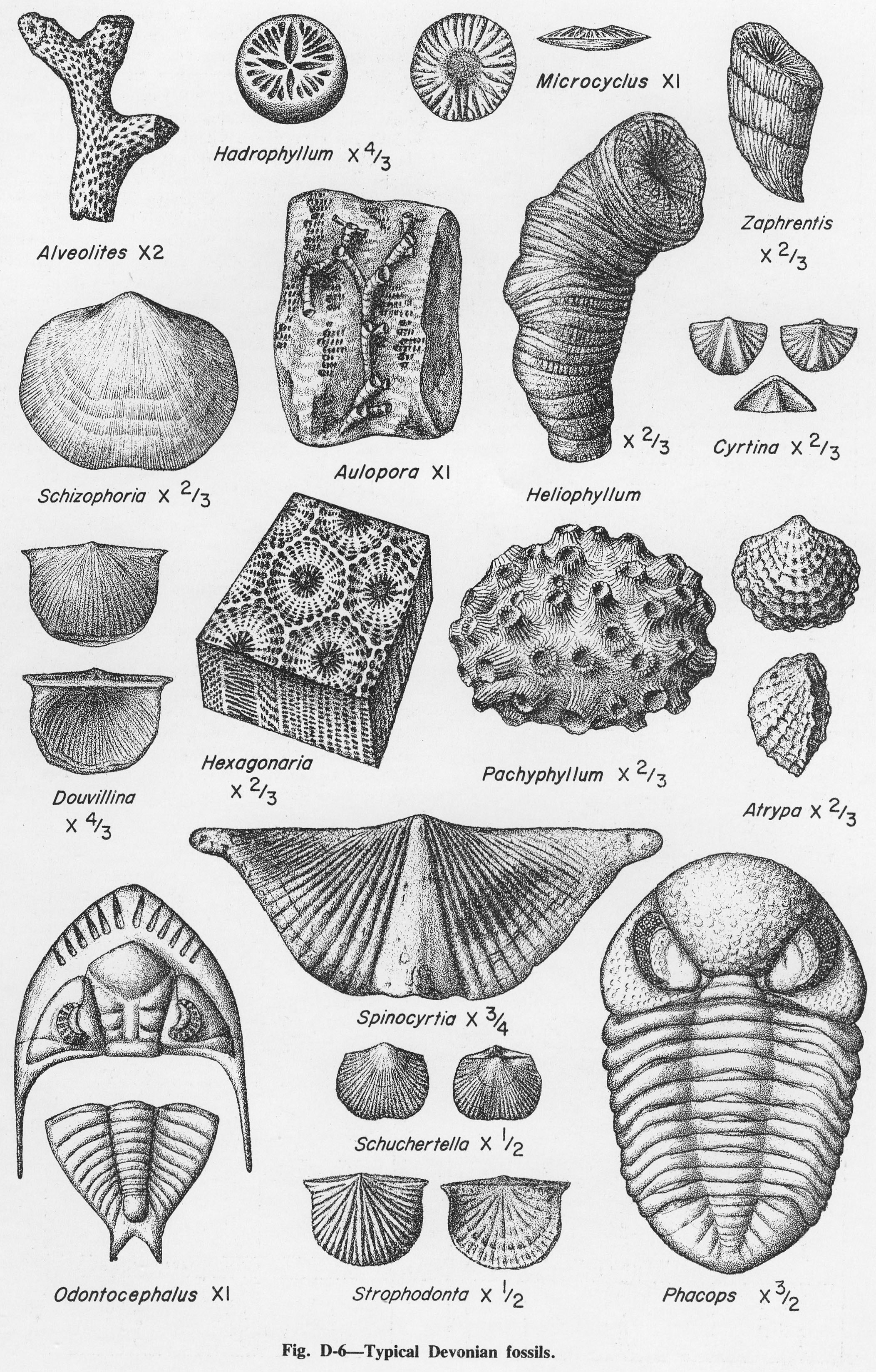
1.56 MB | Alan.Myers | Fig. D-6 -- Typical Devonian fossils. | 1 |
| 15:42, 4 April 2016 | Figure Q-3.jpg (file) |  |
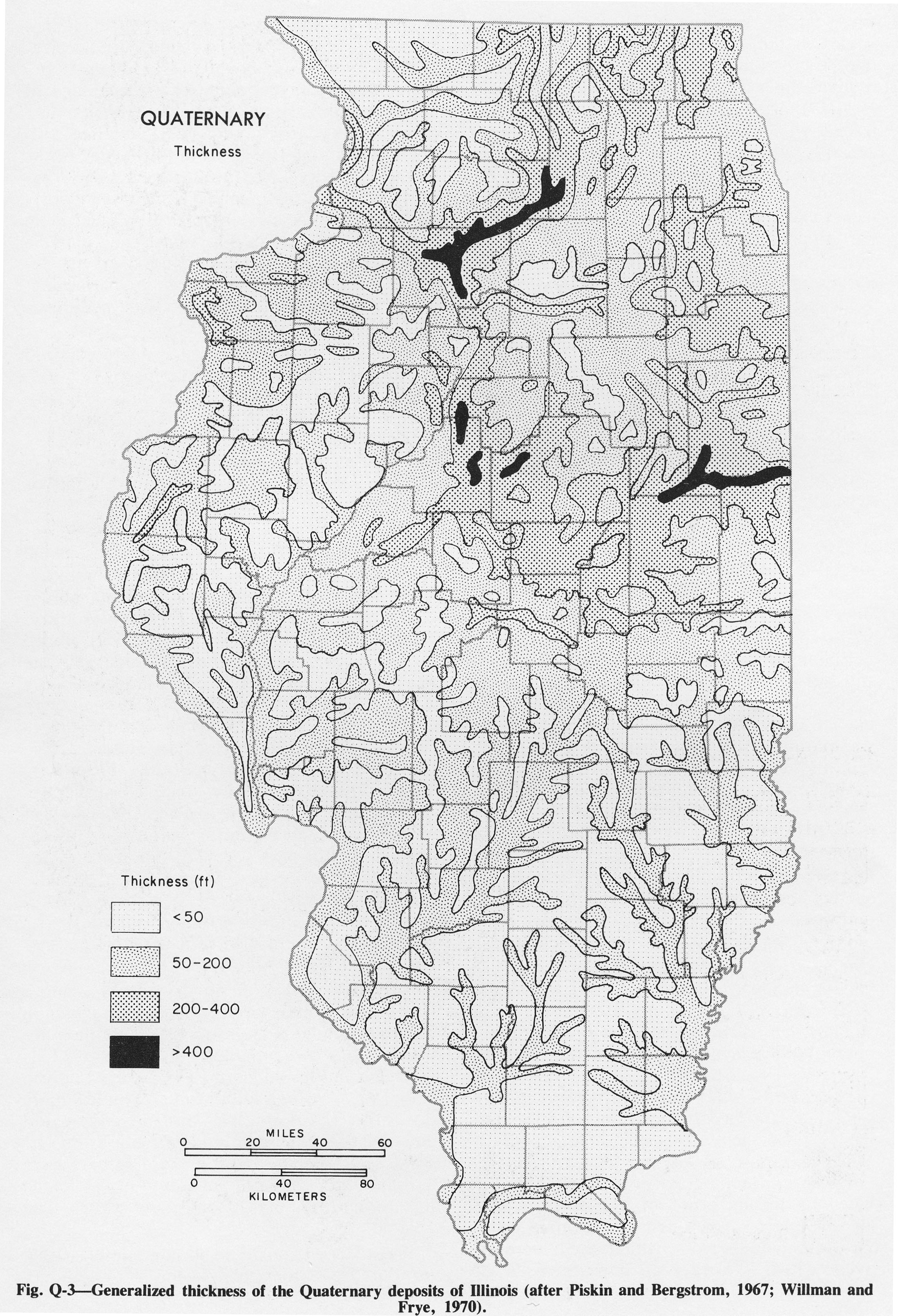
1.55 MB | Alan.Myers | Fig. Q-3 -- Generalized thickness of the Quaternary deposits of Illinois (after Piskin and Bergstrom, 1967; Willman and Frye, 1970). | 1 |
| 21:37, 4 January 2021 | Penn carbondale 4-80.jpg (file) |  |
1.54 MB | Jennifer.Obrad | 1 | |
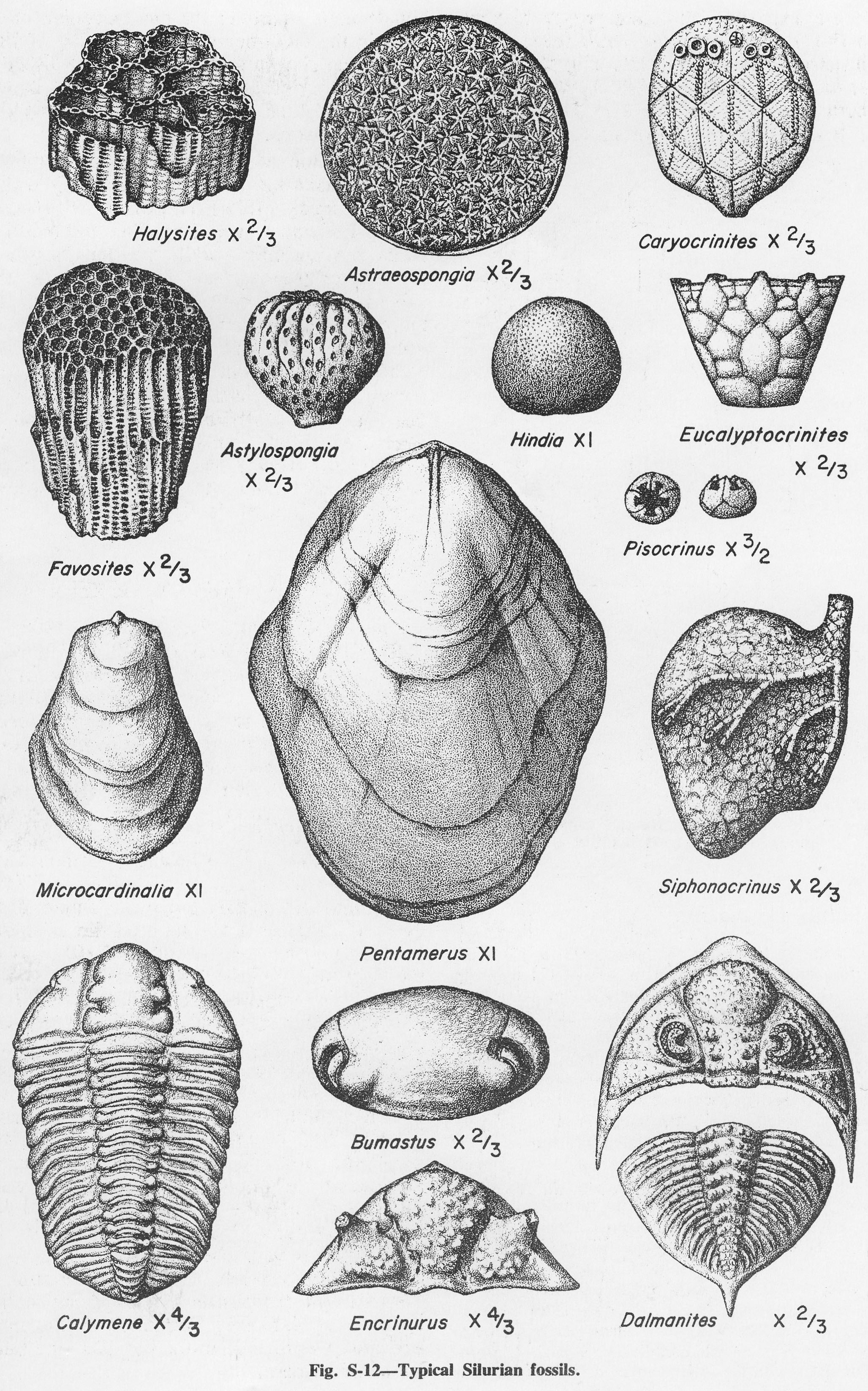
| 17:57, 4 April 2016 | Figure S-12.jpg (file) |  |
1.54 MB | Alan.Myers | Fig. S-12 -- Typical Silurian fossils. | 1 |
| 19:12, 23 December 2020 | Penn carbondale 4-41.jpg (file) |  |
1.54 MB | Jennifer.Obrad | 1 | |
| 14:28, 9 July 2020 | C605-Figure-08.jpg (file) |  |
1.52 MB | Alan.Myers | 1 | |
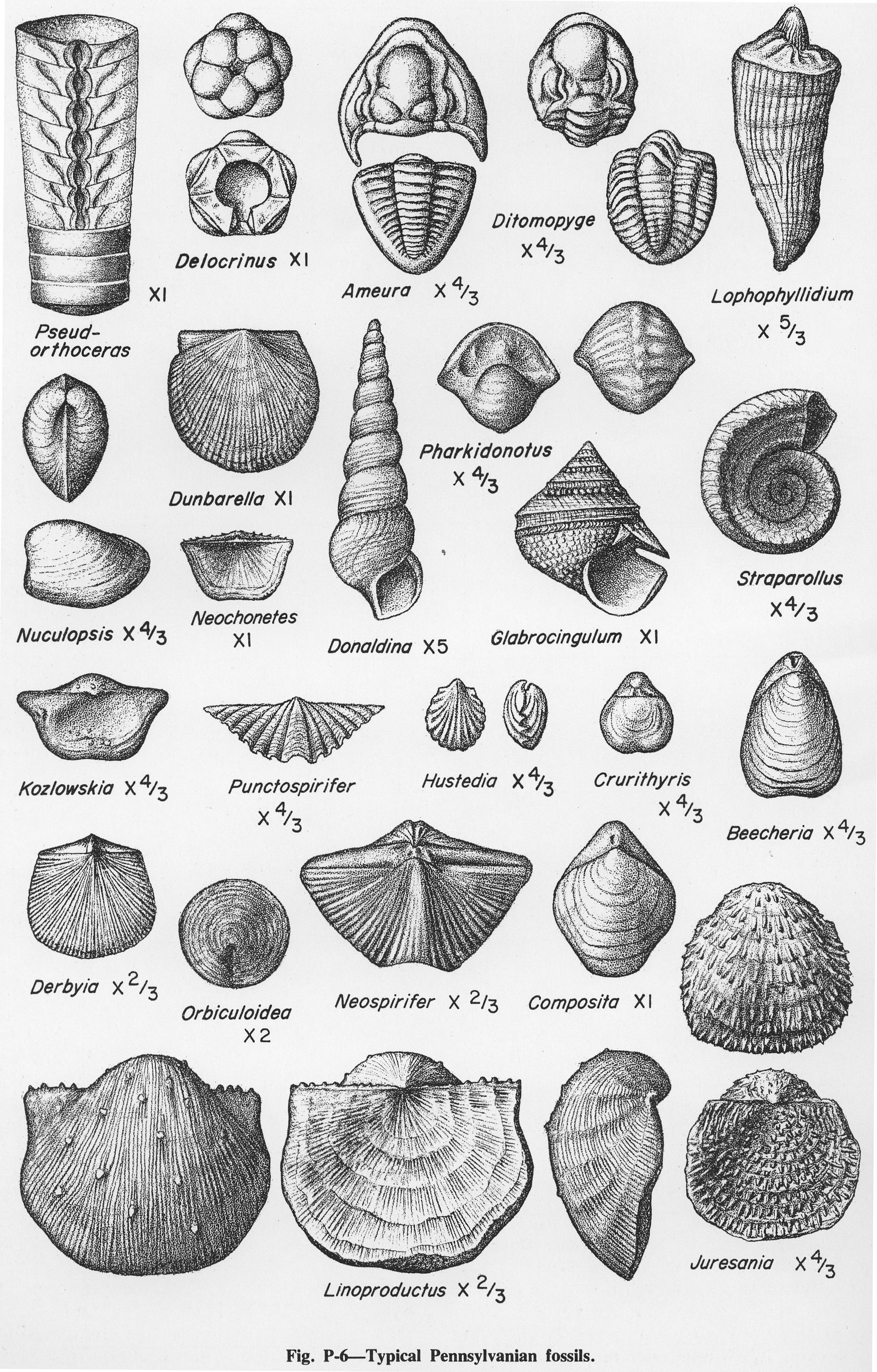
| 20:03, 14 October 2015 | Figure P-6.jpg (file) |  |
1.5 MB | Jennifer.Obrad | Fig. P-6 -- Typical Pennsylvanian fossils | 1 |
| 18:37, 4 April 2016 | Figure K-1B.jpg (file) |  |
1.5 MB | Alan.Myers | Fig. K-1B -- Mounds Gravel in pit along Illinois Highway 145, 8 miles north of Metropolis, Massac County. | 1 |
| 13:16, 5 April 2016 | Figure S-2D.jpg (file) |  |
1.46 MB | Alan.Myers | Fig. S-2D -- Massive Tete des Morts Formation overlying the Mosalem Formation at the top of Silurian escarpment, 4 miles southeast of Galena, Jo Daviess County. | 1 |
| 19:18, 10 July 2020 | C605-Figure-31.jpg (file) |  |
1.45 MB | Alan.Myers | 1 | |
| 14:43, 9 July 2020 | C605-Figure-12.jpg (file) |  |
1.43 MB | Alan.Myers | 1 | |
| 19:58, 10 July 2020 | C605-Plate 5 - Effingham Channel Stewardson Xsec.jpg (file) | 1.42 MB | Alan.Myers | 1 | ||
| 17:30, 23 December 2020 | Penn carbondale 4-35.jpg (file) |  |
1.42 MB | Jennifer.Obrad | 1 |