Uploads by Alan.Myers
Jump to navigation
Jump to search
This special page shows all uploaded files.
| Date | Name | Thumbnail | Size | Description | Versions |
|---|---|---|---|---|---|
| 15:46, 11 July 2020 | C605-Figure-48.jpg (file) |  |
321 KB | 1 | |
| 17:39, 11 July 2020 | C605-Figure-49.jpg (file) |  |
428 KB | 1 | |
| 17:40, 11 July 2020 | C605-Figure-50.jpg (file) |  |
505 KB | 1 | |
| 17:41, 11 July 2020 | C605-Figure-51.jpg (file) |  |
526 KB | 1 | |
| 17:42, 11 July 2020 | C605-Figure-52.jpg (file) |  |
590 KB | 1 | |
| 17:43, 11 July 2020 | C605-Figure-53.jpg (file) |  |
505 KB | 1 | |
| 17:44, 11 July 2020 | C605-Figure-54.jpg (file) |  |
591 KB | 1 | |
| 17:46, 11 July 2020 | C605-Figure-55.jpg (file) |  |
554 KB | 1 | |
| 17:47, 11 July 2020 | C605-Figure-56.jpg (file) |  |
705 KB | 1 | |
| 17:49, 11 July 2020 | C605-Figure-57.jpg (file) |  |
626 KB | 1 | |
| 17:50, 11 July 2020 | C605-Figure-58.jpg (file) |  |
619 KB | 1 | |
| 17:52, 11 July 2020 | C605-Figure-59.jpg (file) |  |
345 KB | 1 | |
| 17:58, 11 July 2020 | C605-Figure-60.jpg (file) |  |
713 KB | 1 | |
| 17:59, 11 July 2020 | C605-Figure-61.jpg (file) |  |
237 KB | 1 | |
| 21:03, 17 July 2020 | C605-Plate-01.jpg (file) |  |
1.04 MB | 2 | |
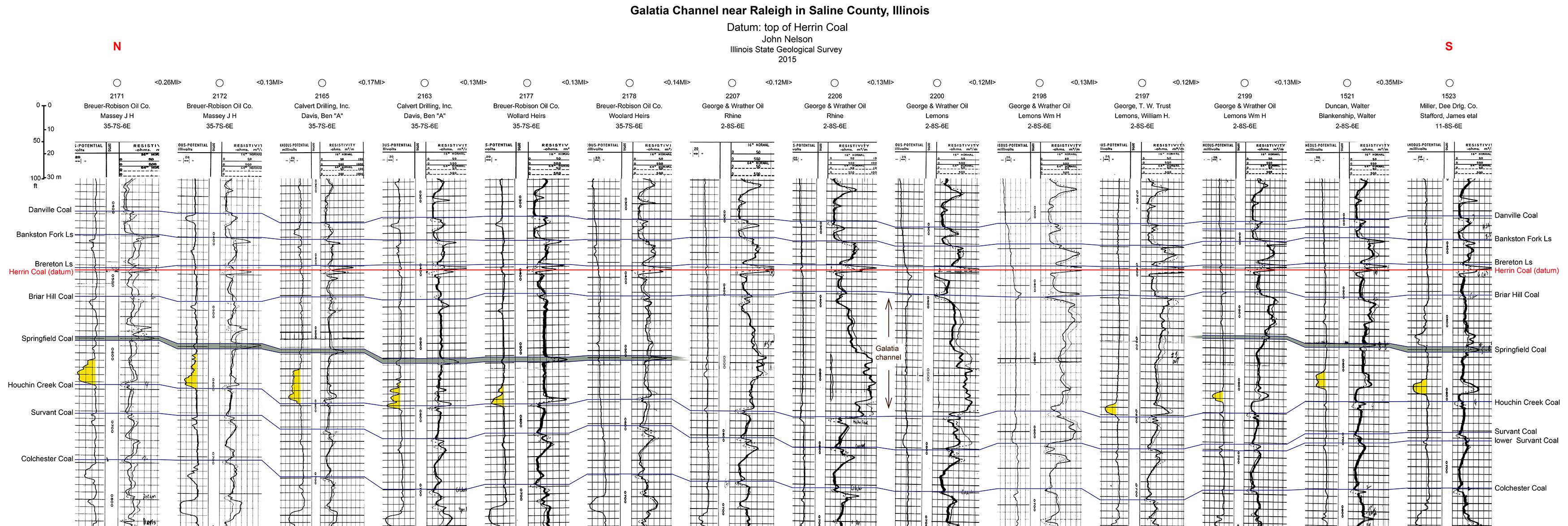
| 18:59, 9 July 2020 | C605-Plate 2 - Galatia Channel Xsec Saline Co.jpg (file) |  |
1.37 MB | 1 | |
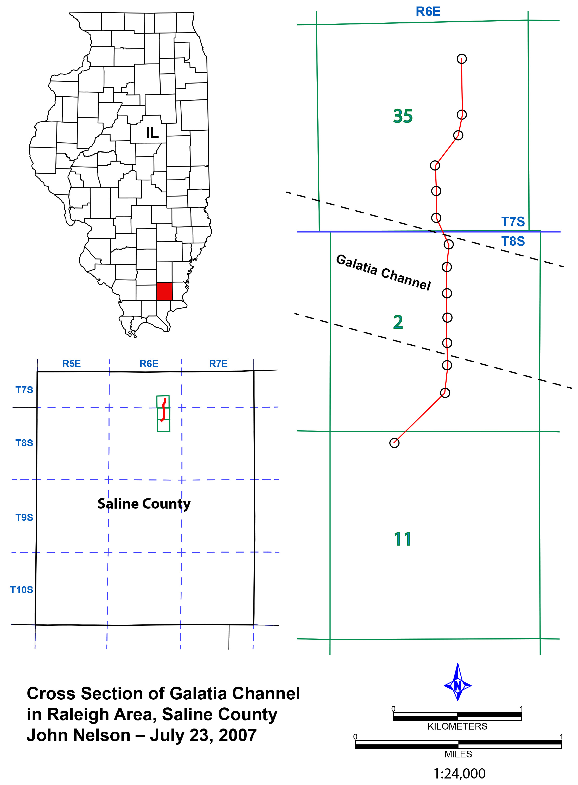
| 18:35, 9 July 2020 | C605-Plate 2 - Galatia Channel Xsec Saline Co map.jpg (file) |  |
607 KB | 1 | |
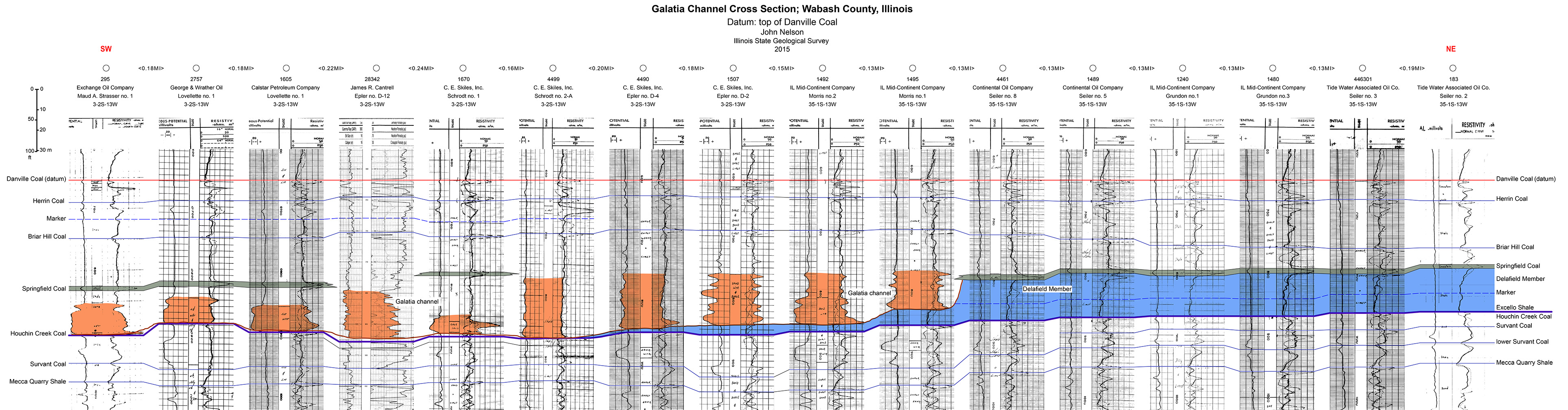
| 19:25, 9 July 2020 | C605-Plate 3 -Galatia Chanel Xsec Wabash Co.jpg (file) | 1.36 MB | 1 | ||
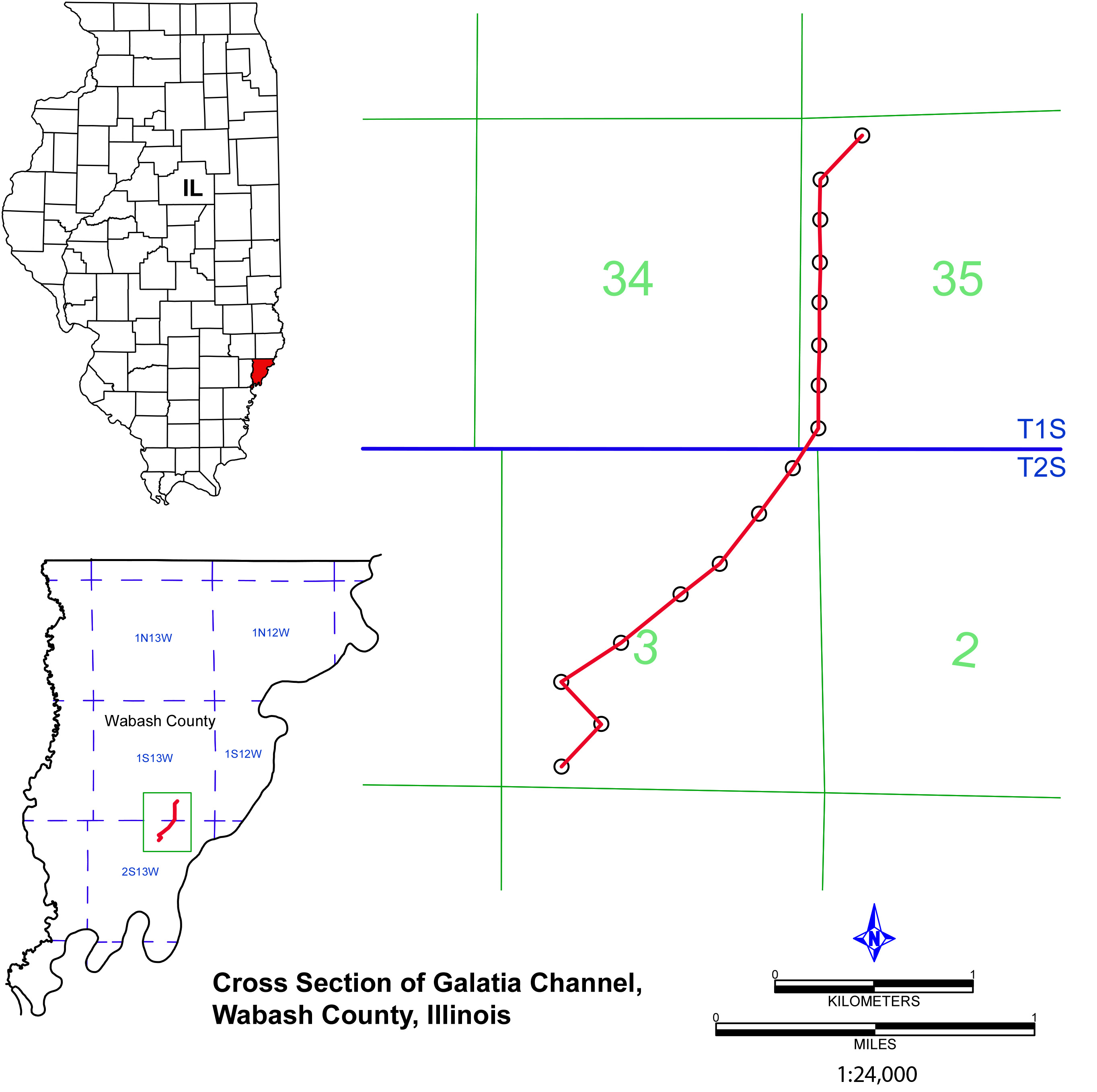
| 19:23, 9 July 2020 | C605-Plate 3 - Galatia Channel Xsec Wabash Co map.jpg (file) |  |
629 KB | 1 | |
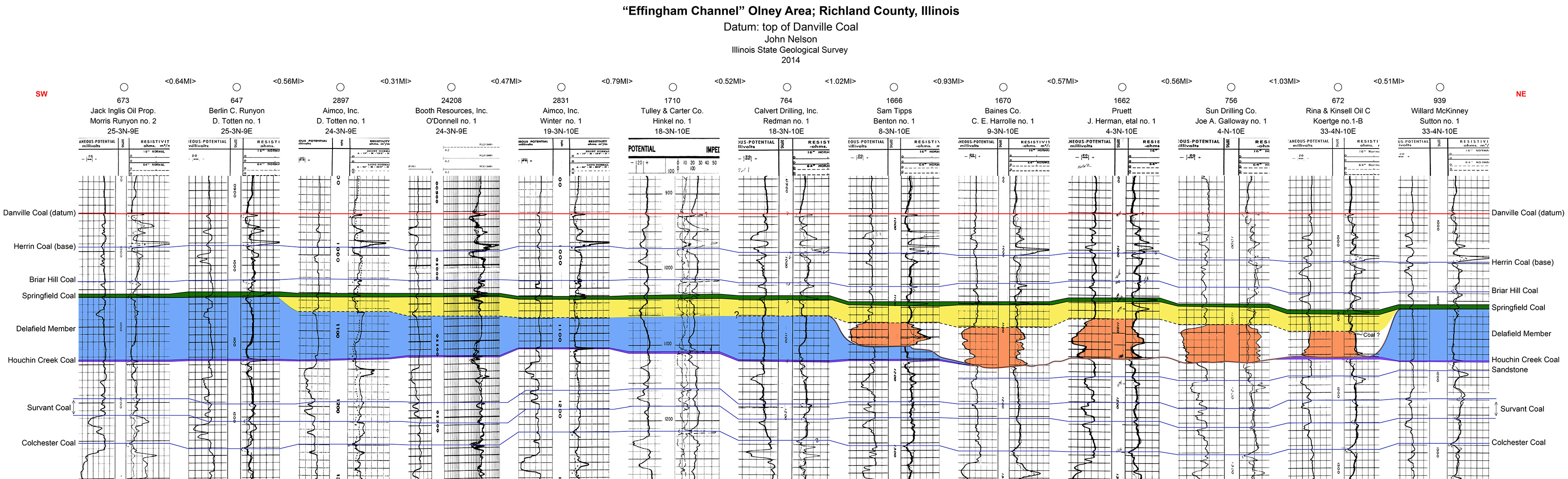
| 19:53, 10 July 2020 | C605-Plate 4 - Effingham Channel Olney Xsec.jpg (file) |  |
1.33 MB | 1 | |
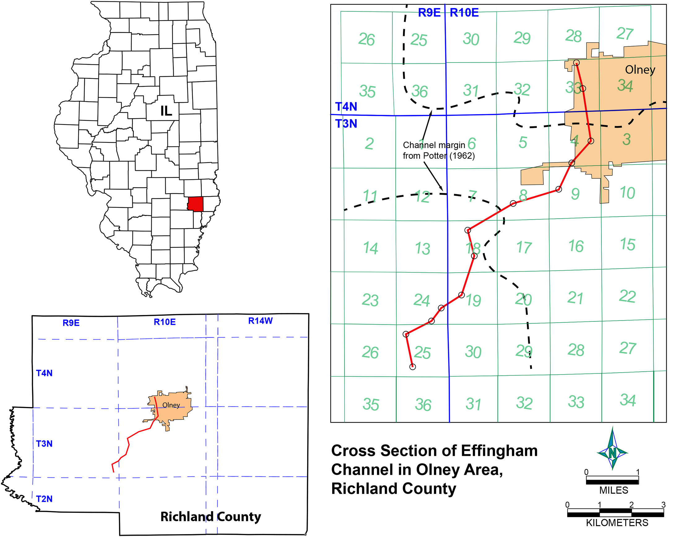
| 19:56, 10 July 2020 | C605-Plate 4 - Effingham Channel Olney Xsec map.jpg (file) |  |
564 KB | 1 | |
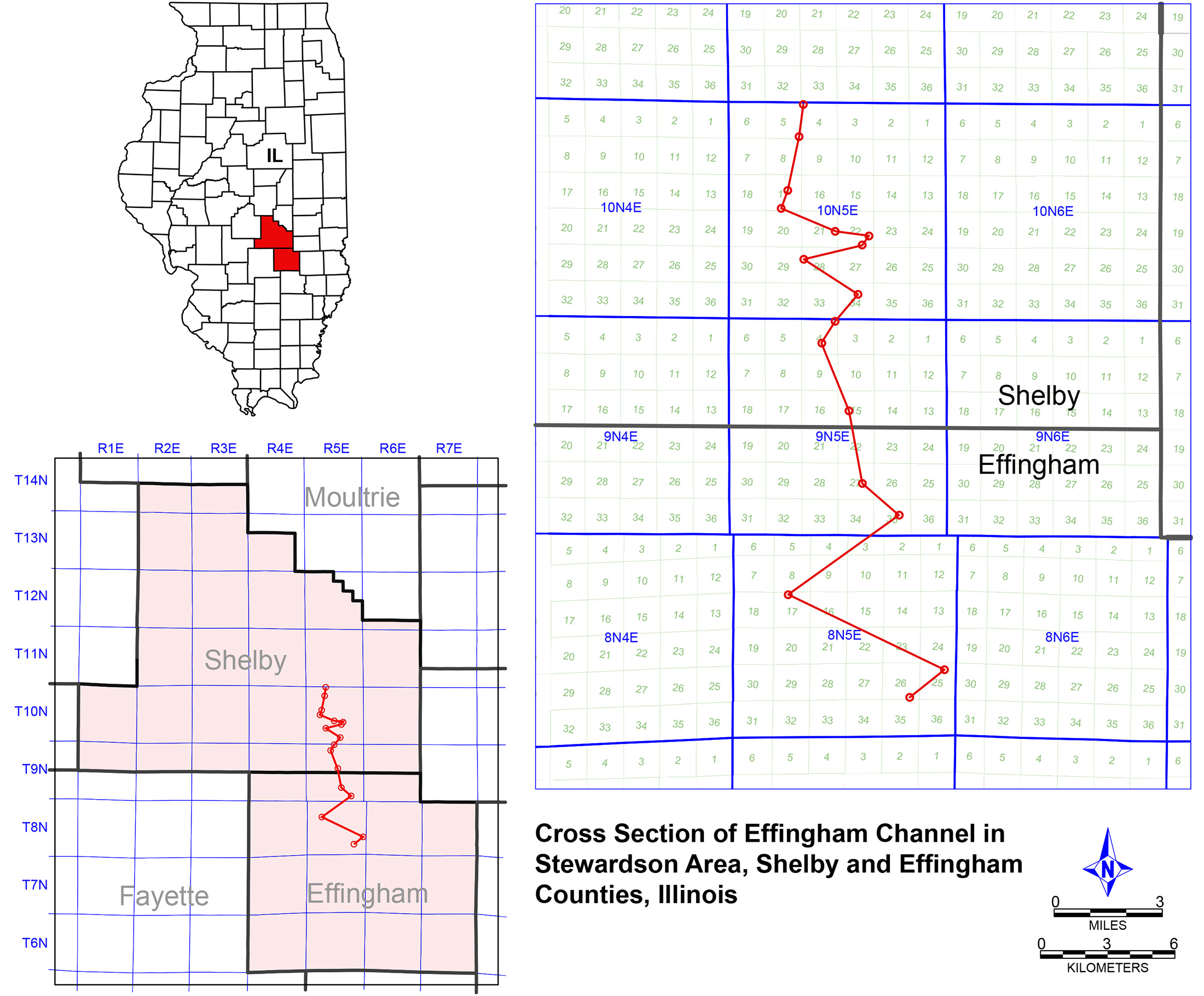
| 19:58, 10 July 2020 | C605-Plate 5 - Effingham Channel Stewardson Xsec.jpg (file) | 1.42 MB | 1 | ||
| 19:59, 10 July 2020 | C605-Plate 5 - Effingham Channel Stewardson Xsec map.jpg (file) |  |
770 KB | 1 | |
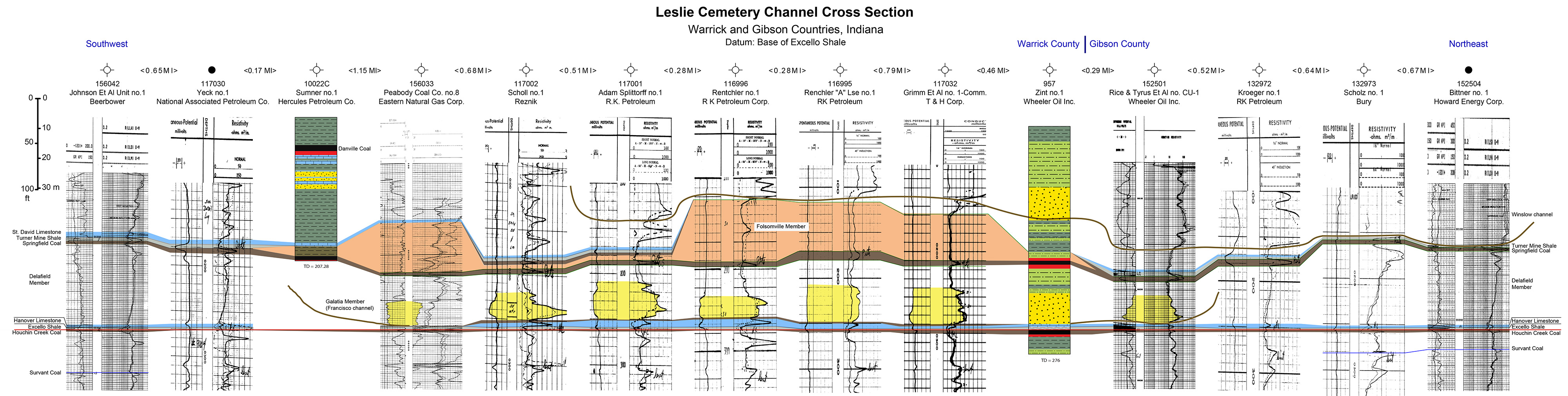
| 20:02, 10 July 2020 | C605-Plate 6 - Leslie Cemetery Channel Xsec.jpg (file) | 1.24 MB | 1 | ||
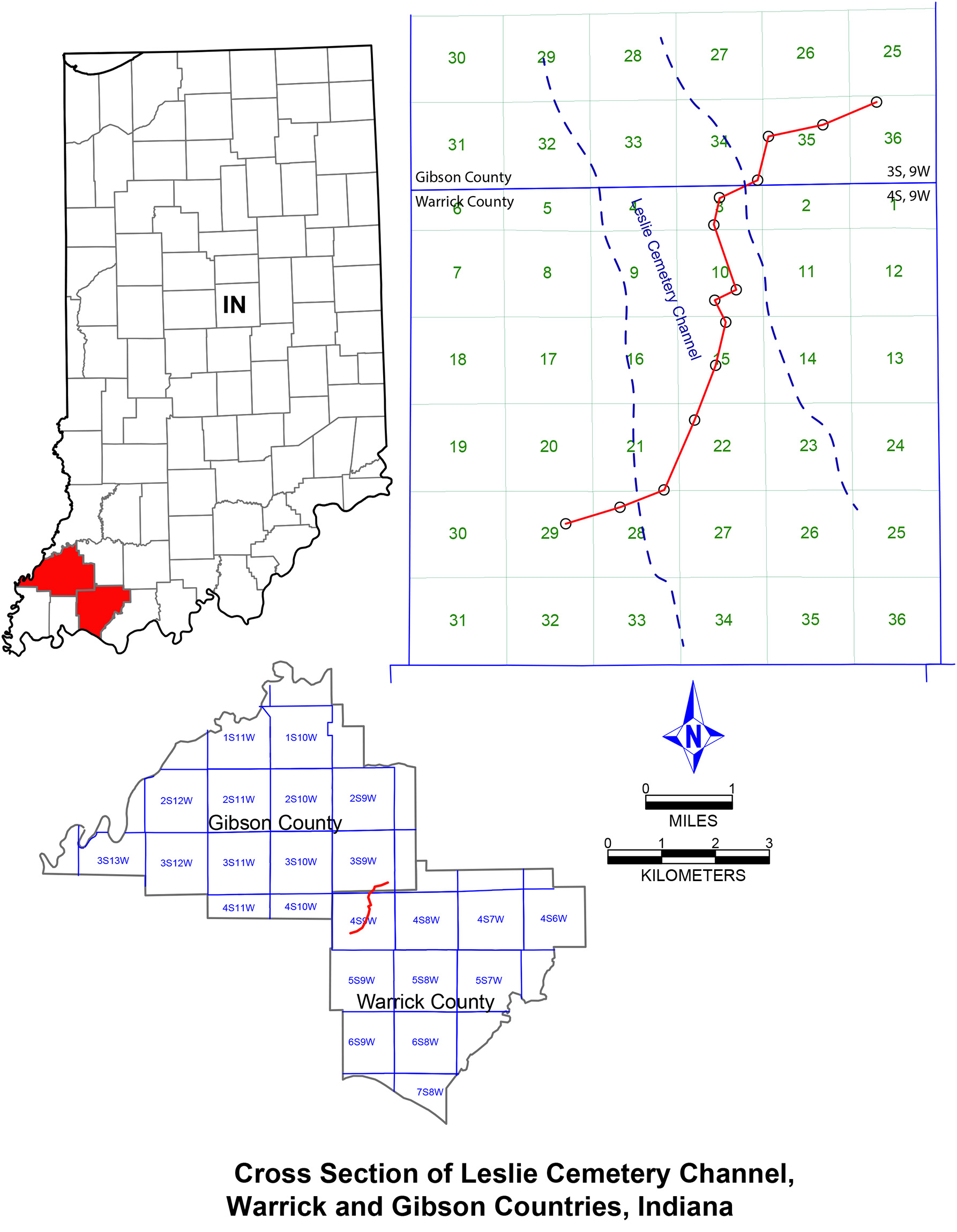
| 20:03, 10 July 2020 | C605-Plate 6 - Leslie Cemetery Channel Xsec map.jpg (file) |  |
540 KB | 1 | |
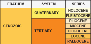
| 17:27, 3 March 2017 | Cenozoic search.jpg (file) |  |
45 KB | 2 | |
| 13:51, 10 January 2017 | Devonian imagepage.jpg (file) |  |
94 KB | Devonian imagemap | 1 |
| 16:24, 31 March 2016 | Figure 1.jpg (file) |  |
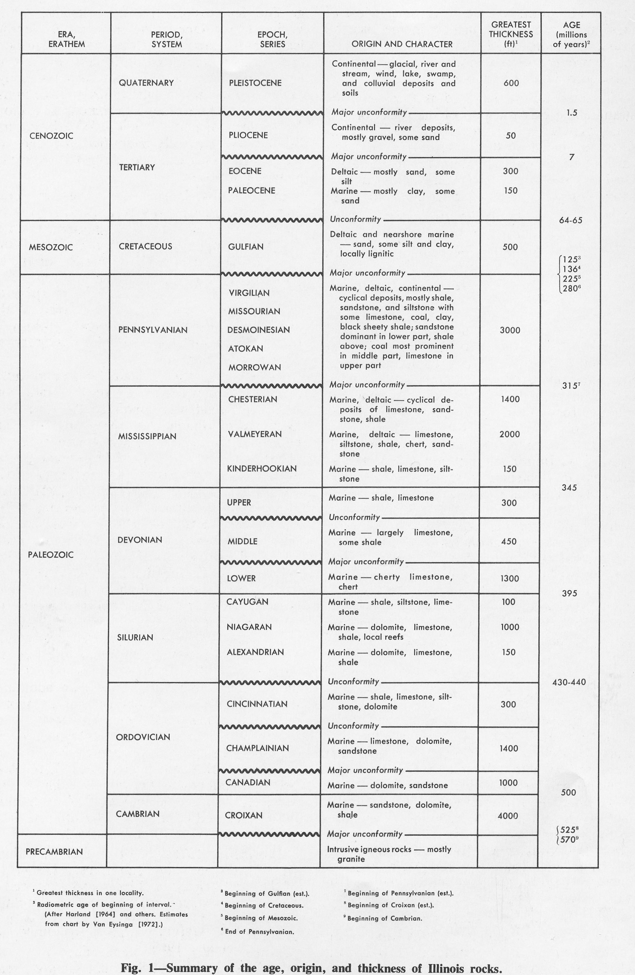
661 KB | Fig. 1 -- Summary of the age, origin, and thickness of Illinois rocks. | 1 |
| 15:57, 1 April 2016 | Figure 11.jpg (file) |  |
1.89 MB | Fig. 11 -- Generalized surficial geology of Illinois. In uneroded areas the loess thins from 25-100 feet thick in the bluffs of the major valleys to 1-2 feet in areas farthest from valleys. | 1 |
| 19:35, 1 April 2016 | Figure 13.jpg (file) |  |
574 KB | Fig. 13 -- Geologic cross section along the lines shown in figure 12 (after Willman er al., 1967). | 1 |
| 19:36, 1 April 2016 | Figure 14.jpg (file) |  |
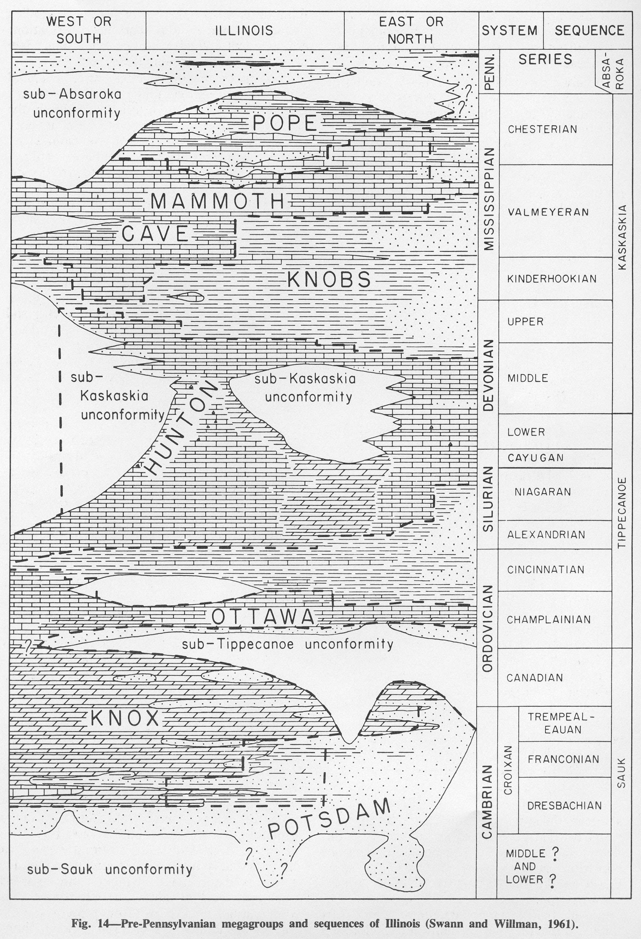
1.08 MB | Fig. 14 -- Pre-Pennsylvanian megagroups and sequences of Illinois (Swann and Willman, 1961). | 1 |
| 19:38, 1 April 2016 | Figure 15.jpg (file) |  |
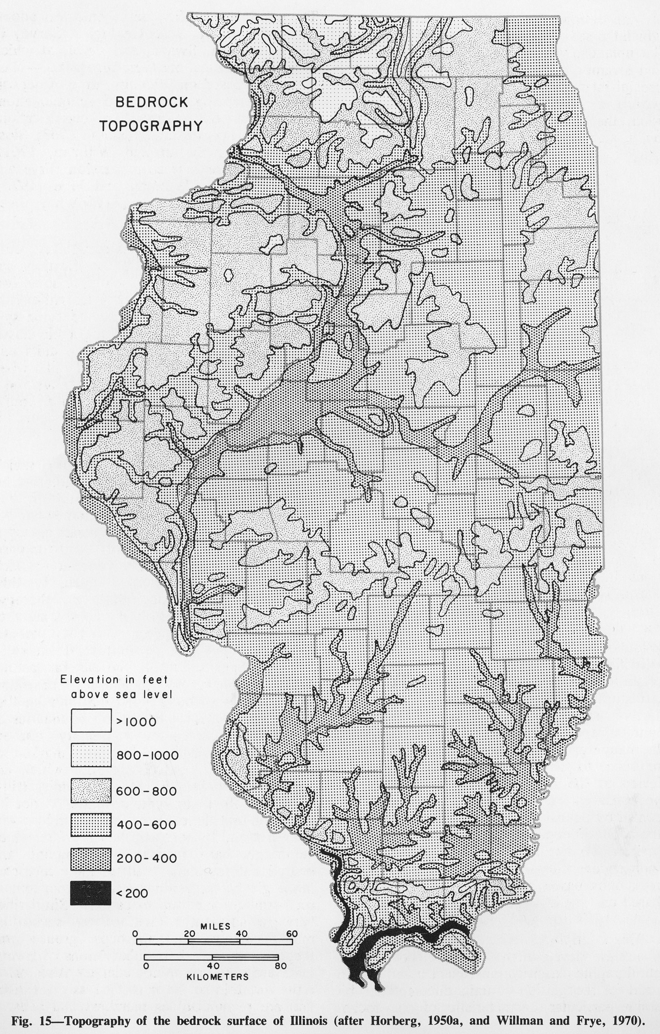
1.73 MB | Fig. 15 -- Topography of the bedrock surface of Illinois (after Horberg, 1950a and Willman and Frye, 1970). | 1 |
| 19:39, 1 April 2016 | Figure 16.jpg (file) |  |
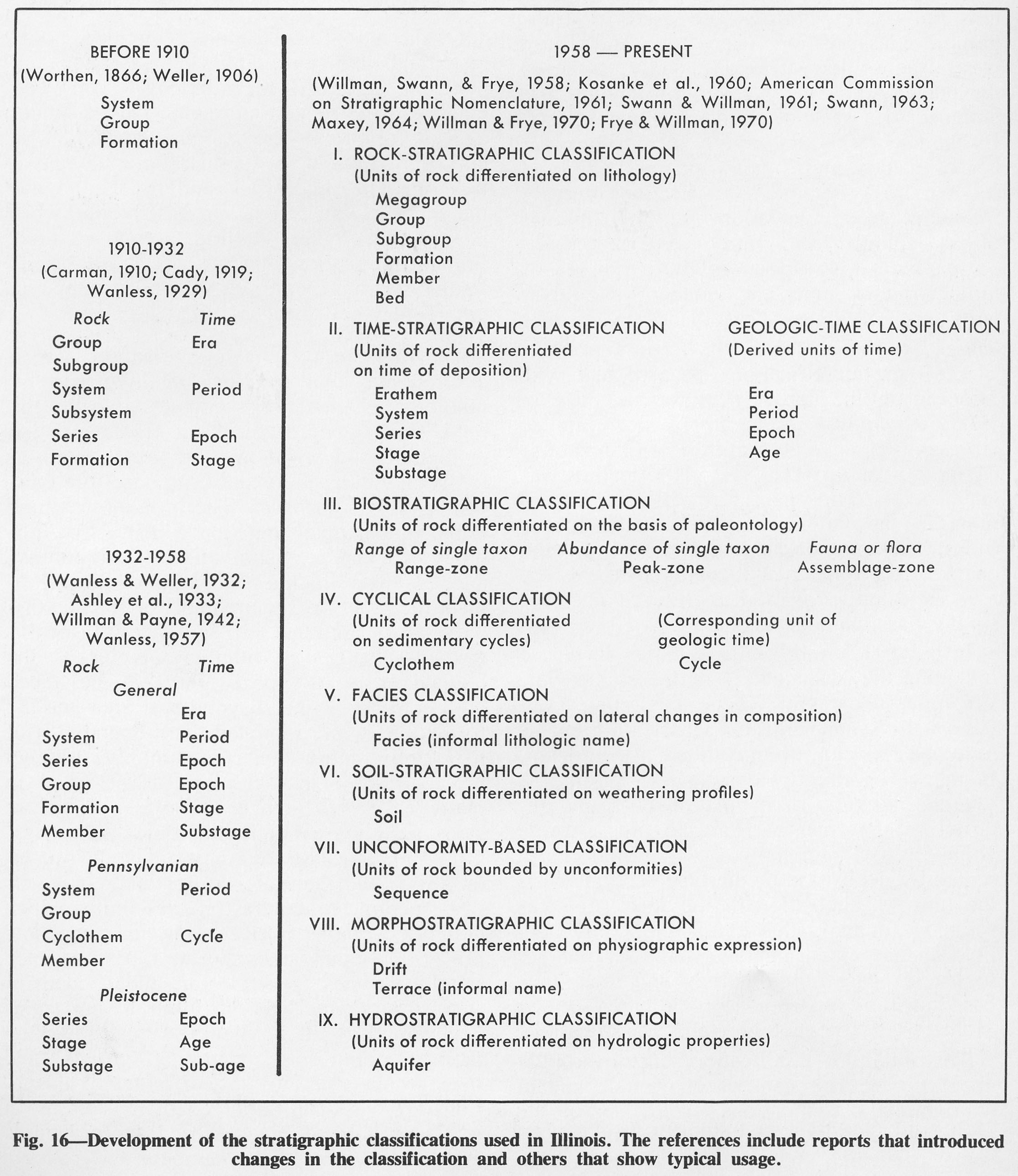
610 KB | Fig. 16 -- Development of the stratigraphic classifications used in Illinois. The references include reports that introduced changes in the classification and others that show typical usage. | 1 |
| 19:40, 1 April 2016 | Figure 17.jpg (file) |  |
301 KB | Fig. 17 -- Patterns and symbols used in figures. | 1 |
| 15:46, 1 April 2016 | Figure 3.jpg (file) |  |
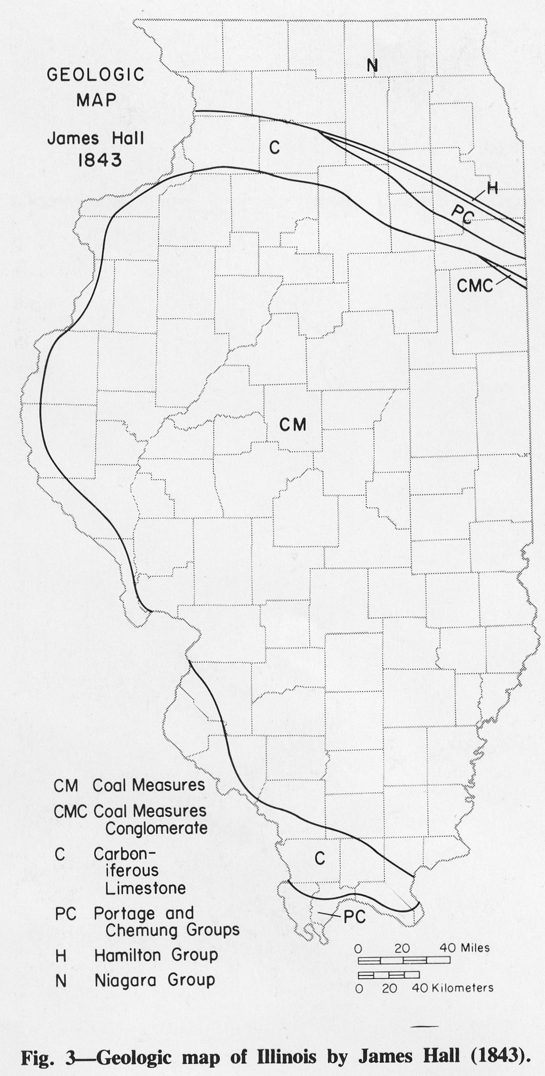
273 KB | Fig. 3 -- Geologic map of Illinois by James Hall (1843). | 1 |
| 15:49, 1 April 2016 | Figure 4.jpg (file) |  |
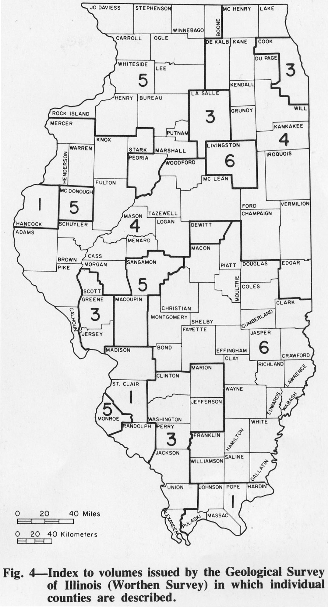
274 KB | Fig. 4 -- Index to volumes issued by the Geological Survey of Illinois (Worthen Survey) in which individual counties are described. | 1 |
| 15:50, 1 April 2016 | Figure 5.jpg (file) |  |
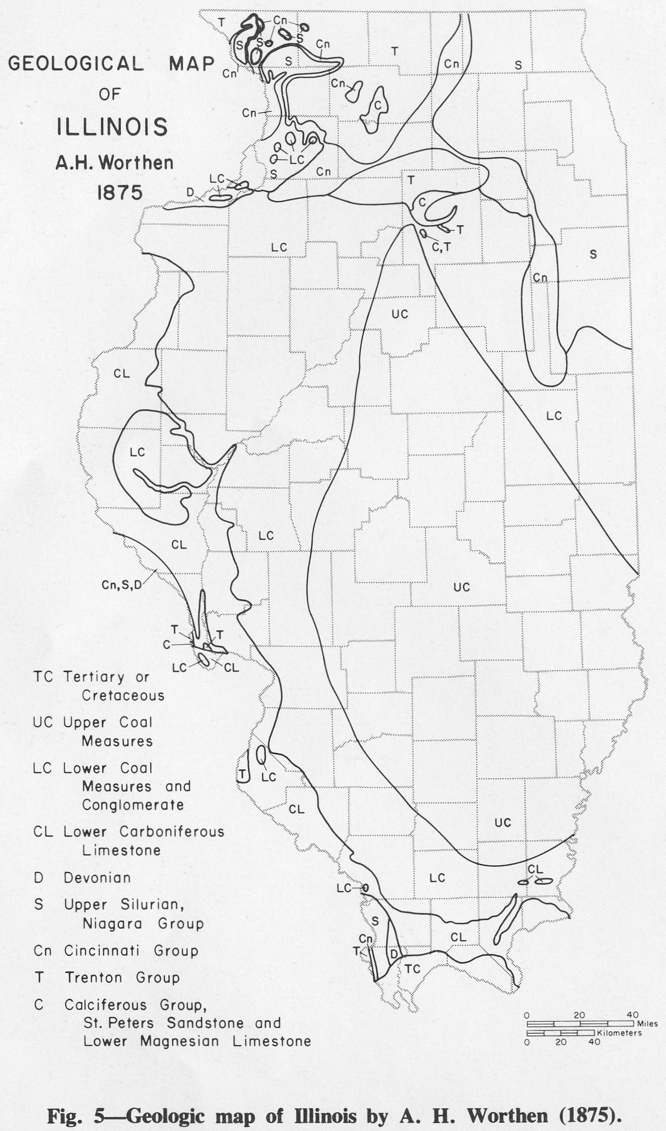
350 KB | Fig. 5 -- Geologic map of Illinois by A. H. Worthen (1875). | 1 |
| 15:51, 1 April 2016 | Figure 6.jpg (file) |  |
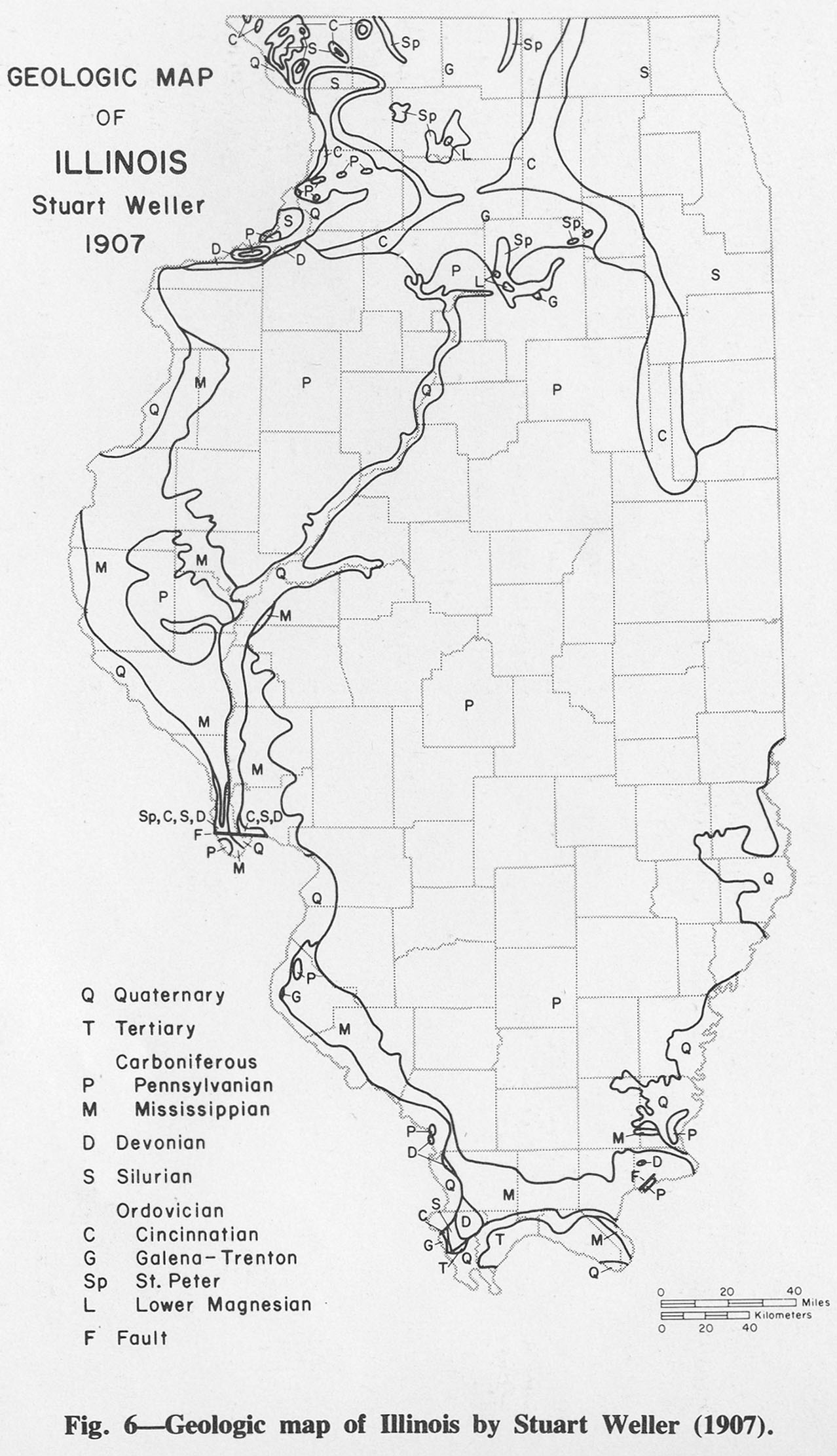
344 KB | Fig. 6 -- Geologic map of Illinois by Stuart Weller (1907). | 1 |
| 15:52, 1 April 2016 | Figure 7.jpg (file) |  |
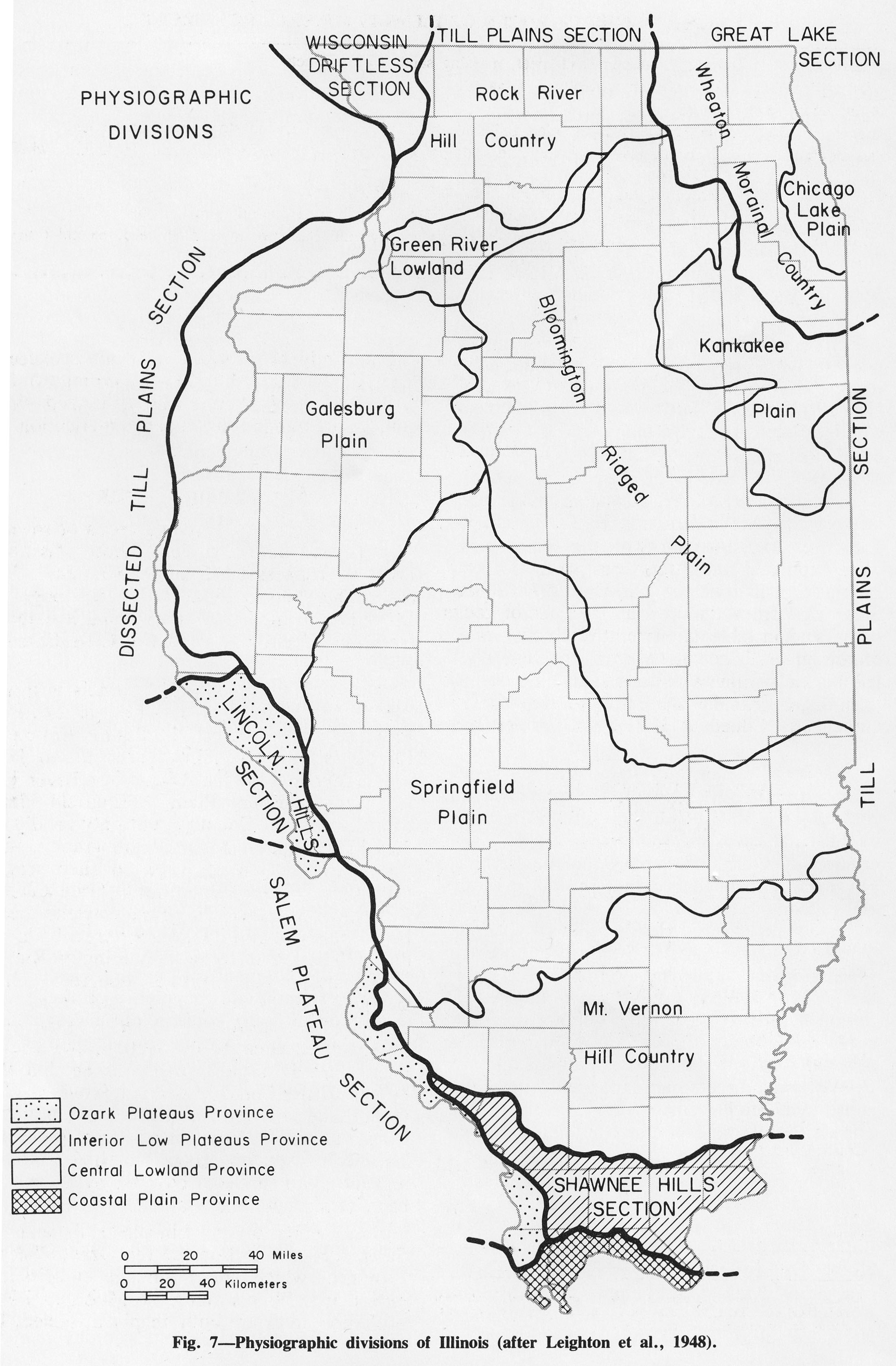
762 KB | Fig. 7 -- Physiographic divisions of Illinois (after Leighton et al., 1948). | 1 |
| 15:53, 1 April 2016 | Figure 8.jpg (file) |  |
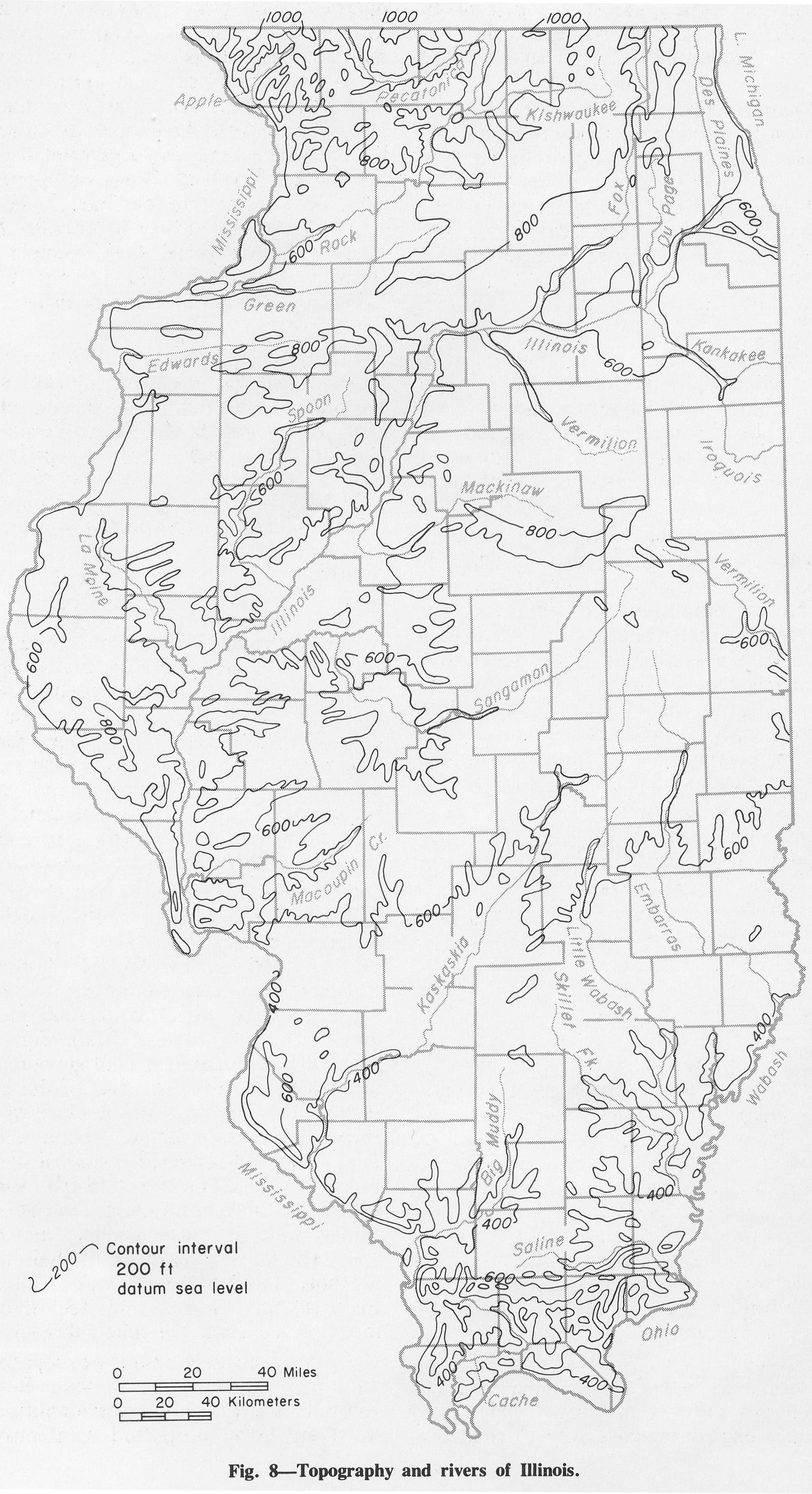
834 KB | Fig. 8 -- Topography and rivers of Illinois. | 1 |
| 15:54, 1 April 2016 | Figure 9.jpg (file) |  |
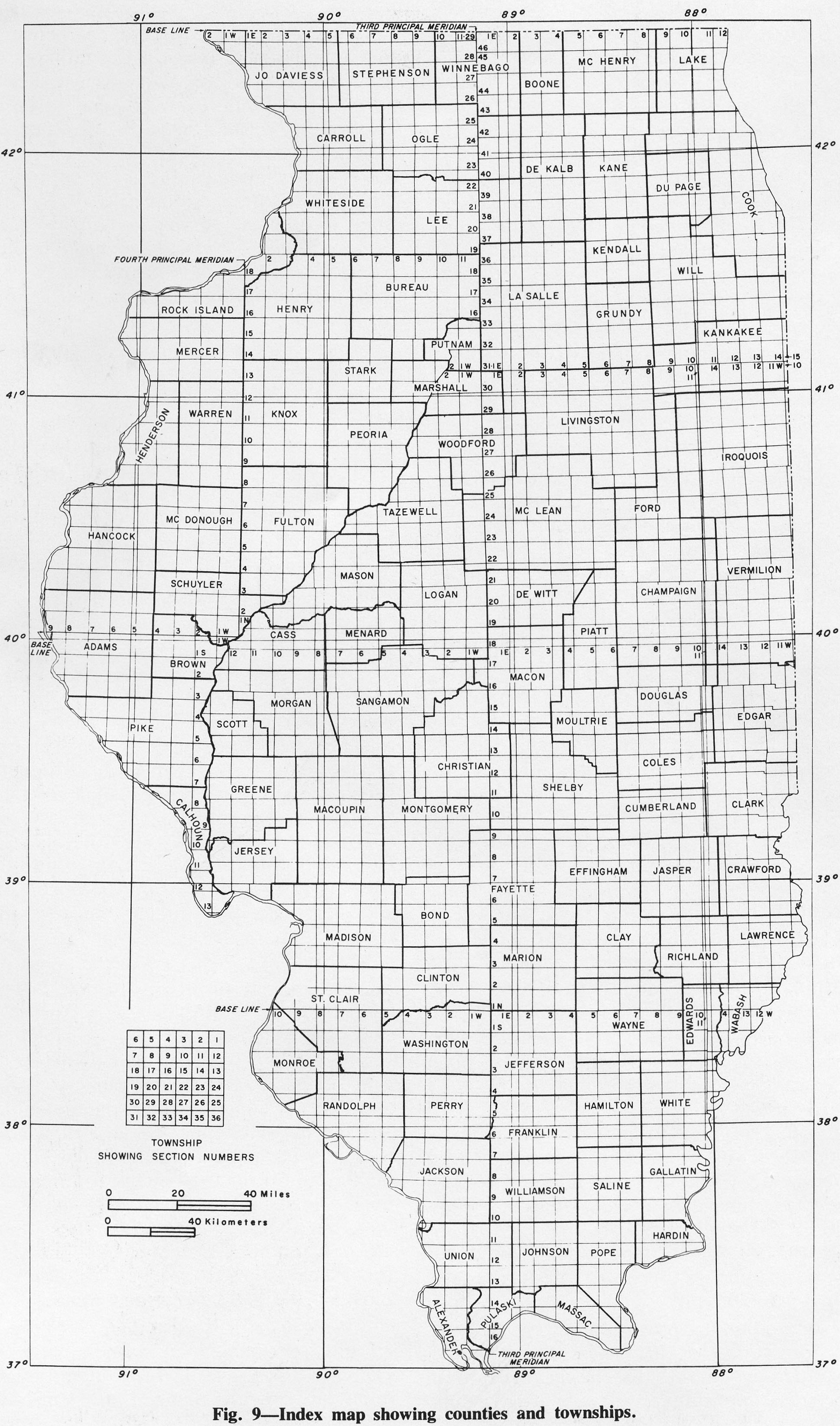
895 KB | Fig. 9 -- Index map showing counties and townships. | 1 |
| 19:48, 1 April 2016 | Figure C-10.jpg (file) |  |
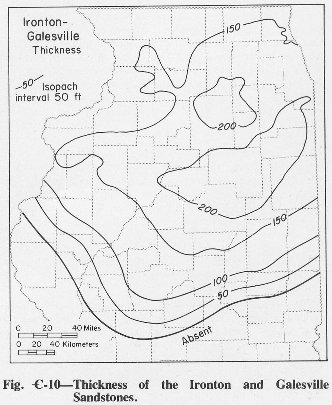
204 KB | Fig. C-10 -- Thickness of the Ironton and Galesville Sandstones. | 1 |
| 19:49, 1 April 2016 | Figure C-11.jpg (file) |  |
263 KB | Fig. C- 11 -- Thickness of the Franconia Formation | 1 |
| 19:50, 1 April 2016 | Figure C-12.jpg (file) |  |
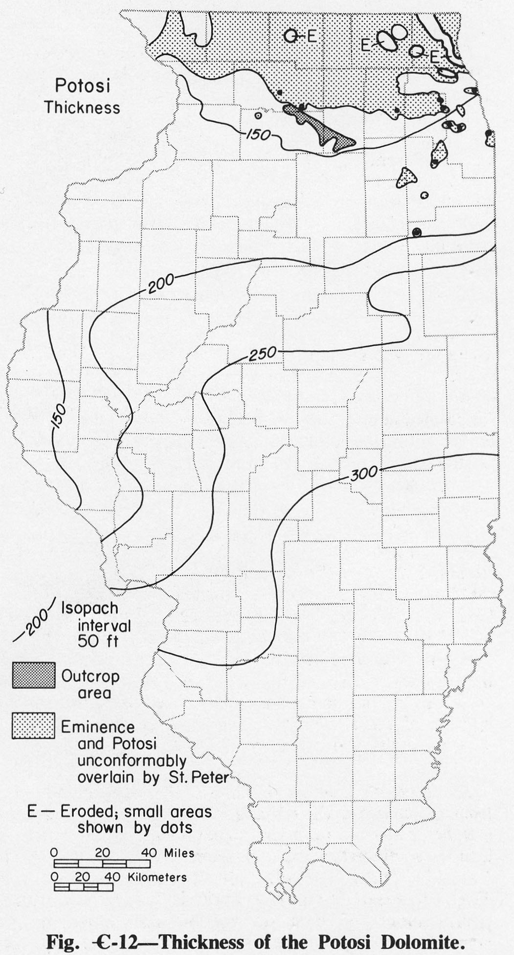
298 KB | Fig. C-12 -- Thickness of the Potosi Dolomite. | 1 |
| 19:51, 1 April 2016 | Figure C-13.jpg (file) |  |
293 KB | Fig. C-13 -- Thickness of the Eminence Formation. | 1 |
| 18:12, 4 April 2016 | Figure C-1A.jpg (file) |  |
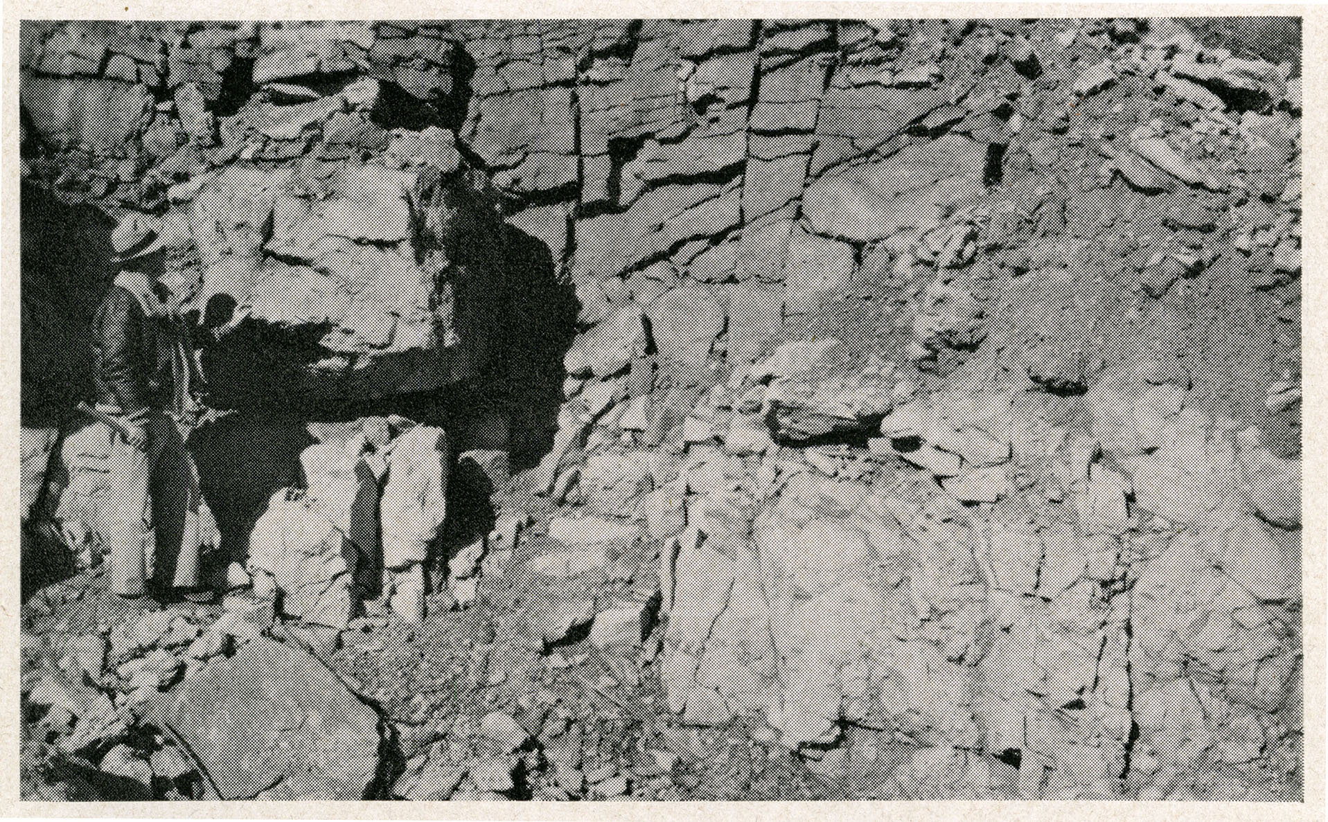
1,023 KB | Fig. C1-A -- Massive Potosi Dolomite in a quarry 4 miles northwest of Ashton, Ogle County. | 1 |
| 18:15, 4 April 2016 | Figure C-1B.jpg (file) |  |
1.18 MB | Fig. C-1B -- Cambrian-Ordovician unconformity showing well bedded Oneota Dolomite overlying massive Potosi Dolomite in a quarry in Lee County, 6 miles south of Rochelle, Ogle County (Willman and Templeton, 1951, p. 113). | 1 |
| 18:17, 4 April 2016 | Figure C-1C.jpg (file) |  |
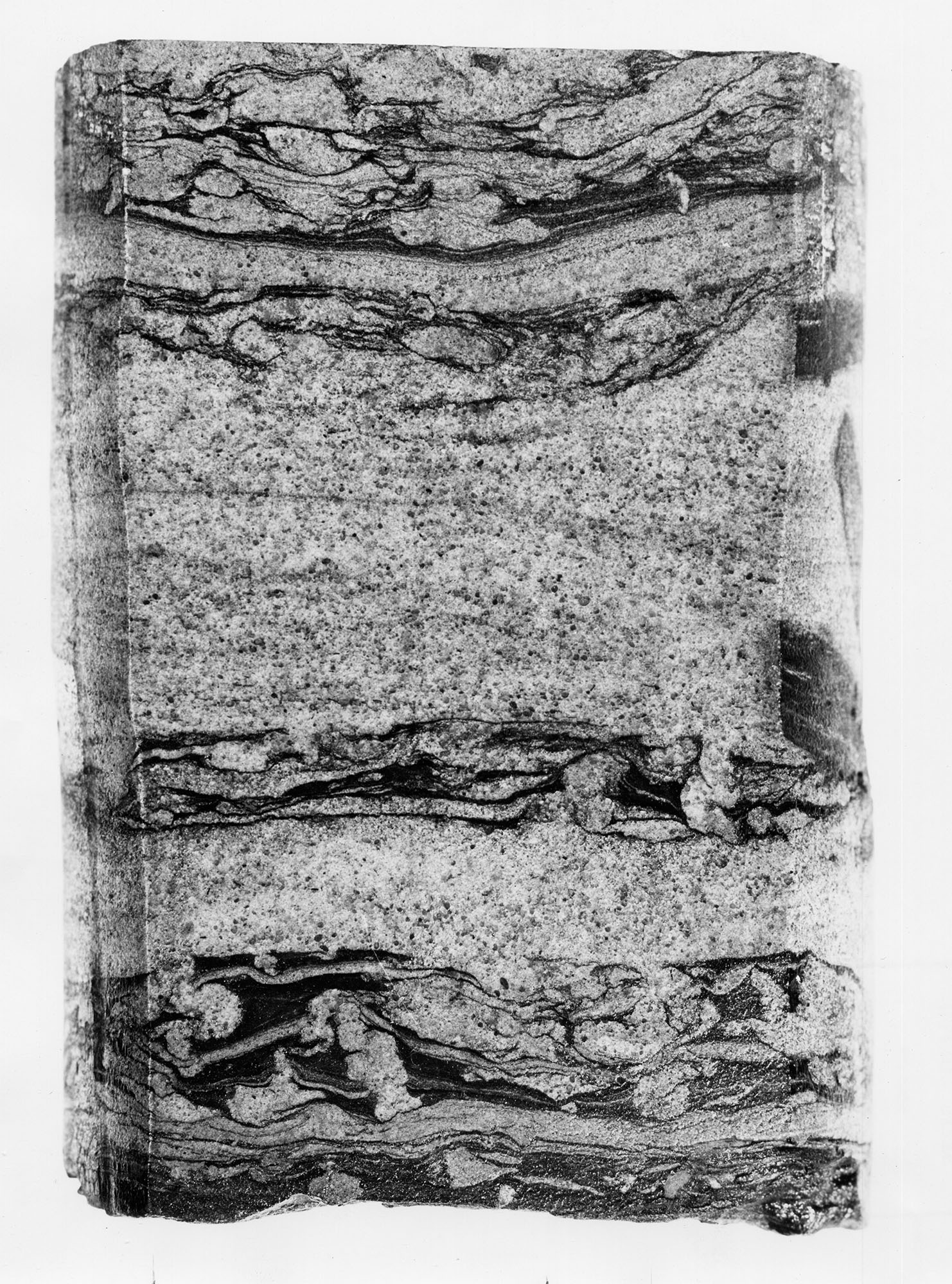
788 KB | Fig. C-1C -- Core of Eau Clair Formation showing penecontemporaneous deformation of shale beds in shaly sanstone; from a boring in Champaign County (x2). | 1 |
| 18:18, 4 April 2016 | Figure C-1D.jpg (file) |  |
776 KB | Fig. C-1D -- Core of Ironton Sandstone showing flat-pebble conglomerate; from boring in Champaign county (x2). | 1 |
| 19:41, 1 April 2016 | Figure C-2.jpg (file) |  |
321 KB | Fig. C-2 --Thickness of the Cambrian System. The dashed lines show reconstructed thickness. | 1 |