Uploads by Alan.Myers
Jump to navigation
Jump to search
This special page shows all uploaded files.
| Date | Name | Thumbnail | Size | Description | Versions |
|---|---|---|---|---|---|
| 20:09, 1 April 2016 | Figure D-14.jpg (file) |  |
232 KB | Fig. D-14 -- Thickness of the Grand Tower Limestone (after North, 1969). | 1 |
| 14:06, 4 April 2016 | Figure M-24.jpg (file) |  |
233 KB | Fig. M-24 -- Thickness of the Renault Limestone. | 1 |
| 19:45, 1 April 2016 | Figure C-6.jpg (file) |  |
233 KB | Fig. C-6 -- Thickness of the Mt. Simon Sandstone. | 1 |
| 18:05, 4 April 2016 | Figure T-2.jpg (file) |  |
233 KB | Fig. T-2 -- Classification of the Tertiary System. | 1 |
| 14:28, 4 April 2016 | Figure M-48.jpg (file) |  |
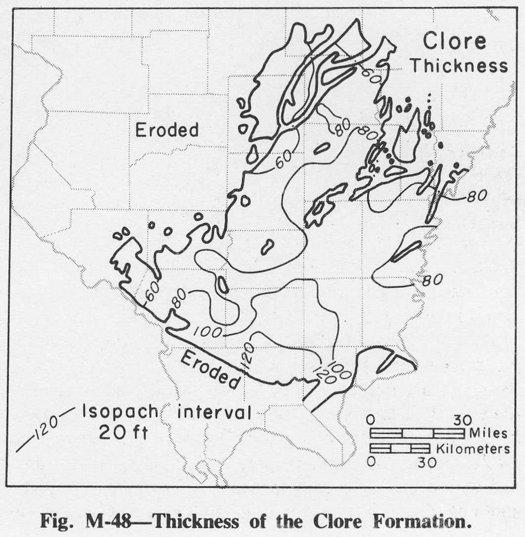
233 KB | Fig. M-48 -- Thickness of the Clore Formation. | 1 |
| 14:26, 4 April 2016 | Figure M-45.jpg (file) |  |
234 KB | Fig. M-45 -- Thickness of the Waltersburg Sandstone. | 1 |
| 14:22, 4 April 2016 | Figure M-40.jpg (file) |  |
235 KB | Fig. M-40 -- Thickness of the Haney Limestone. | 1 |
| 18:07, 4 April 2016 | Table 2.jpg (file) |  |
236 KB | Table 2 -- Illinois Mineral Production in 1972 (Malhotra, 1974). | 1 |
| 17:59, 11 July 2020 | C605-Figure-61.jpg (file) |  |
237 KB | 1 | |
| 14:26, 4 April 2016 | Figure M-46.jpg (file) |  |
239 KB | Fig. M-46 -- Thickness of the Menard Limestone. | 1 |
| 18:06, 4 April 2016 | Table 1.jpg (file) |  |
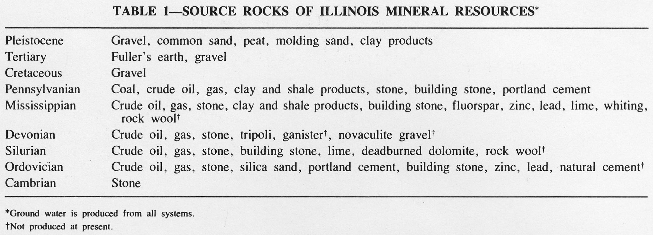
241 KB | Table 1 -- Source Rocks of Illinois Mineral Resources. | 1 |
| 14:21, 4 April 2016 | Figure M-38.jpg (file) |  |
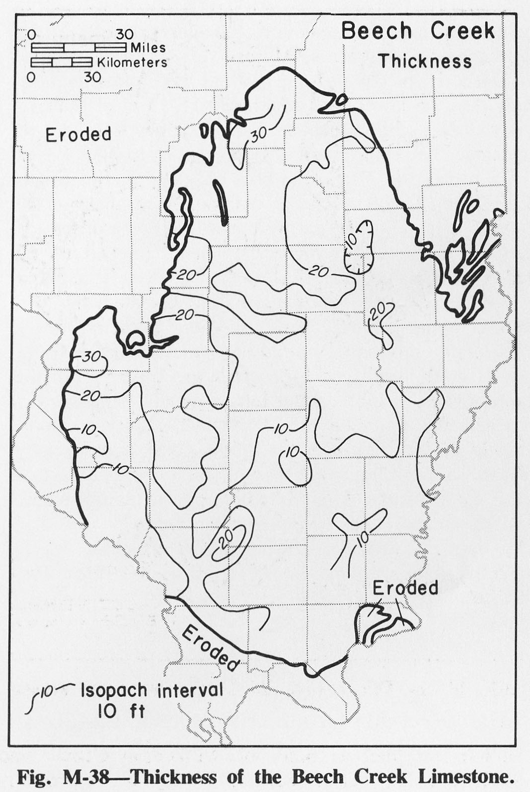
245 KB | Fig. M-38 -- Thickness of the Beech Creek Limestone. | 1 |
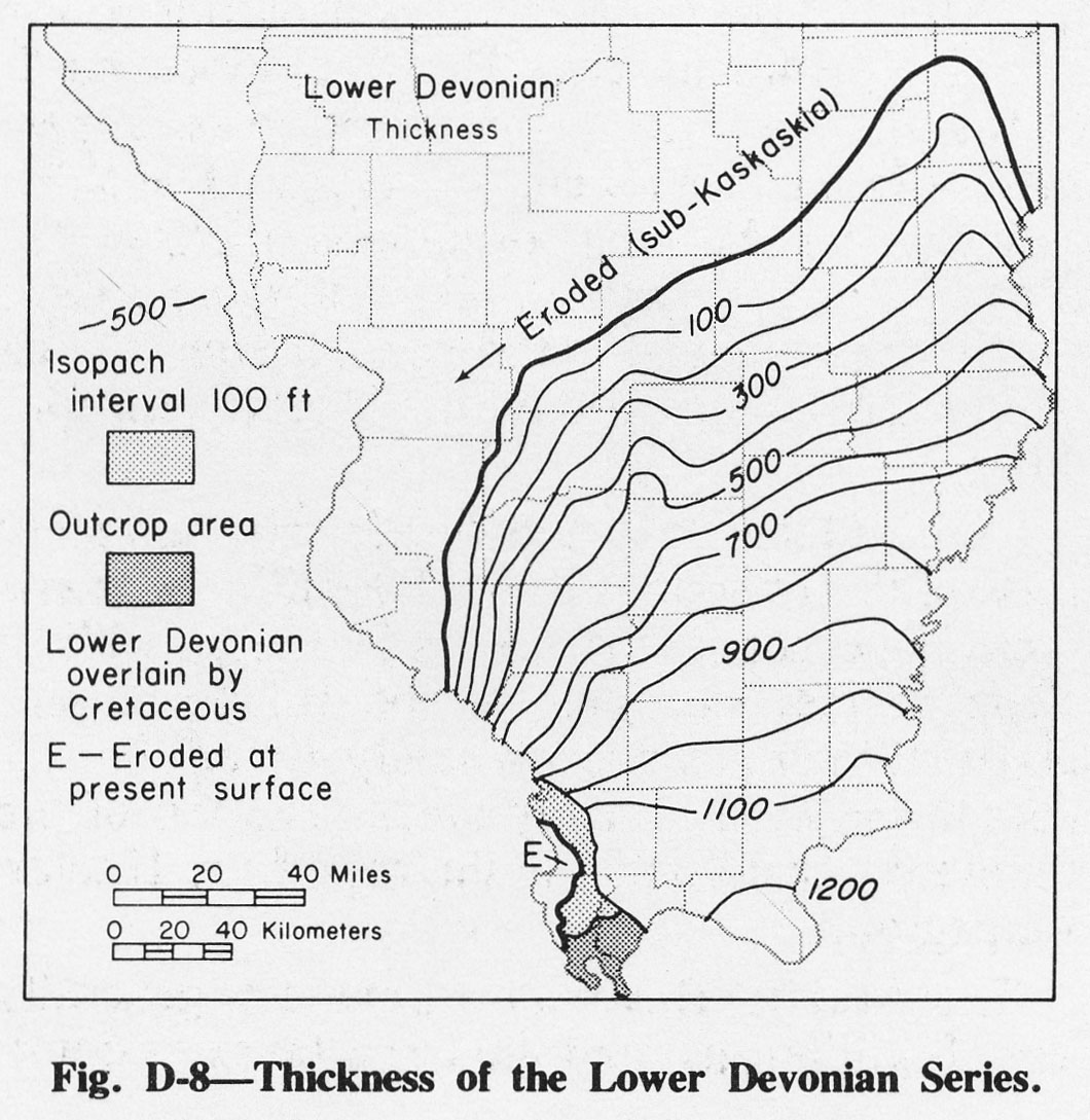
| 20:00, 1 April 2016 | Figure D-8.jpg (file) |  |
245 KB | Fig. D-8 -- Thickness of the Lower Devonian Series. | 1 |
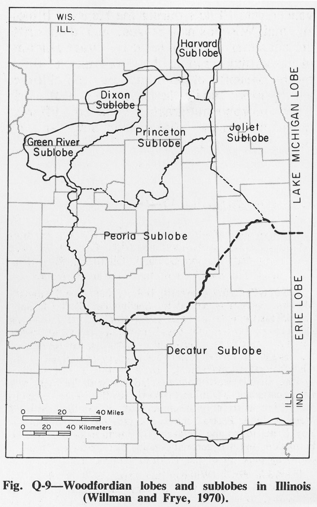
| 15:58, 4 April 2016 | Figure Q-9.jpg (file) |  |
248 KB | Fig. Q-9 -- Woodfordian lobes and sublobes in Illinois (Willman and Frye, 1970). | 1 |
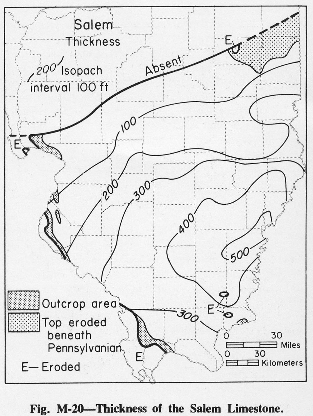
| 14:03, 4 April 2016 | Figure M-20.jpg (file) |  |
248 KB | Fig. M-20 -- Thickness of the Salem Limestone. | 1 |
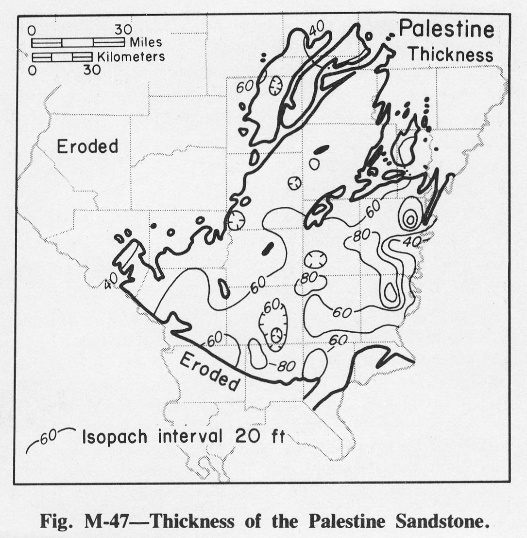
| 14:27, 4 April 2016 | Figure M-47.jpg (file) |  |
249 KB | Fig. M-47 -- Thickness of the Palestine Sandstone. | 1 |
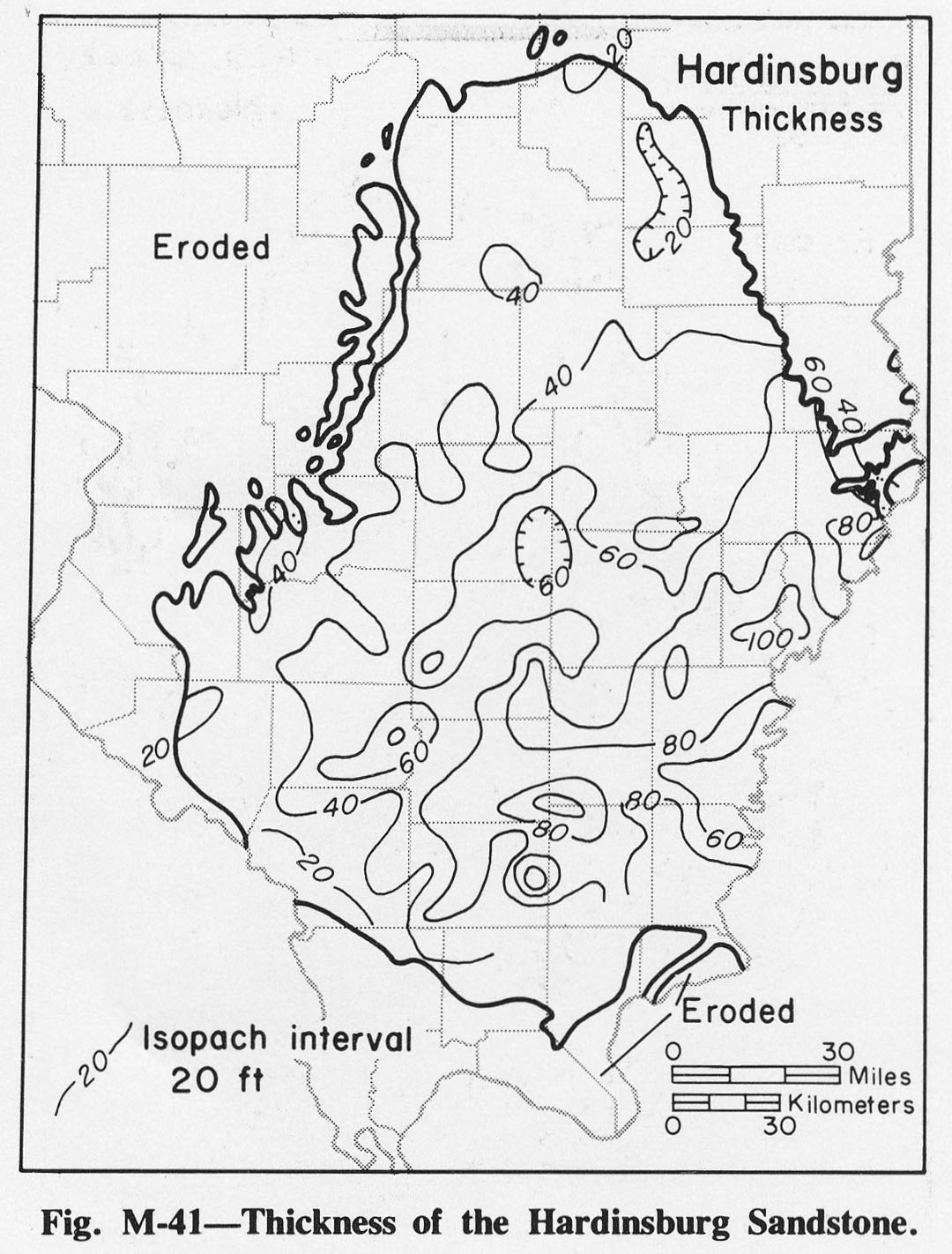
| 14:23, 4 April 2016 | Figure M-41.jpg (file) |  |
249 KB | Fig. M-41 -- Thickness of the Hardinsburg Sandstone. | 1 |
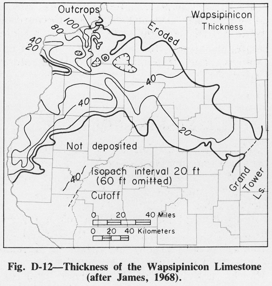
| 20:07, 1 April 2016 | Figure D-12.jpg (file) |  |
249 KB | Fig. D-12 -- Thickness of the Wapsipinicon Limestone (after James, 1968). | 1 |
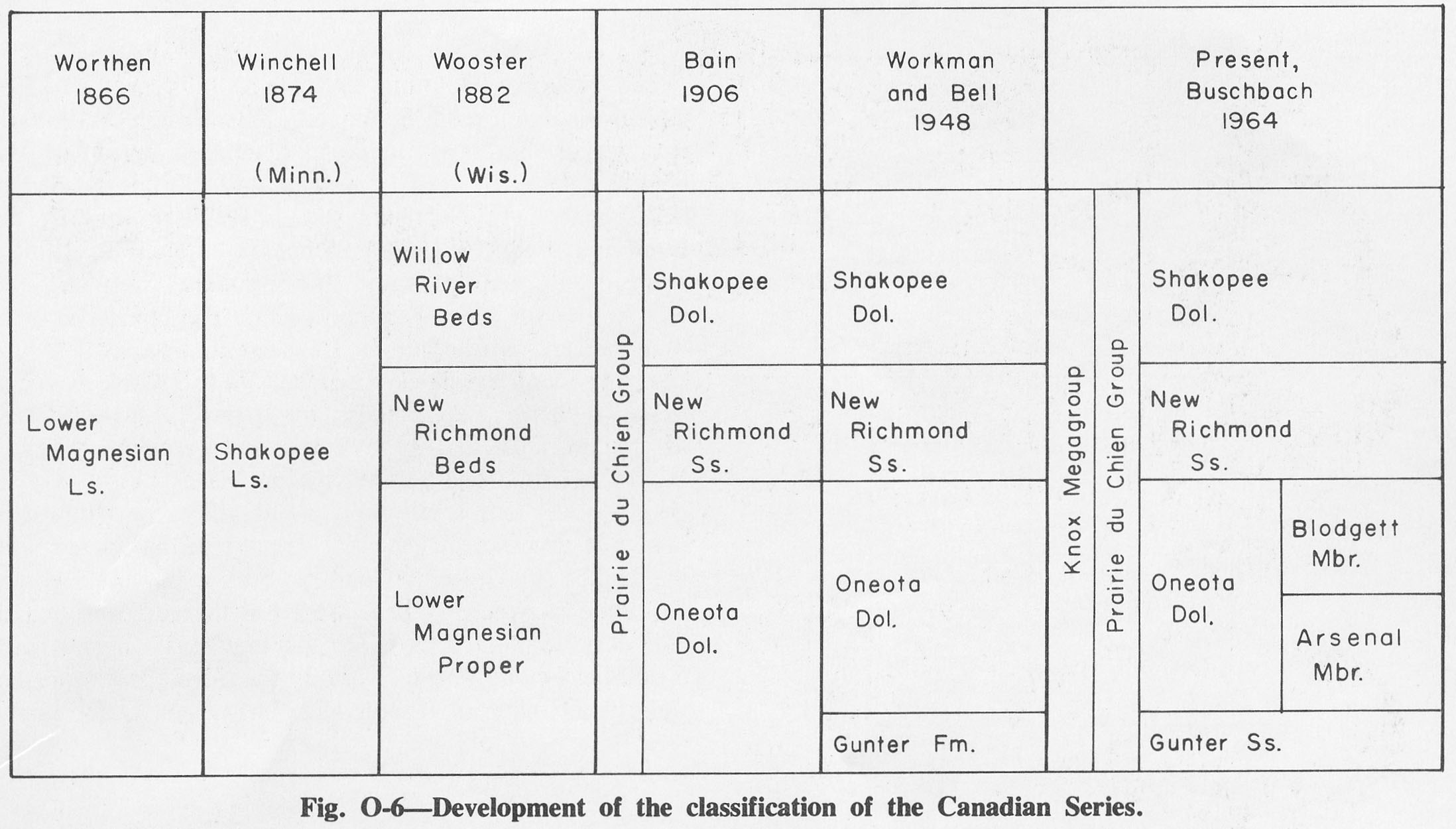
| 14:47, 4 April 2016 | Figure O-6.jpg (file) |  |
251 KB | Fig. O-6 -- Development of the Classification of the Canadian Series. | 1 |
| 14:01, 4 April 2016 | Figure M-17.jpg (file) |  |
251 KB | Fig. M-17 -- Thickness of Burlington Limestone. | 1 |
| 20:13, 1 April 2016 | Figure D-17.jpg (file) |  |
252 KB | Fig. D-17 -- Thickness of the Blocher Shale (after North, 1969). | 1 |
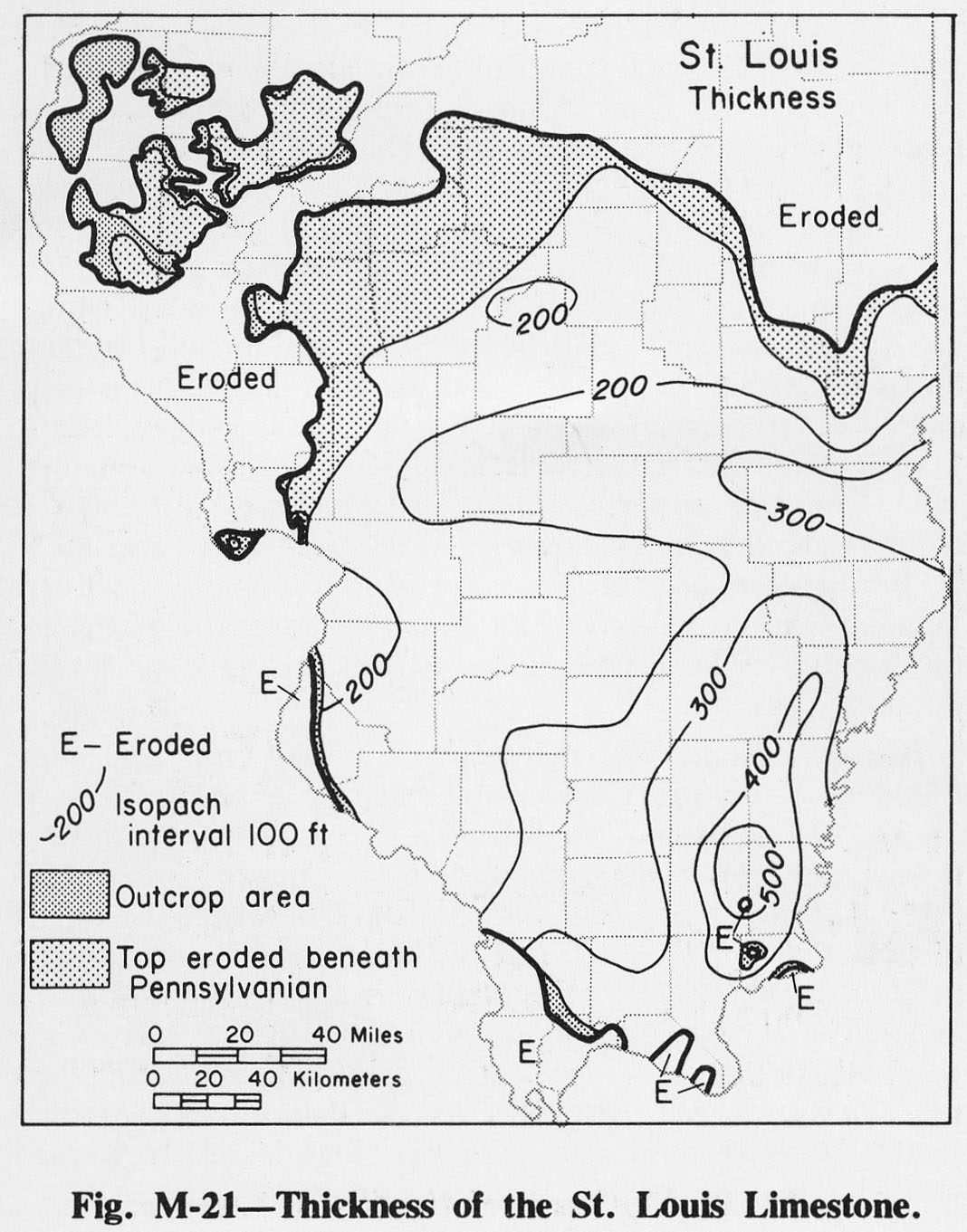
| 14:03, 4 April 2016 | Figure M-21.jpg (file) |  |
253 KB | Fig. M-21 -- THickness of the St. Louis Limestone. | 1 |
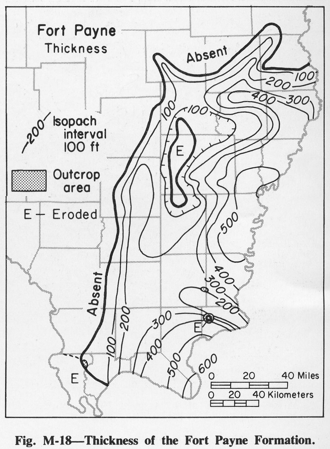
| 14:01, 4 April 2016 | Figure M-18.jpg (file) |  |
254 KB | Fig M-18 -- Thickness of the Fort Payne Formation. | 1 |
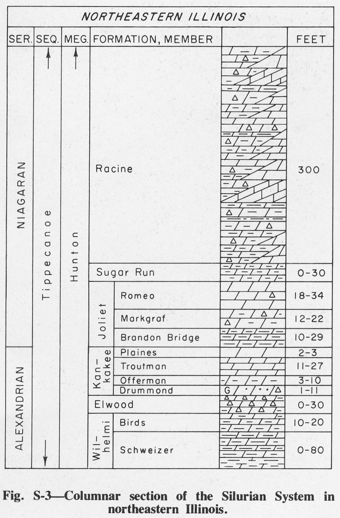
| 17:03, 4 April 2016 | Figure S-3.jpg (file) |  |
254 KB | Fig. S-3 -- Columnar section of Silurian System in northeastern Illinois. | 1 |
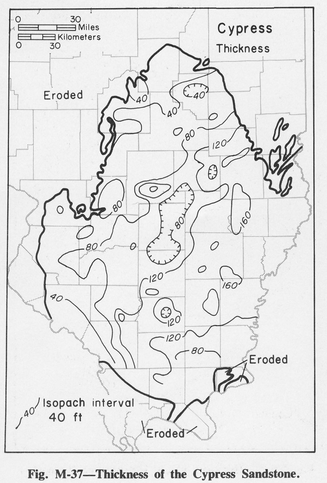
| 14:20, 4 April 2016 | Figure M-37.jpg (file) |  |
256 KB | Fig. M-37 -- Thickness of the Cypress Sandstone. | 1 |
| 13:24, 4 April 2016 | Figure M-5.jpg (file) |  |
257 KB | Fig. M-5 -- Thickness of the Kinderhookian Series. | 1 |
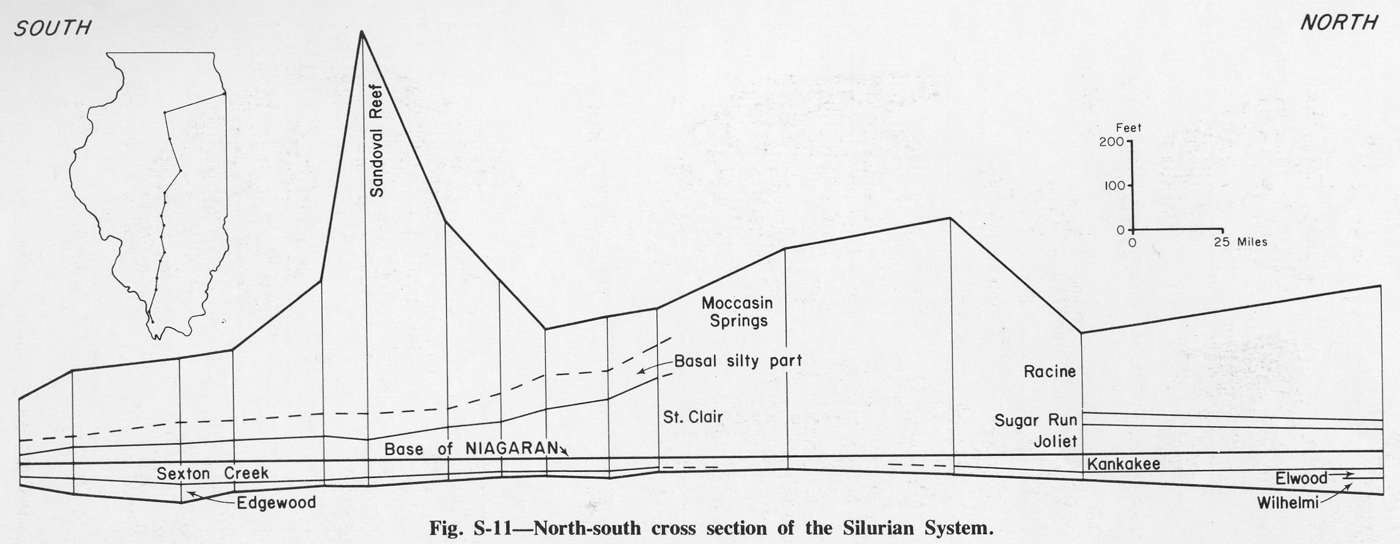
| 17:56, 4 April 2016 | Figure S-11.jpg (file) |  |
257 KB | Fig. S-11 -- North-south cross section of the Silurian System. | 1 |
| 14:19, 4 April 2016 | Figure M-35.jpg (file) |  |
258 KB | Fig. M-35 -- Thickness of the Bethel Sandstone. | 1 |
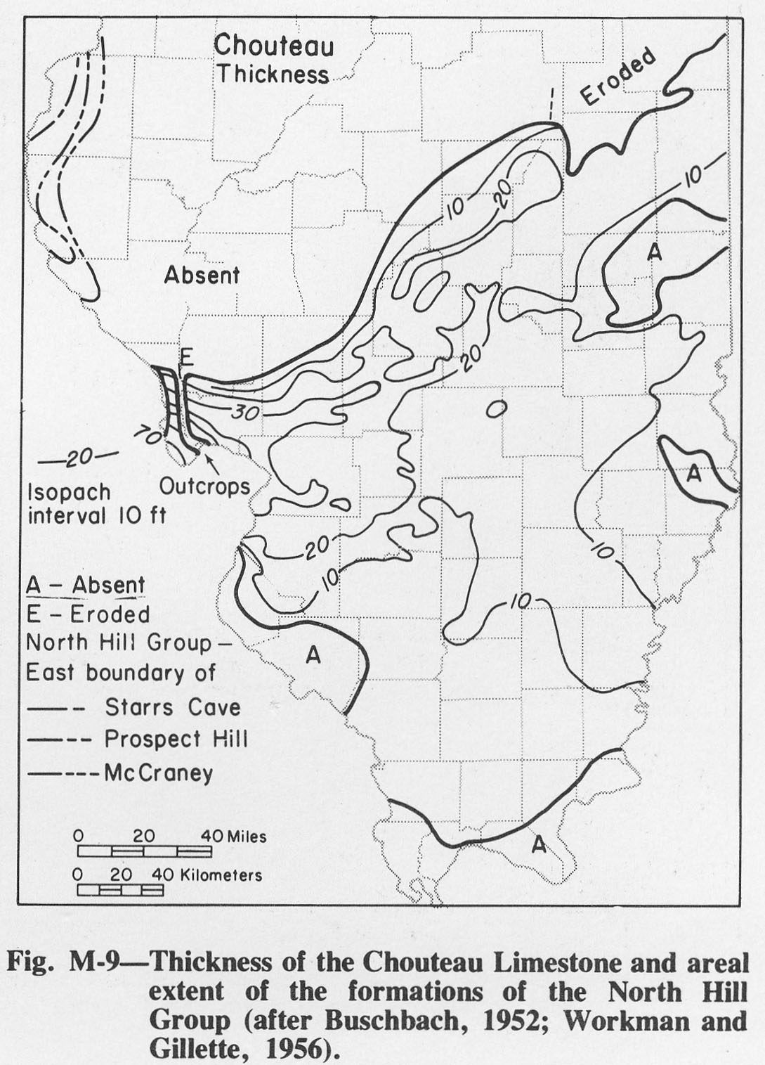
| 13:53, 4 April 2016 | Figure M-9.jpg (file) |  |
259 KB | Fig. M-9 -- Thickness of Chouteau Limestone and areal extent of formations of the North Hill Group (after Buschback, 1952; Workman and Gillete, 1956). | 1 |
| 19:47, 1 April 2016 | Figure C-8.jpg (file) |  |
260 KB | Fig. C-8 -- Thickness of the Eau Claire Formation. | 1 |
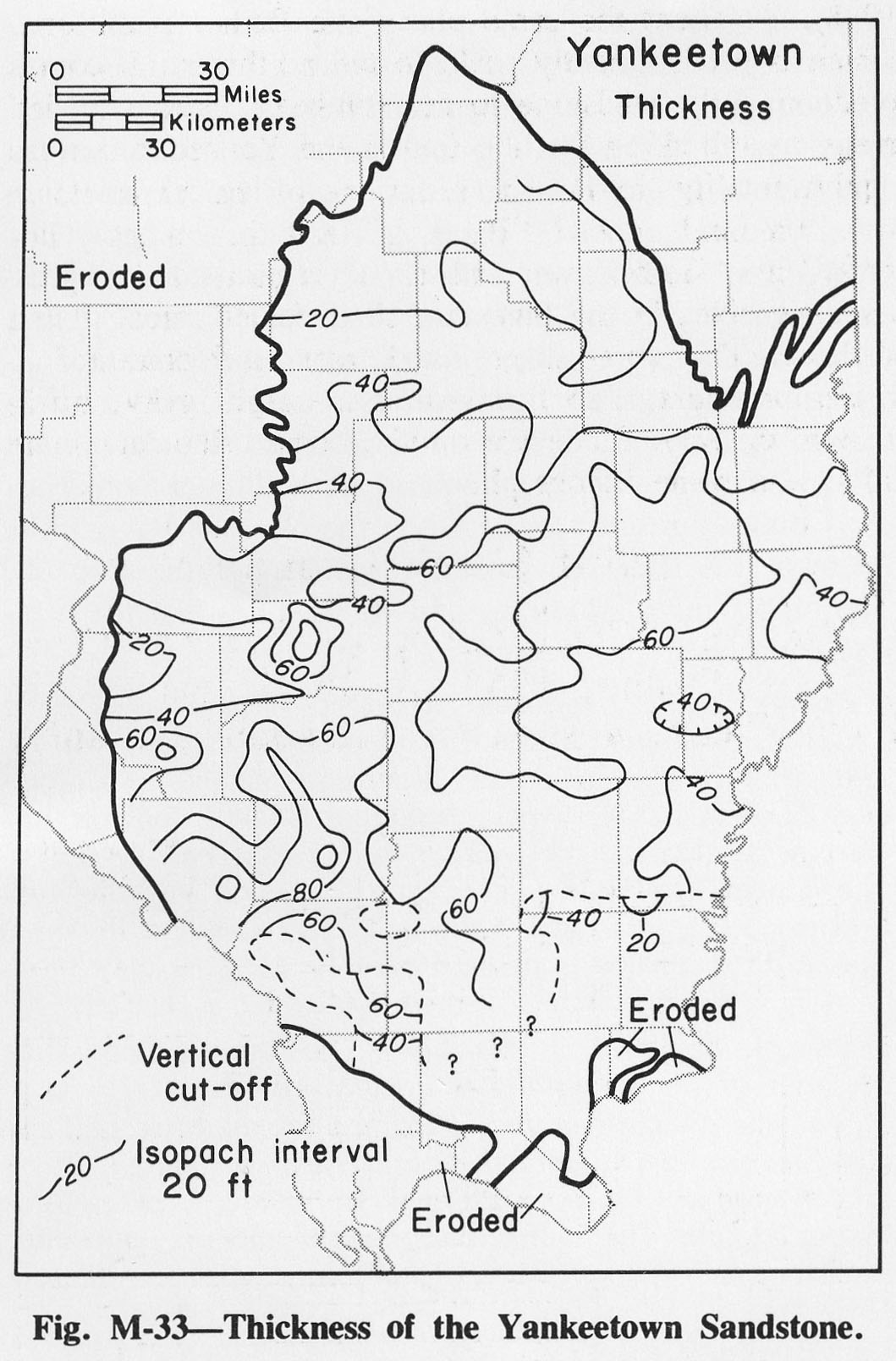
| 14:17, 4 April 2016 | Figure M-33.jpg (file) |  |
261 KB | Fig. M-33 -- Thickness of the Yankeetown Sandstone. | 1 |
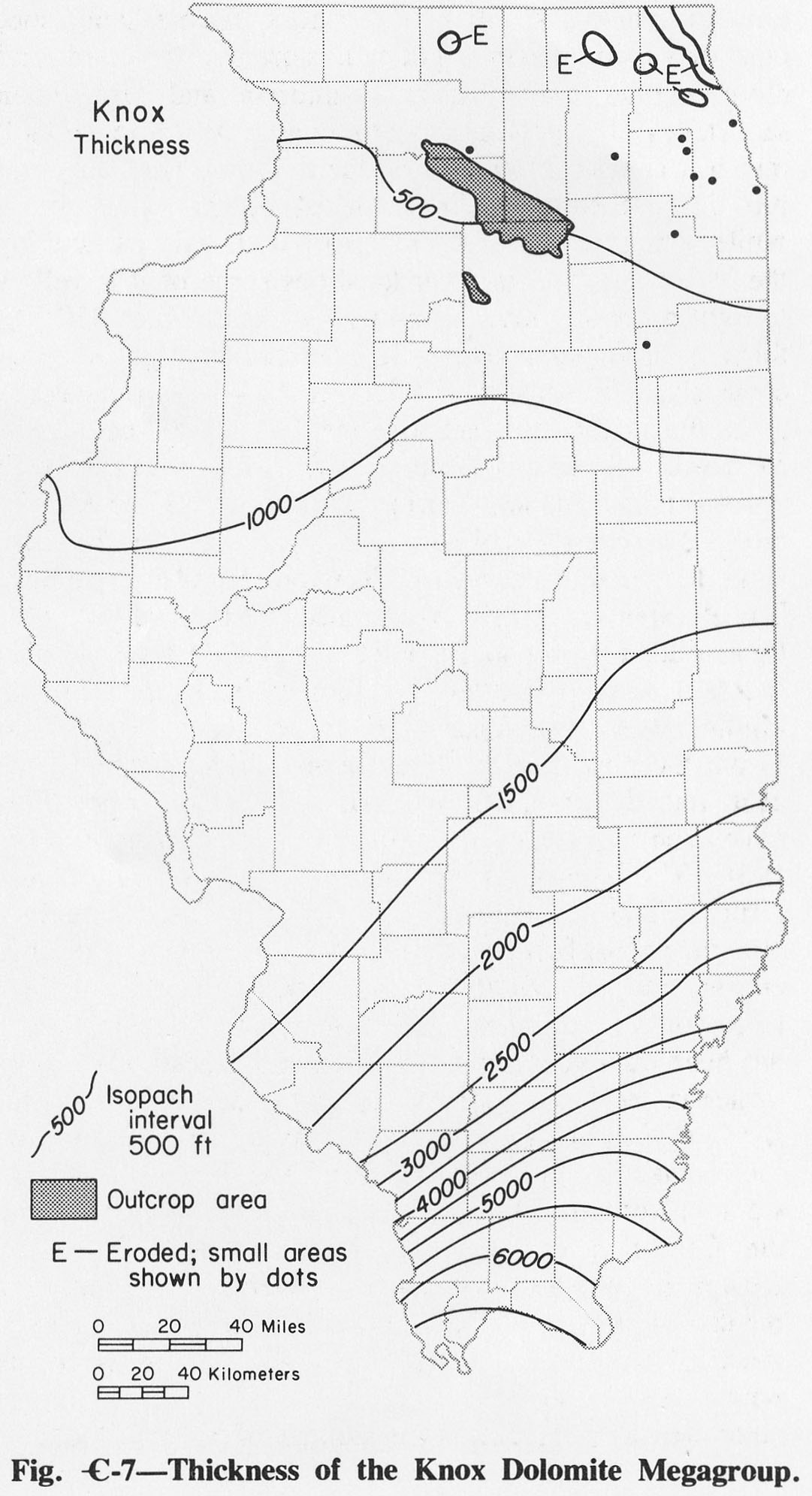
| 19:46, 1 April 2016 | Figure C-7.jpg (file) |  |
261 KB | Fig. C-7 -- Thickness of the Knox Dolomite Megagroup. | 1 |
| 19:49, 1 April 2016 | Figure C-11.jpg (file) |  |
263 KB | Fig. C- 11 -- Thickness of the Franconia Formation | 1 |
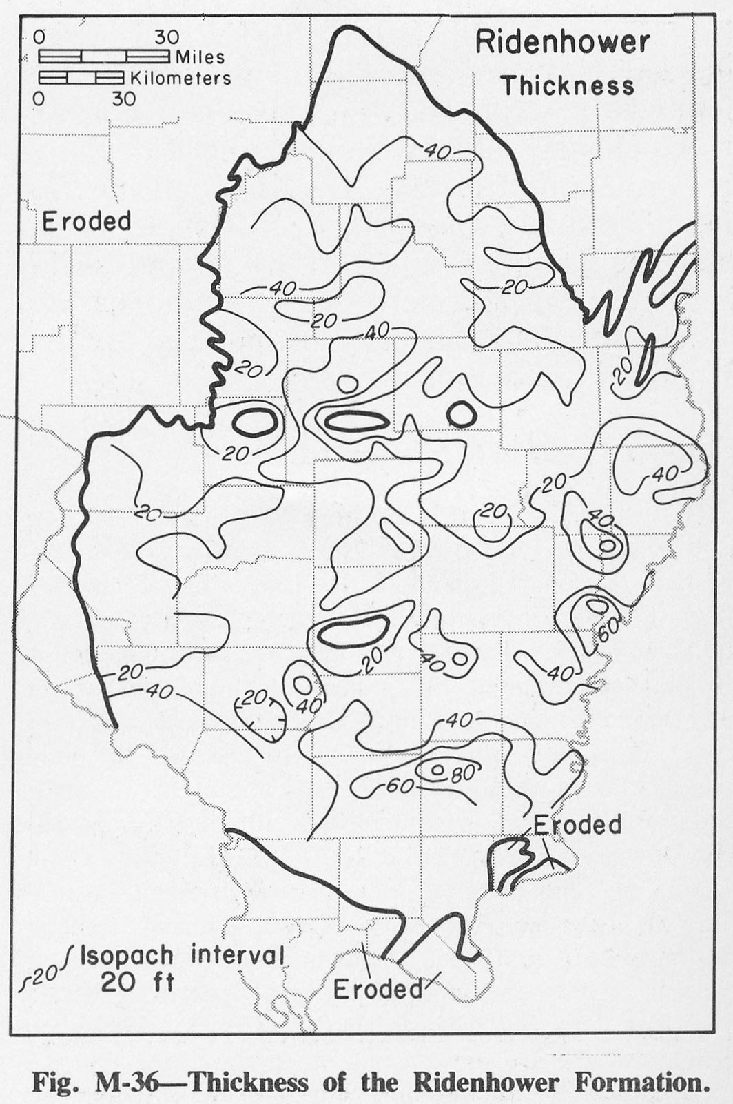
| 14:19, 4 April 2016 | Figure M-36.jpg (file) |  |
264 KB | Fig. M-36 -- Thickness of the Ridenhower Formation. | 1 |
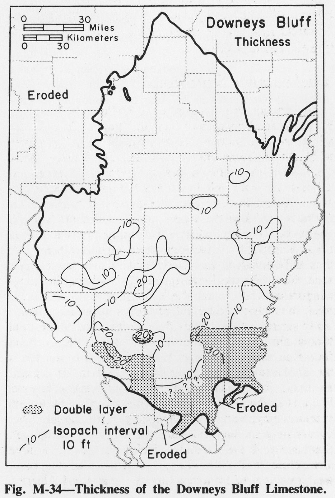
| 14:18, 4 April 2016 | Figure M-34.jpg (file) |  |
267 KB | Fig. M-34 -- Thickness of the Downeys Bluff Limestone. | 1 |
| 17:55, 4 April 2016 | Figure S-9.jpg (file) |  |
269 KB | Fig. S-9 -- Development of the classification of the Silurian System in western Illinois. | 1 |
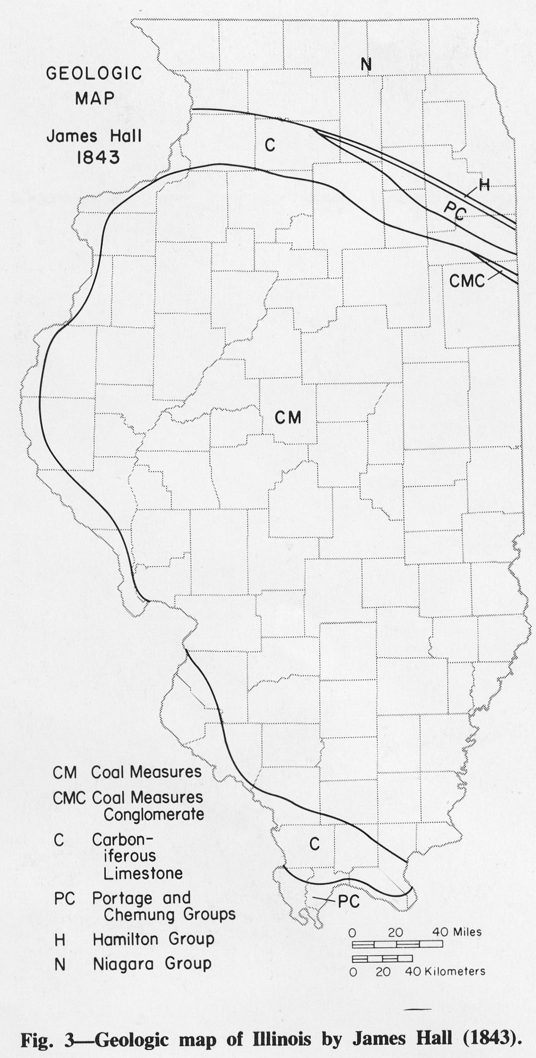
| 15:46, 1 April 2016 | Figure 3.jpg (file) |  |
273 KB | Fig. 3 -- Geologic map of Illinois by James Hall (1843). | 1 |
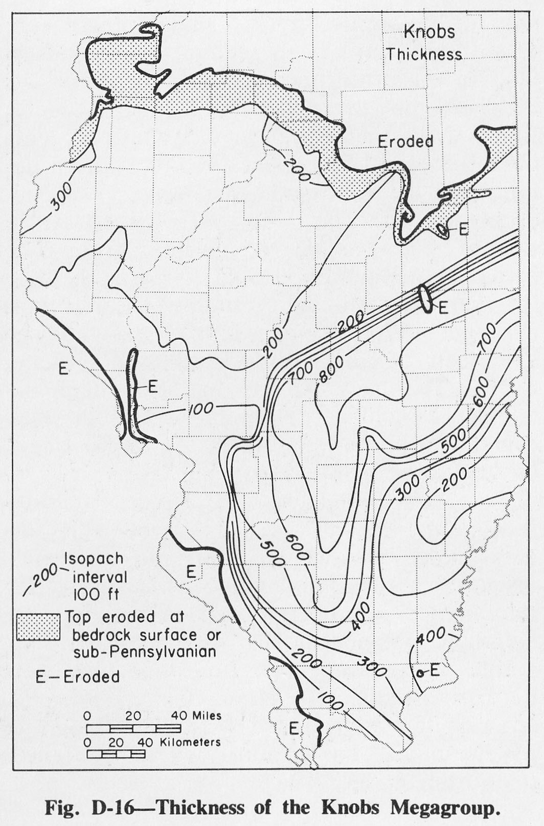
| 20:12, 1 April 2016 | Figure D-16.jpg (file) |  |
273 KB | Fig. D-16 -- Thickness of the Knobs Megagroup. | 1 |
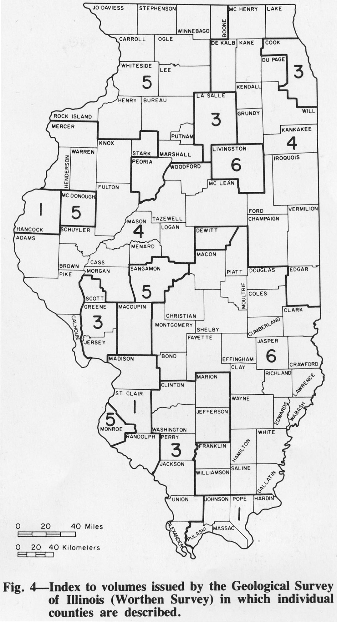
| 15:49, 1 April 2016 | Figure 4.jpg (file) |  |
274 KB | Fig. 4 -- Index to volumes issued by the Geological Survey of Illinois (Worthen Survey) in which individual counties are described. | 1 |
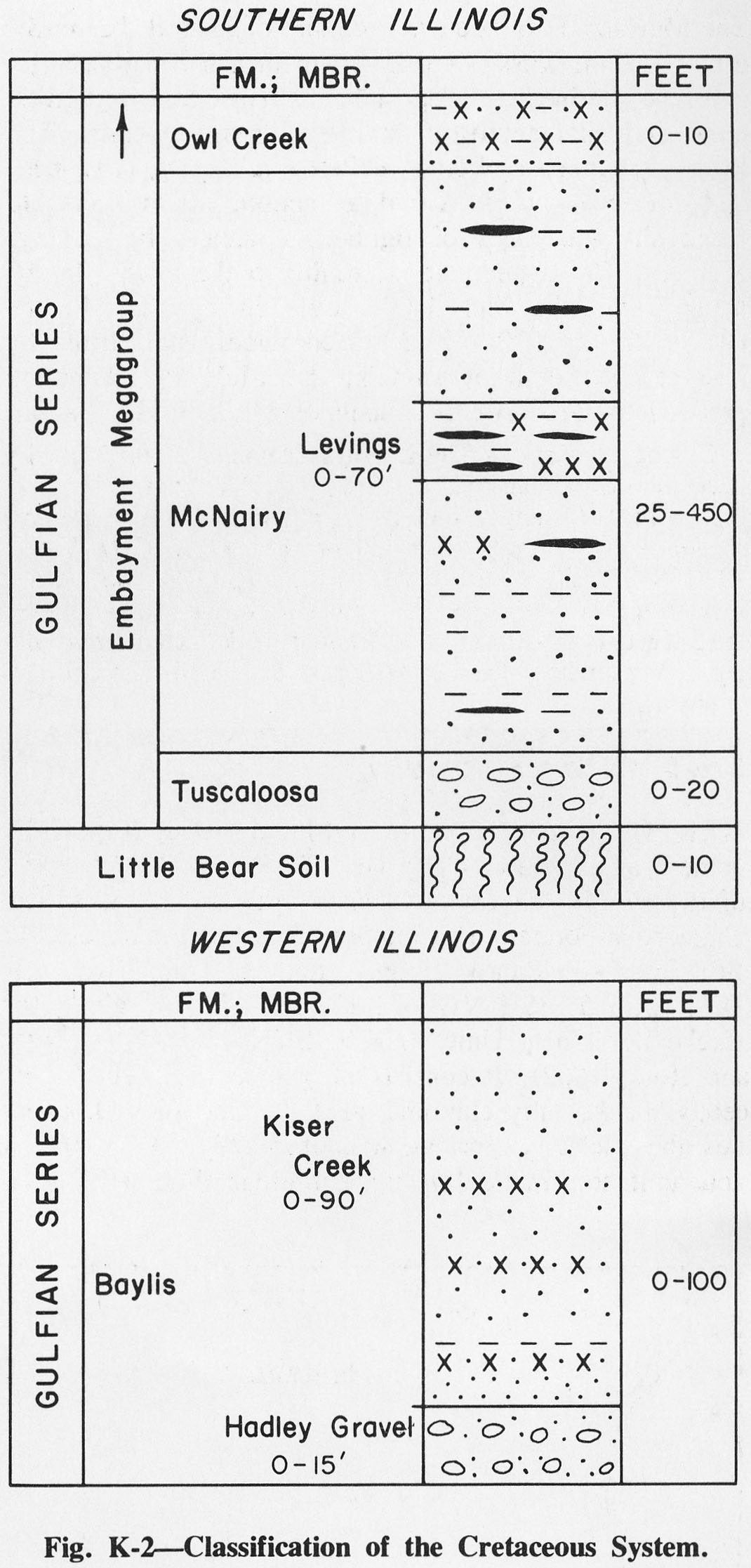
| 15:02, 6 August 2015 | Figure K-2.jpg (file) |  |
275 KB | Fig. K-2 -- Classification of the Cretaceous System | 1 |
| 14:56, 4 April 2016 | Figure O-17.jpg (file) |  |
282 KB | Fig. O-17 -- Thickness of the St. Peter Sandstone. | 1 |
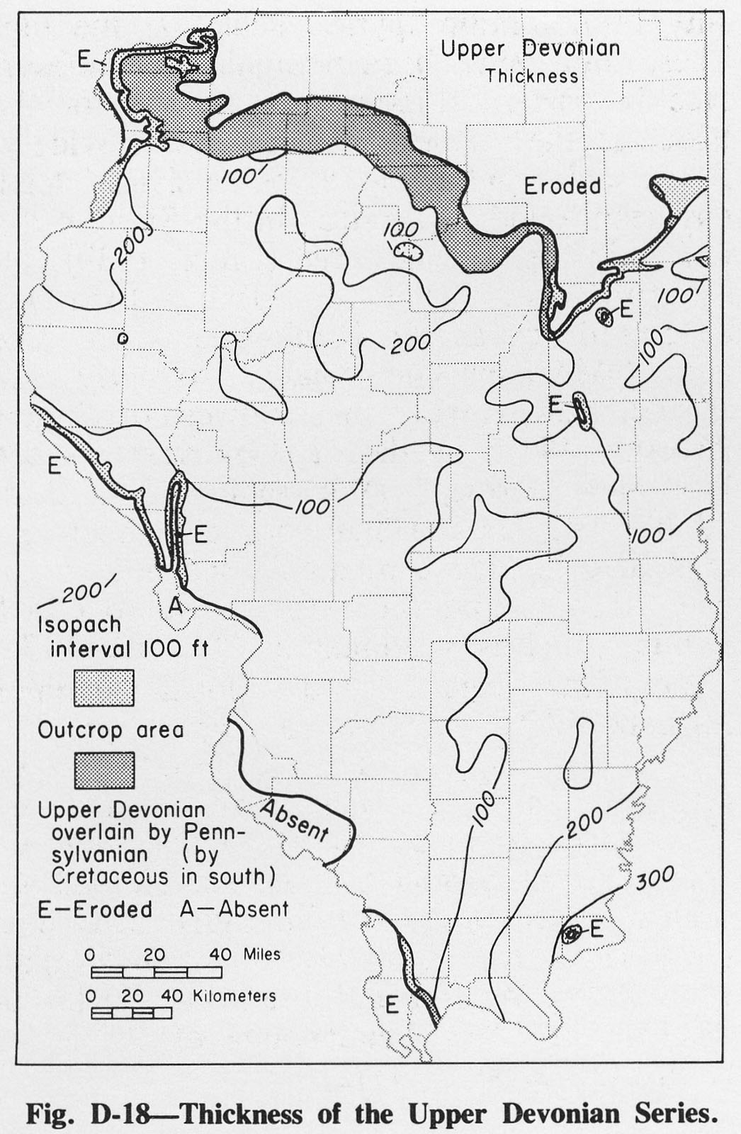
| 20:15, 1 April 2016 | Figure D-18.jpg (file) |  |
283 KB | 1 | |
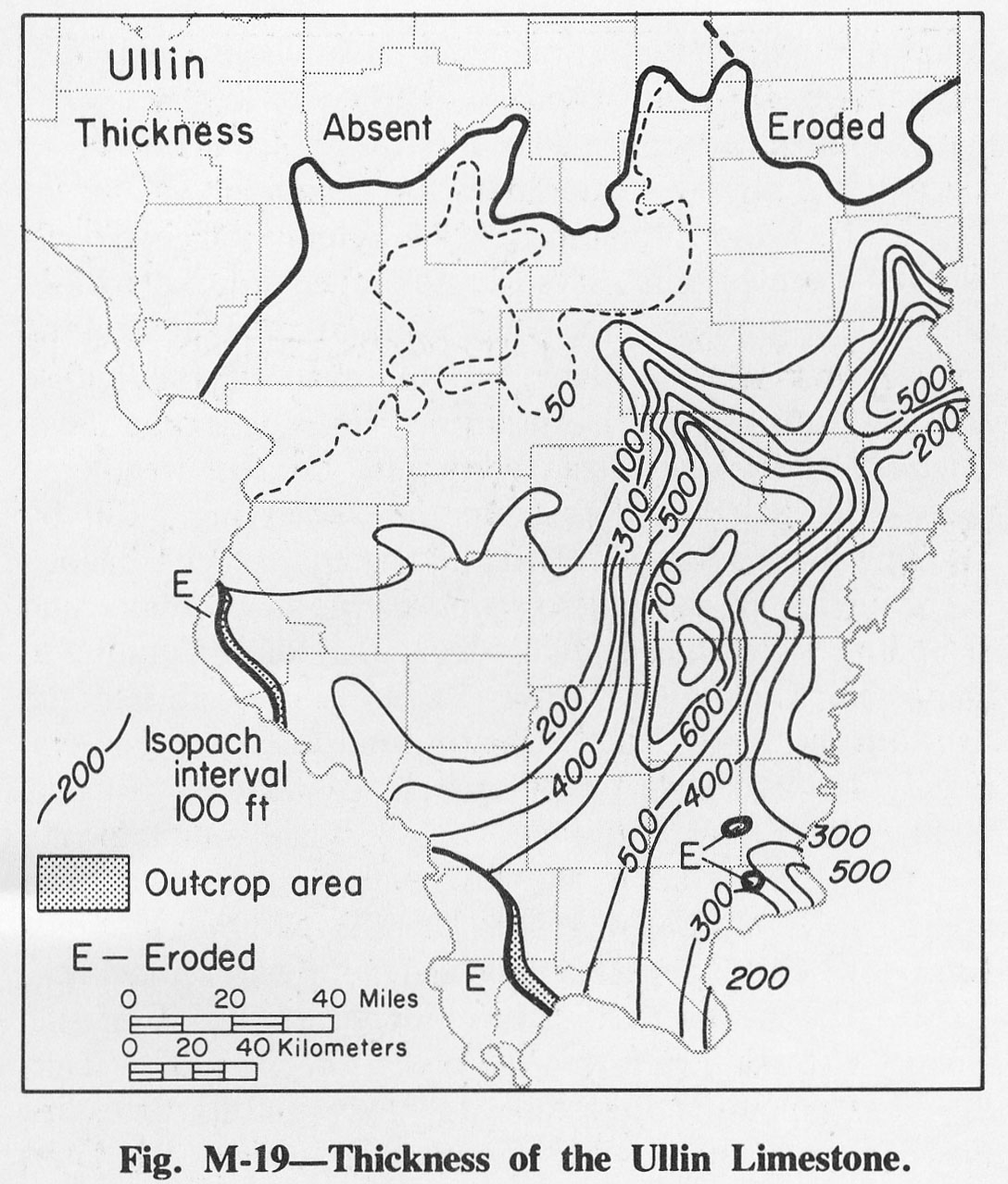
| 14:02, 4 April 2016 | Figure M-19.jpg (file) |  |
285 KB | Fig. M-19 -- Thickness of the Ullin Limestone. | 1 |
| 15:23, 9 July 2020 | C605-Figure-26.jpg (file) |  |
285 KB | 1 | |
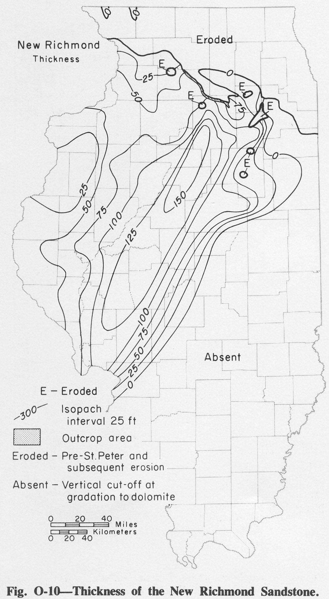
| 14:51, 4 April 2016 | Figure O-10.jpg (file) |  |
287 KB | Fig. O-10 -- Thickness of the New Richmond Sandstone. | 1 |
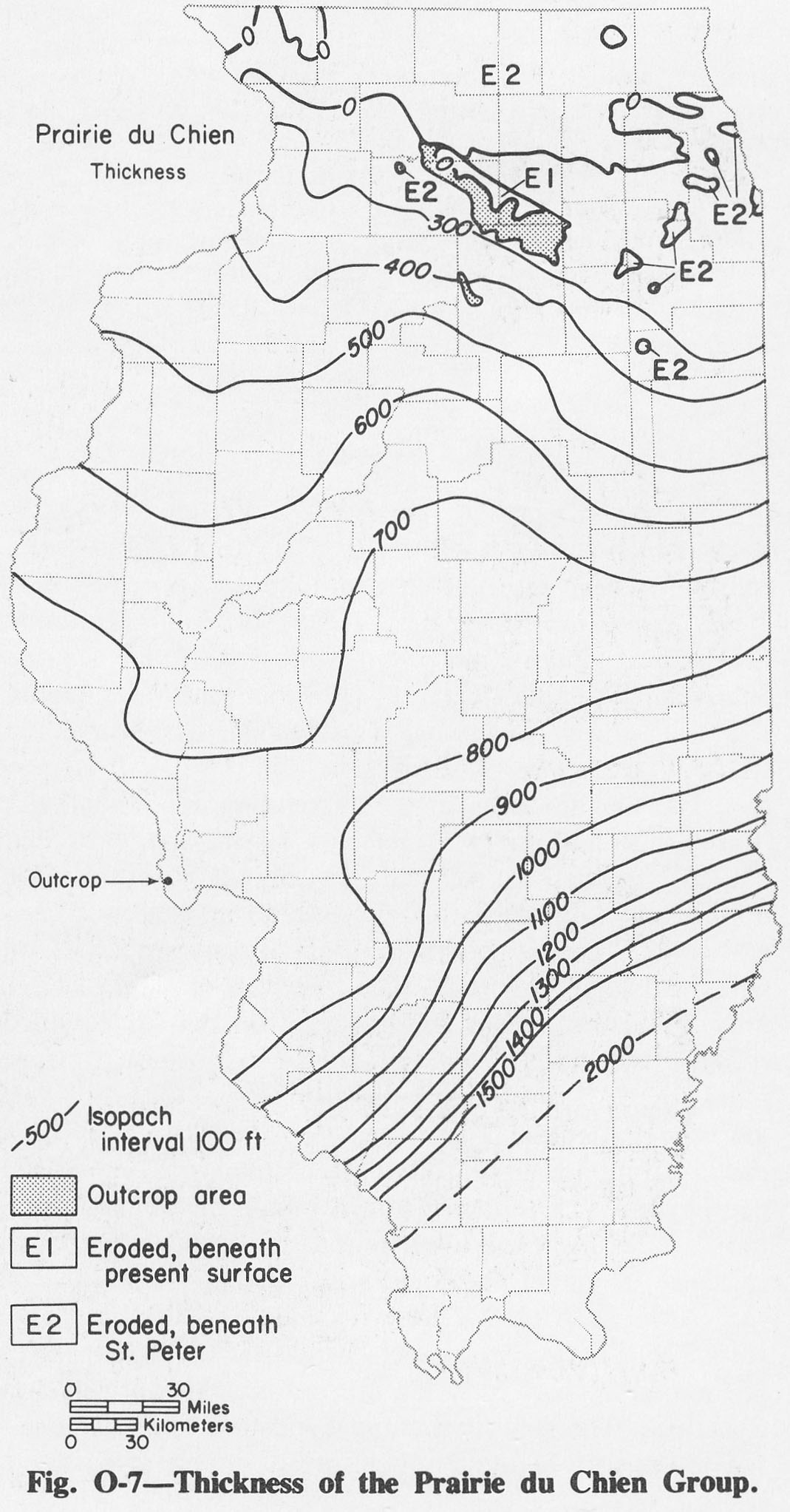
| 14:48, 4 April 2016 | Figure O-7.jpg (file) |  |
289 KB | Fig. O-7 -- Thickness of the Prairie du Chien Group. | 1 |
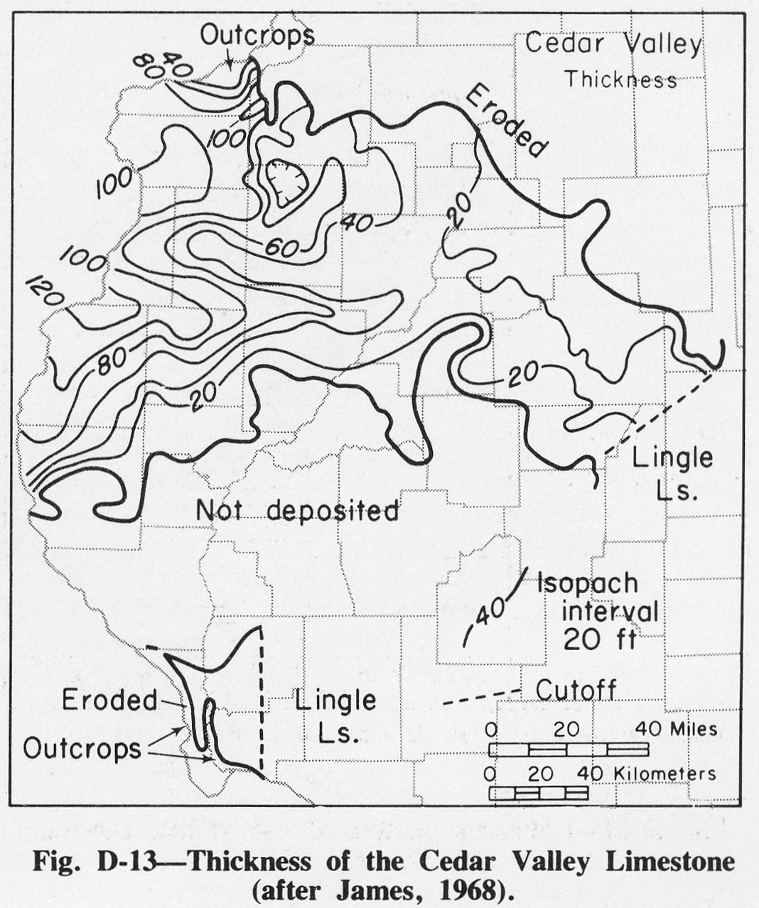
| 20:08, 1 April 2016 | Figure D-13.jpg (file) |  |
291 KB | Fig. D-13 -- Thickness of the Cedar Valley Limestone (after James, 1968). | 1 |
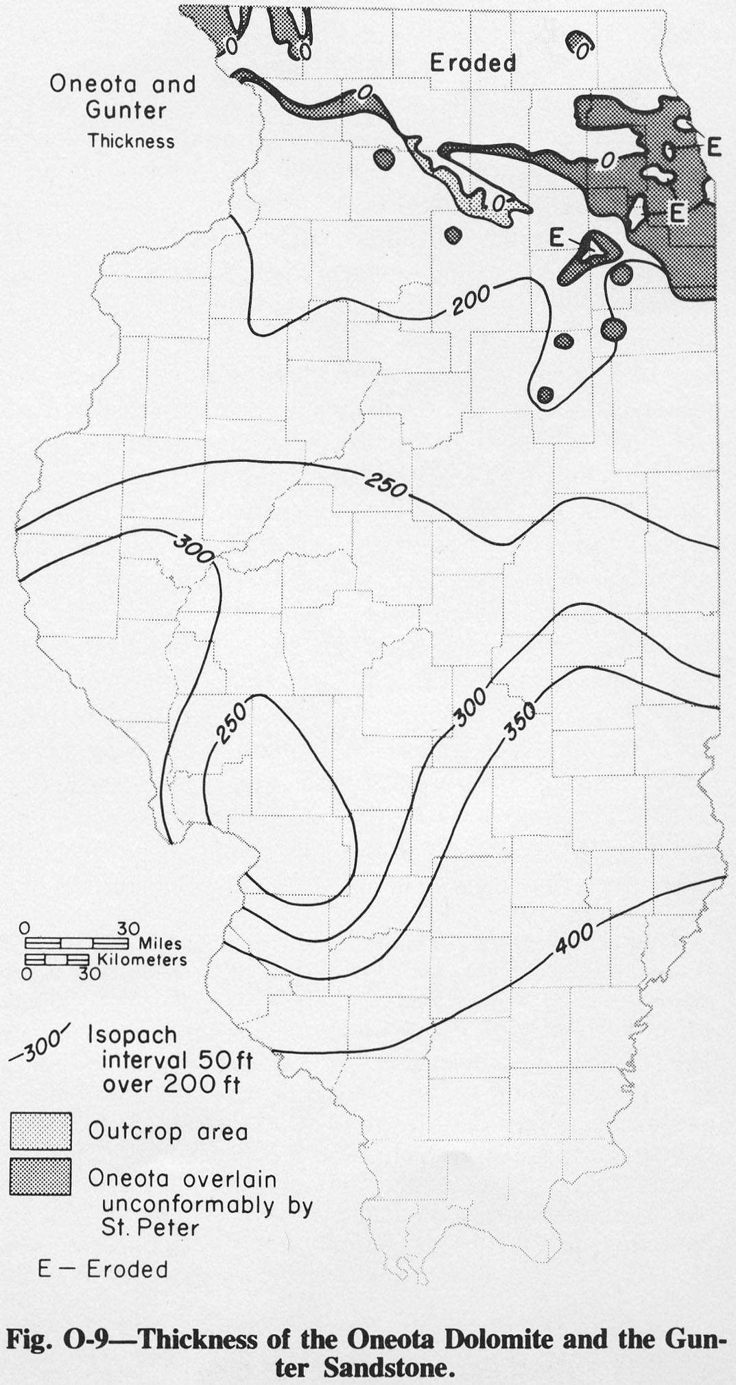
| 14:50, 4 April 2016 | Figure O-9.jpg (file) |  |
291 KB | Fig. O-9 -- Thickness of the Oneota Dolomite and the Gunter Sandstone. | 1 |
| 19:51, 1 April 2016 | Figure C-13.jpg (file) |  |
293 KB | Fig. C-13 -- Thickness of the Eminence Formation. | 1 |
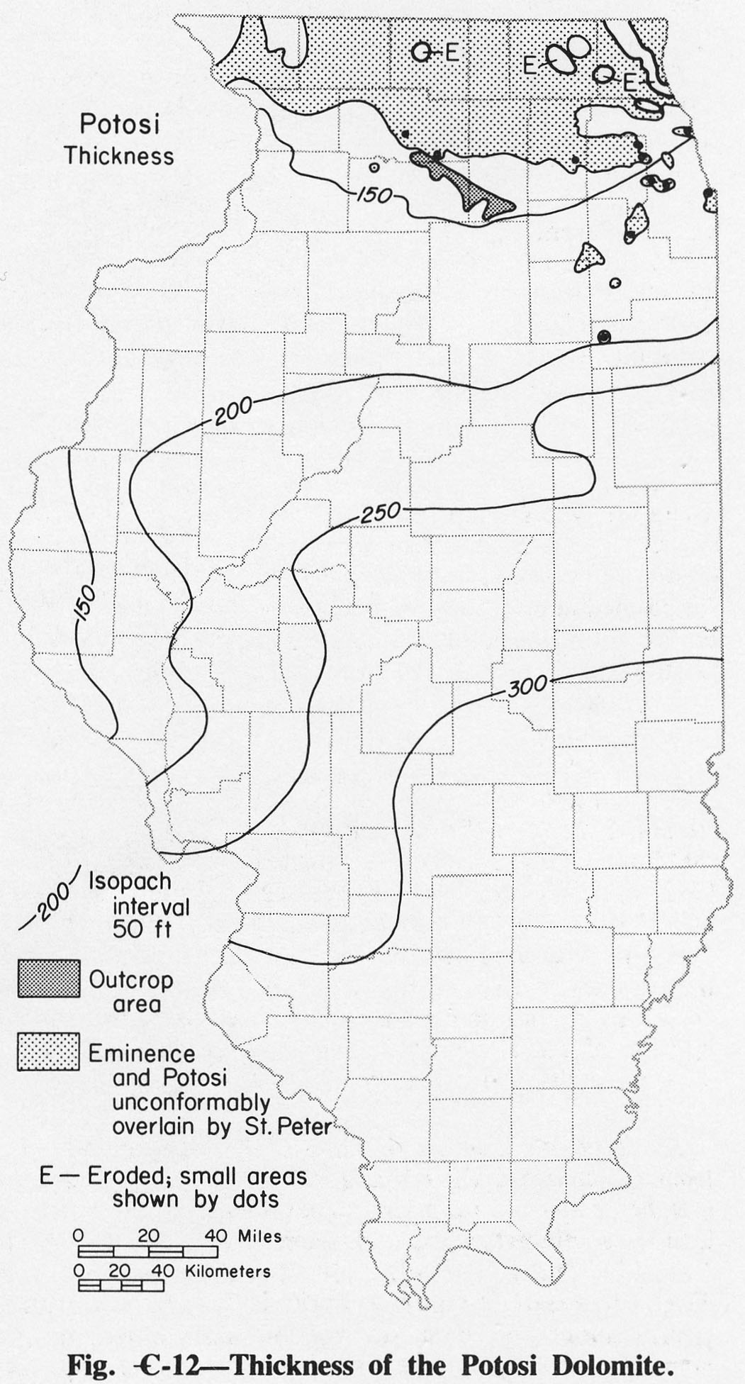
| 19:50, 1 April 2016 | Figure C-12.jpg (file) |  |
298 KB | Fig. C-12 -- Thickness of the Potosi Dolomite. | 1 |