File list
Jump to navigation
Jump to search
This special page shows all uploaded files.
| Date | Name | Thumbnail | Size | User | Description | Versions |
|---|---|---|---|---|---|---|
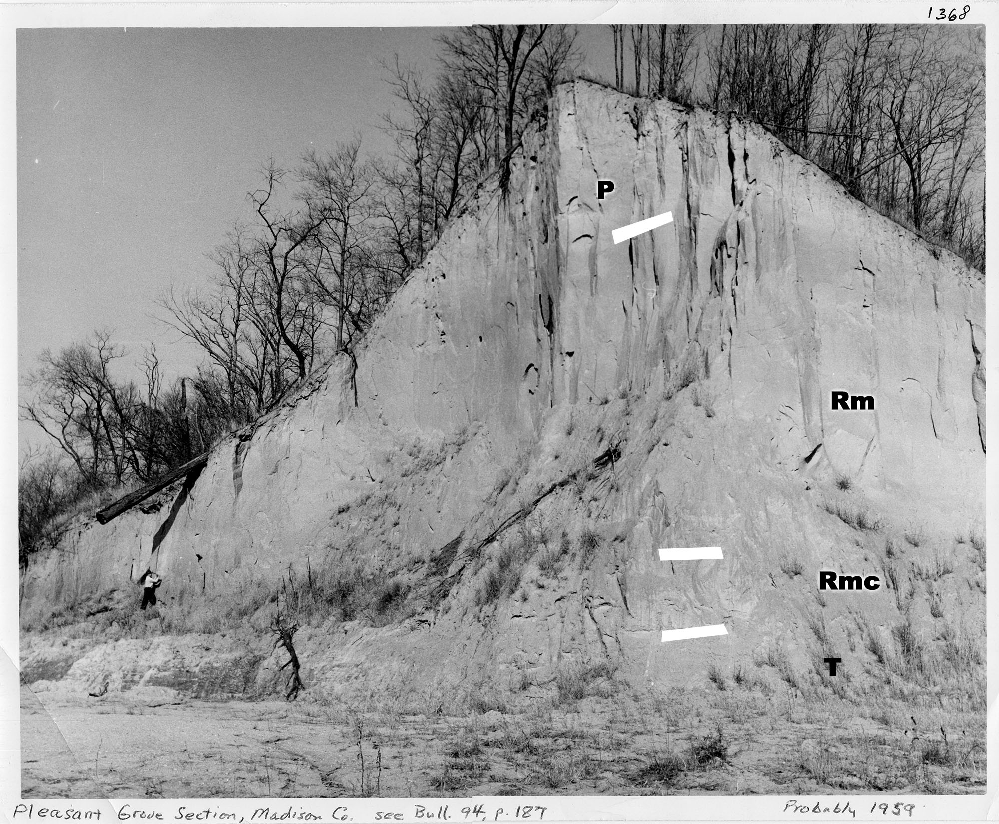
| 16:24, 5 April 2016 | Figure Q-1C.jpg (file) |  |
707 KB | Alan.Myers | Fig. Q-1C -- Wisconsinan Peoria Loess (P) overlying the Roxana Silt (Rm-Meadow Loess Member, Rmc-McDonough Loess Member) and the Illinoian Teneriffe Silt (T) in the Pleasant Grove School Section in the Mississippi River bluffs northwest of Collinsville... | 2 |
| 16:12, 5 April 2016 | Figure Q-1B.jpg (file) |  |
1.11 MB | Alan.Myers | Fig. Q-1B -- The Wisconsinan Wedron (W-interbedded till and outwash) and Peddicord (P-lake sediments) Formations overlying till of the Illinoian Glasford Formation in the Wedron Silica Company pit at Wedron, LaSalle County-the type sections of the Wedr... | 2 |
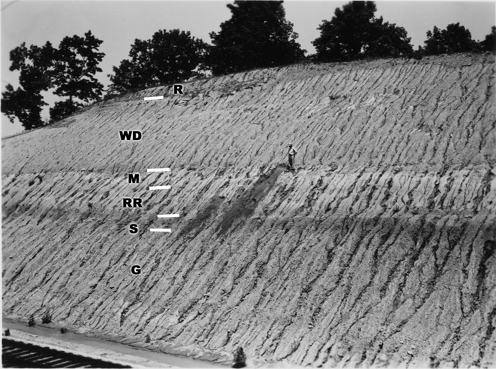
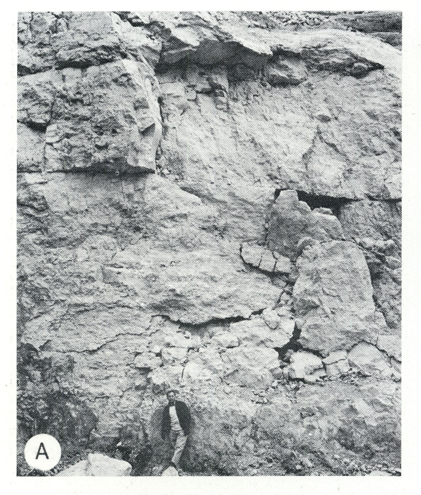
| 16:02, 5 April 2016 | Figure Q-1A.jpg (file) |  |
735 KB | Alan.Myers | Fig. Q-1A -- Wisconsinan Richland Loess (R), Delavan Till Member of the Wedron Formation (Wd), Morton Loess(M), Robein and Roxana Silts (RR), and the Sangamon Soil (S) on till of the Illinoian Glasford Formation(C); in a railroad cut a mile east of Far... | 2 |
| 13:22, 5 April 2016 | Figure S-2F.jpg (file) |  |
1.19 MB | Alan.Myers | Fig. S-2F -- Dense, argillaceous dolomite containing chert nodules characteristic of Racine interreef facies in the Chicago area. The outer, porous parts of the nodules are blackened by air pollutants. | 1 |
| 13:16, 5 April 2016 | Figure S-2E.jpg (file) |  |
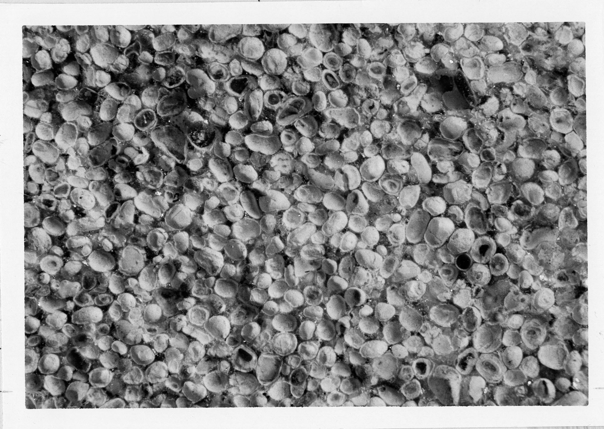
1.26 MB | Alan.Myers | Fig. S-2E -- Mottled, porous, pure dolomite characteristic of Racine reef facies in the Chicago area (x 1). | 1 |
| 13:16, 5 April 2016 | Figure S-2D.jpg (file) |  |
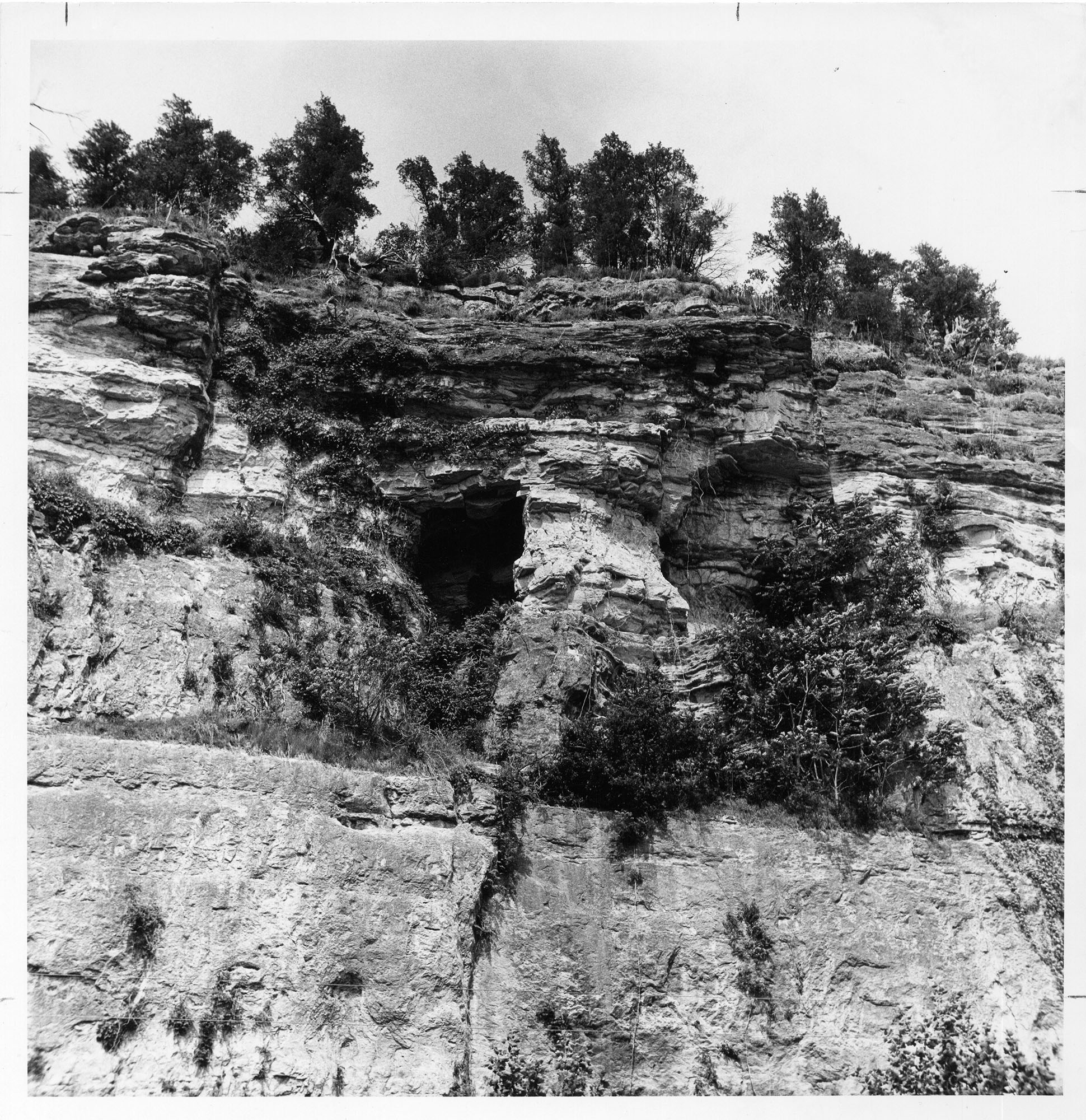
1.46 MB | Alan.Myers | Fig. S-2D -- Massive Tete des Morts Formation overlying the Mosalem Formation at the top of Silurian escarpment, 4 miles southeast of Galena, Jo Daviess County. | 1 |
| 13:15, 5 April 2016 | Figure S-2C.jpg (file) |  |
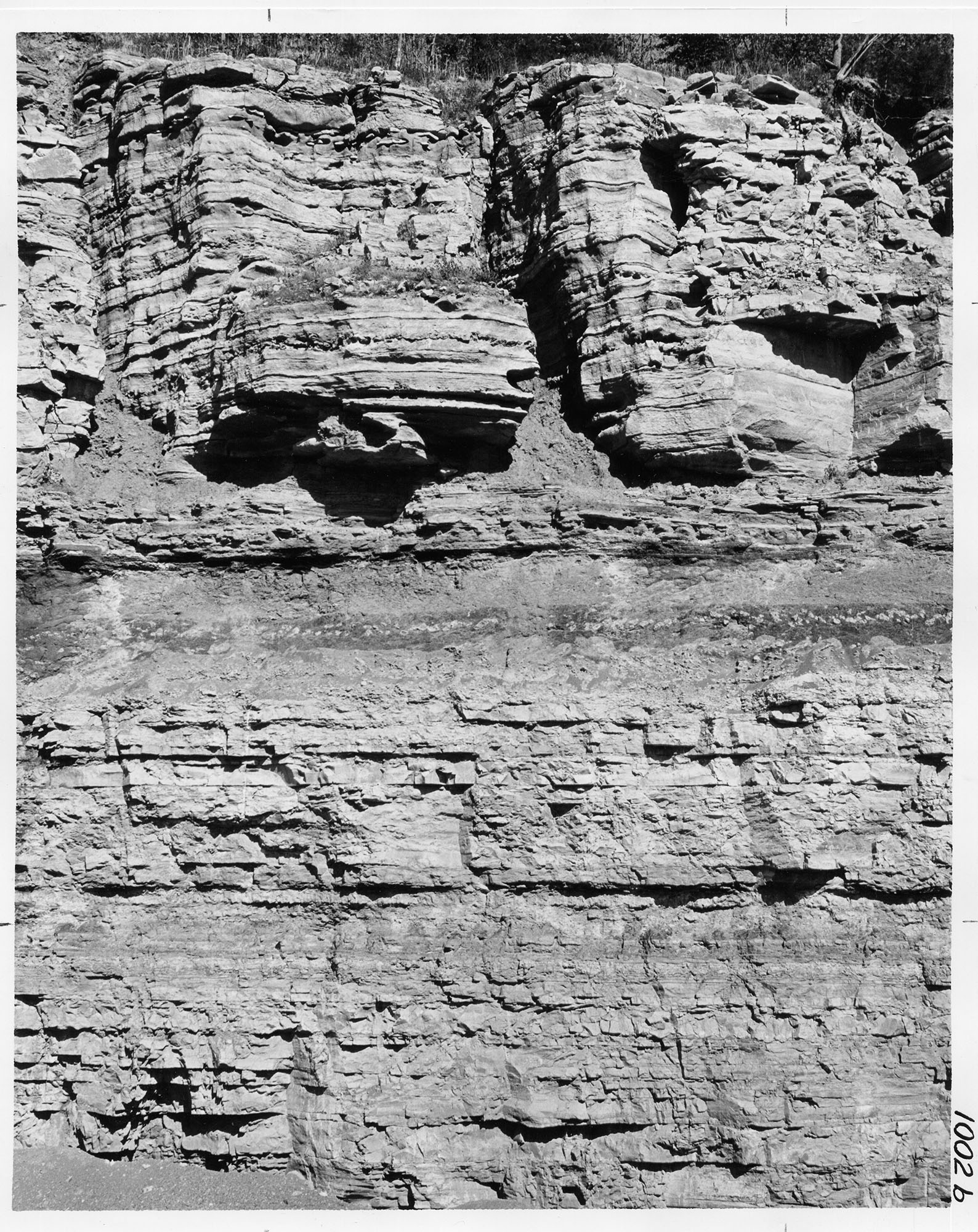
1.38 MB | Alan.Myers | Fig. S-2C -- Massive Marcus Dolomite in a quarry 3 miles east of Fulton, Whiteside County. | 1 |
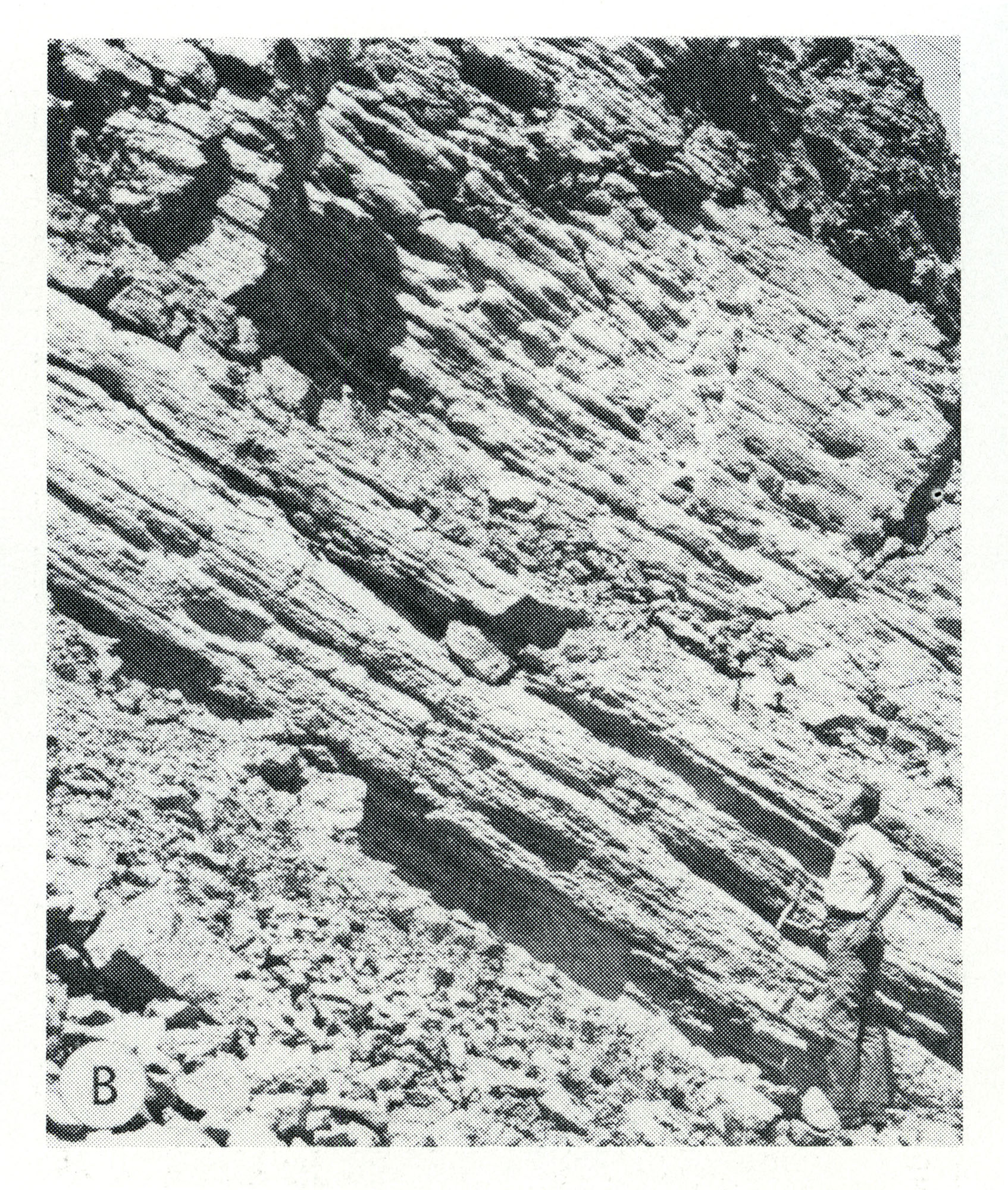
| 13:14, 5 April 2016 | Figure S-2B.jpg (file) |  |
1.29 MB | Alan.Myers | Fig. S-2B -- Steeply dipping, well bedded dolomite forming the fiank of a Racine (Niagaran) reef, in the Material Service Corporation quarry at Thornton, Cook County. | 1 |
| 13:14, 5 April 2016 | Figure S-2A.jpg (file) |  |
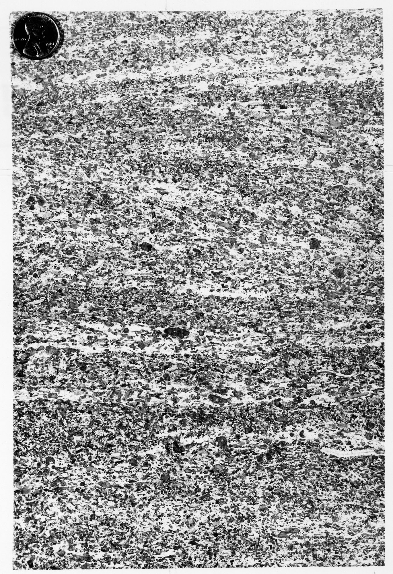
1.33 MB | Alan.Myers | Fig. S-2A -- Massive dolomite in the core of a Racine (Niagaran) reef, at the top of the Material Service Corporation (Stearns) quarry on Archer Avenue at 28th Street, Chicago. | 1 |
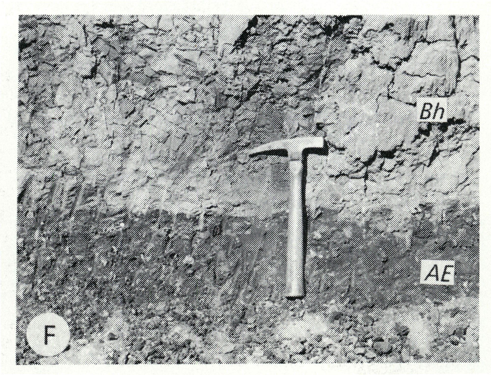
| 13:12, 5 April 2016 | Figure Q-1F.jpg (file) |  |
1.13 MB | Alan.Myers | Fig. Q-1F -- Harkness Silt Member of the ~ansan Banner Formation (Bh) overlying the Afton Soil developed on gravel of the Nebraskan Enion Formation (AE); in a roadcut at the Zion Church, 2 miles southeast of Marblehead, Adams County (Willman and Frye,... | 1 |
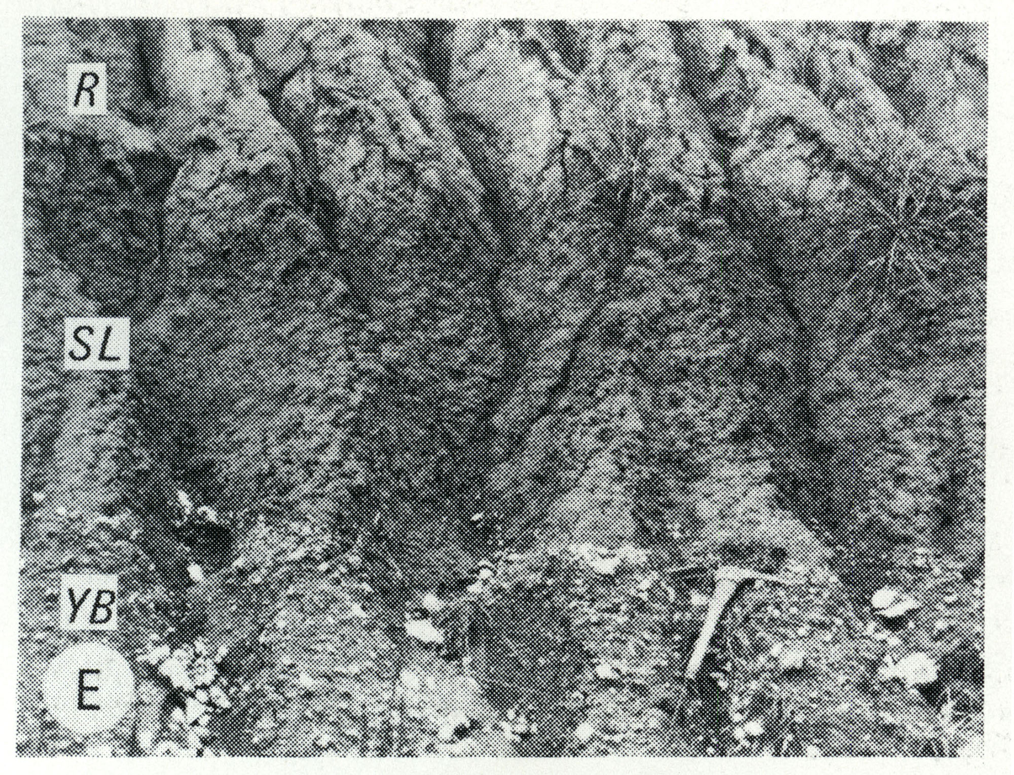
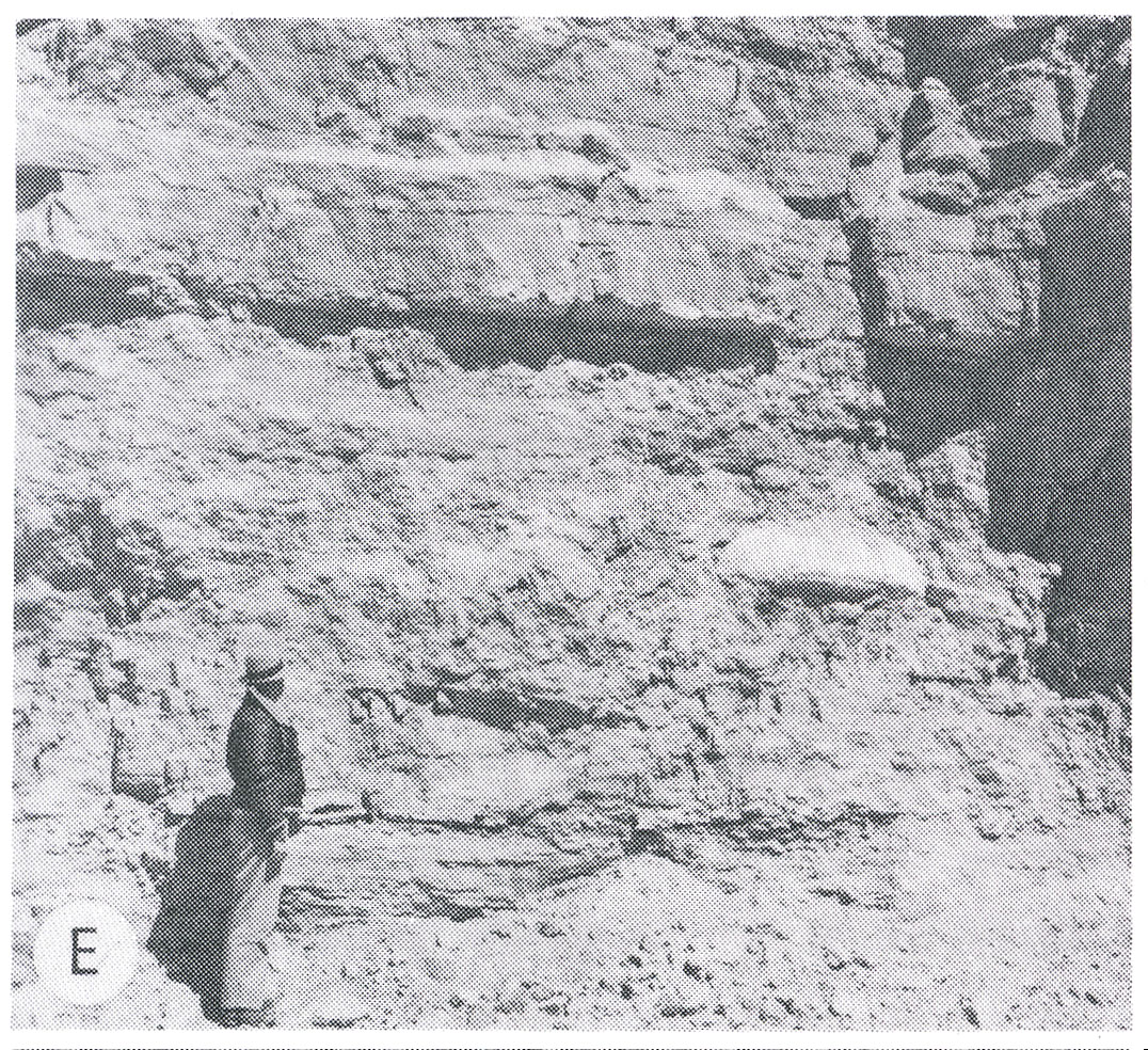
| 13:11, 5 April 2016 | Figure Q-1E.jpg (file) |  |
1.16 MB | Alan.Myers | Fig. Q-1E -- Wisconsinan Roxana Silt (R), Sangamon Soil developed in the Illinoian Loveland Silt (SL) and Yarmouth Soil developed in till of the Kansan Banner Formation (YB); in a roadcut at Independence, 5 miles south of Pittsfield, Pike County (Frye... | 1 |
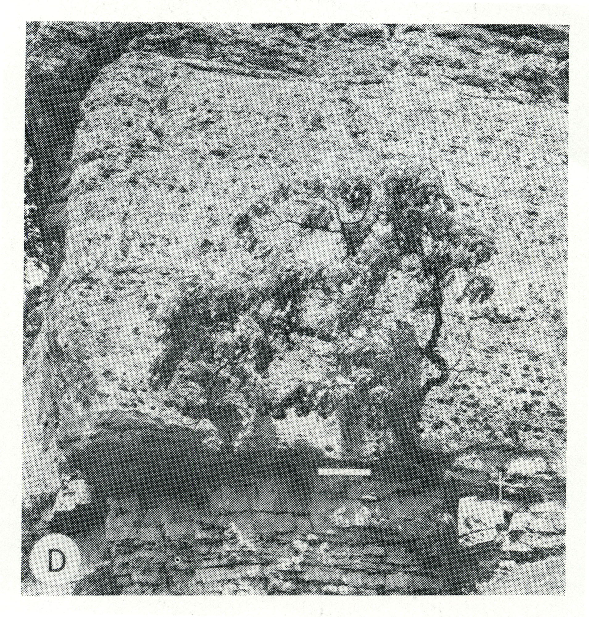
| 13:10, 5 April 2016 | Figure Q-1D.jpg (file) |  |
1.16 MB | Alan.Myers | Fig. Q-1D -- Illinoian Glasford Formation (Hagarstown Member) showing steeply dipping sand and gravel (crevasse deposit) in a mound in the Kaskaskia Ridged Drift area, 2 miles southwest of Lakewood, Shelby County. | 1 |
| 20:22, 4 April 2016 | Figure O-2F.jpg (file) |  |
601 KB | Alan.Myers | Fig. O-2F -- Thin-bedded dolomite of the Quimbys Mill Formation overlying massive dolomite of the Nachusa Formation in a quarry on River Street in Dixon, Lee County. | 1 |
| 20:21, 4 April 2016 | Figure O-2E.jpg (file) |  |
585 KB | Alan.Myers | Fig. O-2E -- Massice Oneota Dolomite containing a large algal growth; in a quarry in Lee County, 6 Miles south of Rochelle, Ogle County. | 1 |
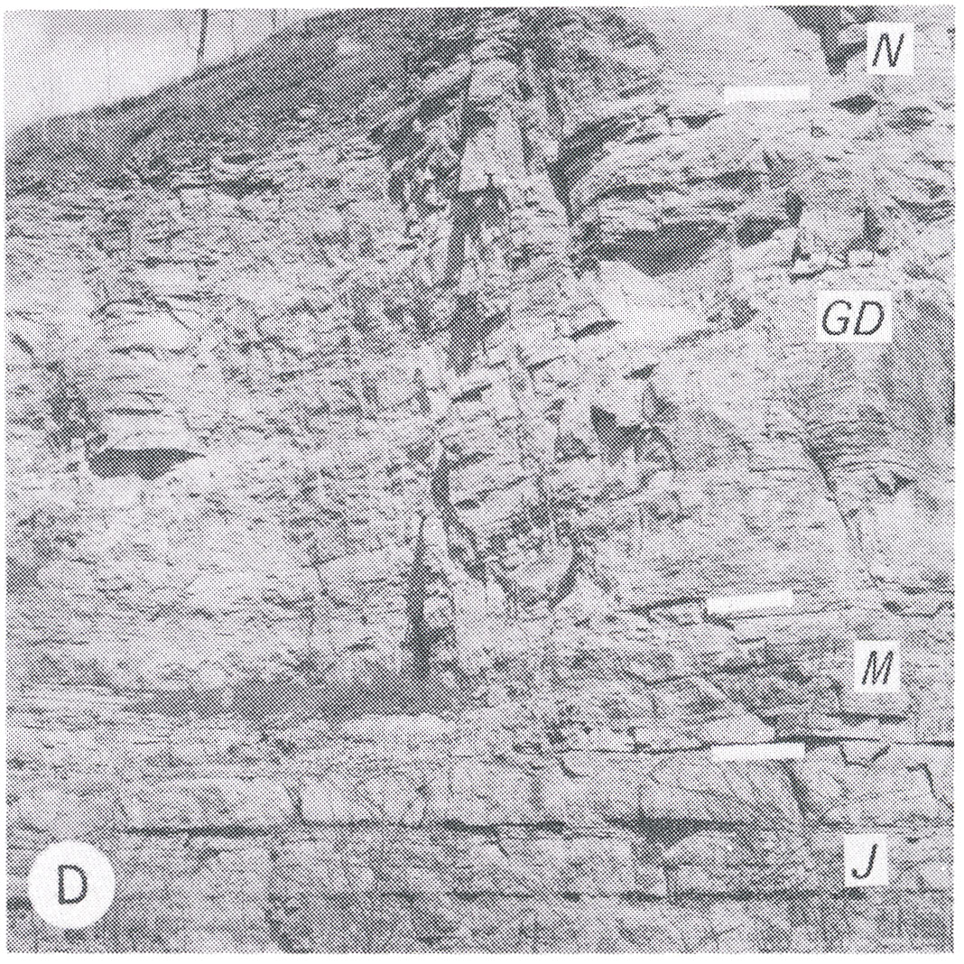
| 20:19, 4 April 2016 | Figure O-2D.jpg (file) |  |
647 KB | Alan.Myers | Fig. O-2D -- Relatively thin-bedded Platteville Limestone Group showing the Nashusa (N), Grand Detour (GD), and Mifflin (M) Formations overlying the thick-bedded Joachim Dolomite (J) in a quarry at West Point Landing, Calhoun County (Templeton and Will... | 1 |
| 20:17, 4 April 2016 | Figure O-2C.jpg (file) |  |
669 KB | Alan.Myers | Fig. O-2C -- Massive Wise Lake Formation overlying the thinner bedded Dunleith Formation, which contains lenses and beds of white chert, in a quarry on the south side of Freeport, Stephenson County. | 1 |
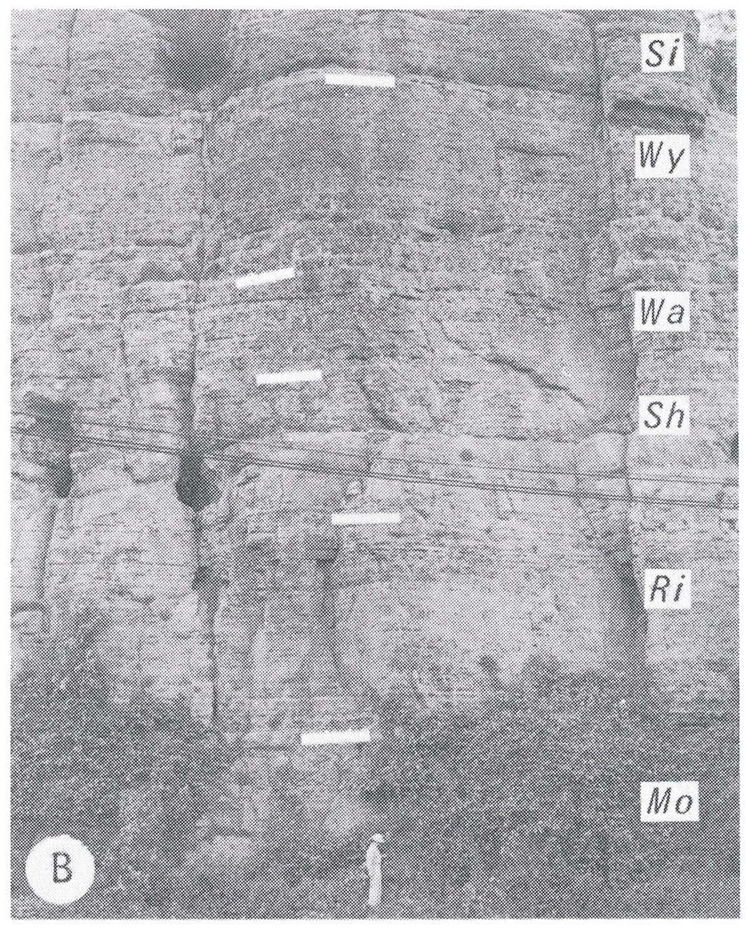
| 20:14, 4 April 2016 | Figure O-2B.jpg (file) |  |
719 KB | Alan.Myers | Fig. O-2B -- Type section of Dunleith Formation showing the Mortime (Mo), Rivoli (Ri), Sherwood (Sh), Wall (Wa) and Wyota (Wy) Members overlain by the Sinsinawa Member (Si) of the Wise Lake Formation at East Dubuque, Jo Daviess County (Templeton and Wi... | 1 |
| 18:55, 4 April 2016 | Figure M-1F.jpg (file) |  |
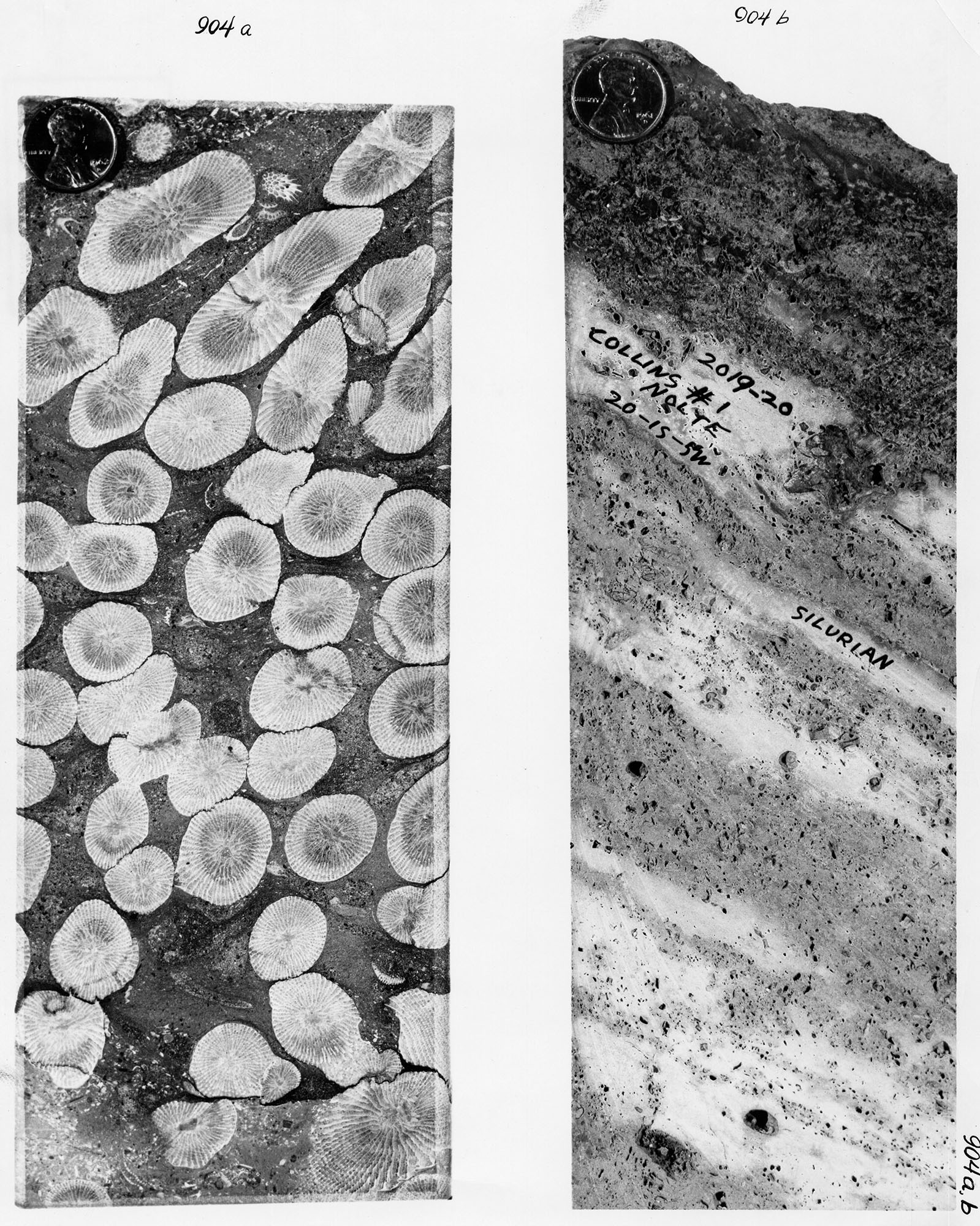
1.03 MB | Alan.Myers | Fig. M-1F -- Grannular texture of the Ullin Limestone along Mill Creek, south of Anna, Union County (x1). | 1 |
| 18:54, 4 April 2016 | Figure M-1E.jpg (file) |  |
521 KB | Alan.Myers | Fig. M-1E -- Oolitic texture of the Ste. Genevieve Limestone at Anna, Union County (x10). | 1 |
| 18:52, 4 April 2016 | Figure M-1D.jpg (file) |  |
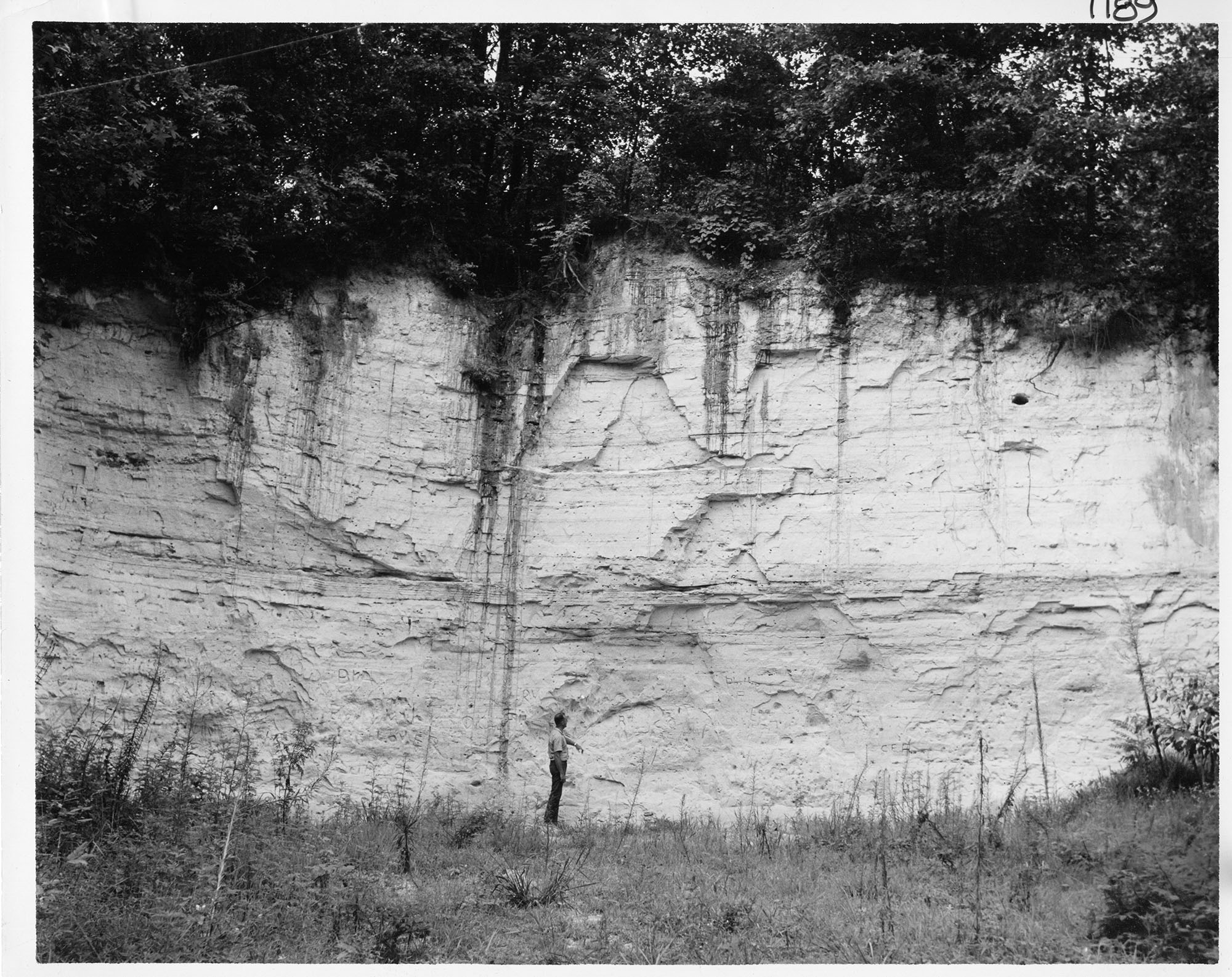
1.02 MB | Alan.Myers | Fig. M-1D -- Well bedded St. Louis Limestone with cave in its base overlying massive Salem Limestone in Mississippi River bluff a mile northwest of Prairie du Rocher, Randolph County. | 1 |
| 18:50, 4 April 2016 | Figure M-1C.jpg (file) |  |
902 KB | Alan.Myers | Fig. M-1C -- Kinkaid Limestone showing clay-filled solution cavity in the Goreville Member at the top overlying a layer of shale with red bed (black) at the tope of the Cave Hill Member; in Southern Illinois Limestone Company quarry north of Buncombe,... | 1 |
| 18:46, 4 April 2016 | Figure M-1B.jpg (file) |  |
653 KB | Alan.Myers | Fig. M-1B -- Massive Ste. GEnevieve Limestone overlying well bedded St. Louis Limestone in Mississippi River bluff (about 60 feet high) on northwest side of Alton, Madison County. | 1 |
| 18:44, 4 April 2016 | Figure M-1A.jpg (file) |  |
736 KB | Alan.Myers | Fig. M-1A -- Vienna Limestone overlying the sheet facies of the Tar Springs Sandstone in roadcut (about 40 feet high) of Illinois Highway 3 on southeast side of Chester, Randolph County. | 1 |
| 18:38, 4 April 2016 | Figure K-1C.jpg (file) |  |
1.14 MB | Alan.Myers | Fig. K-1C -- Bedding surface of Mounds Gravel in same pit as exposure B (x1.5). | 1 |
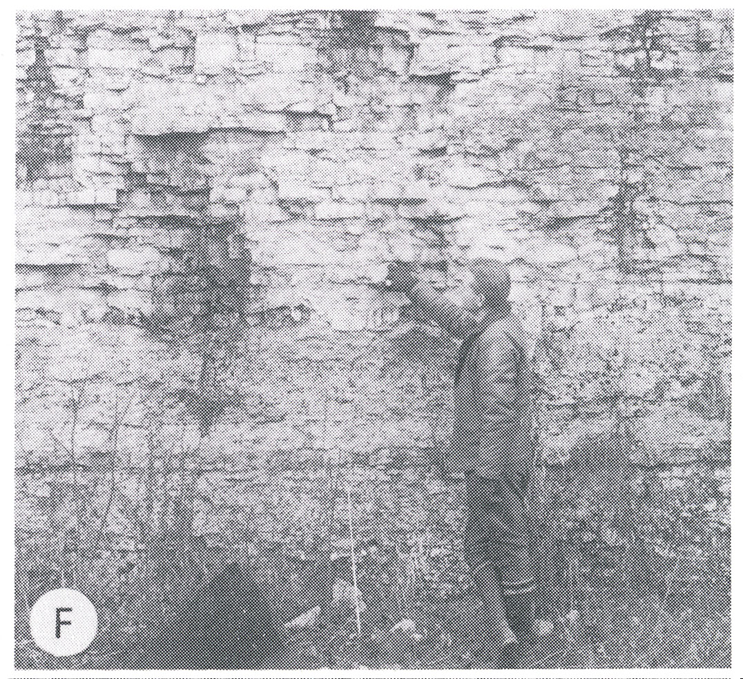
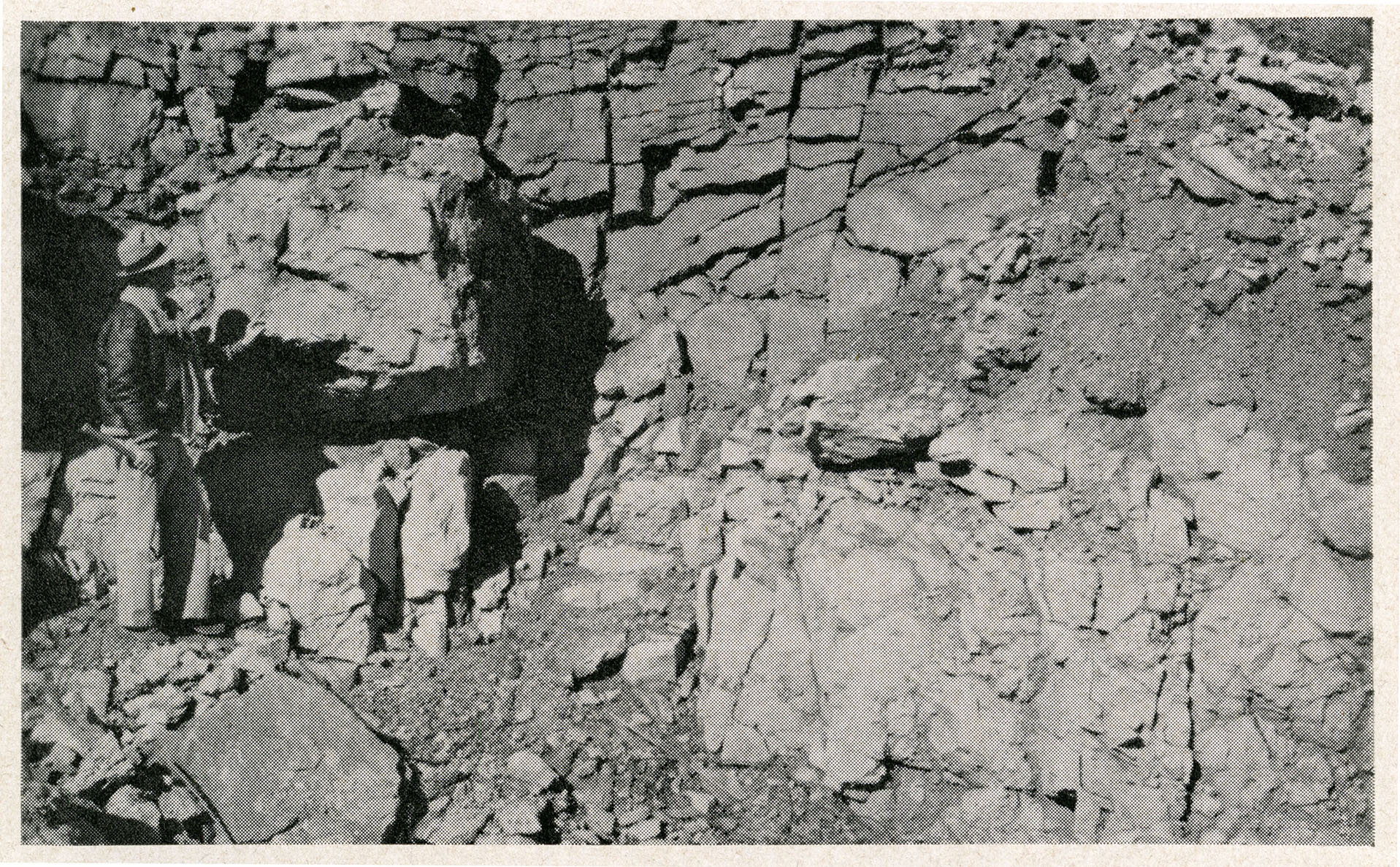
| 18:37, 4 April 2016 | Figure K-1B.jpg (file) |  |
1.5 MB | Alan.Myers | Fig. K-1B -- Mounds Gravel in pit along Illinois Highway 145, 8 miles north of Metropolis, Massac County. | 1 |
| 18:35, 4 April 2016 | Figure K-1A.jpg (file) |  |
701 KB | Alan.Myers | Fig. K-1A -- McNairy Sand in a pit near Fayville, Alexander County. | 1 |
| 18:33, 4 April 2016 | Figure D-3E.jpg (file) |  |
797 KB | Alan.Myers | Fig. D-3E -- Dark gray, fine-grained Middle Devovian limestone containing white corals; polished section of core from depth of 3270 feet in Marion County (x1). | 1 |
| 18:31, 4 April 2016 | Figure D-3D.jpg (file) |  |
732 KB | Alan.Myers | Fig. D-3D -- Fine-grained, fossiliferous limestone characteristic of Cedar Valley Limestone in the Rock Island area, Rock Island County (x1). | 1 |
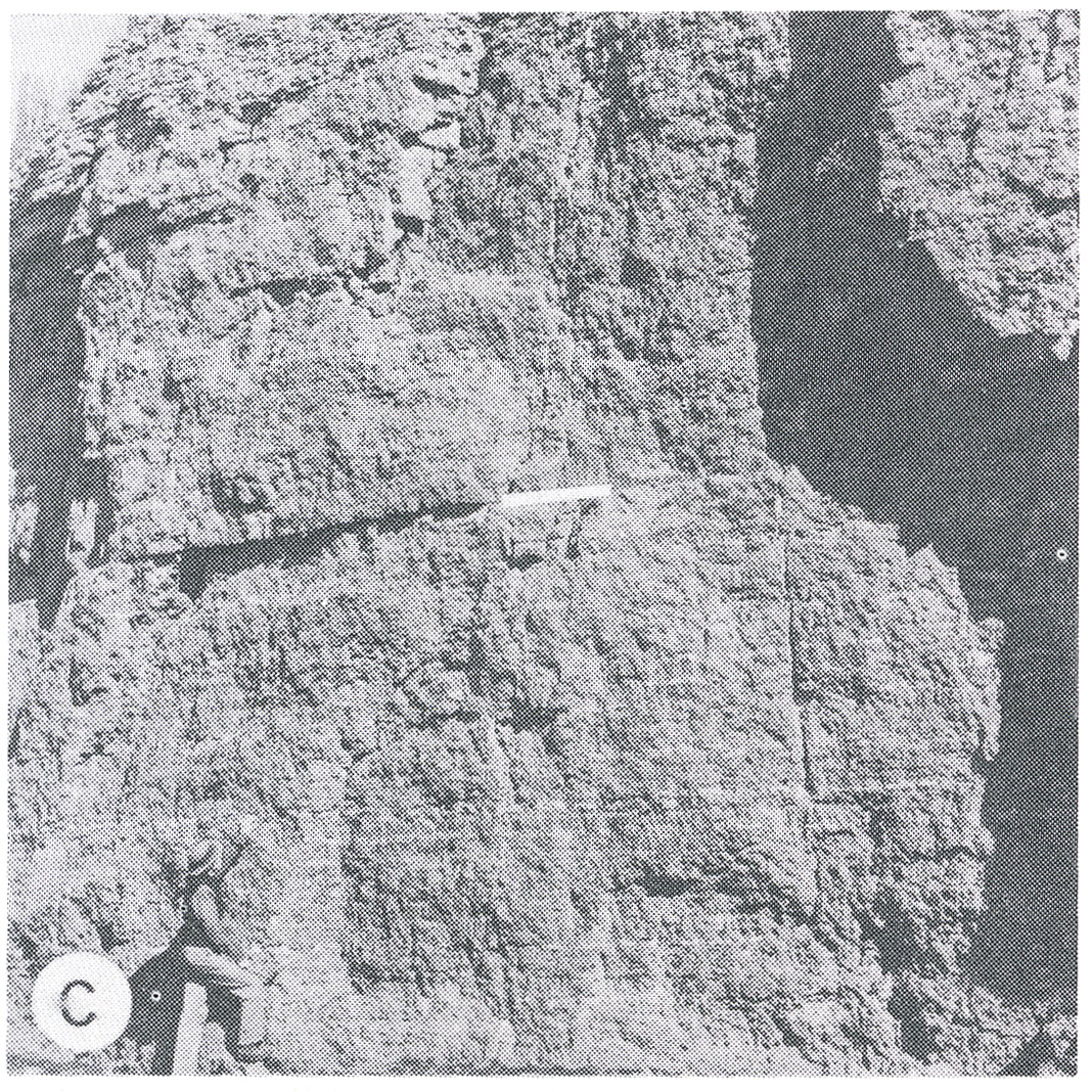
| 18:29, 4 April 2016 | Figure D-3C.jpg (file) |  |
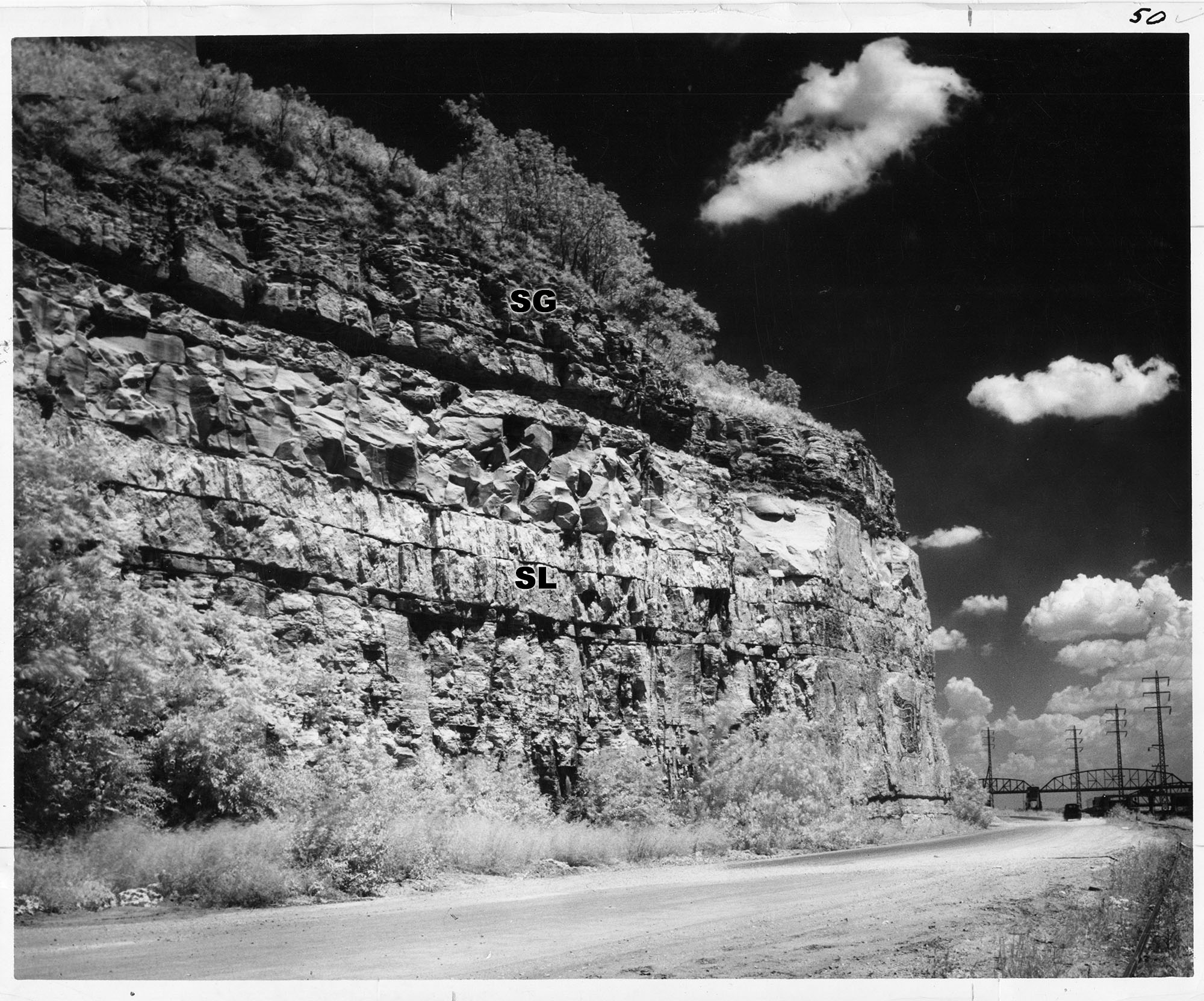
601 KB | Alan.Myers | Fig. D-3C -- Cedar Valley (CV) and Wapsipinicon (W) Limestone in Collinson Stone Company Quarry, 1 mile southeast of Milan, Rock Island County. The Rock face is about 70 feet high. | 2 |
| 18:22, 4 April 2016 | Figure D-3B.jpg (file) |  |
690 KB | Alan.Myers | Fig. D-3B -- Bailey Limestone in Pine Hills (Mississippi River bluffs), 5 miles north of Wolf Lake, Union County. | 1 |
| 18:21, 4 April 2016 | Figure D-3A.jpg (file) |  |
1.04 MB | Alan.Myers | Fig. D-3A -- Middle Devonian Limestone (Lingle and Grand Tower) in ridge ("the Backbone") along the Mississippi River north of Grand Tower, Jackson County (from Worthen, 1868, opp. p. 61). | 1 |
| 18:18, 4 April 2016 | Figure C-1D.jpg (file) |  |
776 KB | Alan.Myers | Fig. C-1D -- Core of Ironton Sandstone showing flat-pebble conglomerate; from boring in Champaign county (x2). | 1 |
| 18:17, 4 April 2016 | Figure C-1C.jpg (file) |  |
788 KB | Alan.Myers | Fig. C-1C -- Core of Eau Clair Formation showing penecontemporaneous deformation of shale beds in shaly sanstone; from a boring in Champaign County (x2). | 1 |
| 18:15, 4 April 2016 | Figure C-1B.jpg (file) |  |
1.18 MB | Alan.Myers | Fig. C-1B -- Cambrian-Ordovician unconformity showing well bedded Oneota Dolomite overlying massive Potosi Dolomite in a quarry in Lee County, 6 miles south of Rochelle, Ogle County (Willman and Templeton, 1951, p. 113). | 1 |
| 18:12, 4 April 2016 | Figure C-1A.jpg (file) |  |
1,023 KB | Alan.Myers | Fig. C1-A -- Massive Potosi Dolomite in a quarry 4 miles northwest of Ashton, Ogle County. | 1 |
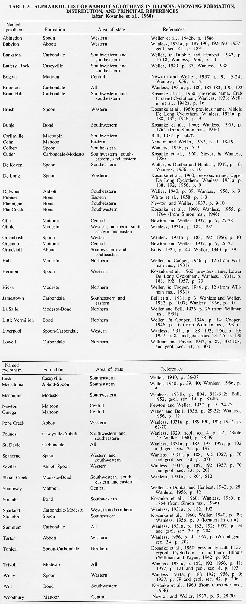
| 18:09, 4 April 2016 | Table 3.jpg (file) |  |
371 KB | Alan.Myers | Table 3 -- Alphabetic list of named cyclothems in Illinois, showing formation, distribution, and principal references (after Kosanke et al., 1960). | 1 |
| 18:07, 4 April 2016 | Table 2.jpg (file) |  |
236 KB | Alan.Myers | Table 2 -- Illinois Mineral Production in 1972 (Malhotra, 1974). | 1 |
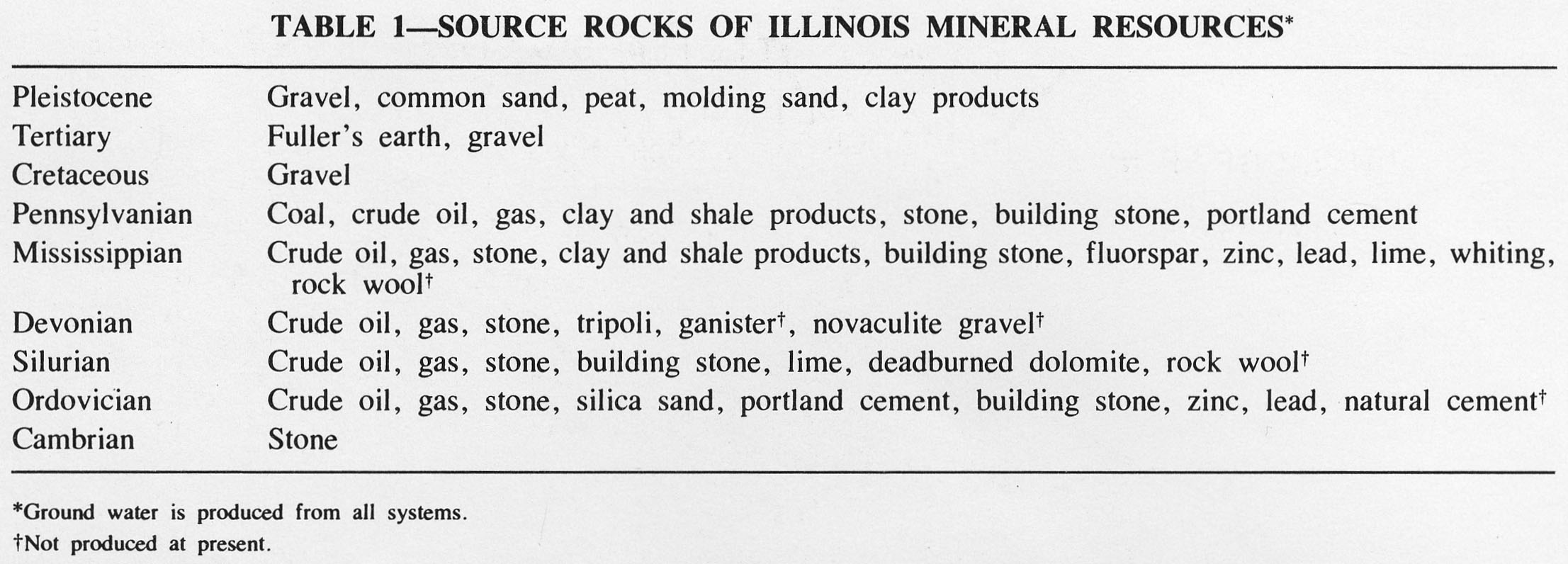
| 18:06, 4 April 2016 | Table 1.jpg (file) |  |
241 KB | Alan.Myers | Table 1 -- Source Rocks of Illinois Mineral Resources. | 1 |
| 18:05, 4 April 2016 | Figure T-2.jpg (file) |  |
233 KB | Alan.Myers | Fig. T-2 -- Classification of the Tertiary System. | 1 |
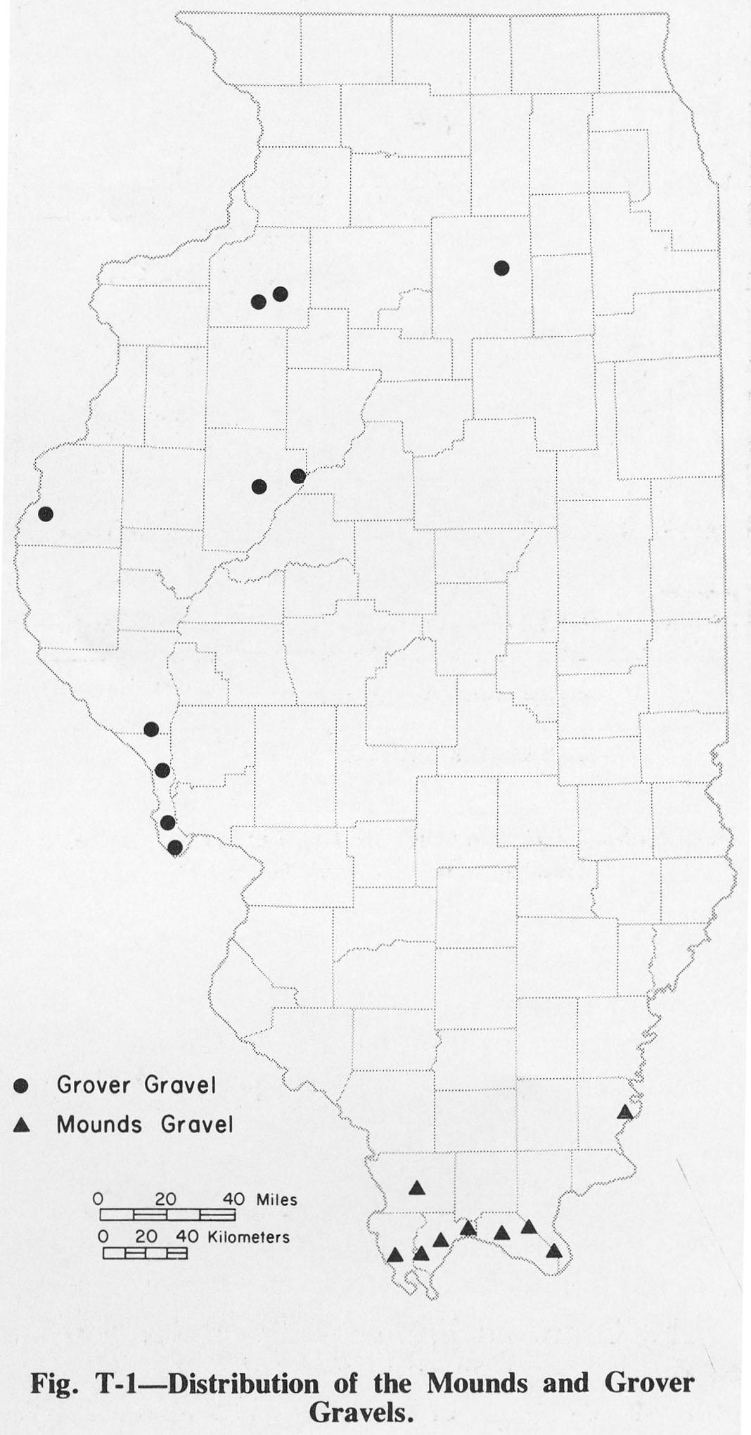
| 18:04, 4 April 2016 | Figure T-1.jpg (file) |  |
209 KB | Alan.Myers | Fig. T-1 -- Distribution of the Mounds and Grover Gravels. | 1 |
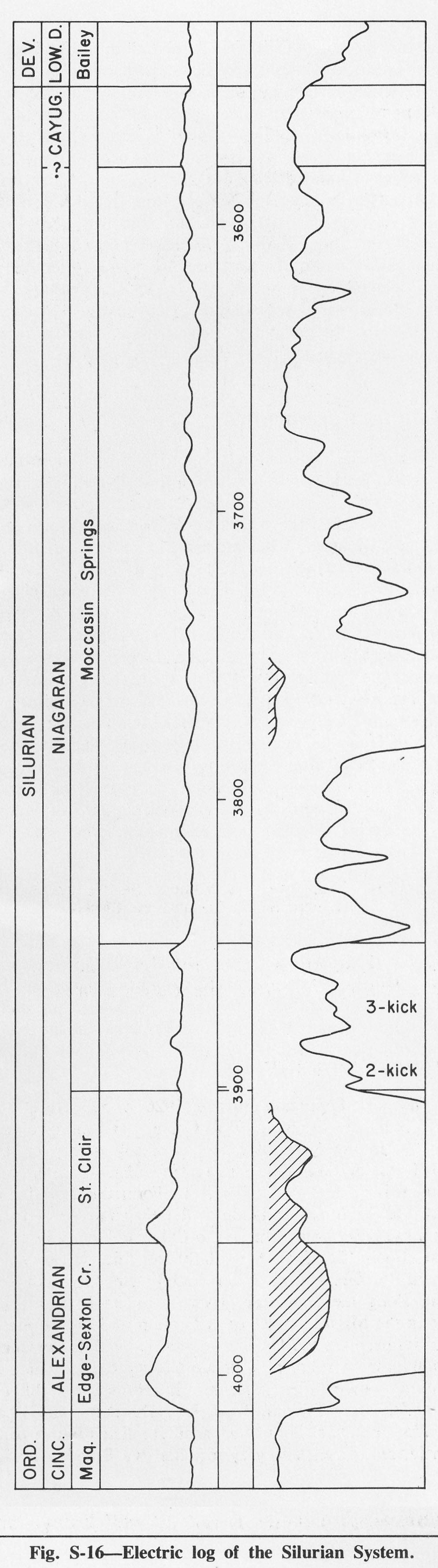
| 18:02, 4 April 2016 | Figure S-16.jpg (file) |  |
323 KB | Alan.Myers | Fig. S-16 -- Electric log of the Silurian System. | 1 |
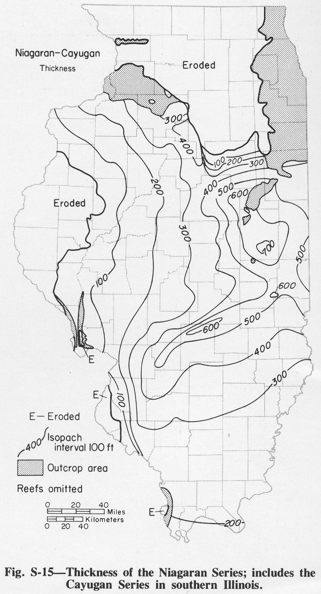
| 18:00, 4 April 2016 | Figure S-15.jpg (file) |  |
322 KB | Alan.Myers | Fig. S-15 -- Thickness of teh Niagaran Series; includes the Cayugan Series in southern Illinois. | 1 |
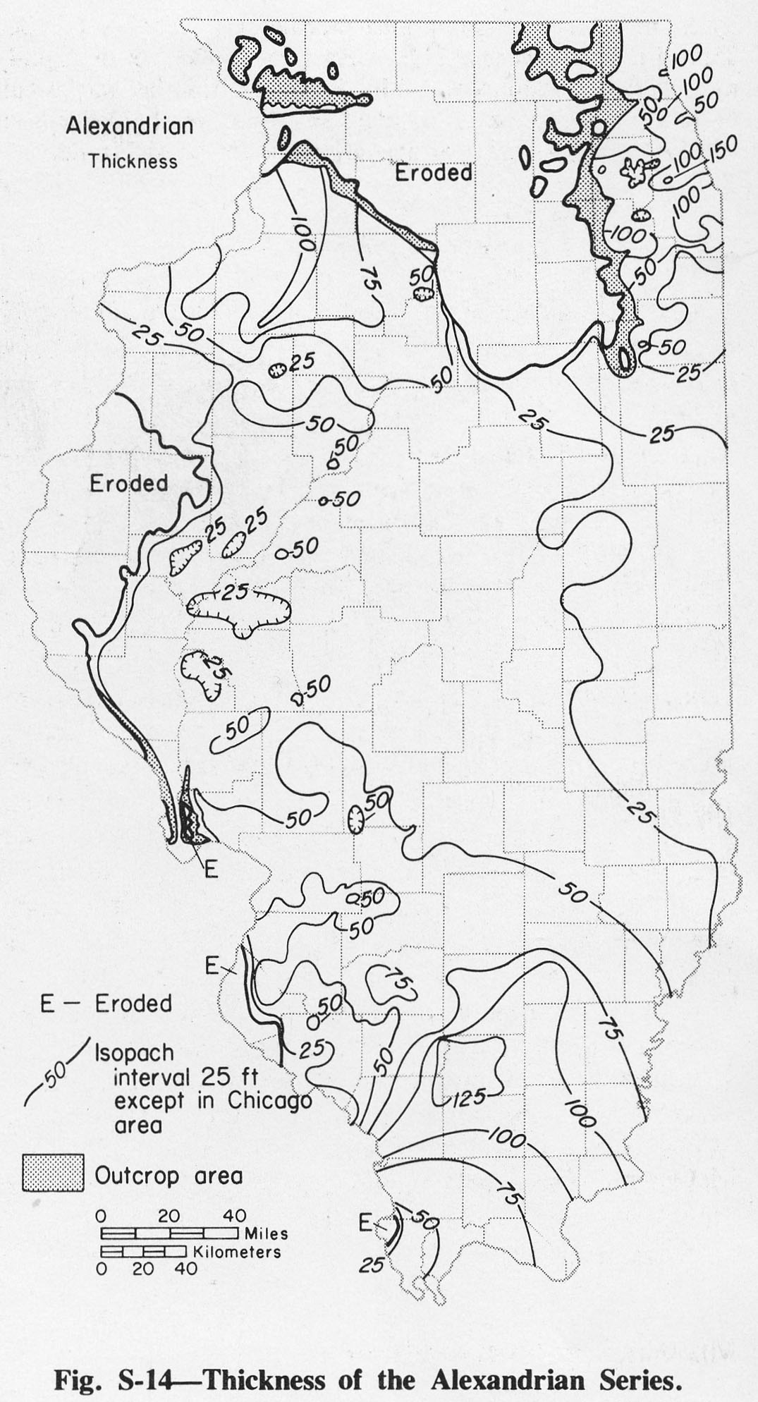
| 17:59, 4 April 2016 | Figure S-14.jpg (file) |  |
328 KB | Alan.Myers | Fig. S-14 -- Thickness of the Alexandrian Series. | 1 |
| 17:58, 4 April 2016 | Figure S-13.jpg (file) |  |
365 KB | Alan.Myers | Fig. S-13 -- Thickness of the Hunton Limestone Megagroup (modified from Bond et al., 1971). | 1 |
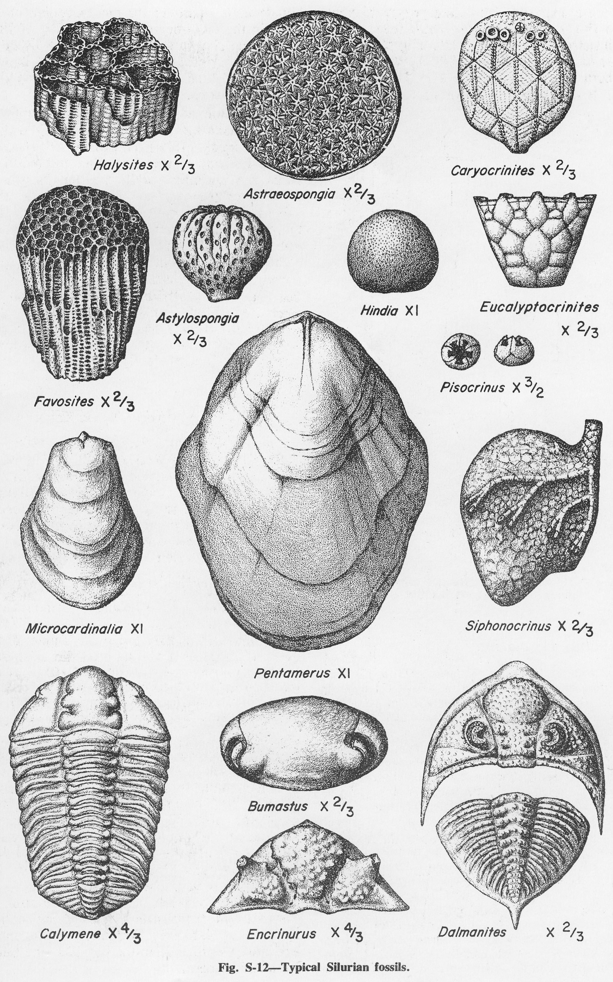
| 17:57, 4 April 2016 | Figure S-12.jpg (file) |  |
1.54 MB | Alan.Myers | Fig. S-12 -- Typical Silurian fossils. | 1 |
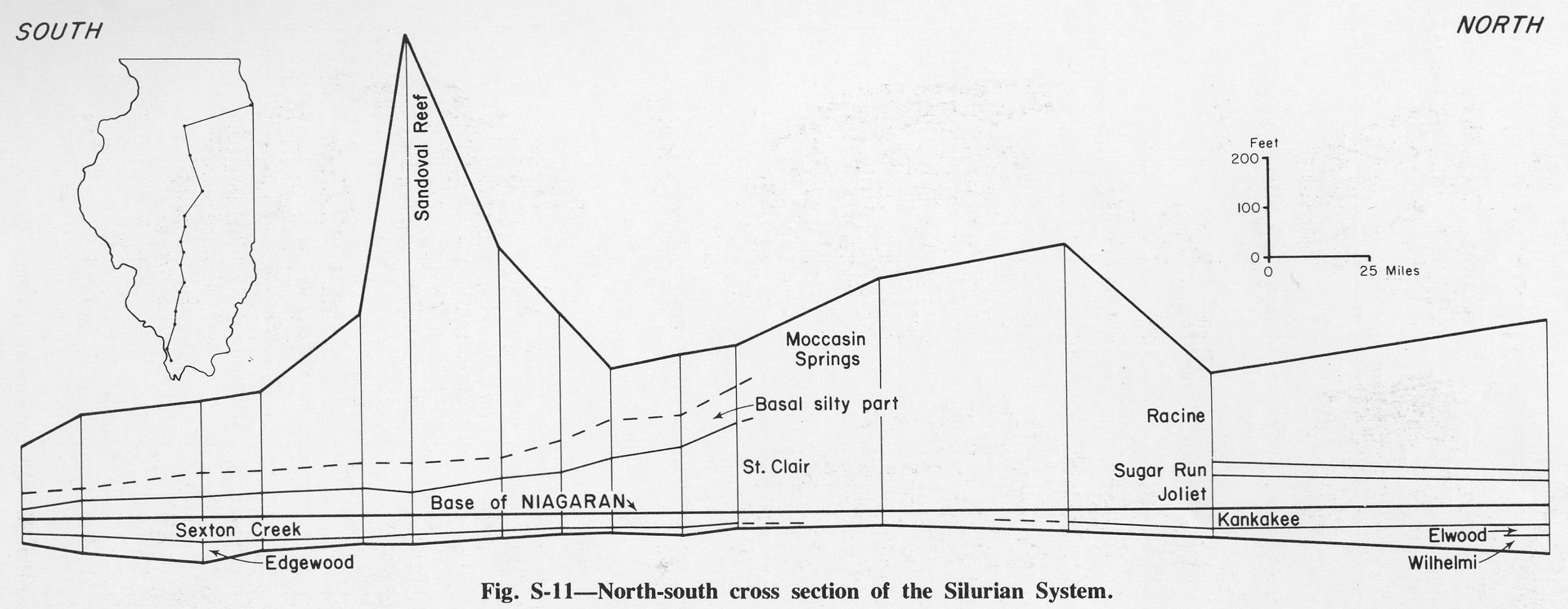
| 17:56, 4 April 2016 | Figure S-11.jpg (file) |  |
257 KB | Alan.Myers | Fig. S-11 -- North-south cross section of the Silurian System. | 1 |
| 17:56, 4 April 2016 | Figure S-10.jpg (file) |  |
326 KB | Alan.Myers | Fig. S-10 -- Development of the classification of the Silurian System in southern Illinois. | 1 |
| 17:55, 4 April 2016 | Figure S-9.jpg (file) |  |
269 KB | Alan.Myers | Fig. S-9 -- Development of the classification of the Silurian System in western Illinois. | 1 |
| 17:54, 4 April 2016 | Figure S-8.jpg (file) |  |
319 KB | Alan.Myers | Fig. S-8 -- Development of the classification of the Silurian System in northwestern Illinois. | 1 |
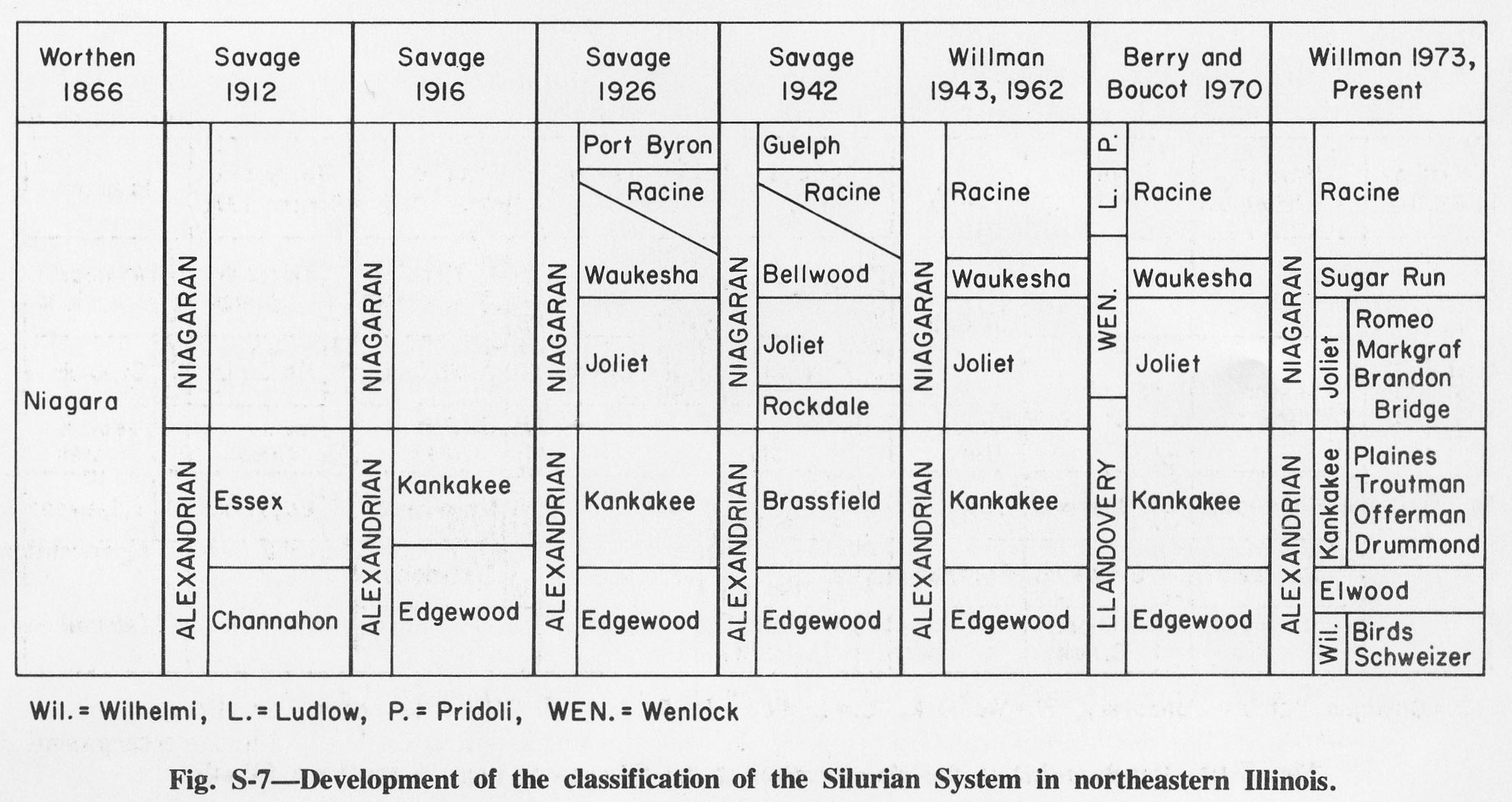
| 17:53, 4 April 2016 | Figure S-7.jpg (file) |  |
329 KB | Alan.Myers | Fig. S-7 -- Development of the classification of the Silurian System in northeastern Illinois. | 1 |