Uploads by Alan.Myers
Jump to navigation
Jump to search
This special page shows all uploaded files.
| Date | Name | Thumbnail | Size | Description | Versions |
|---|---|---|---|---|---|
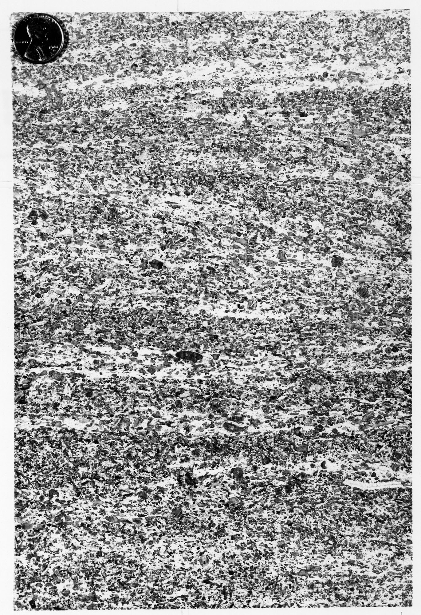
| 18:55, 4 April 2016 | Figure M-1F.jpg (file) |  |
1.03 MB | Fig. M-1F -- Grannular texture of the Ullin Limestone along Mill Creek, south of Anna, Union County (x1). | 1 |
| 21:03, 17 July 2020 | C605-Plate-01.jpg (file) |  |
1.04 MB | 2 | |
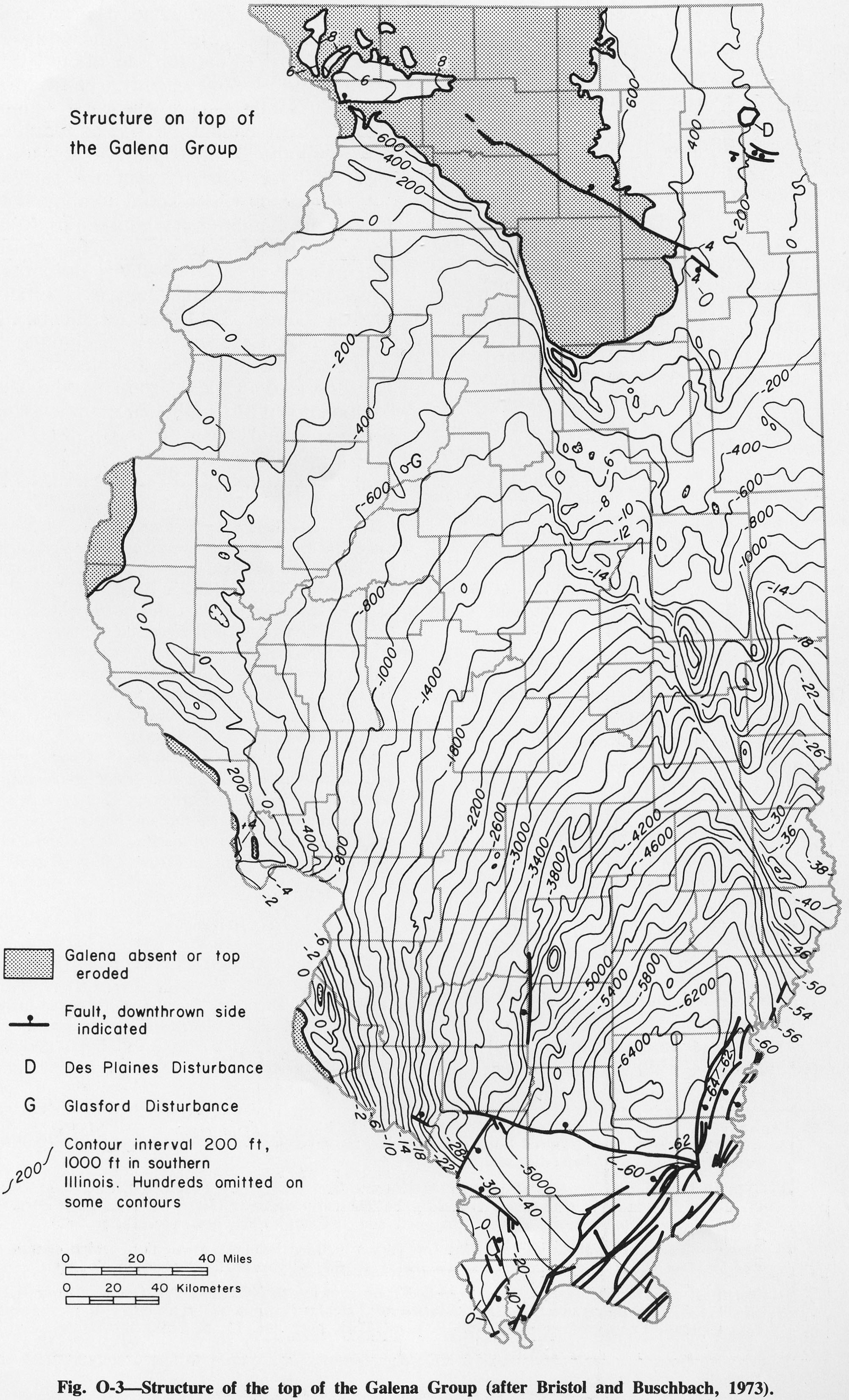
| 14:45, 4 April 2016 | Figure O-3.jpg (file) |  |
1.04 MB | Fig O-3 -- Structure of the top of the Galena Group (after Bristol and Buschbach, 1973). | 1 |
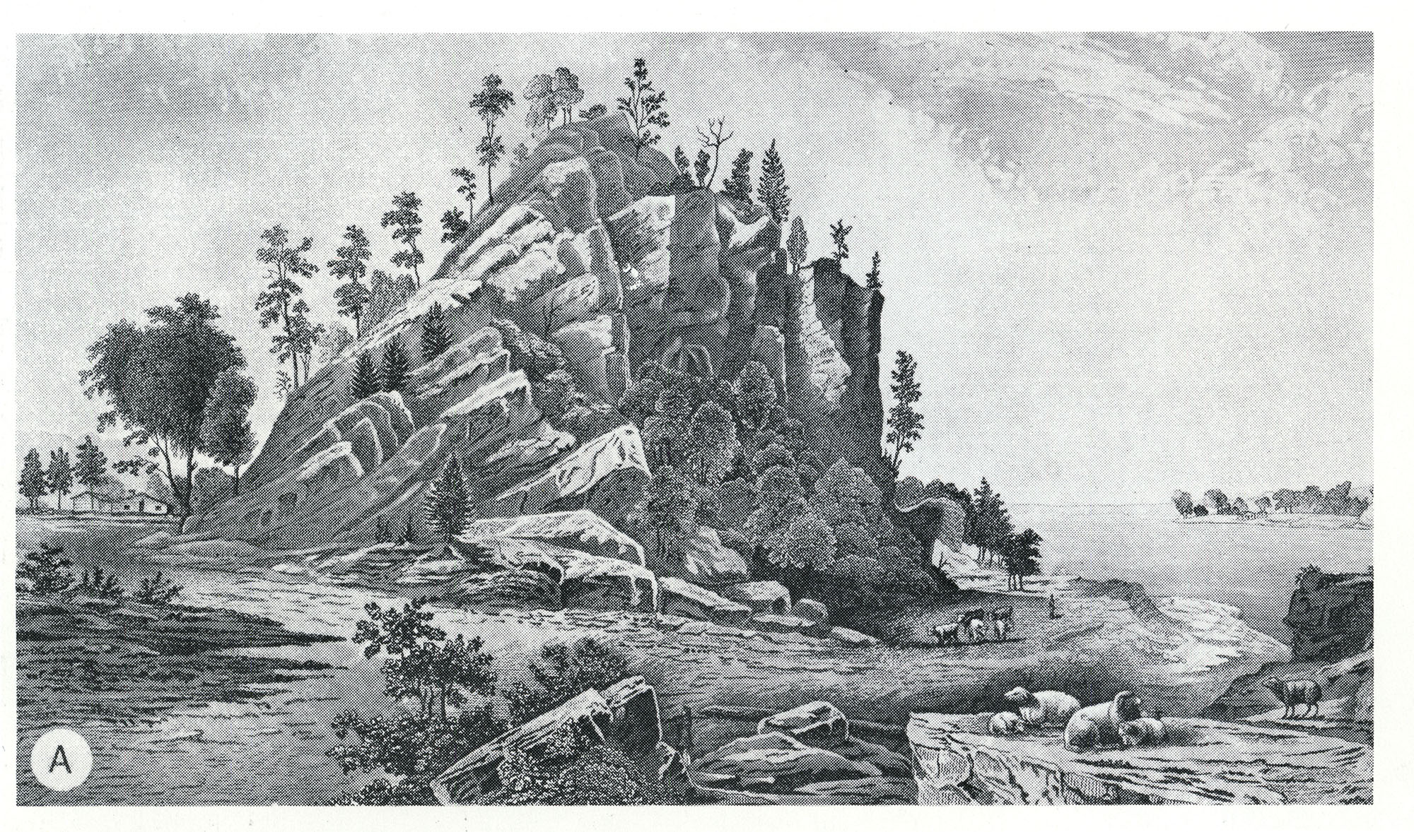
| 18:21, 4 April 2016 | Figure D-3A.jpg (file) |  |
1.04 MB | Fig. D-3A -- Middle Devonian Limestone (Lingle and Grand Tower) in ridge ("the Backbone") along the Mississippi River north of Grand Tower, Jackson County (from Worthen, 1868, opp. p. 61). | 1 |
| 15:33, 11 July 2020 | C605-Figure-42.jpg (file) |  |
1.04 MB | 1 | |
| 20:07, 8 July 2020 | C605-Figure-04.jpg (file) |  |
1.05 MB | 1 | |
| 15:17, 9 July 2020 | C605-Figure-21.jpg (file) |  |
1.06 MB | 1 | |
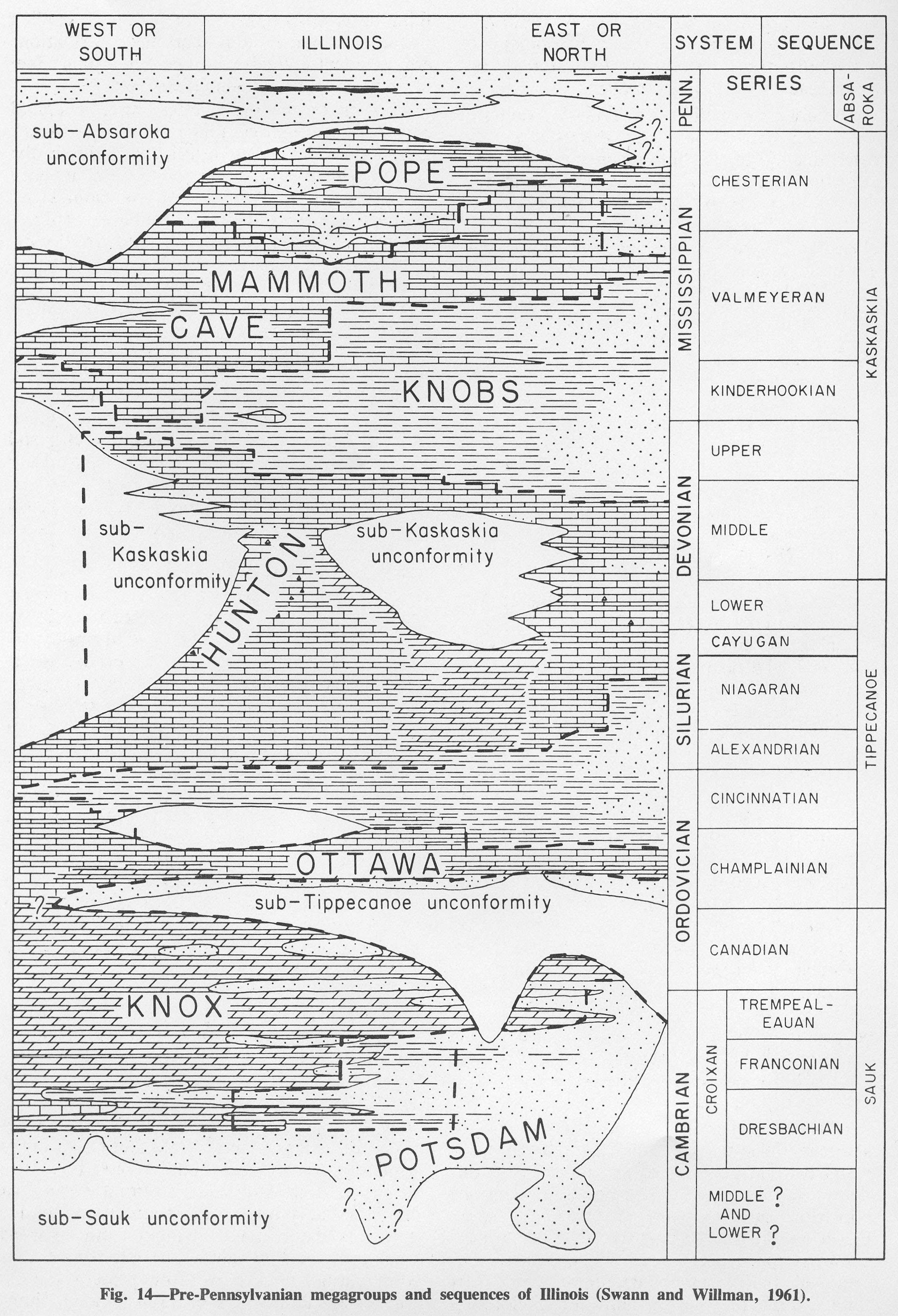
| 19:36, 1 April 2016 | Figure 14.jpg (file) |  |
1.08 MB | Fig. 14 -- Pre-Pennsylvanian megagroups and sequences of Illinois (Swann and Willman, 1961). | 1 |
| 14:53, 9 July 2020 | C605-Figure-15.jpg (file) |  |
1.09 MB | 1 | |
| 15:39, 11 July 2020 | C605-Figure-46.jpg (file) |  |
1.09 MB | 1 | |
| 16:12, 5 April 2016 | Figure Q-1B.jpg (file) |  |
1.11 MB | Fig. Q-1B -- The Wisconsinan Wedron (W-interbedded till and outwash) and Peddicord (P-lake sediments) Formations overlying till of the Illinoian Glasford Formation in the Wedron Silica Company pit at Wedron, LaSalle County-the type sections of the Wedr... | 2 |
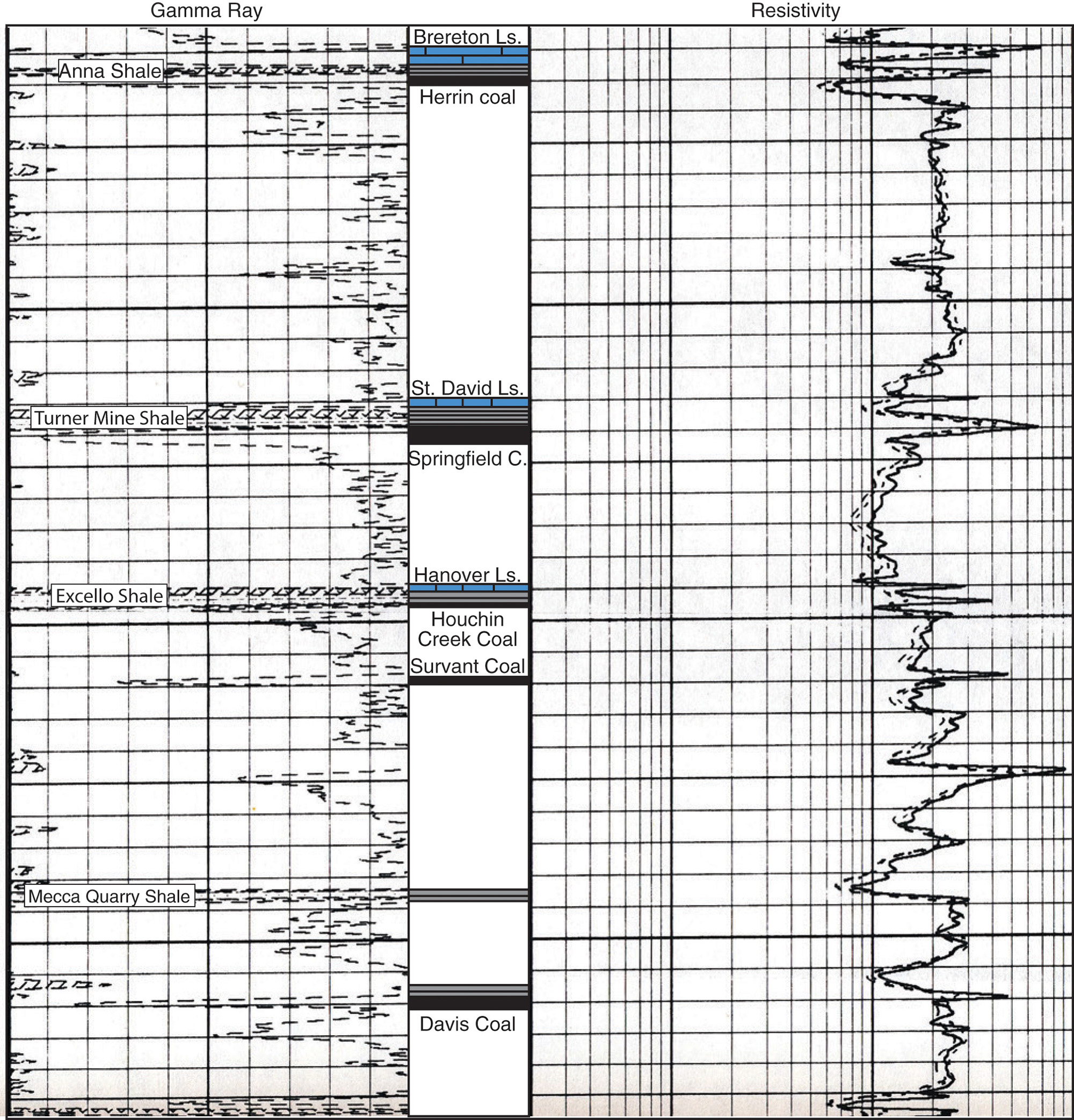
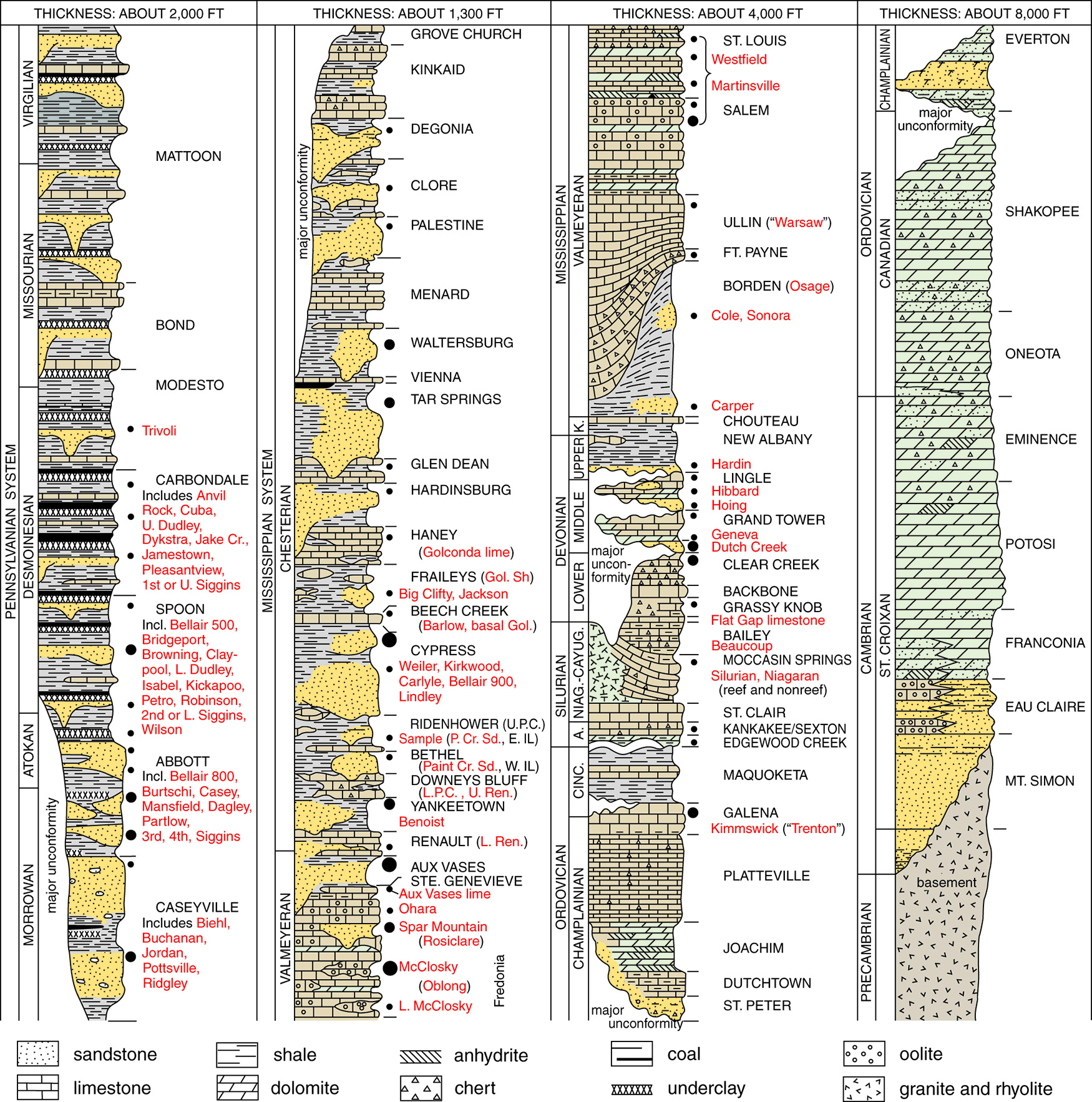
| 16:12, 10 August 2015 | Pennsylvanian column.jpg (file) |  |
1.13 MB | Pennsylvanian Column test | 1 |
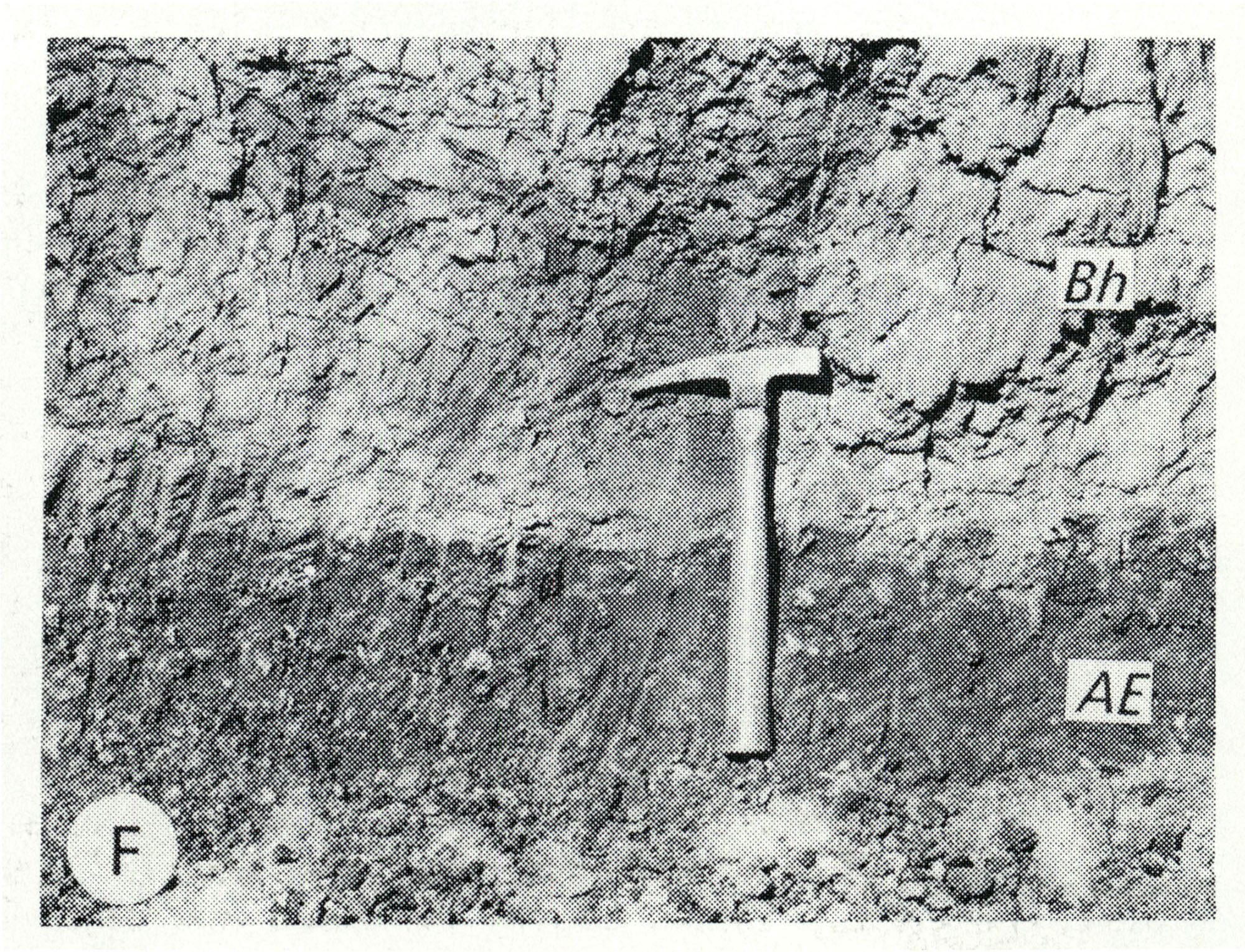
| 13:12, 5 April 2016 | Figure Q-1F.jpg (file) |  |
1.13 MB | Fig. Q-1F -- Harkness Silt Member of the ~ansan Banner Formation (Bh) overlying the Afton Soil developed on gravel of the Nebraskan Enion Formation (AE); in a roadcut at the Zion Church, 2 miles southeast of Marblehead, Adams County (Willman and Frye,... | 1 |
| 20:32, 8 July 2020 | C605-Figure-05b.jpg (file) |  |
1.13 MB | 1 | |
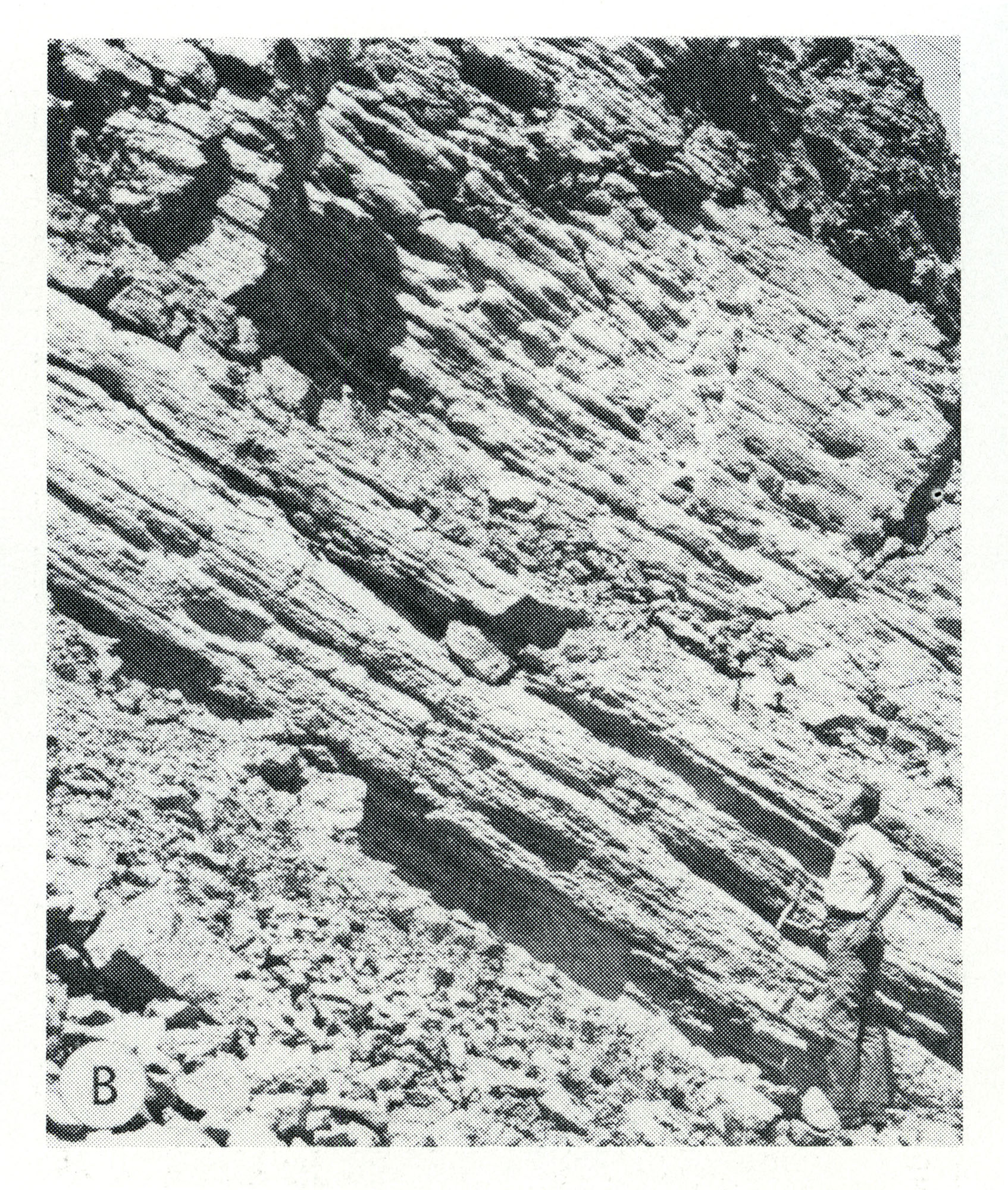
| 18:38, 4 April 2016 | Figure K-1C.jpg (file) |  |
1.14 MB | Fig. K-1C -- Bedding surface of Mounds Gravel in same pit as exposure B (x1.5). | 1 |
| 15:15, 9 July 2020 | C605-Figure-20.jpg (file) |  |
1.15 MB | 1 | |
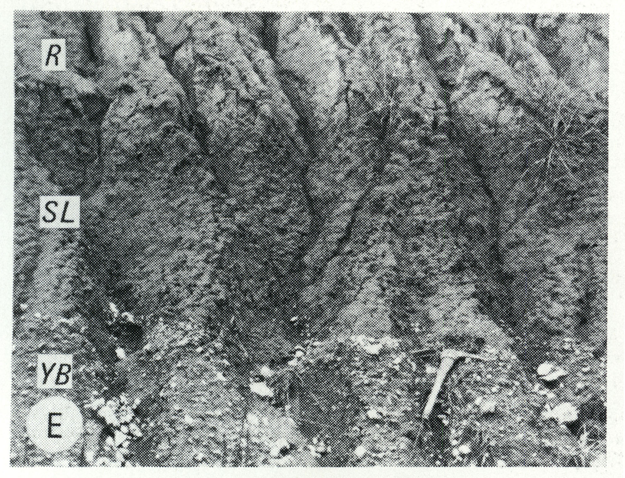
| 13:11, 5 April 2016 | Figure Q-1E.jpg (file) |  |
1.16 MB | Fig. Q-1E -- Wisconsinan Roxana Silt (R), Sangamon Soil developed in the Illinoian Loveland Silt (SL) and Yarmouth Soil developed in till of the Kansan Banner Formation (YB); in a roadcut at Independence, 5 miles south of Pittsfield, Pike County (Frye... | 1 |
| 13:10, 5 April 2016 | Figure Q-1D.jpg (file) |  |
1.16 MB | Fig. Q-1D -- Illinoian Glasford Formation (Hagarstown Member) showing steeply dipping sand and gravel (crevasse deposit) in a mound in the Kaskaskia Ridged Drift area, 2 miles southwest of Lakewood, Shelby County. | 1 |
| 18:15, 4 April 2016 | Figure C-1B.jpg (file) |  |
1.18 MB | Fig. C-1B -- Cambrian-Ordovician unconformity showing well bedded Oneota Dolomite overlying massive Potosi Dolomite in a quarry in Lee County, 6 miles south of Rochelle, Ogle County (Willman and Templeton, 1951, p. 113). | 1 |
| 13:22, 5 April 2016 | Figure S-2F.jpg (file) |  |
1.19 MB | Fig. S-2F -- Dense, argillaceous dolomite containing chert nodules characteristic of Racine interreef facies in the Chicago area. The outer, porous parts of the nodules are blackened by air pollutants. | 1 |
| 19:14, 10 July 2020 | C605-Figure-28.jpg (file) |  |
1.24 MB | 1 | |
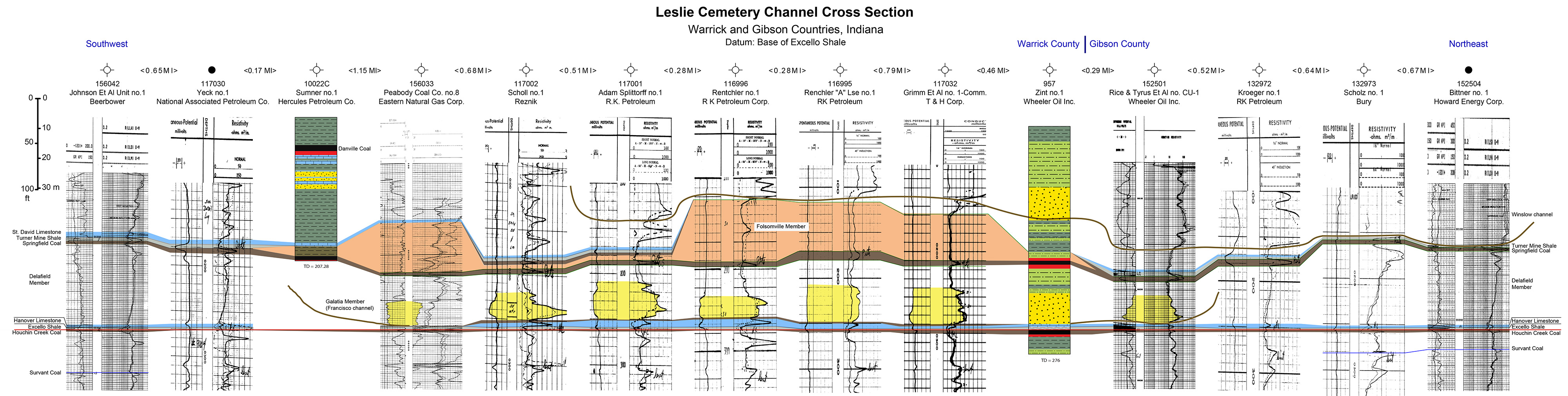
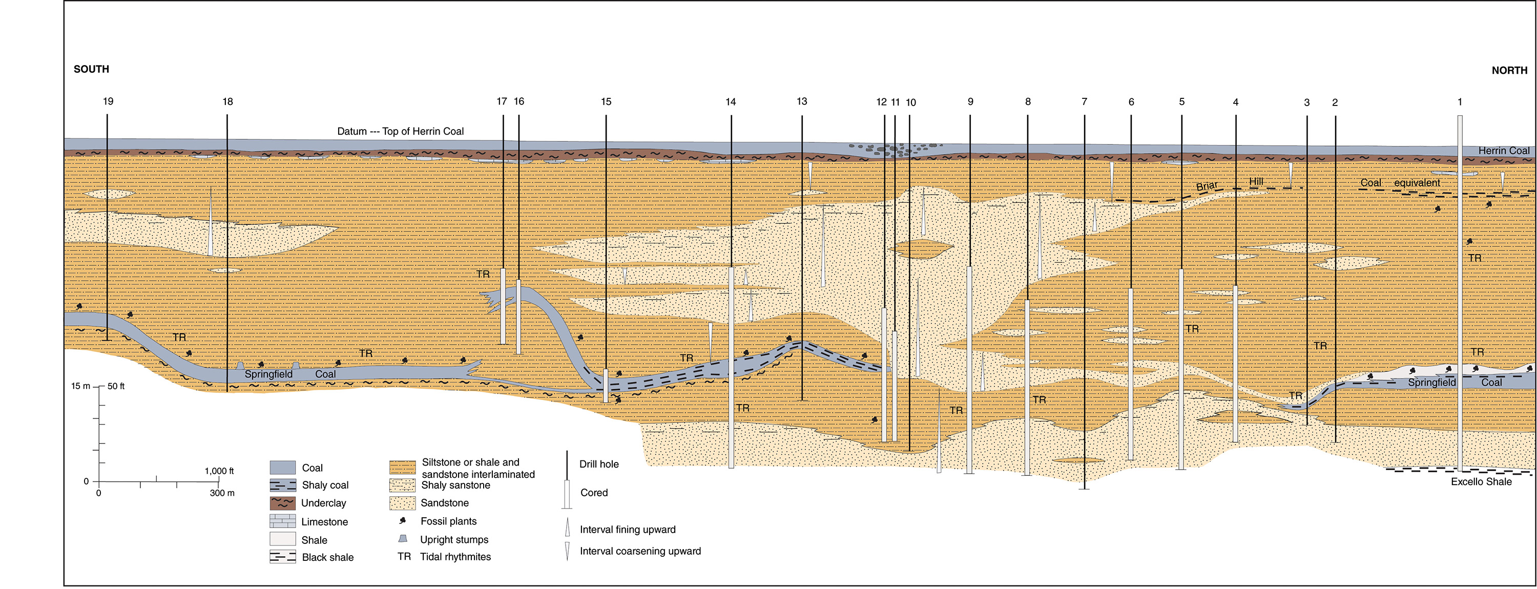
| 20:02, 10 July 2020 | C605-Plate 6 - Leslie Cemetery Channel Xsec.jpg (file) | 1.24 MB | 1 | ||
| 13:16, 5 April 2016 | Figure S-2E.jpg (file) |  |
1.26 MB | Fig. S-2E -- Mottled, porous, pure dolomite characteristic of Racine reef facies in the Chicago area (x 1). | 1 |
| 21:21, 17 July 2020 | C605-Figure-03.jpg (file) |  |
1.29 MB | 2 | |
| 13:14, 5 April 2016 | Figure S-2B.jpg (file) |  |
1.29 MB | Fig. S-2B -- Steeply dipping, well bedded dolomite forming the fiank of a Racine (Niagaran) reef, in the Material Service Corporation quarry at Thornton, Cook County. | 1 |
| 13:14, 5 April 2016 | Figure S-2A.jpg (file) |  |
1.33 MB | Fig. S-2A -- Massive dolomite in the core of a Racine (Niagaran) reef, at the top of the Material Service Corporation (Stearns) quarry on Archer Avenue at 28th Street, Chicago. | 1 |
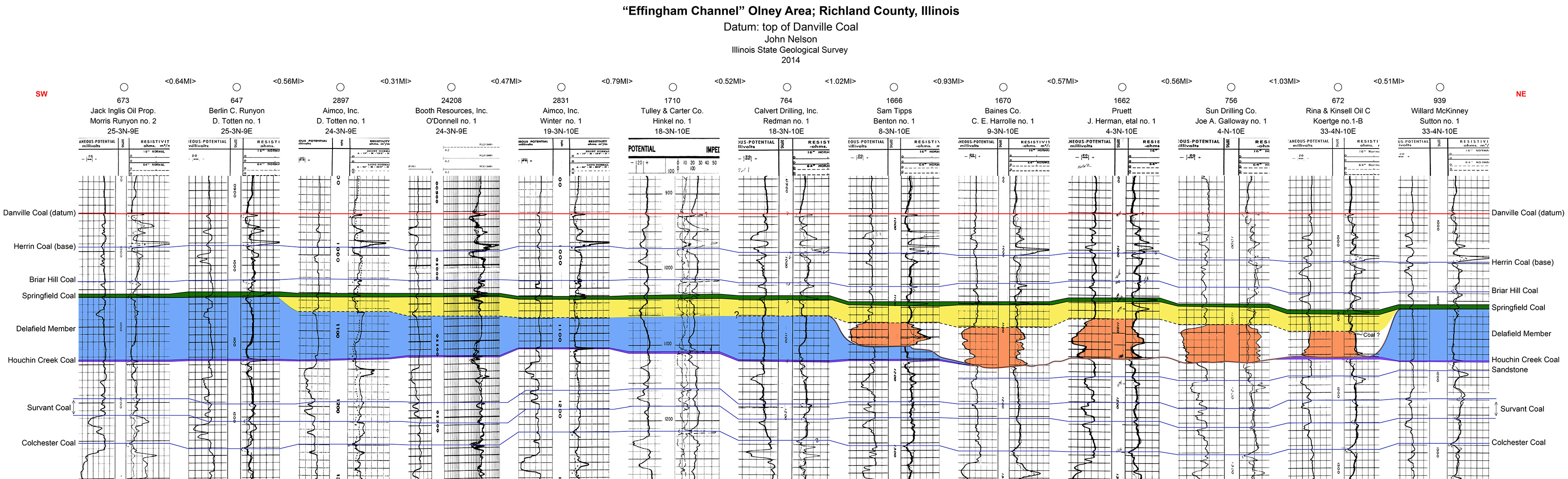
| 19:53, 10 July 2020 | C605-Plate 4 - Effingham Channel Olney Xsec.jpg (file) |  |
1.33 MB | 1 | |
| 14:40, 9 July 2020 | C605-Figure-11.jpg (file) |  |
1.34 MB | 1 | |
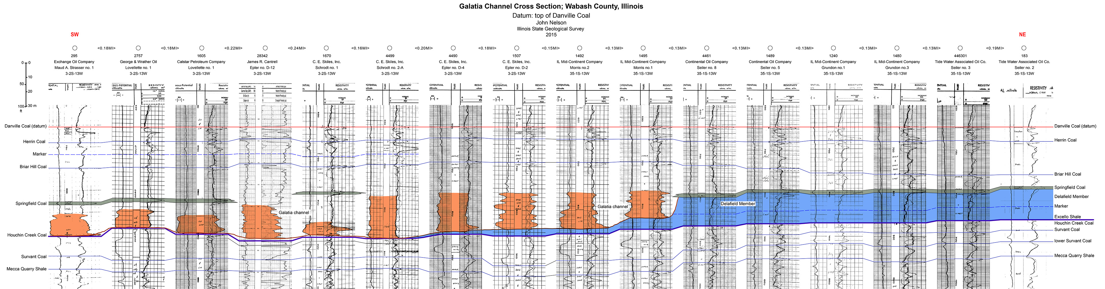
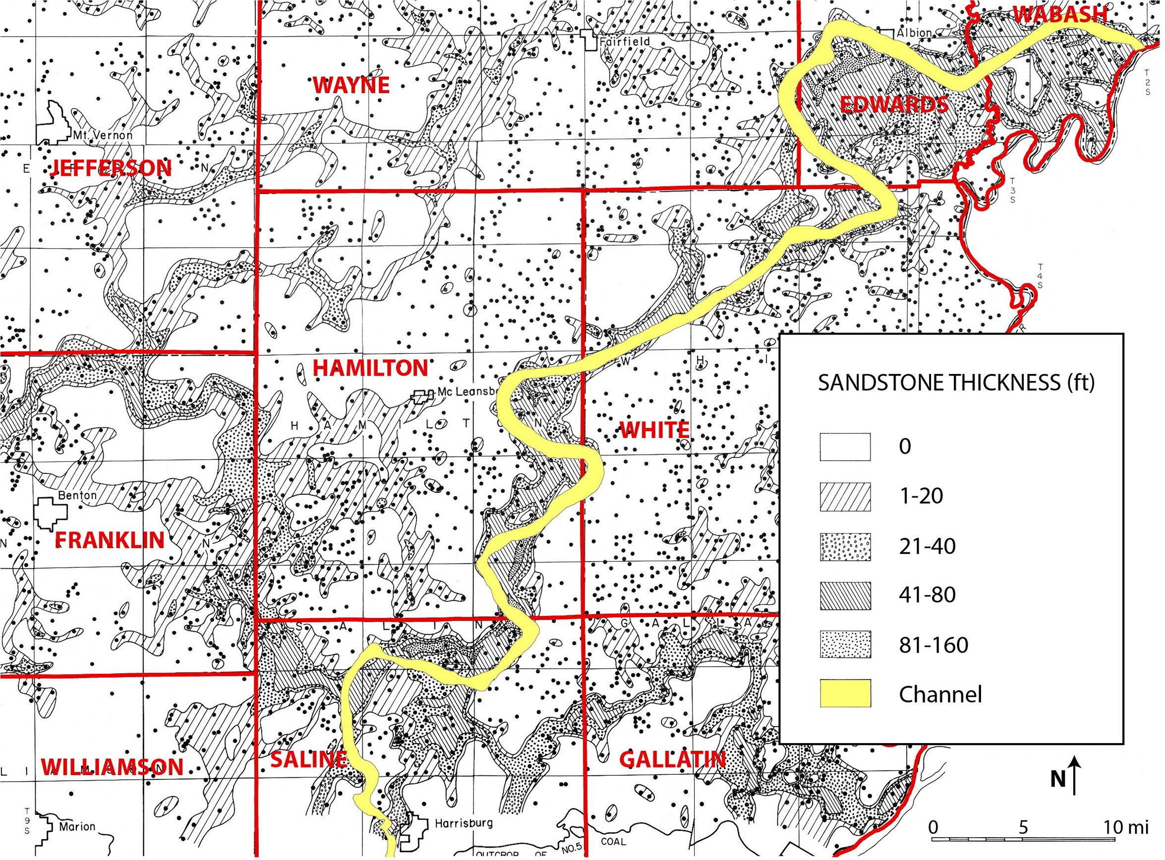
| 19:25, 9 July 2020 | C605-Plate 3 -Galatia Chanel Xsec Wabash Co.jpg (file) | 1.36 MB | 1 | ||
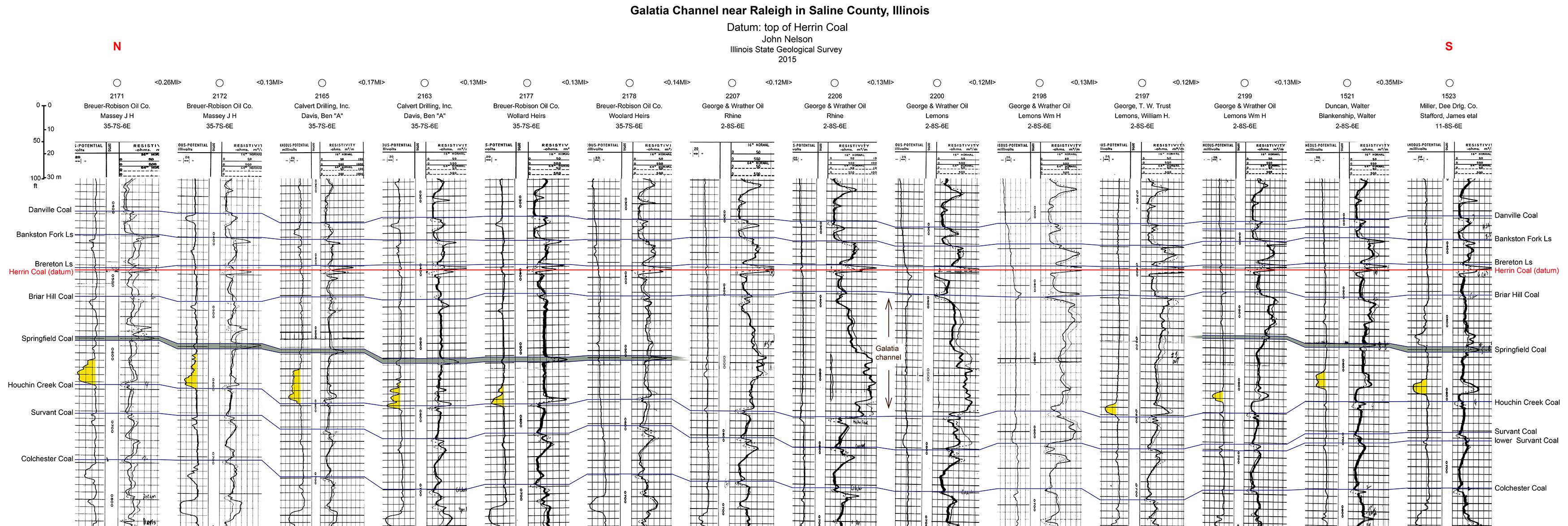
| 18:59, 9 July 2020 | C605-Plate 2 - Galatia Channel Xsec Saline Co.jpg (file) |  |
1.37 MB | 1 | |
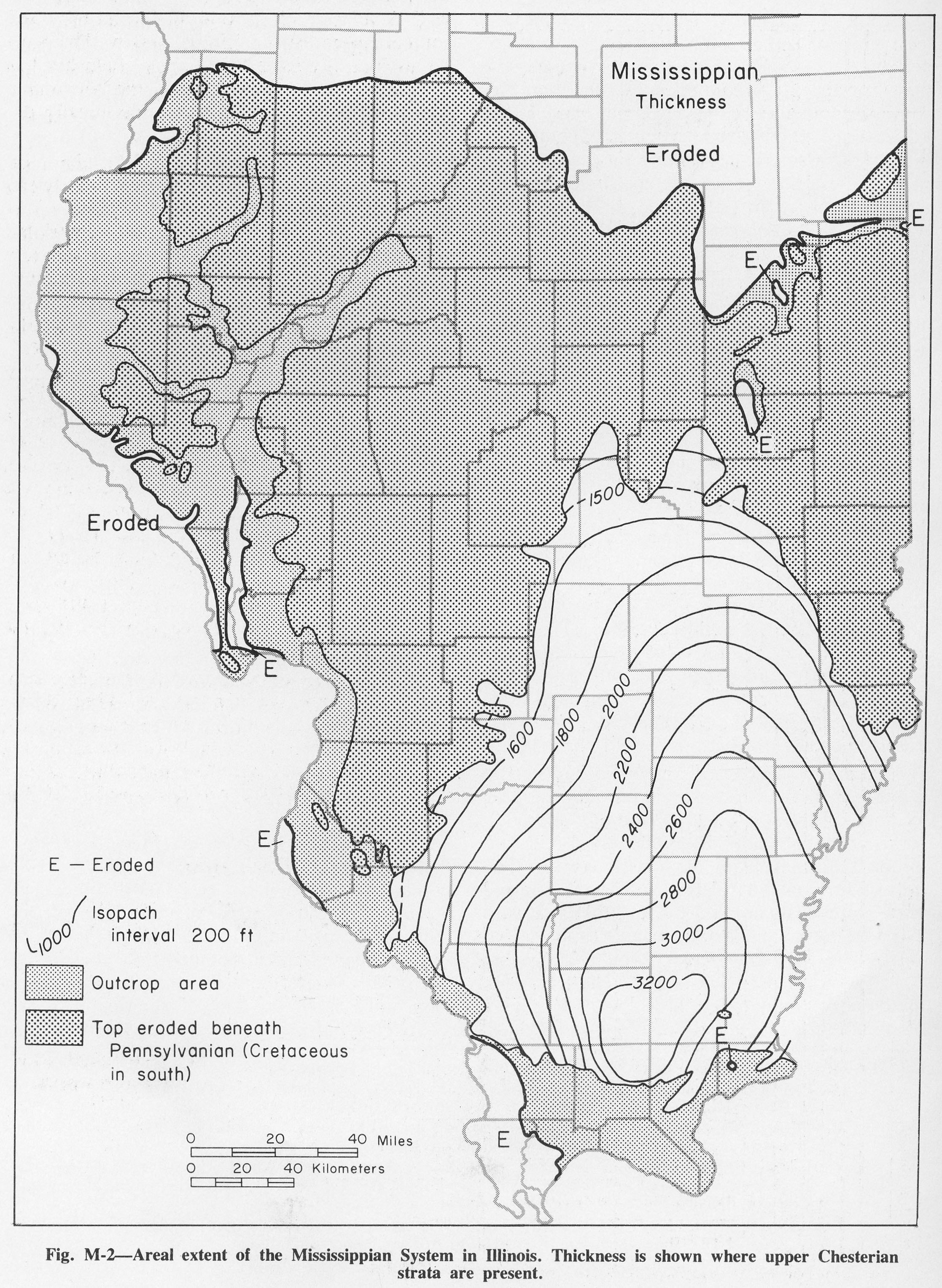
| 13:04, 4 April 2016 | Figure M-2.jpg (file) |  |
1.38 MB | Fig. M-2 -- Areal extent of the Mississippian System in Illinois. Thickness is shown where upper Chesterian strata are present. | 1 |
| 13:15, 5 April 2016 | Figure S-2C.jpg (file) |  |
1.38 MB | Fig. S-2C -- Massive Marcus Dolomite in a quarry 3 miles east of Fulton, Whiteside County. | 1 |
| 19:58, 10 July 2020 | C605-Plate 5 - Effingham Channel Stewardson Xsec.jpg (file) | 1.42 MB | 1 | ||
| 14:43, 9 July 2020 | C605-Figure-12.jpg (file) |  |
1.43 MB | 1 | |
| 19:18, 10 July 2020 | C605-Figure-31.jpg (file) |  |
1.45 MB | 1 | |
| 13:16, 5 April 2016 | Figure S-2D.jpg (file) |  |
1.46 MB | Fig. S-2D -- Massive Tete des Morts Formation overlying the Mosalem Formation at the top of Silurian escarpment, 4 miles southeast of Galena, Jo Daviess County. | 1 |
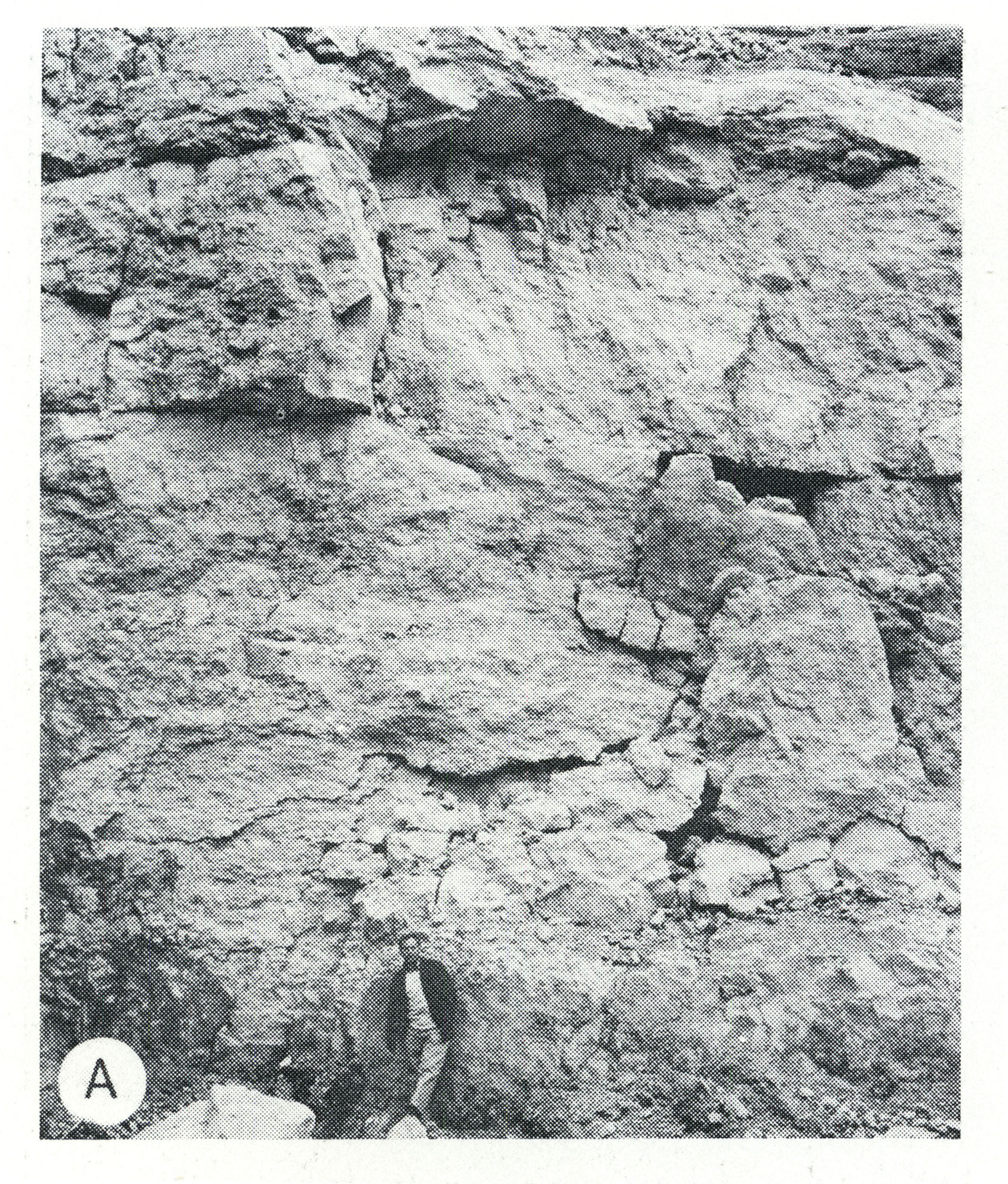
| 18:37, 4 April 2016 | Figure K-1B.jpg (file) |  |
1.5 MB | Fig. K-1B -- Mounds Gravel in pit along Illinois Highway 145, 8 miles north of Metropolis, Massac County. | 1 |
| 14:28, 9 July 2020 | C605-Figure-08.jpg (file) |  |
1.52 MB | 1 | |
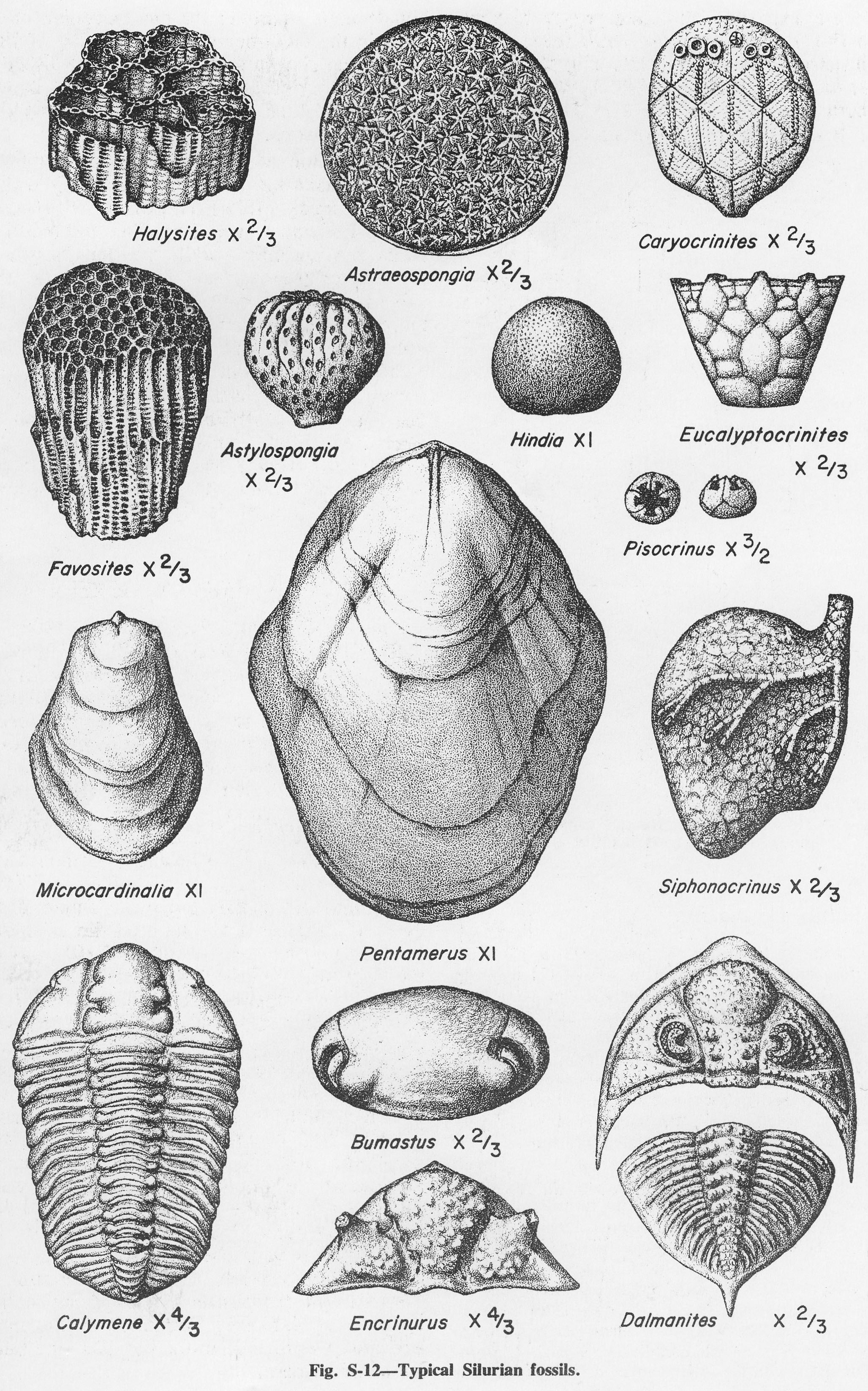
| 17:57, 4 April 2016 | Figure S-12.jpg (file) |  |
1.54 MB | Fig. S-12 -- Typical Silurian fossils. | 1 |
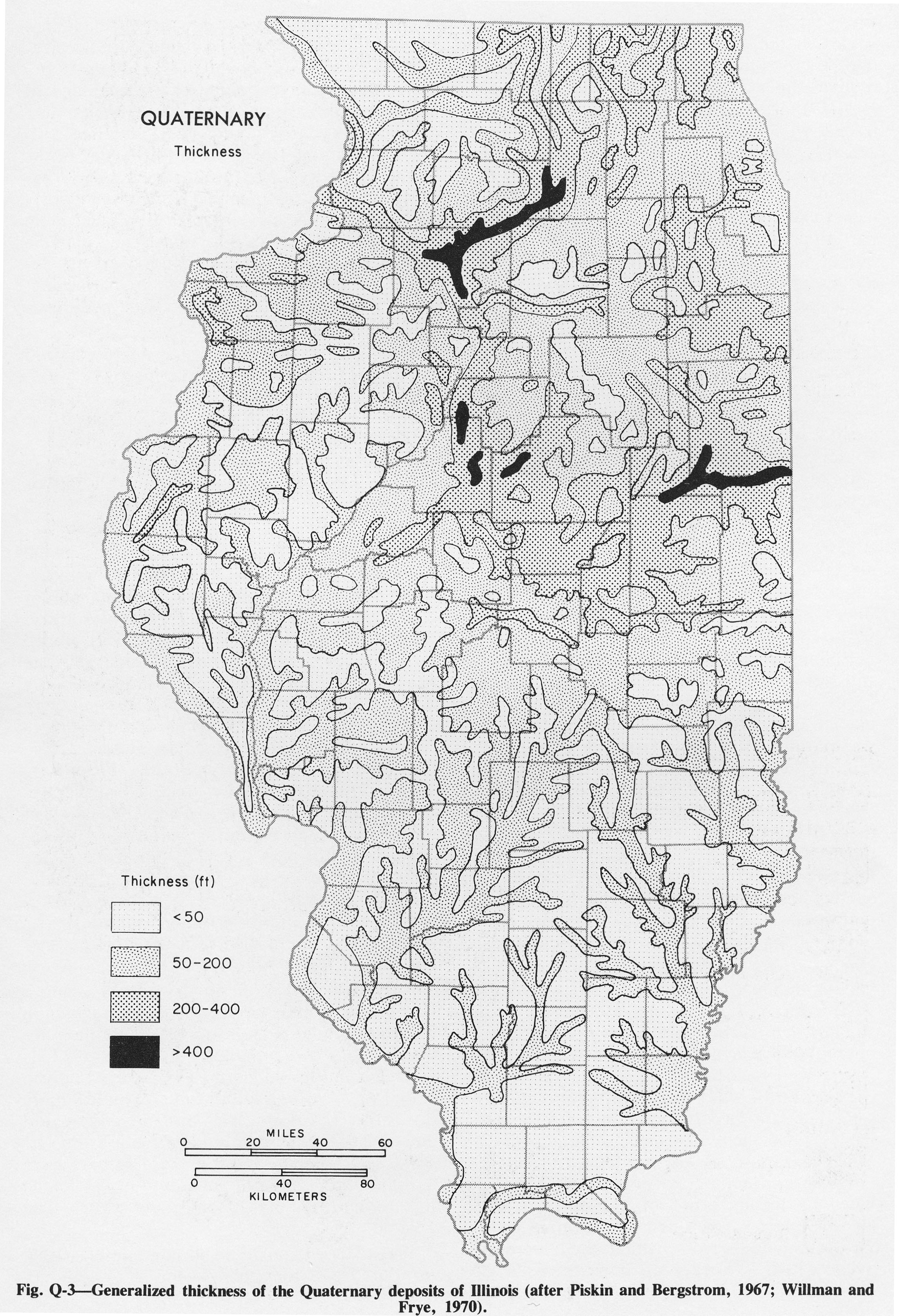
| 15:42, 4 April 2016 | Figure Q-3.jpg (file) |  |
1.55 MB | Fig. Q-3 -- Generalized thickness of the Quaternary deposits of Illinois (after Piskin and Bergstrom, 1967; Willman and Frye, 1970). | 1 |
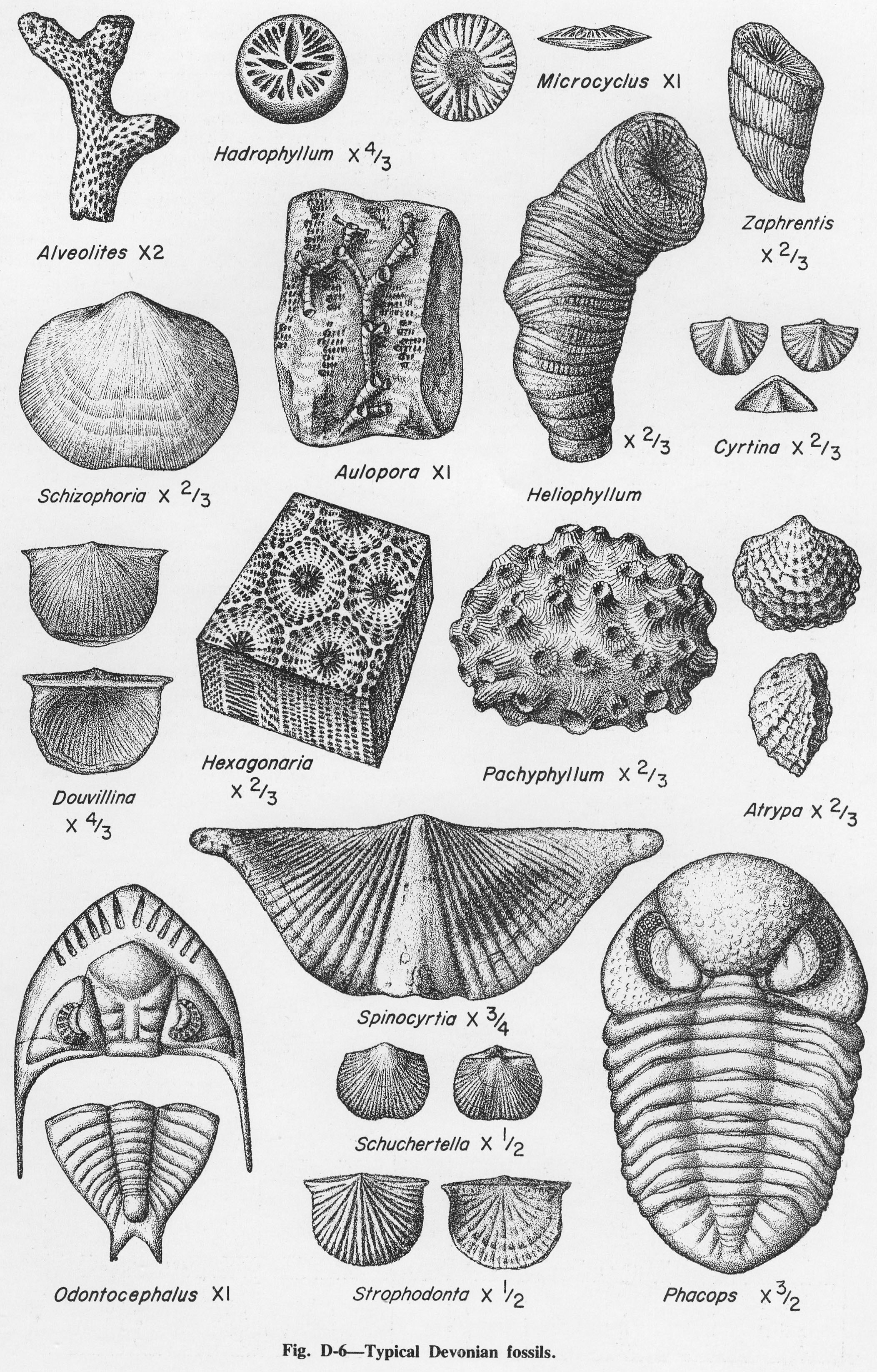
| 19:58, 1 April 2016 | Figure D-6.jpg (file) |  |
1.56 MB | Fig. D-6 -- Typical Devonian fossils. | 1 |
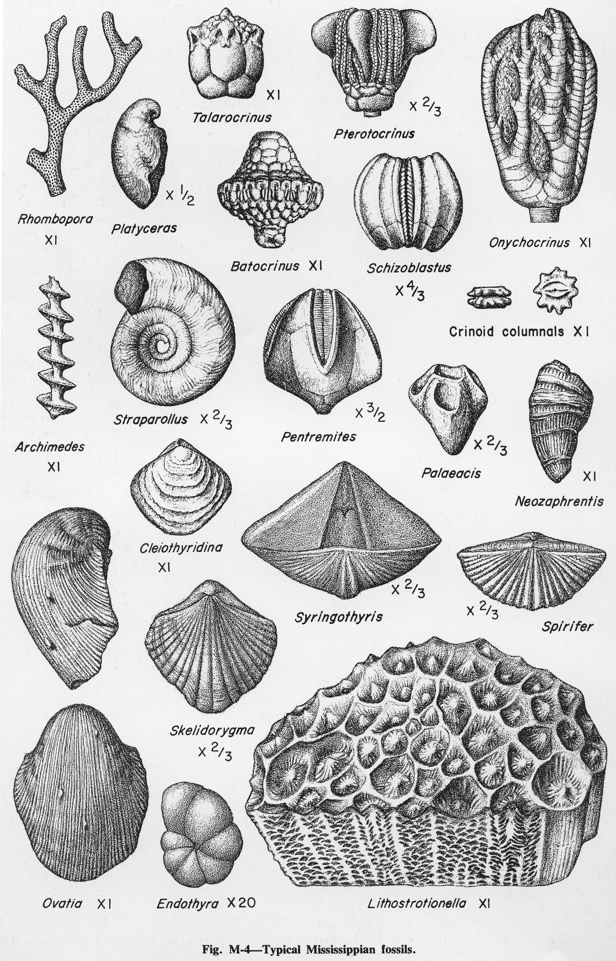
| 13:23, 4 April 2016 | Figure M-4.jpg (file) |  |
1.57 MB | Fig. M-4 -- Typical Mississippian fossils. | 1 |
| 19:16, 10 July 2020 | C605-Figure-30.jpg (file) |  |
1.64 MB | 1 | |
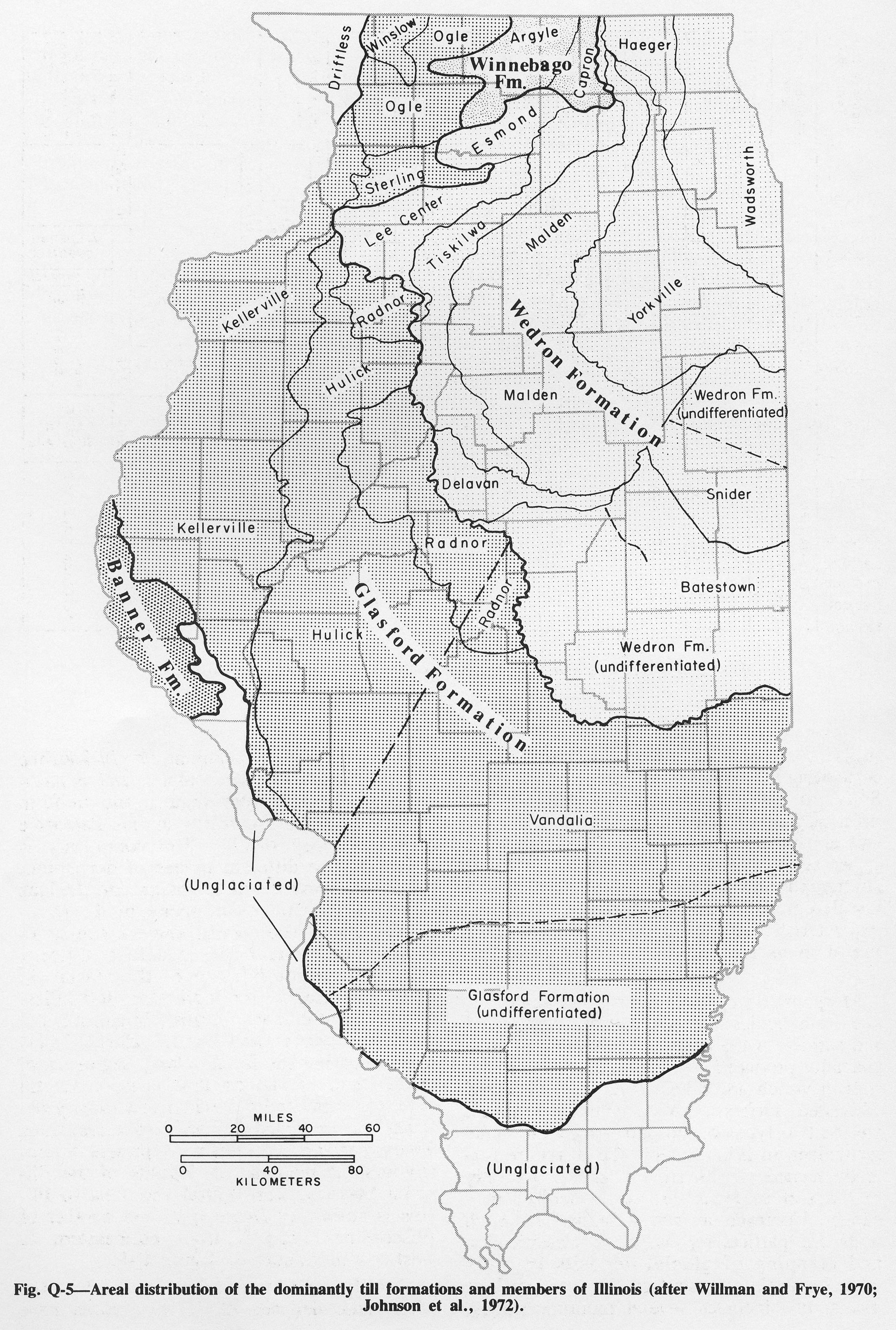
| 15:53, 4 April 2016 | Figure Q-5.jpg (file) |  |
1.68 MB | Fig. Q-5 -- Areal distribution of the dominantly till formations and members of Illinois (after Willman and Frye, 1970; Johnson et al., 1972). | 1 |
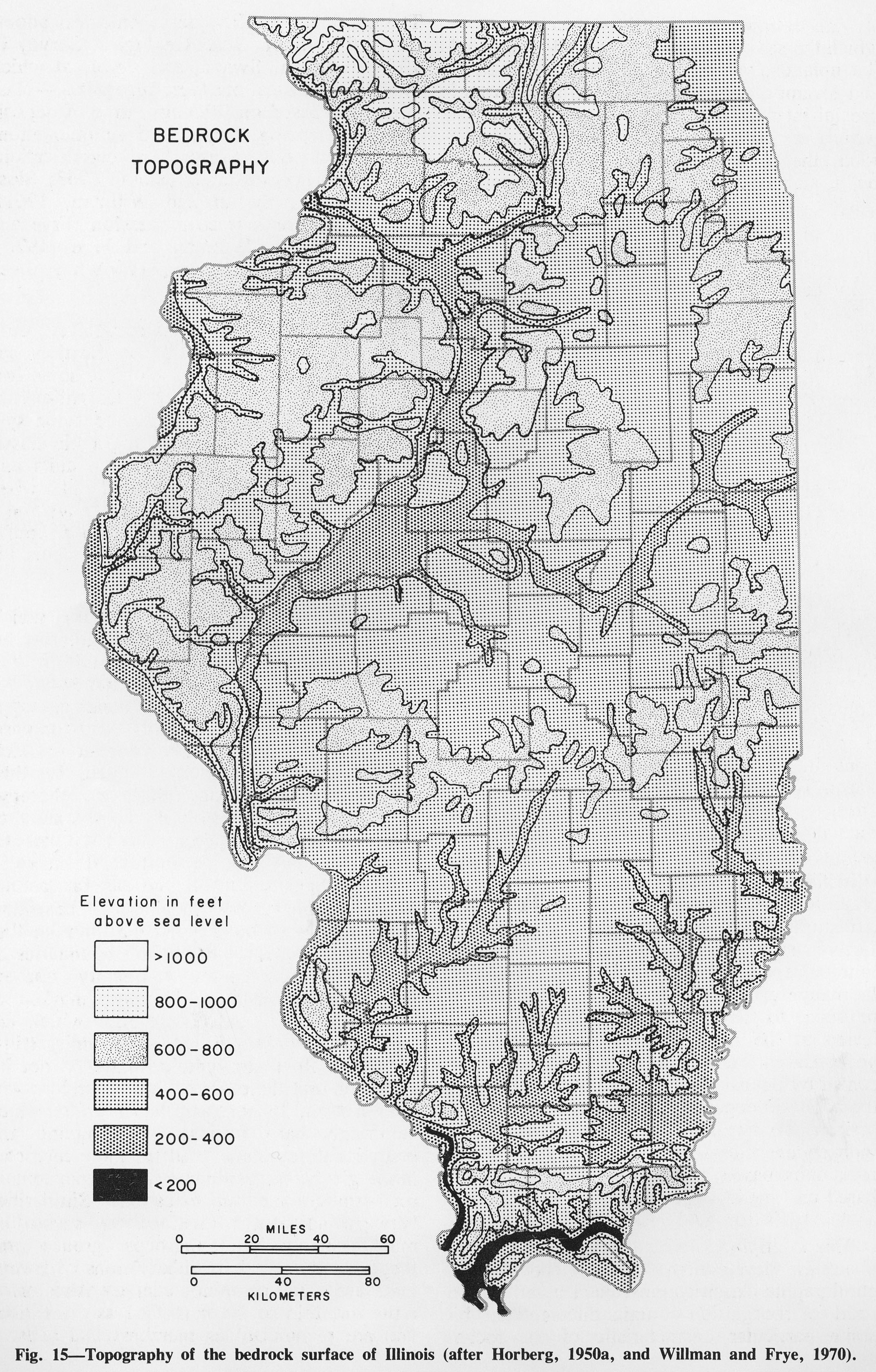
| 19:38, 1 April 2016 | Figure 15.jpg (file) |  |
1.73 MB | Fig. 15 -- Topography of the bedrock surface of Illinois (after Horberg, 1950a and Willman and Frye, 1970). | 1 |
| 15:41, 4 April 2016 | Figure Q-2.jpg (file) |  |
1.76 MB | Fig. Q-2 -- Glacial map of Illinois (after Willman and Frye, 1970). | 1 |
| 13:32, 16 October 2019 | GOI-ch15-fig15.jpg (file) |  |
1.88 MB | 1 | |
| 15:57, 1 April 2016 | Figure 11.jpg (file) |  |
1.89 MB | Fig. 11 -- Generalized surficial geology of Illinois. In uneroded areas the loess thins from 25-100 feet thick in the bluffs of the major valleys to 1-2 feet in areas farthest from valleys. | 1 |
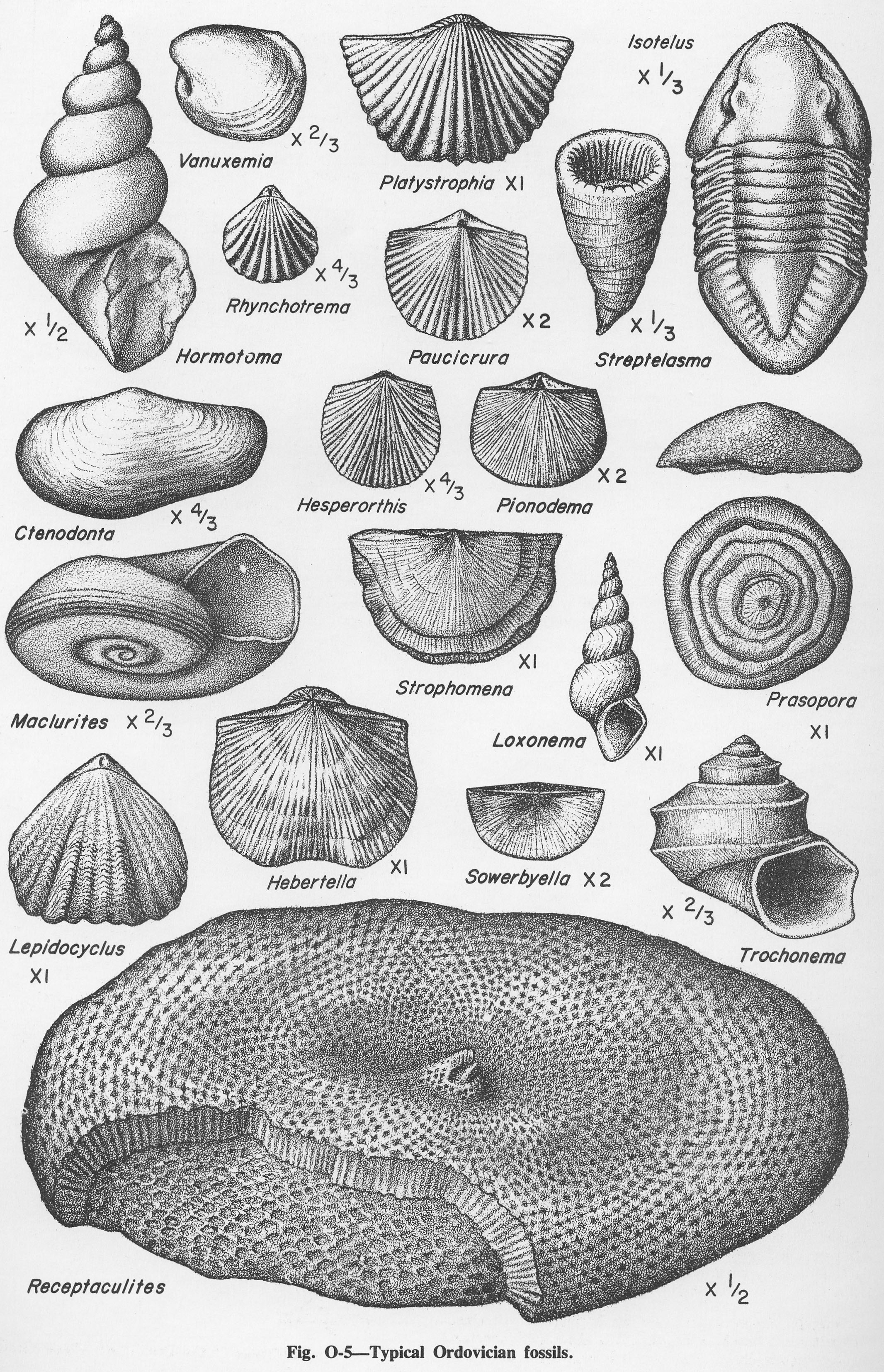
| 14:46, 4 April 2016 | Figure O-5.jpg (file) |  |
1.9 MB | Fig. O-5 -- Typical Ordovician fossils | 1 |
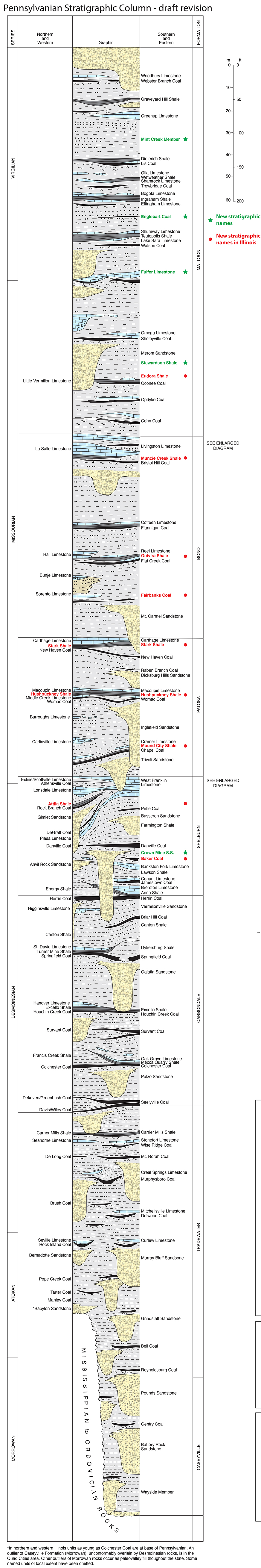
| 16:57, 10 August 2015 | Pennsylvanian column update.jpg (file) |  |
1.91 MB | 1 |