File list
Jump to navigation
Jump to search
This special page shows all uploaded files.
| Date | Name | Thumbnail | Size | User | Description | Versions |
|---|---|---|---|---|---|---|
| 17:51, 19 April 2016 | 104-Figure 30.jpg (file) |  |
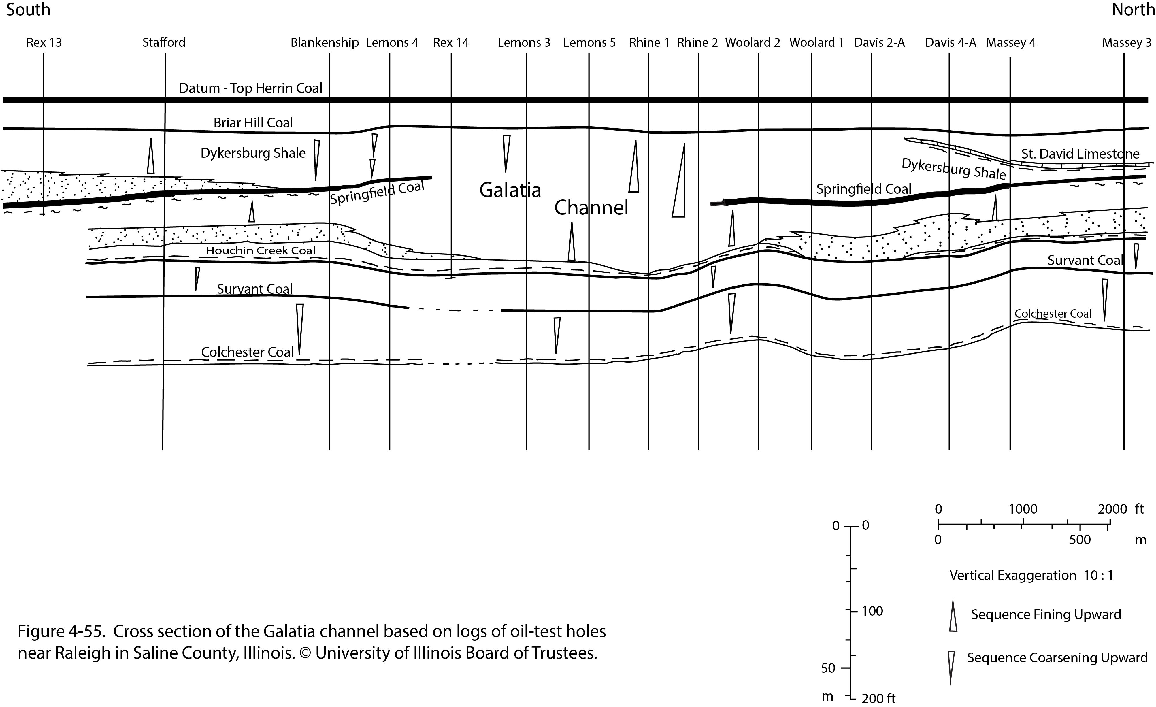
801 KB | Illex-gron | Figure 30 -- Stratified and crossbedded proglacial sand and gravel of the Henry Formation. | 1 |
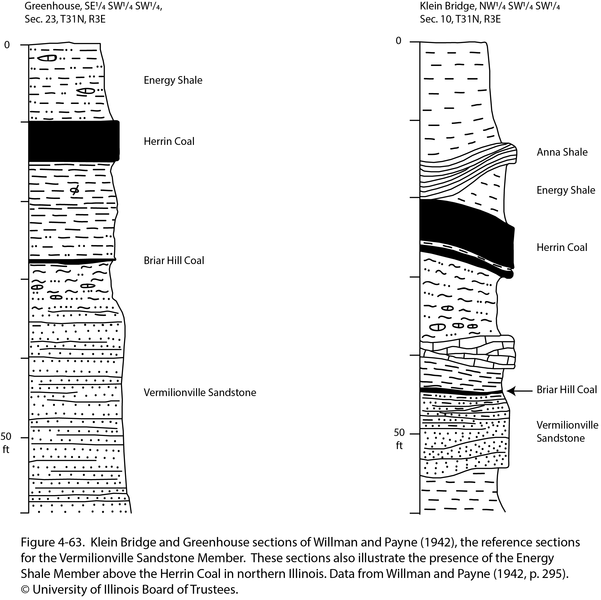
| 21:57, 23 December 2020 | Penn carbondale 4-63.jpg (file) |  |
807 KB | Jennifer.Obrad | 1 | |
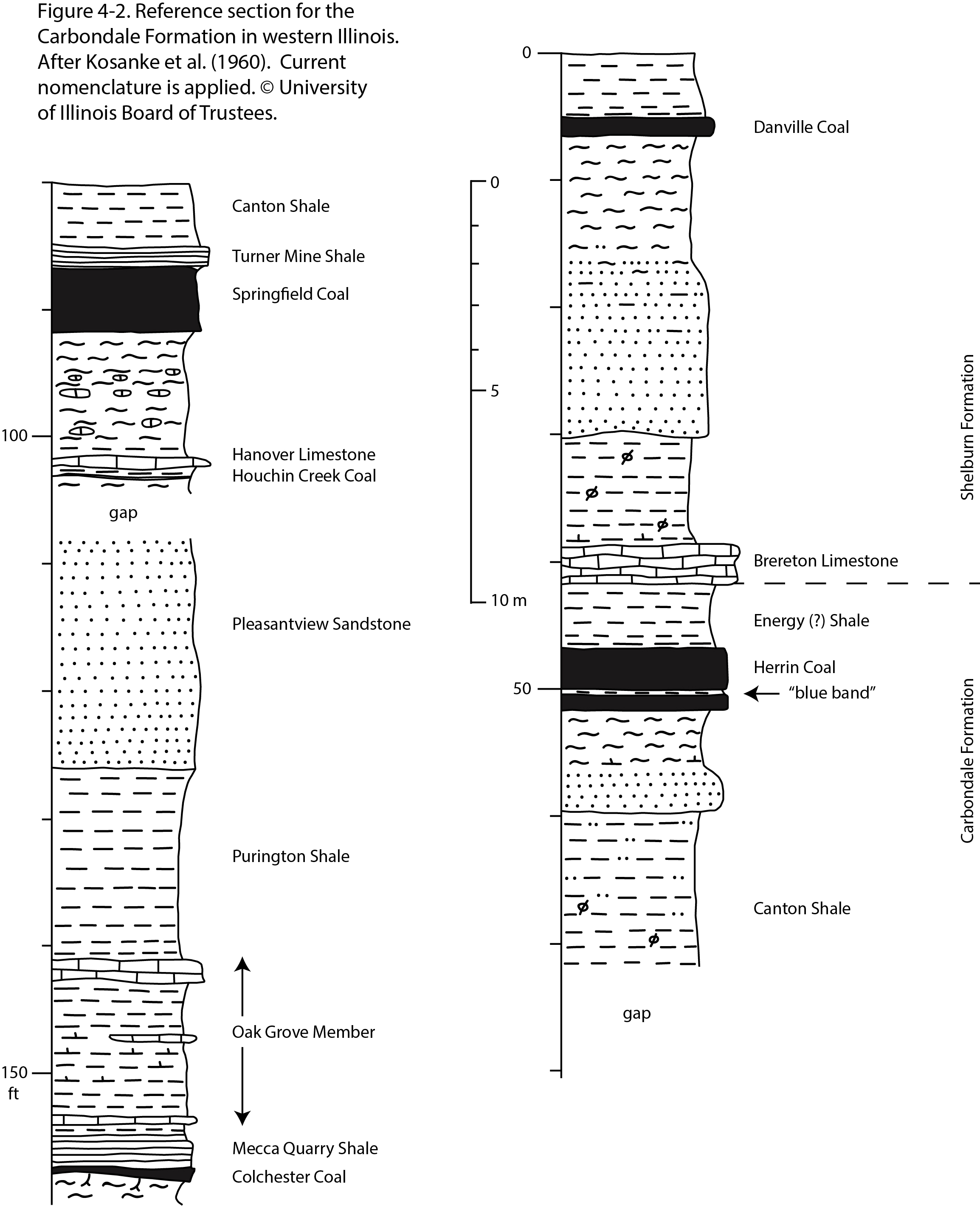
| 20:44, 22 December 2020 | Penn carbondale 4-2.jpg (file) |  |
808 KB | Jennifer.Obrad | 1 | |
| 14:29, 1 April 2016 | Figure 12.jpg (file) |  |
808 KB | Illex-gron | Fig. 12 -- Principal geologic structures of Illinois. | 1 |
| 14:45, 9 July 2020 | C605-Figure-13.jpg (file) |  |
822 KB | Alan.Myers | 1 | |
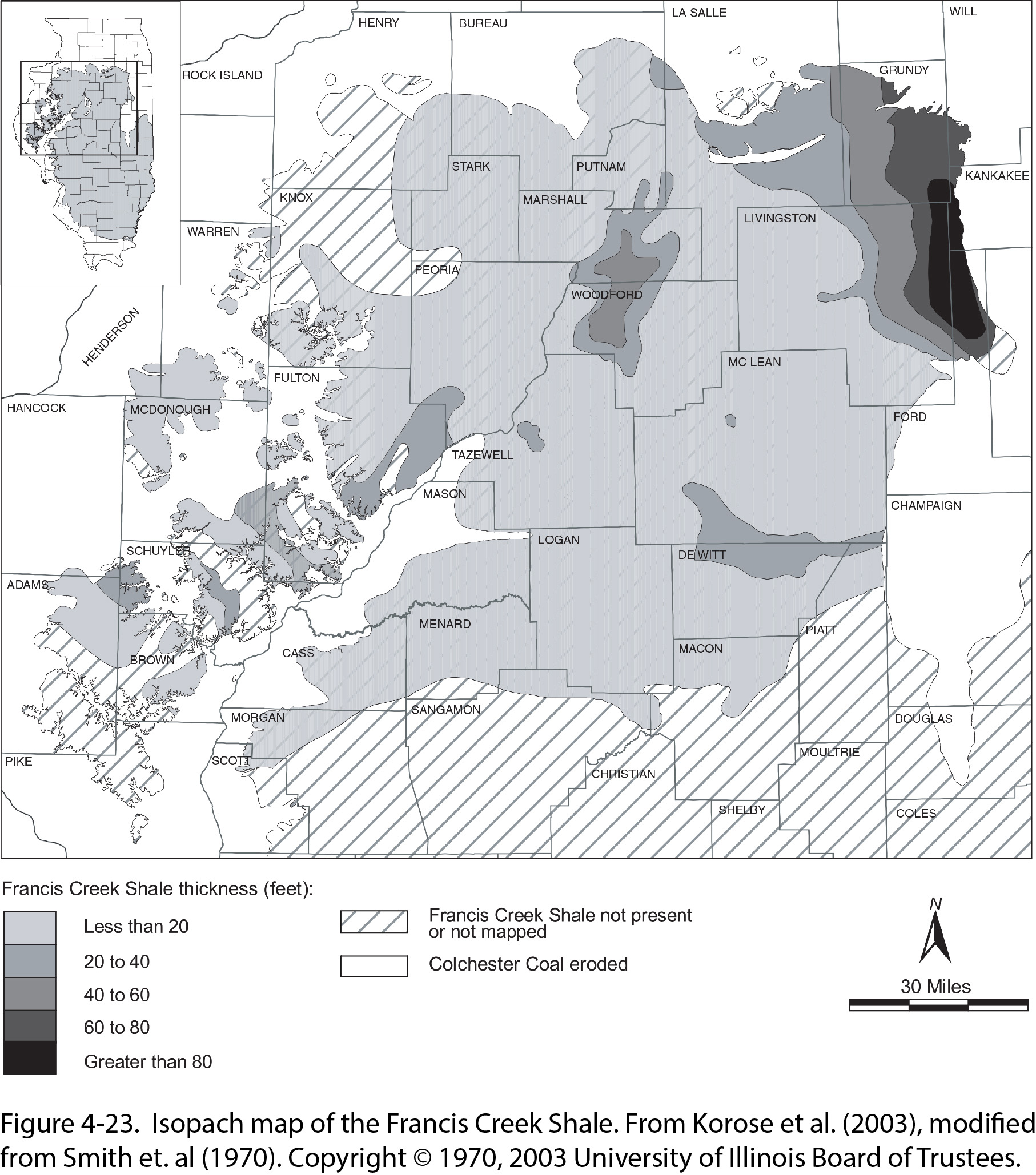
| 16:18, 23 December 2020 | Penn carbondale 4-23.jpg (file) |  |
830 KB | Jennifer.Obrad | 1 | |
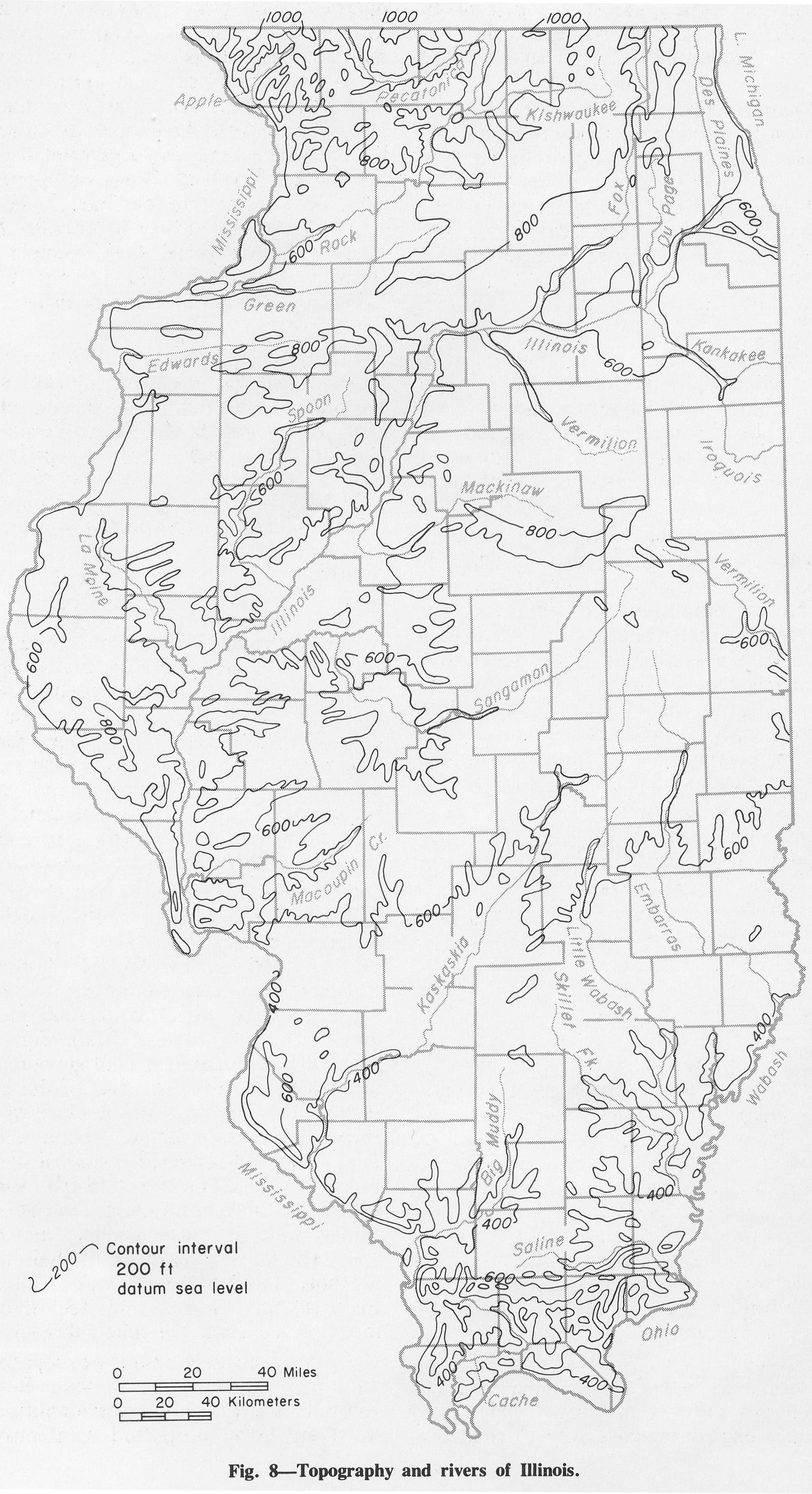
| 15:53, 1 April 2016 | Figure 8.jpg (file) |  |
834 KB | Alan.Myers | Fig. 8 -- Topography and rivers of Illinois. | 1 |
| 13:59, 4 April 2016 | Figure M-15.jpg (file) |  |
847 KB | Alan.Myers | Fig M-15 -- Development of the classification of the Valmeyeran Series. | 1 |
| 14:10, 4 April 2016 | Figure M-27.jpg (file) |  |
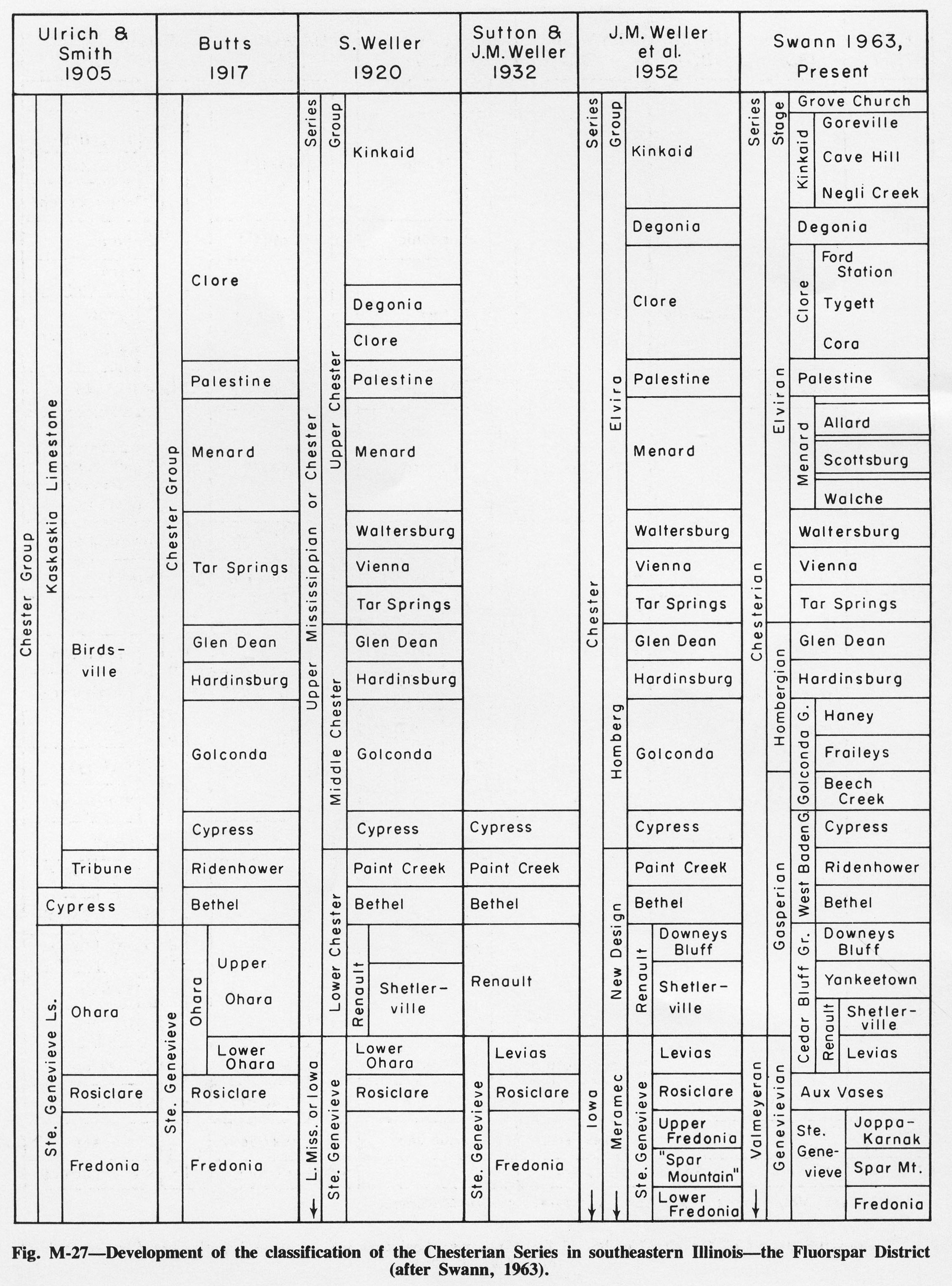
848 KB | Alan.Myers | Fig. M-27 -- Development of the classification of the Chesterian Series in southeastern Illinois -- the Fluorspar District (after Swann, 1963). | 1 |
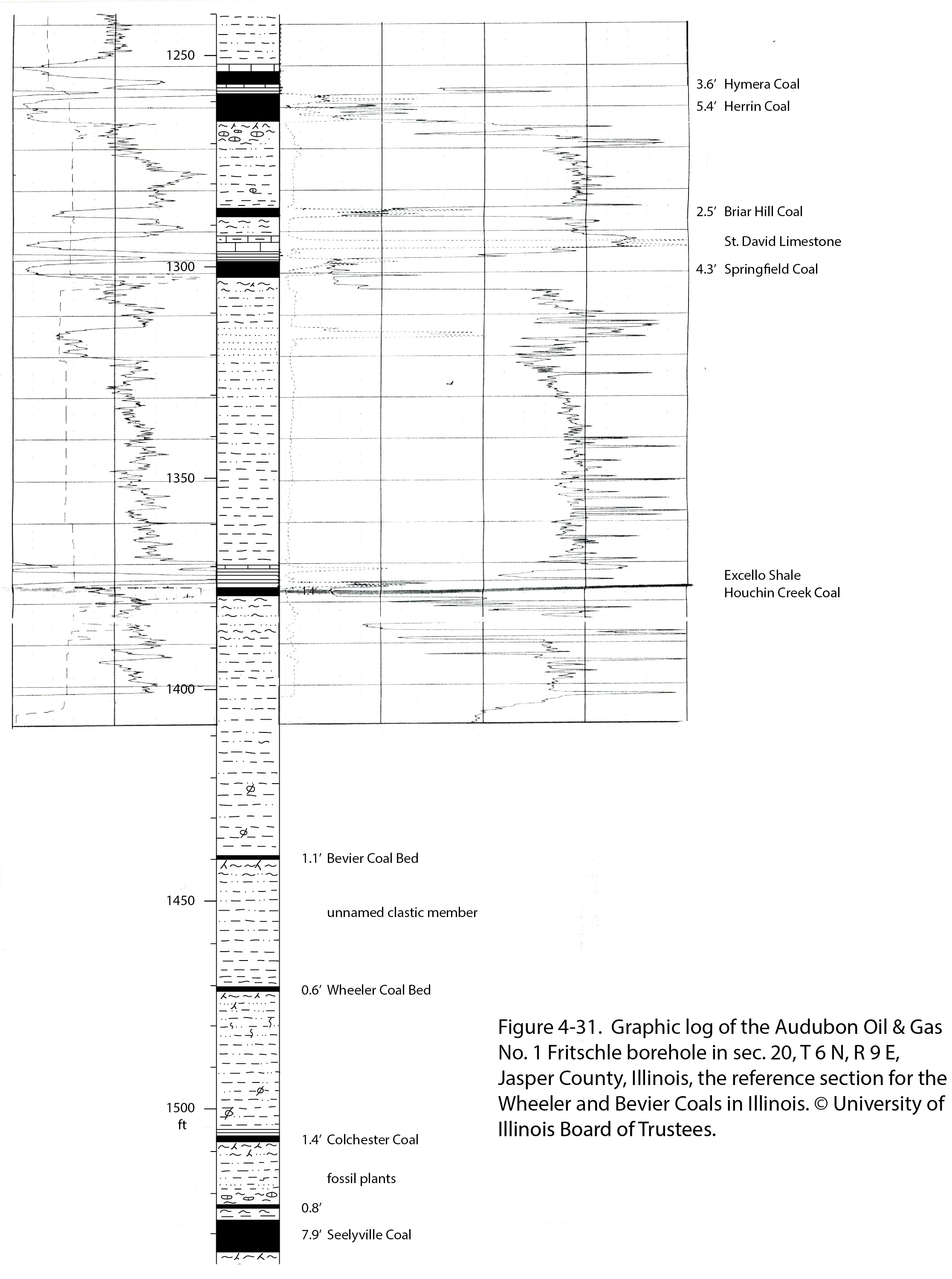
| 17:11, 23 December 2020 | Penn carbondale 4-31.jpg (file) |  |
858 KB | Jennifer.Obrad | 1 | |
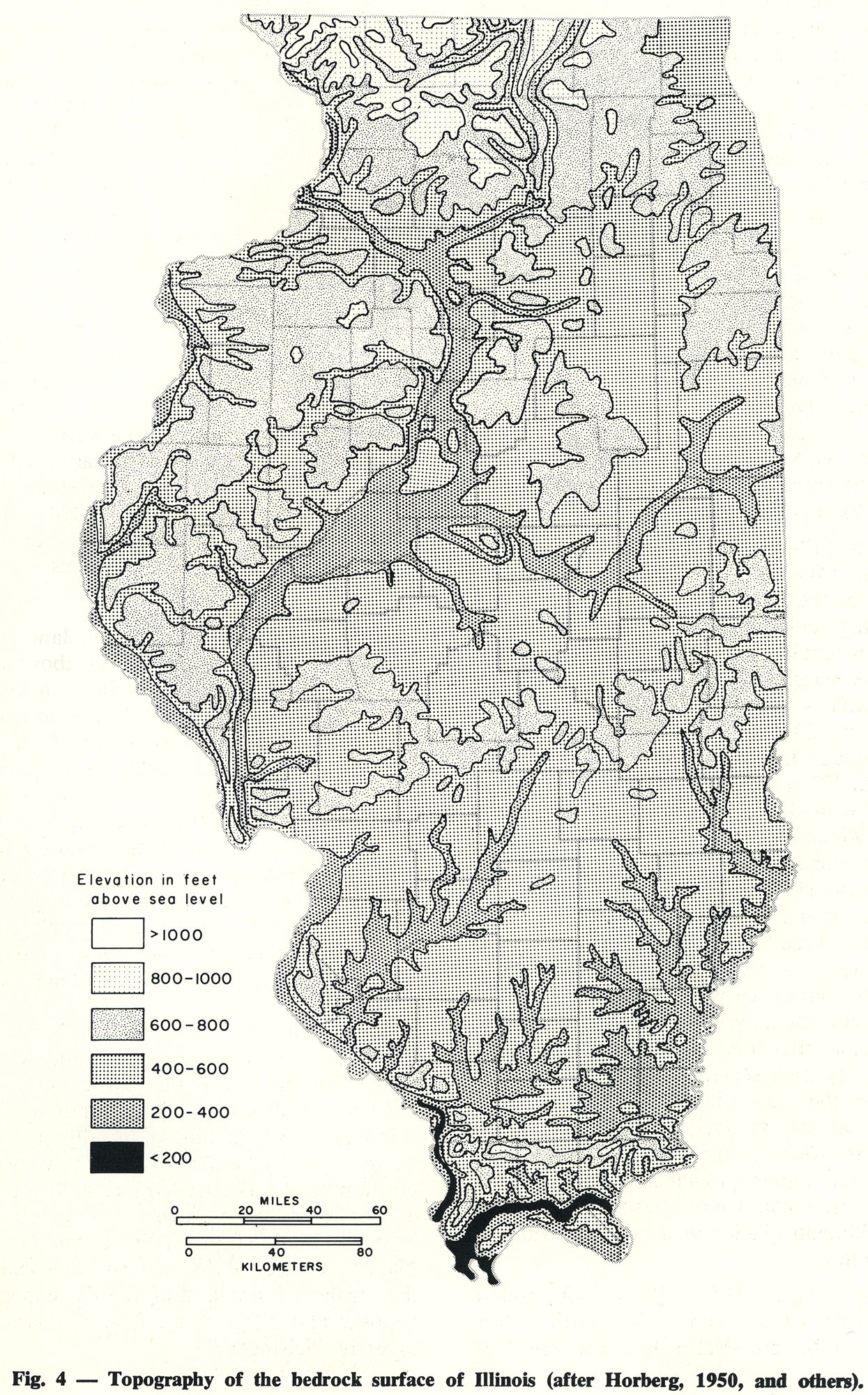
| 16:21, 18 April 2016 | 94-fig 4.jpg (file) |  |
858 KB | Illex-gron | Fig. 4 -- Topography of the bedrock surface of Illinois (after Horberg, 1950, and others). | 1 |
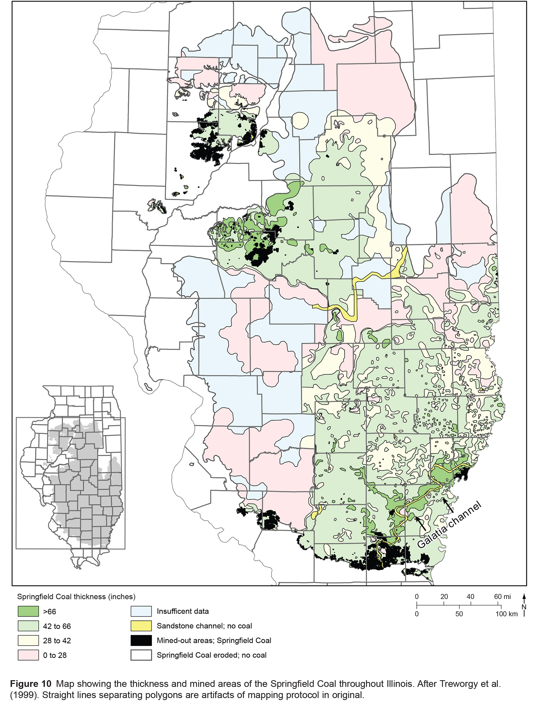
| 15:50, 17 August 2023 | C605-Figure-10.jpg (file) |  |
859 KB | Alan.Myers | 1 | |
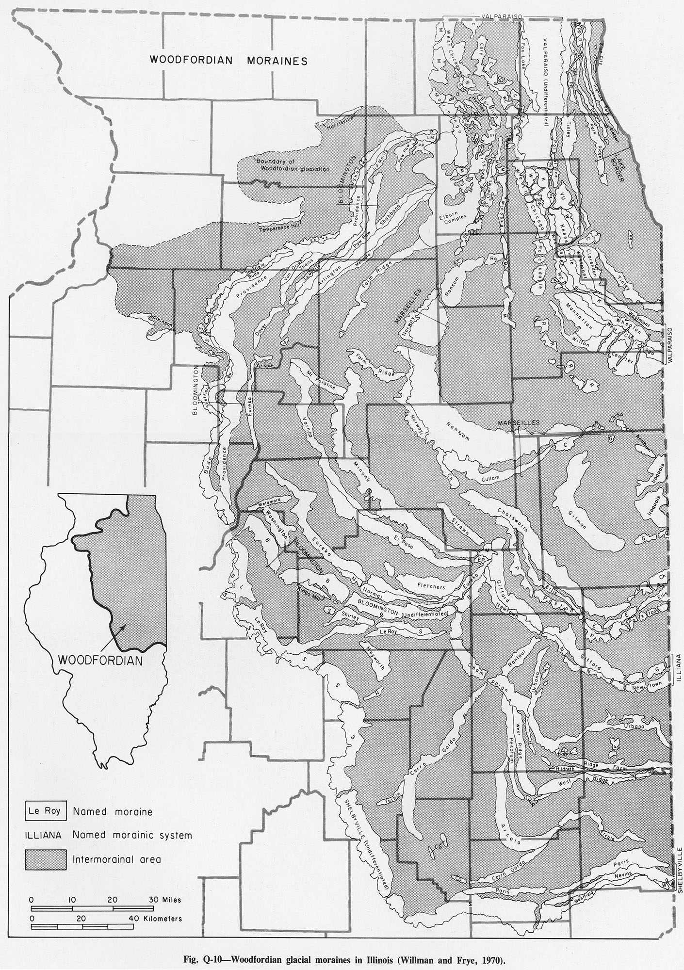
| 16:00, 4 April 2016 | Figure Q-10.jpg (file) |  |
860 KB | Alan.Myers | Fig. Q-10 -- Woodfordian glacial moraines in Illinois (Willman and Frye, 1970). | 2 |
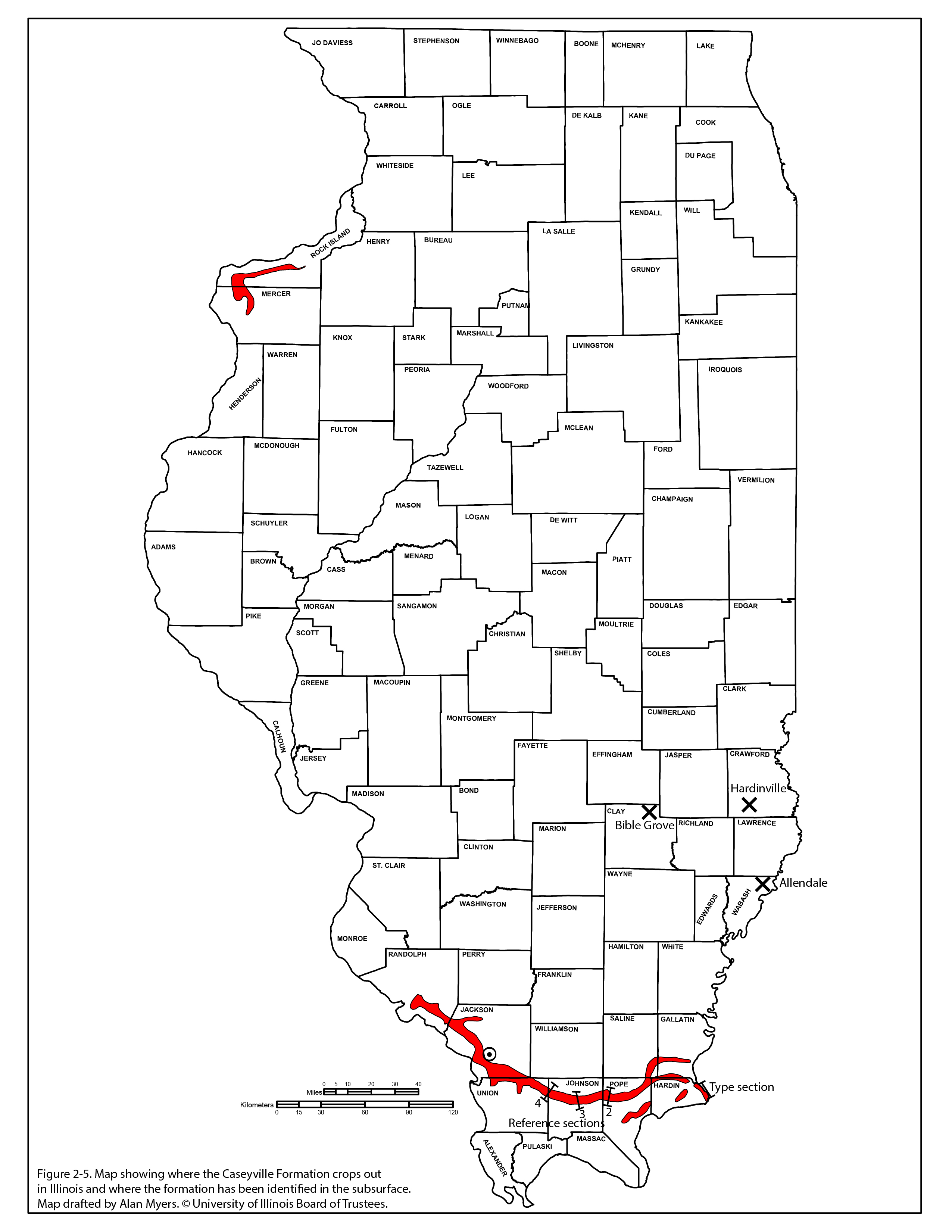
| 16:17, 20 July 2020 | Penn caseyville 2-5.jpg (file) |  |
875 KB | Jennifer.Obrad | 1 | |
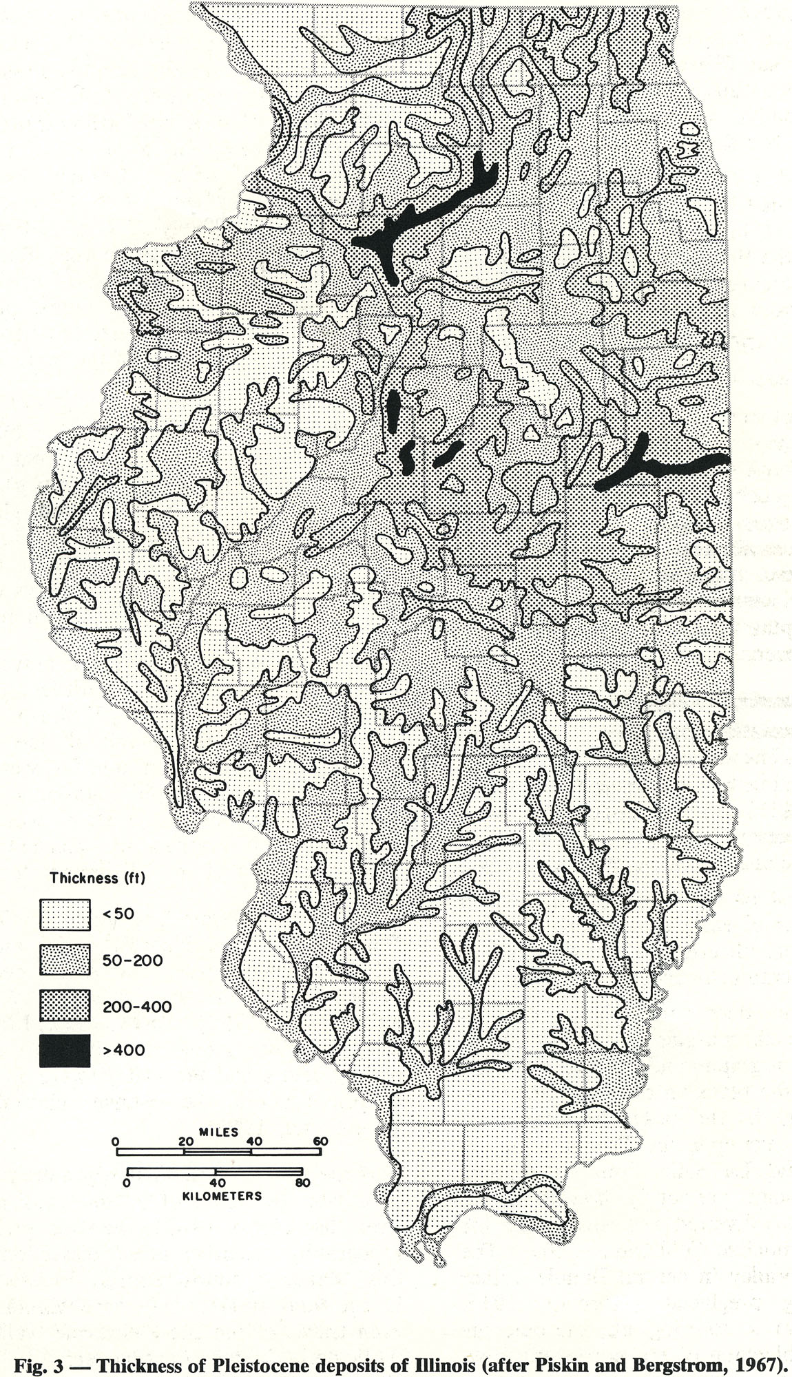
| 16:19, 18 April 2016 | 94-fig 3.jpg (file) |  |
876 KB | Illex-gron | Fig. 3 -- Thickness of Pleistocene deposits of Illinois (after Piskin and Bergstrom, 1967). | 1 |
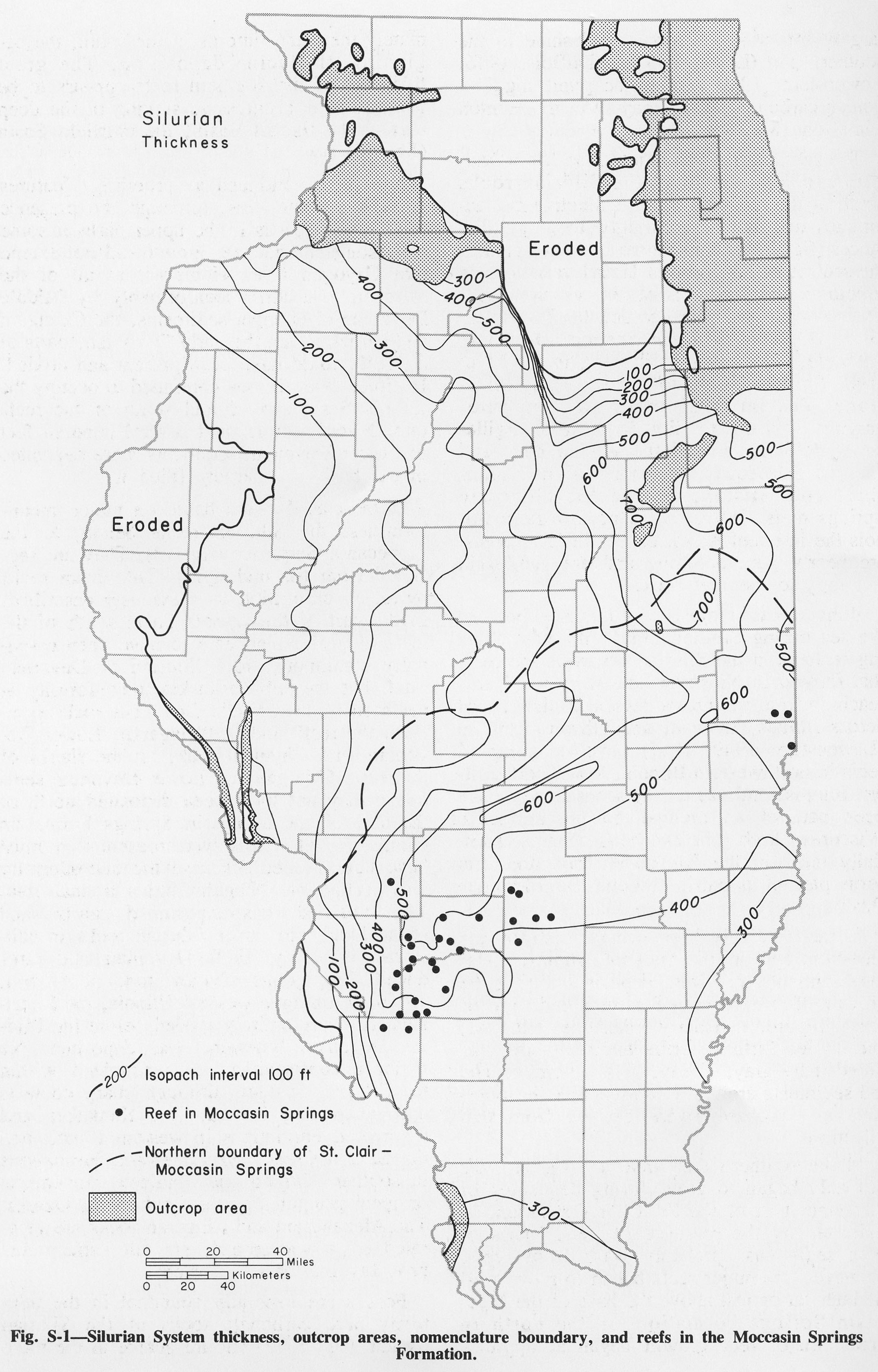
| 17:02, 4 April 2016 | Figure S-1.jpg (file) |  |
883 KB | Alan.Myers | Fig. S-1 -- Silurian System thickness, outcroup areas, nomenclature boundary, and reef in the Moccasin Springs Formation. | 1 |
| 16:18, 20 July 2020 | Penn caseyville 2-6.jpg (file) |  |
886 KB | Jennifer.Obrad | 1 | |
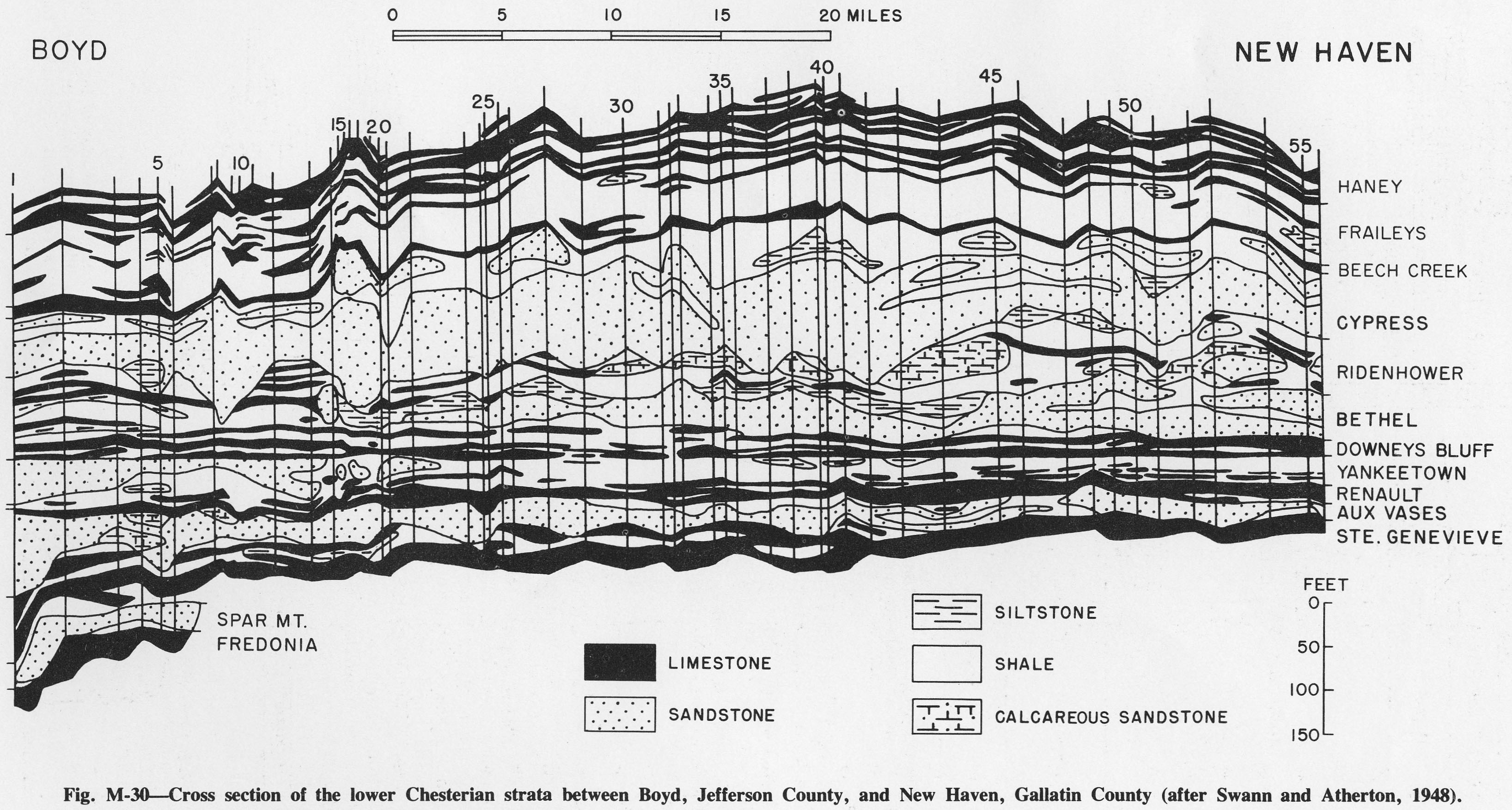
| 14:14, 4 April 2016 | Figure M-30.jpg (file) |  |
891 KB | Alan.Myers | Fig. M-30 -- Cross section of the lower Chesterian strata between Boyd, Jefferson County, and New Haven, Gallatin County (after Swann and Atherton, 1948). | 1 |
| 16:15, 18 April 2016 | 94-fig 2.jpg (file) |  |
893 KB | Illex-gron | Fig. 2 -- Generalized areal geology of the bedrock surface of Illinois. (see Willman et at., 1967, for more detailed mapping). | 1 |
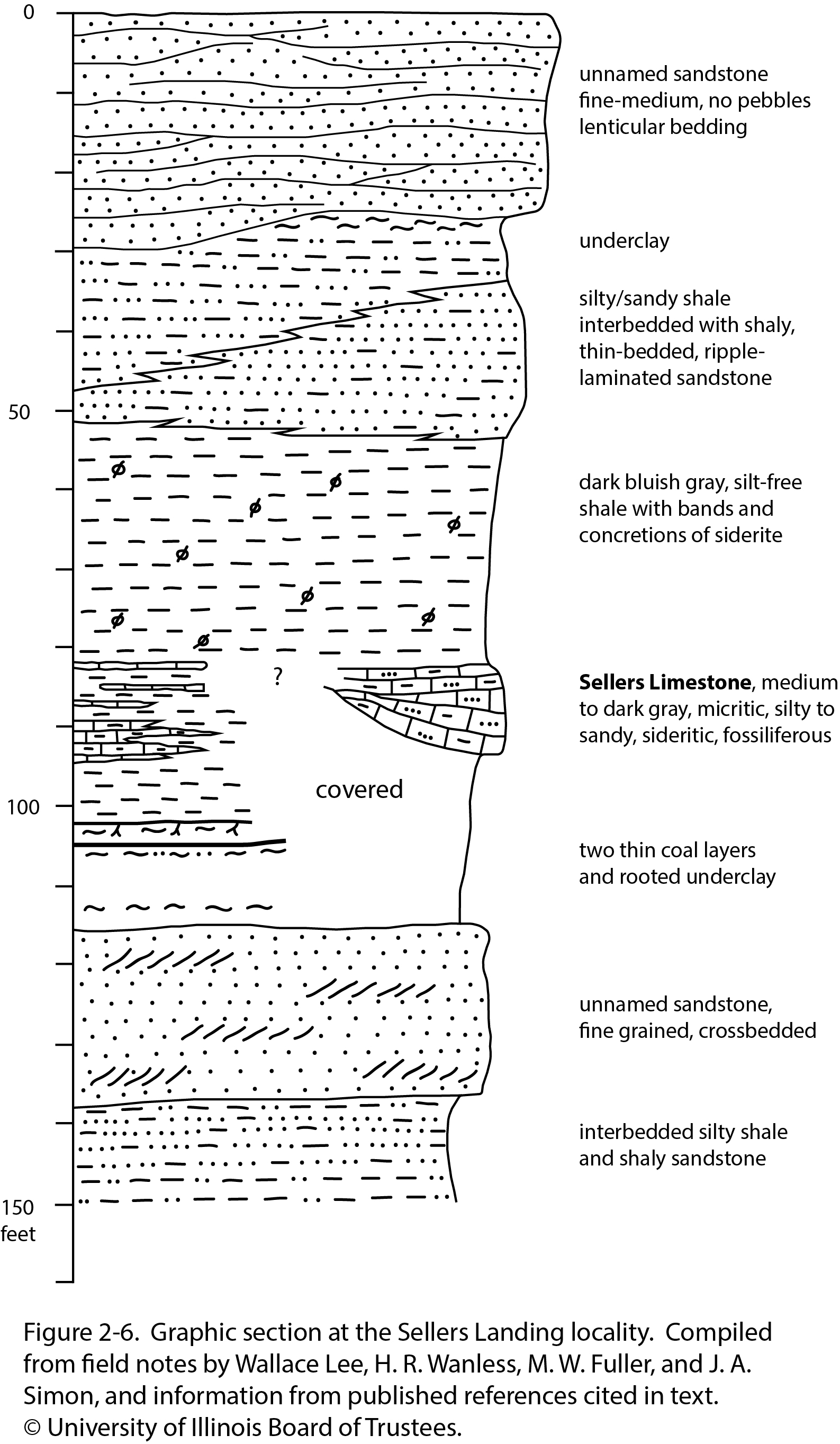
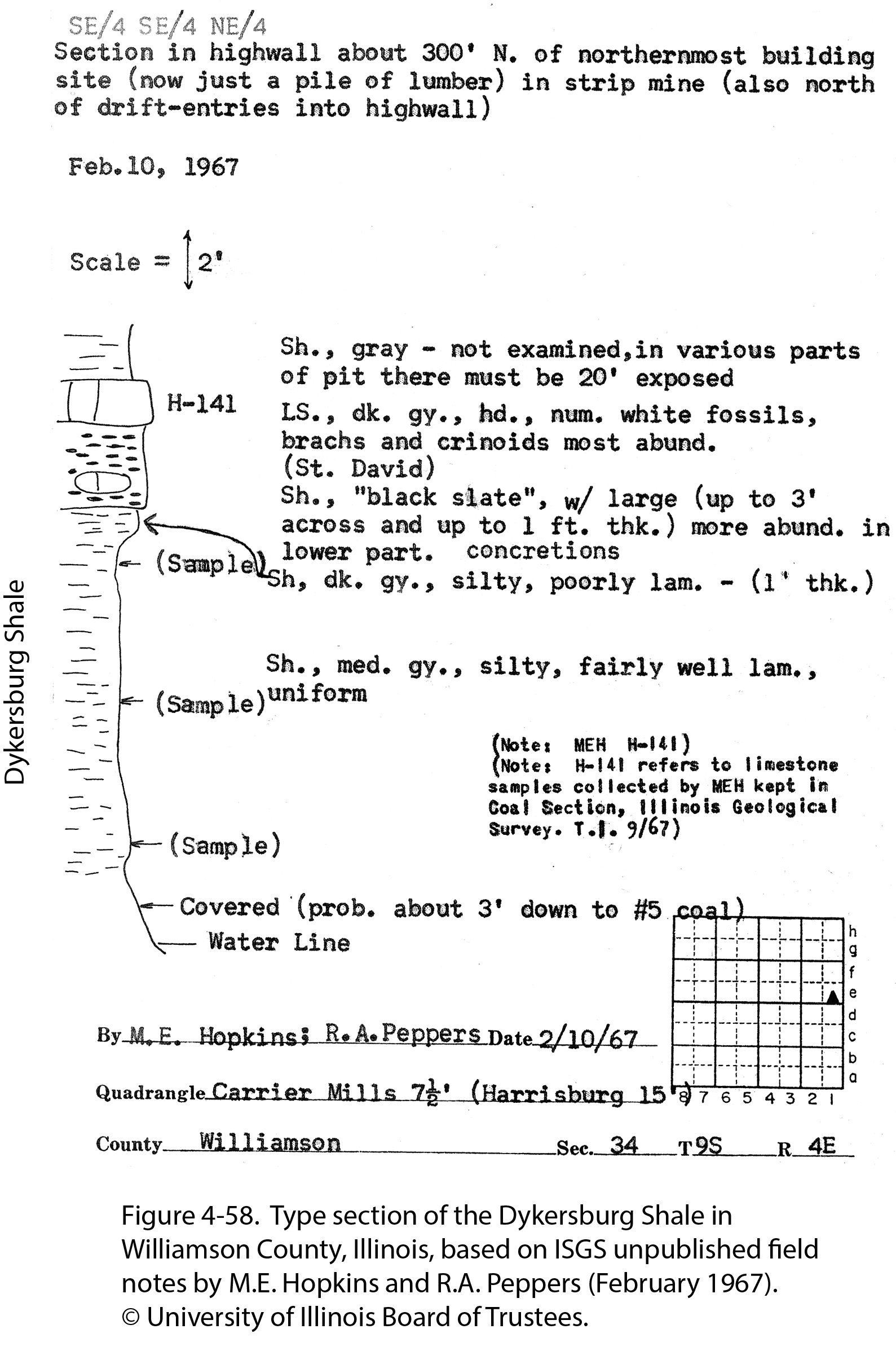
| 21:04, 23 December 2020 | Penn carbondale 4-58.jpg (file) |  |
894 KB | Jennifer.Obrad | 1 | |
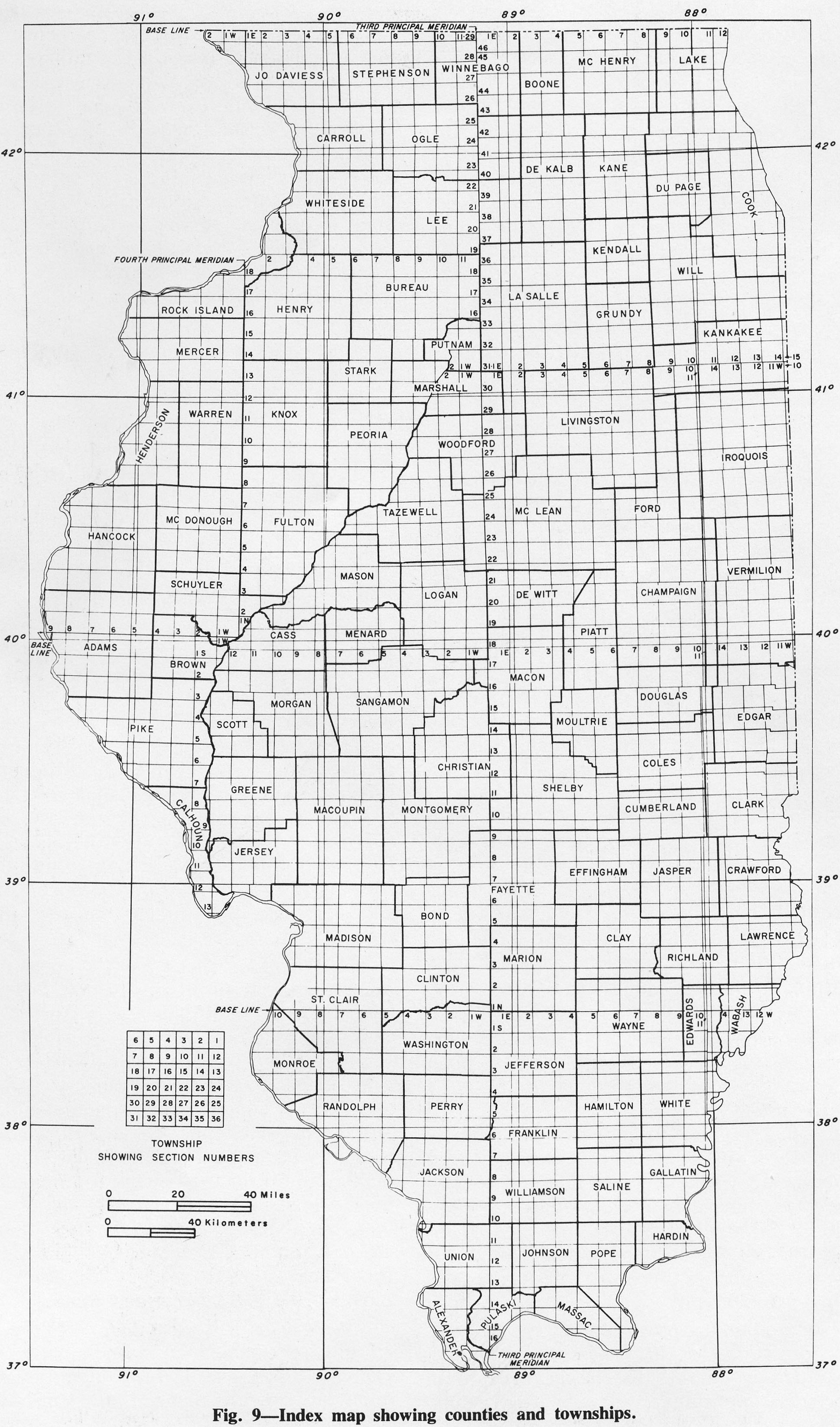
| 15:54, 1 April 2016 | Figure 9.jpg (file) |  |
895 KB | Alan.Myers | Fig. 9 -- Index map showing counties and townships. | 1 |
| 19:27, 10 July 2020 | C605-Figure-35.jpg (file) |  |
900 KB | Alan.Myers | 1 | |
| 18:50, 4 April 2016 | Figure M-1C.jpg (file) |  |
902 KB | Alan.Myers | Fig. M-1C -- Kinkaid Limestone showing clay-filled solution cavity in the Goreville Member at the top overlying a layer of shale with red bed (black) at the tope of the Cave Hill Member; in Southern Illinois Limestone Company quarry north of Buncombe,... | 1 |
| 17:06, 8 March 2016 | Penn carb fig3.jpg (file) |  |
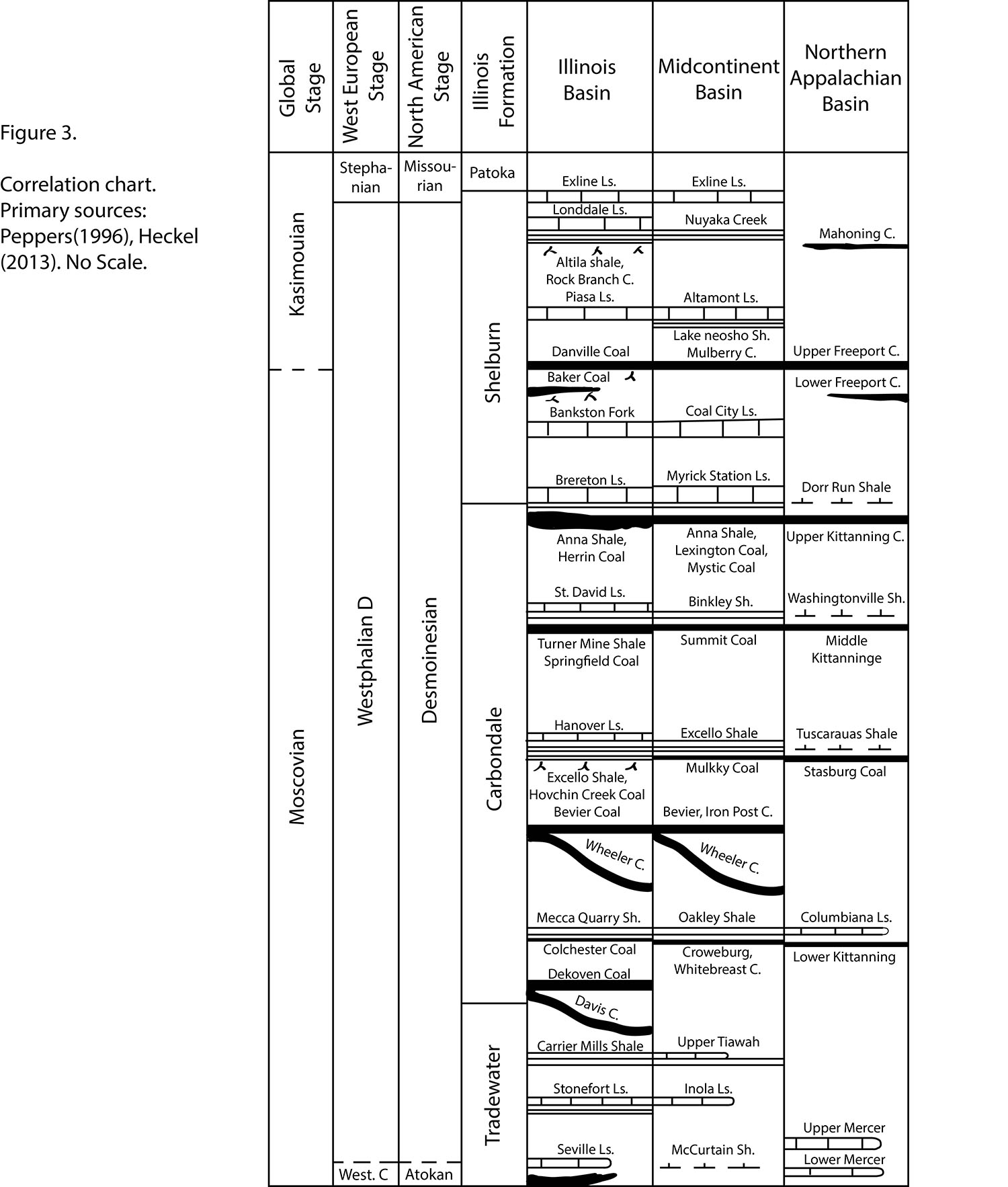
905 KB | Jennifer.Obrad | Correlation chart. Primary sources: Peppers (1996), Hickel (2013). No Scale | 1 |
| 14:08, 4 April 2016 | Figure M-26.jpg (file) |  |
923 KB | Alan.Myers | Fig. M-26 -- Thickness of the Chesterian Series. | 1 |
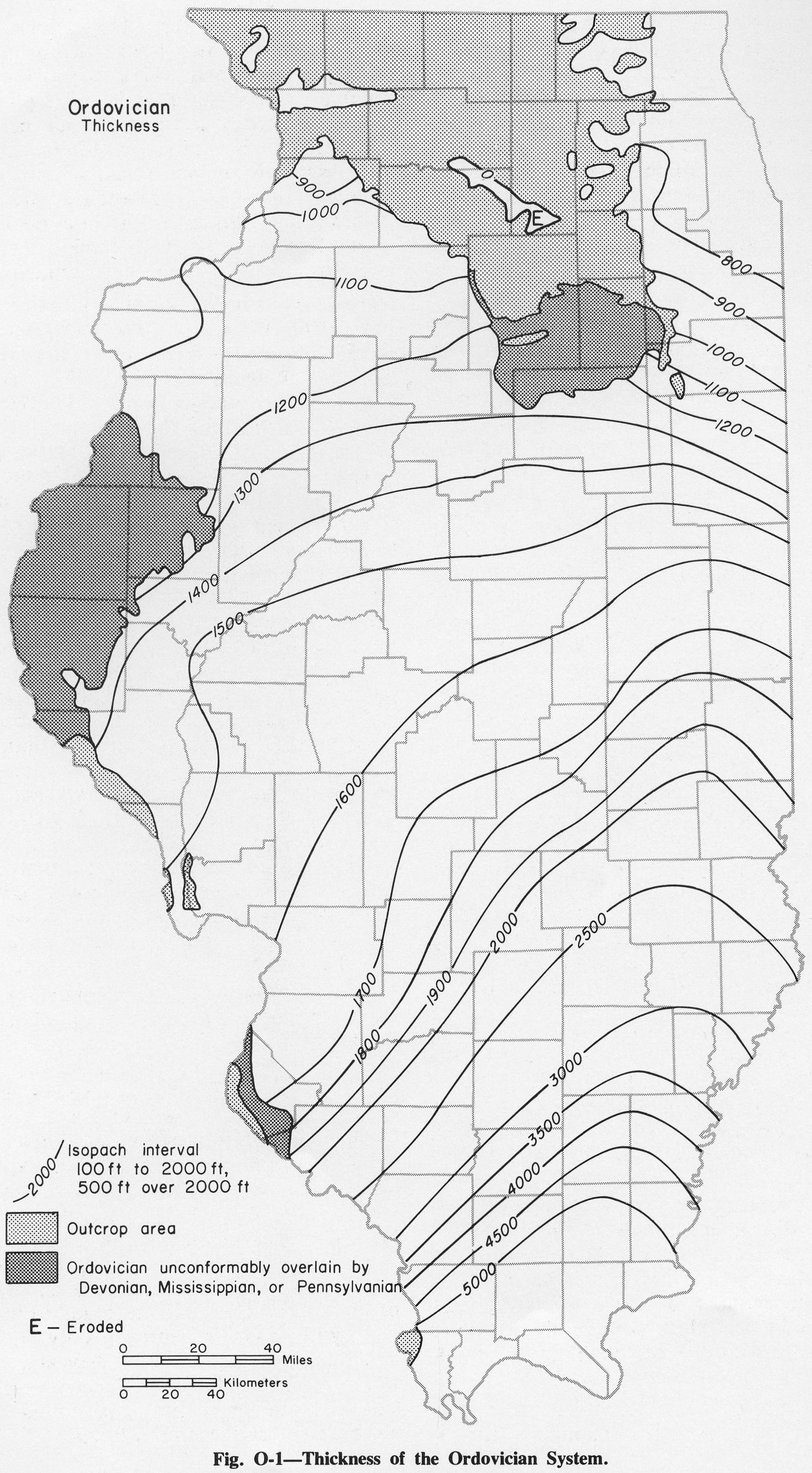
| 14:43, 4 April 2016 | Figure O-1.jpg (file) |  |
929 KB | Alan.Myers | Fig O-1 -- Thickness of Ordovician System. | 1 |
| 14:08, 4 April 2016 | Figure M-25.jpg (file) |  |
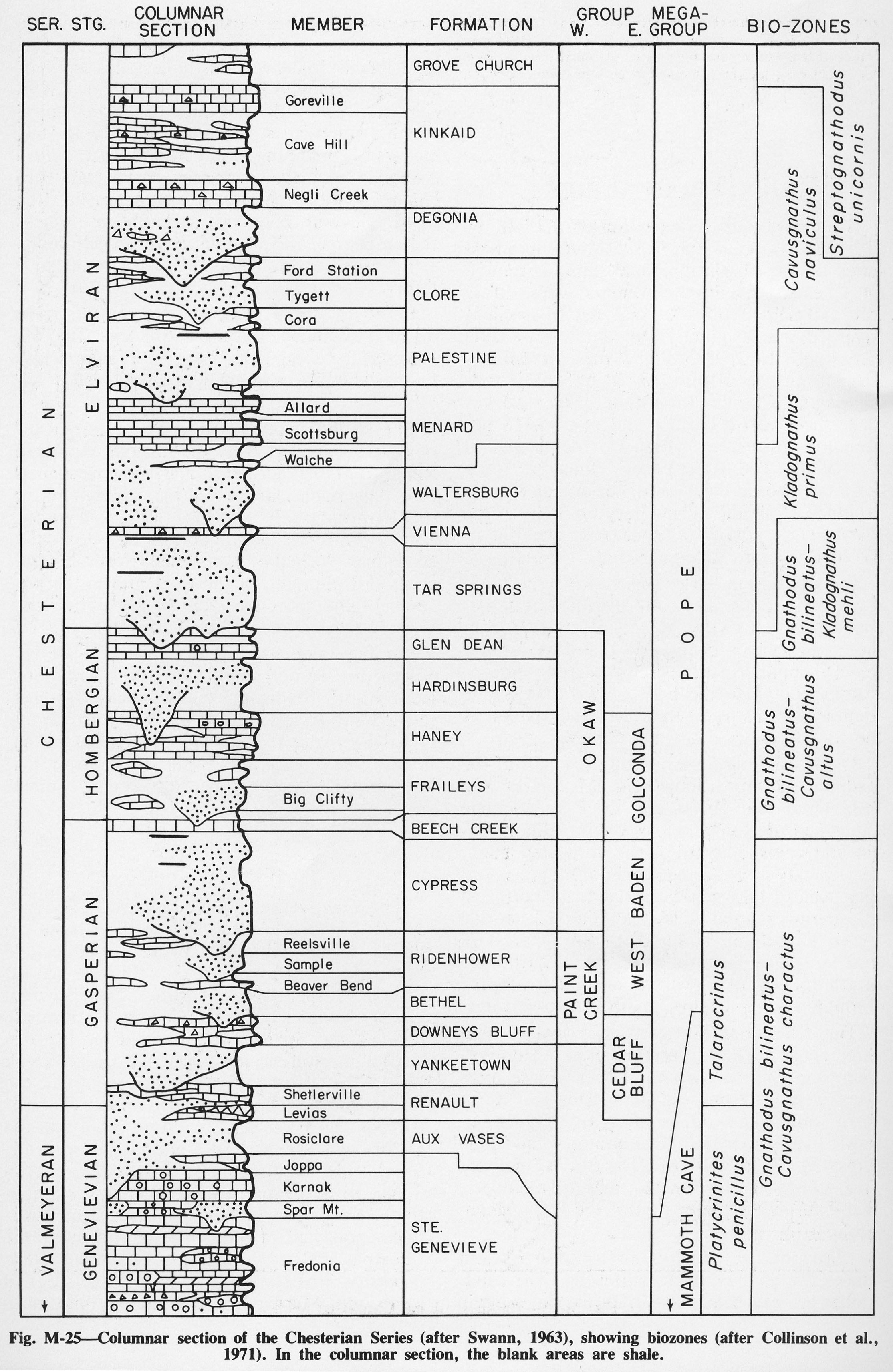
930 KB | Alan.Myers | Fig. M-25 -- Columnar section of the Chesterian Series (after Swan, 1963), showing biozones (after Collinson et al., 1971). In the columnar section, the blank areas are shale. | 1 |
| 15:14, 9 July 2020 | C605-Figure-19.jpg (file) |  |
932 KB | Alan.Myers | 1 | |
| 20:16, 8 July 2020 | C605-Figure-05a.jpg (file) |  |
937 KB | Alan.Myers | 1 | |
| 19:20, 23 December 2020 | Penn carbondale 4-45.jpg (file) |  |
948 KB | Jennifer.Obrad | 1 | |
| 19:29, 10 July 2020 | C605-Figure-36.jpg (file) |  |
956 KB | Alan.Myers | 1 | |
| 14:36, 9 July 2020 | C605-Figure-09.jpg (file) |  |
969 KB | Alan.Myers | 1 | |
| 15:41, 11 July 2020 | C605-Figure-47.jpg (file) |  |
981 KB | Alan.Myers | 1 | |
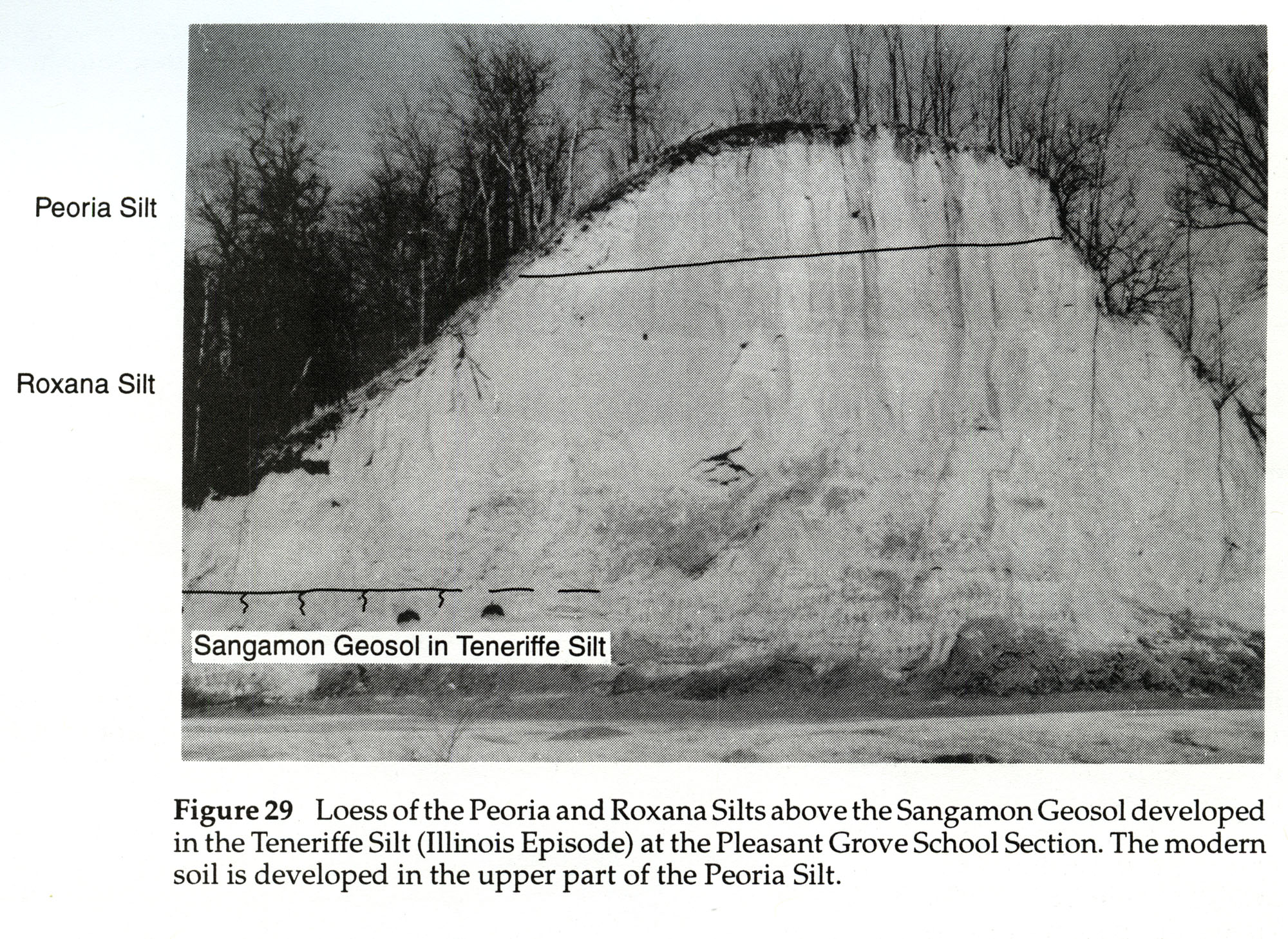
| 17:50, 19 April 2016 | 104-Figure 29.jpg (file) |  |
1,015 KB | Illex-gron | Figure 29 -- Loess of the Peoria and Roxana Silts above the Sangamon Geosol developed in the Teneriffe Silt (Illinois Episode) at the Pleasant Grove School Section. The modern soil is developed in the upper part of the Peoria Silt. | 1 |
| 18:12, 4 April 2016 | Figure C-1A.jpg (file) |  |
1,023 KB | Alan.Myers | Fig. C1-A -- Massive Potosi Dolomite in a quarry 4 miles northwest of Ashton, Ogle County. | 1 |
| 19:23, 23 December 2020 | Penn carbondale 4-47.jpg (file) |  |
1 MB | Jennifer.Obrad | 1 | |
| 17:38, 23 December 2020 | Penn carbondale 4-38.jpg (file) |  |
1 MB | Jennifer.Obrad | 1 | |
| 21:14, 26 January 2021 | Penn carbondale 4-19.jpg (file) |  |
1 MB | Jennifer.Obrad | 1 | |
| 21:46, 23 December 2020 | Penn carbondale 4-60.jpg (file) |  |
1.01 MB | Jennifer.Obrad | 1 | |
| 15:01, 9 July 2020 | C605-Figure-18.jpg (file) |  |
1.02 MB | Alan.Myers | 1 | |
| 18:52, 4 April 2016 | Figure M-1D.jpg (file) |  |
1.02 MB | Alan.Myers | Fig. M-1D -- Well bedded St. Louis Limestone with cave in its base overlying massive Salem Limestone in Mississippi River bluff a mile northwest of Prairie du Rocher, Randolph County. | 1 |
| 20:49, 23 December 2020 | Penn carbondale 4-55.jpg (file) |  |
1.03 MB | Jennifer.Obrad | 1 | |
| 18:55, 4 April 2016 | Figure M-1F.jpg (file) |  |
1.03 MB | Alan.Myers | Fig. M-1F -- Grannular texture of the Ullin Limestone along Mill Creek, south of Anna, Union County (x1). | 1 |
| 21:03, 17 July 2020 | C605-Plate-01.jpg (file) |  |
1.04 MB | Alan.Myers | 2 | |
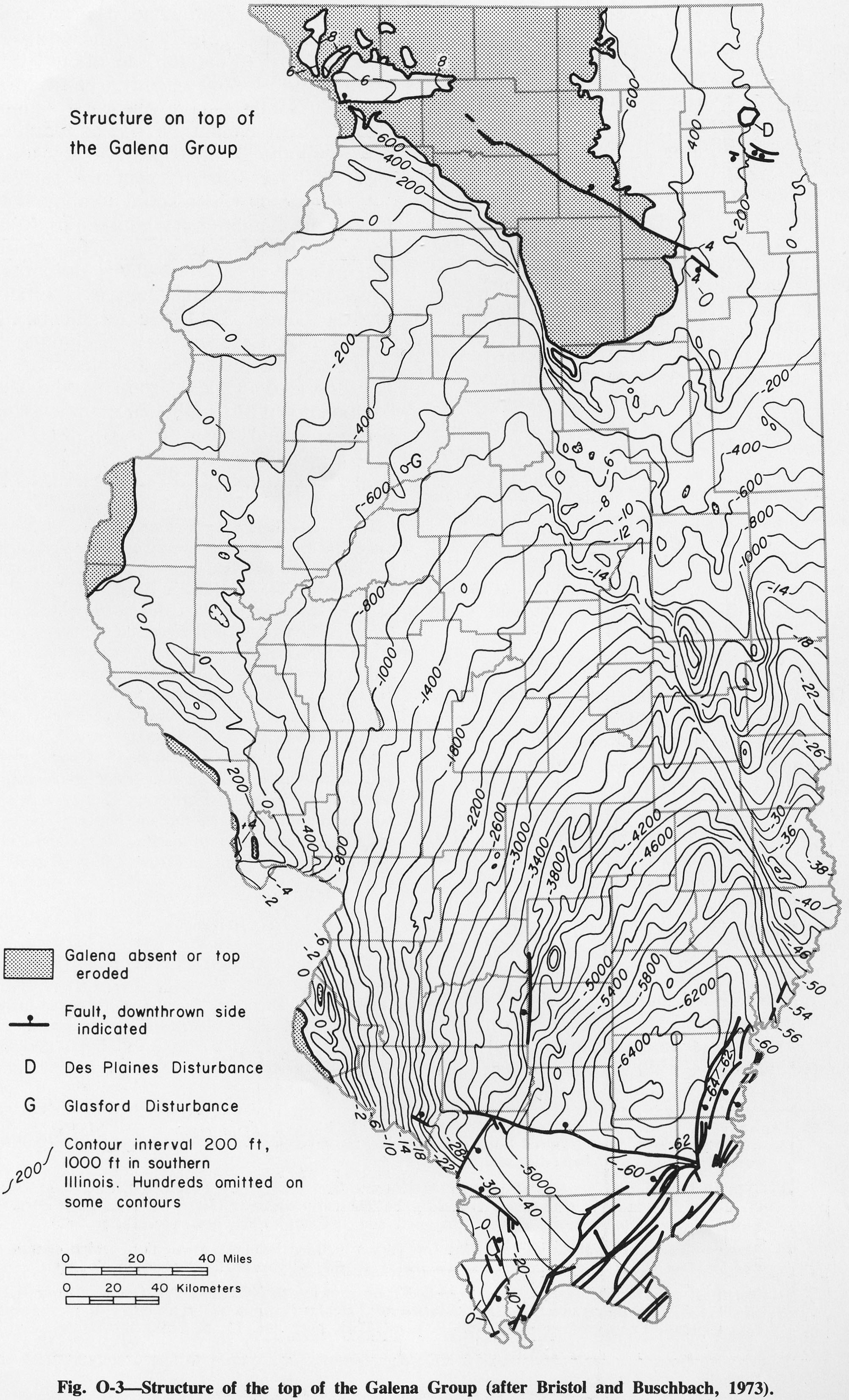
| 14:45, 4 April 2016 | Figure O-3.jpg (file) |  |
1.04 MB | Alan.Myers | Fig O-3 -- Structure of the top of the Galena Group (after Bristol and Buschbach, 1973). | 1 |
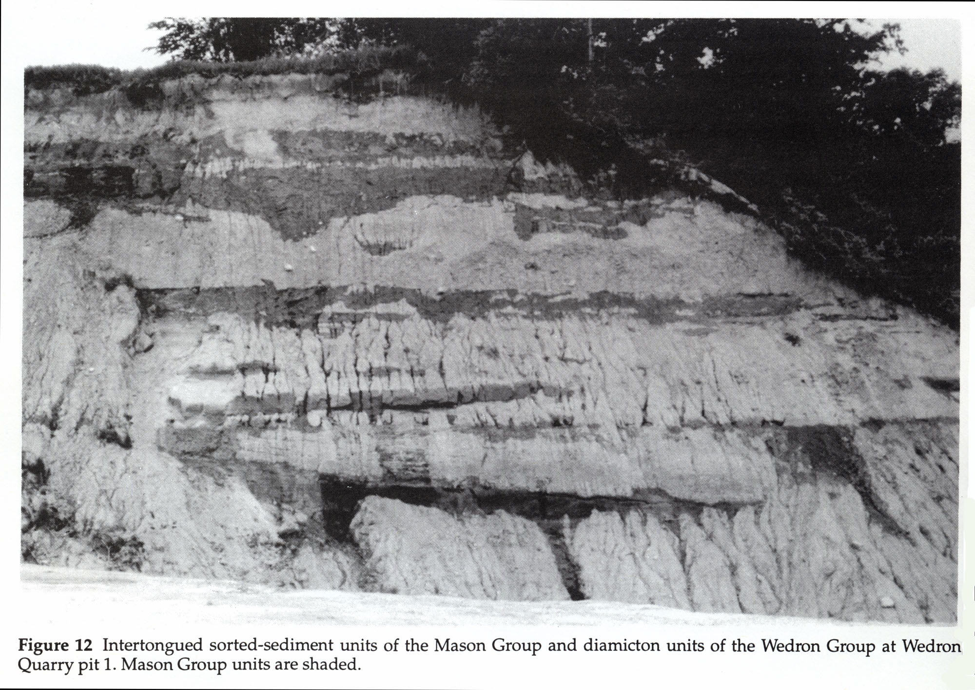
| 16:36, 19 April 2016 | 104-Figure 12.jpg (file) |  |
1.04 MB | Illex-gron | Figure 12 -- Intertongued sorted-sediment units of the Mason Group and diamicton units of the Wedron Group at Wedron Quarry pit 1. Mason Group units are shaded. | 1 |
| 18:21, 4 April 2016 | Figure D-3A.jpg (file) |  |
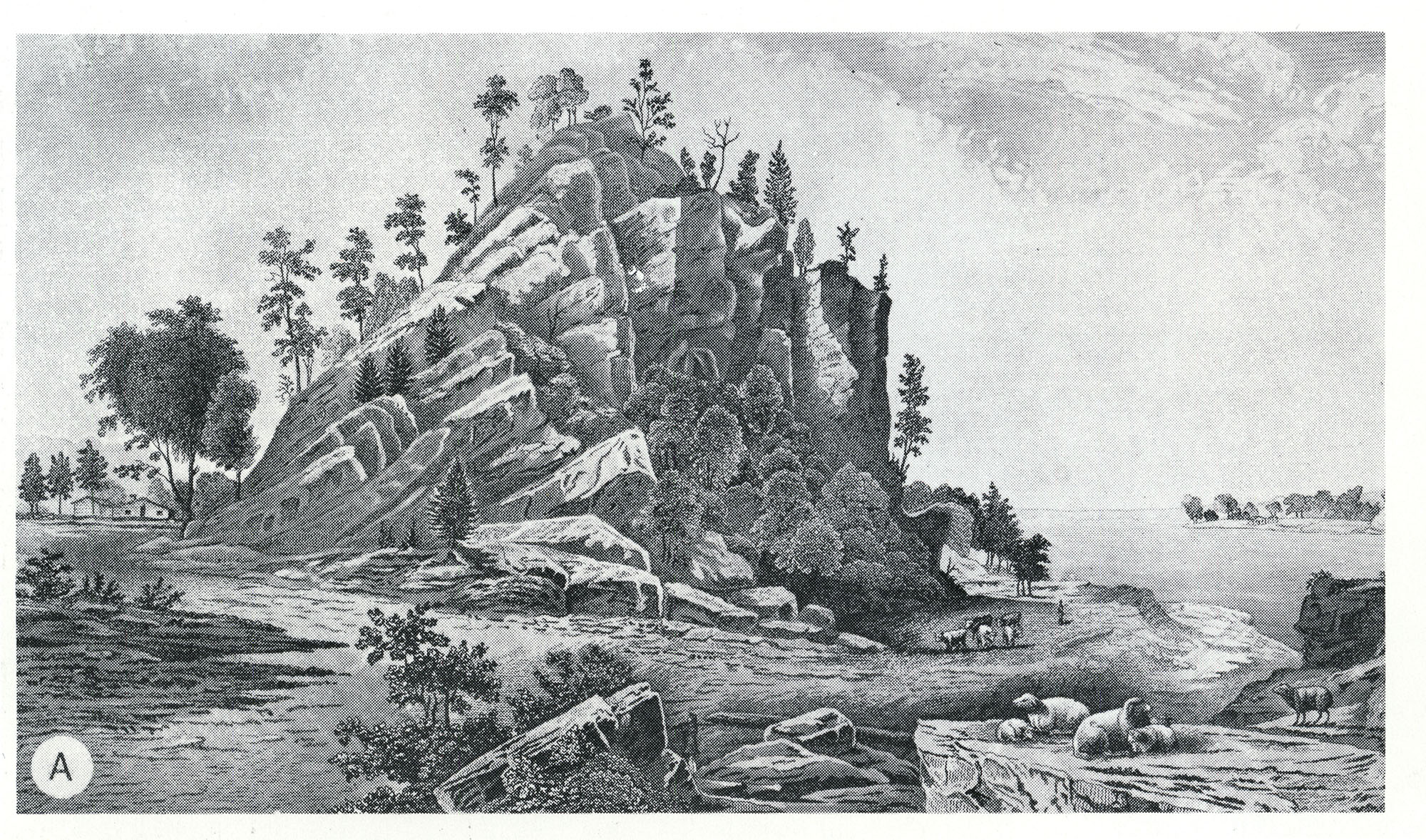
1.04 MB | Alan.Myers | Fig. D-3A -- Middle Devonian Limestone (Lingle and Grand Tower) in ridge ("the Backbone") along the Mississippi River north of Grand Tower, Jackson County (from Worthen, 1868, opp. p. 61). | 1 |
| 15:33, 11 July 2020 | C605-Figure-42.jpg (file) |  |
1.04 MB | Alan.Myers | 1 | |
| 20:07, 8 July 2020 | C605-Figure-04.jpg (file) |  |
1.05 MB | Alan.Myers | 1 | |
| 15:17, 9 July 2020 | C605-Figure-21.jpg (file) |  |
1.06 MB | Alan.Myers | 1 |