File:Penn caseyville 2-5.jpg: Difference between revisions
Jump to navigation
Jump to search
(Figure 2-5. Map showing where the Caseyville Formation crops out in Illinois and where the formation has been identified in the subsurface. Map drafted by Alan Myers.) |
(IlLex uploaded a new version of File:Penn caseyville 2-5.jpg) |
||
| (2 intermediate revisions by the same user not shown) | |||
| Line 1: | Line 1: | ||
Figure 2-5. Map showing where the Caseyville Formation crops out in Illinois and where the formation has been identified in the subsurface. Map drafted by Alan Myers. | Figure 2-5. Map showing where the Caseyville Formation crops out in Illinois and where the formation has been identified in the subsurface. Map drafted by Alan Myers. © University of Illinois Board of Trustees. | ||
Latest revision as of 16:17, 20 July 2020
Figure 2-5. Map showing where the Caseyville Formation crops out in Illinois and where the formation has been identified in the subsurface. Map drafted by Alan Myers. © University of Illinois Board of Trustees.
File history
Click on a date/time to view the file as it appeared at that time.
| Date/Time | Thumbnail | Dimensions | User | Comment | |
|---|---|---|---|---|---|
| current | ★ Approved revision 16:17, 20 July 2020 | 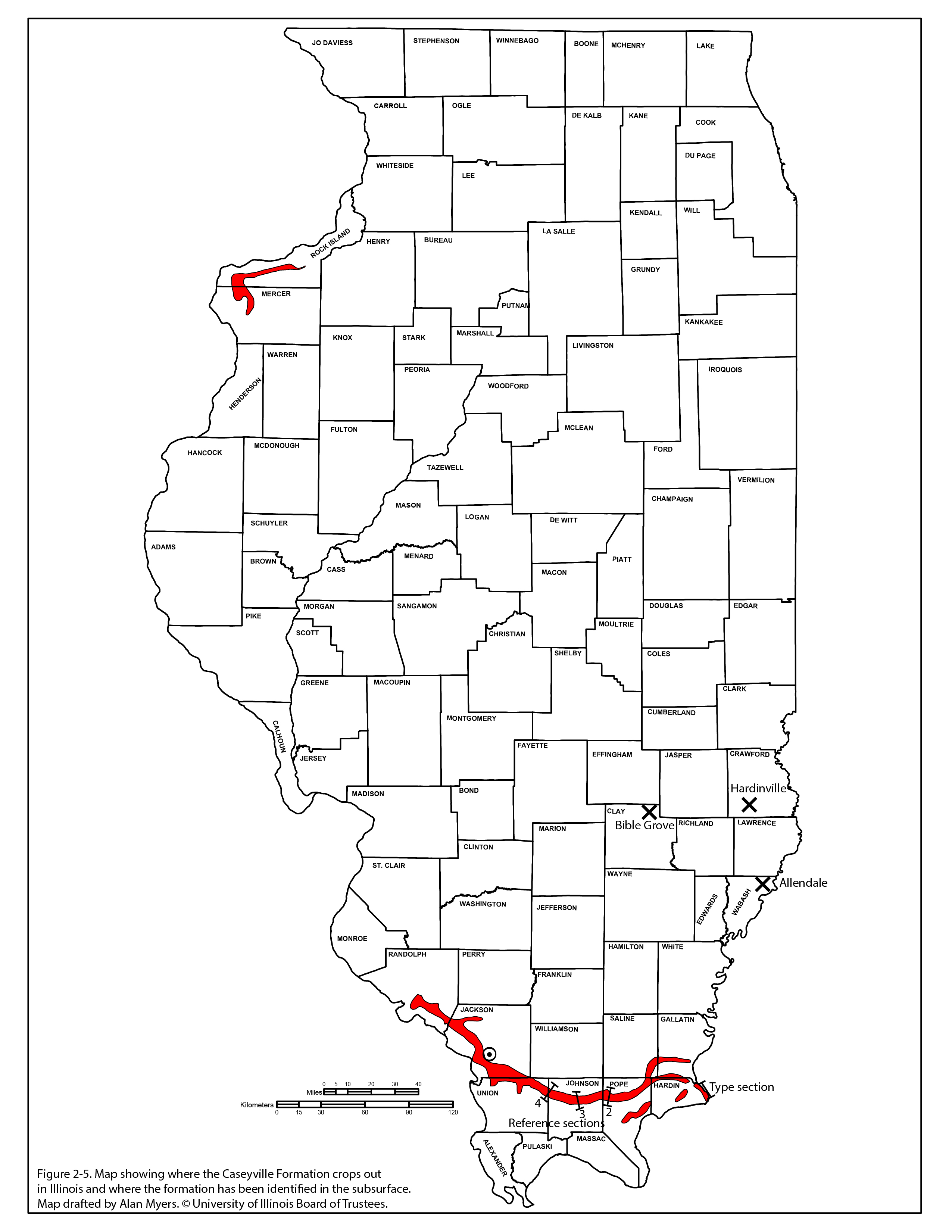 | 2,551 × 3,301 (875 KB) | Jennifer.Obrad (talk | contribs) |
You cannot overwrite this file.
File usage
The following page uses this file: