File:Penn carbondale 4-62.jpg
Revision as of 21:56, 23 December 2020 by Jennifer.Obrad (talk | contribs)

Size of this preview: 454 × 599 pixels. Other resolution: 2,359 × 3,115 pixels.
Original file (2,359 × 3,115 pixels, file size: 7.43 MB, MIME type: image/jpeg)
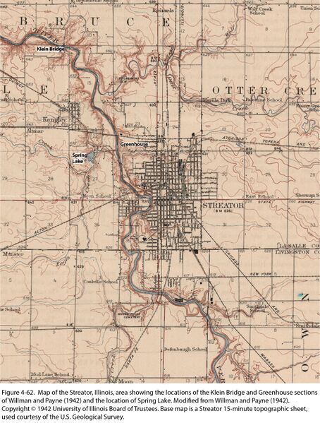
Figure 4-62. Map of the Streator, Illinois, area showing the locations of the Klein Bridge and Greenhouse sections of Willman and Payne (1942) and the location of Spring Lake. Modified from Willman and Payne (1942). Copyright © 1942 University of Illinois Board of Trustees. Base map is a Streator 15-minute topographic sheet, used courtesy of the U.S. Geological Survey.
File history
Click on a date/time to view the file as it appeared at that time.
| Date/Time | Thumbnail | Dimensions | User | Comment | |
|---|---|---|---|---|---|
| current | ★ Approved revision 21:55, 23 December 2020 | | 2,359 × 3,115 (7.43 MB) | Jennifer.Obrad (talk | contribs) |
You cannot overwrite this file.
File usage
The following 3 pages use this file: