File:Penn carbondale 4-55 map.jpg
Revision as of 20:52, 23 December 2020 by Jennifer.Obrad (talk | contribs)
Size of this preview: 403 × 600 pixels. Other resolution: 1,783 × 2,653 pixels.
Original file (1,783 × 2,653 pixels, file size: 356 KB, MIME type: image/jpeg)
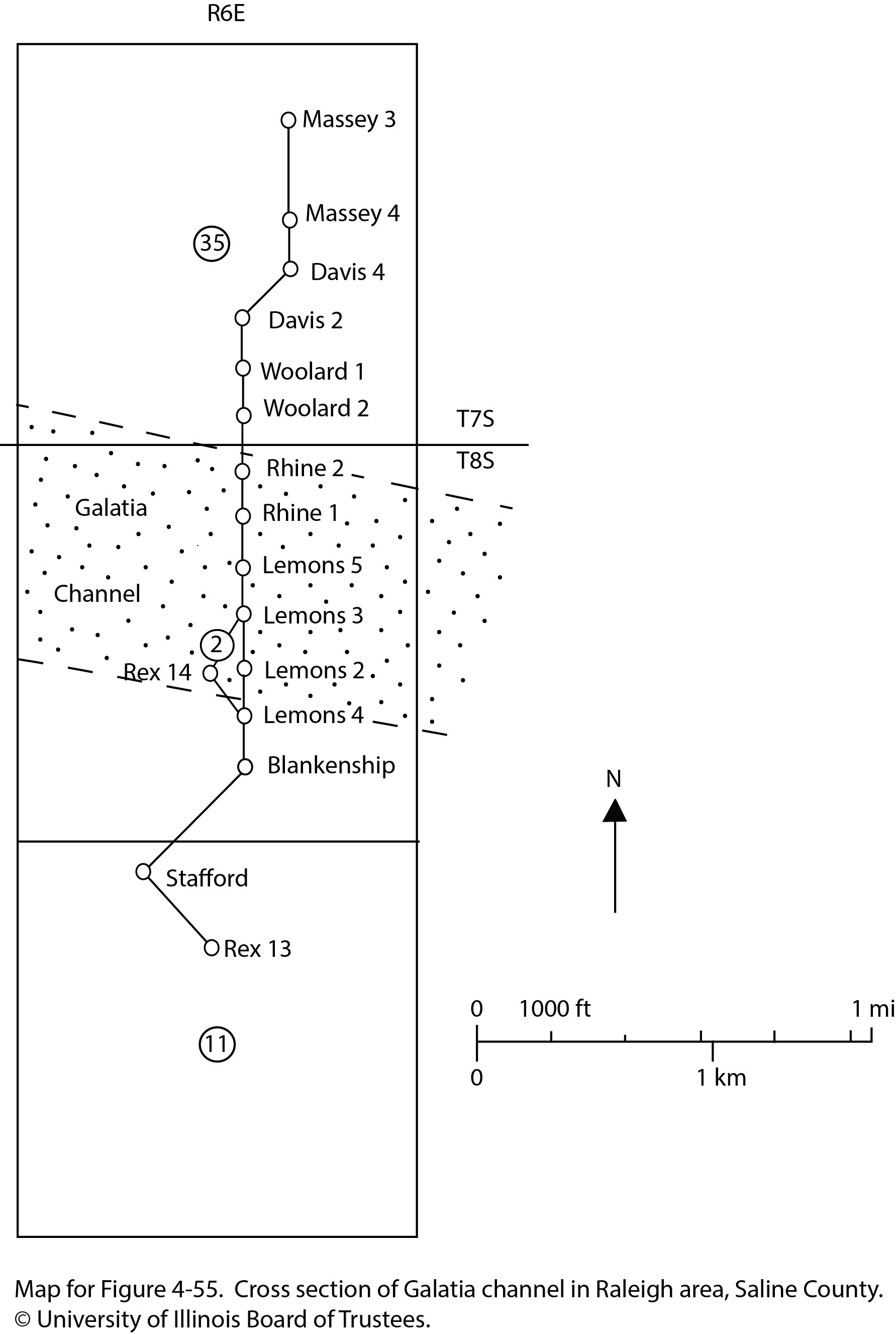
Map for Figure 4-55. Cross section of Galatia channel in Raleigh area, Saline County. © University of Illinois Board of Trustees.
File history
Click on a date/time to view the file as it appeared at that time.
| Date/Time | Thumbnail | Dimensions | User | Comment | |
|---|---|---|---|---|---|
| current | ★ Approved revision 20:52, 23 December 2020 | | 1,783 × 2,653 (356 KB) | Jennifer.Obrad (talk | contribs) |
You cannot overwrite this file.
File usage
There are no pages that use this file.