File:Figure Q-2.jpg
Revision as of 15:41, 4 April 2016 by Alan.Myers (talk | contribs) (Fig. Q-2 -- Glacial map of Illinois (after Willman and Frye, 1970).)

Size of this preview: 400 × 599 pixels. Other resolution: 2,209 × 3,307 pixels.
Original file (2,209 × 3,307 pixels, file size: 1.76 MB, MIME type: image/jpeg)
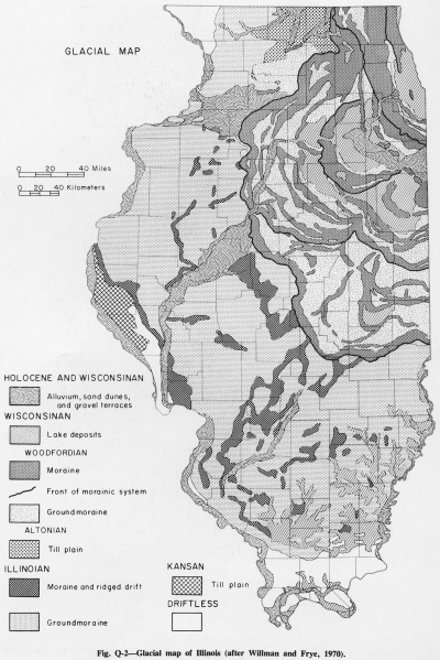
Fig. Q-2 -- Glacial map of Illinois (after Willman and Frye, 1970).
File history
Click on a date/time to view the file as it appeared at that time.
| Date/Time | Thumbnail | Dimensions | User | Comment | |
|---|---|---|---|---|---|
| current | ★ Approved revision 15:41, 4 April 2016 | | 2,209 × 3,307 (1.76 MB) | Alan.Myers (talk | contribs) | Fig. Q-2 -- Glacial map of Illinois (after Willman and Frye, 1970). |
You cannot overwrite this file.
File usage
The following 2 pages use this file: