File:Figure Q-1D.jpg
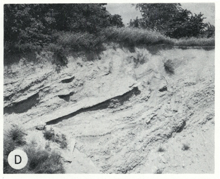
Revision as of 13:10, 5 April 2016 by Alan.Myers (talk | contribs) (Fig. Q-1D -- Illinoian Glasford Formation (Hagarstown Member) showing steeply dipping sand and gravel (crevasse deposit) in a mound in the Kaskaskia Ridged Drift area, 2 miles southwest of Lakewood, Shelby County.)

Size of this preview: 733 × 599 pixels. Other resolution: 2,000 × 1,635 pixels.
Original file (2,000 × 1,635 pixels, file size: 1.16 MB, MIME type: image/jpeg)
Fig. Q-1D -- Illinoian Glasford Formation (Hagarstown Member) showing steeply dipping sand and gravel (crevasse deposit) in a mound in the Kaskaskia Ridged Drift area, 2 miles southwest of Lakewood, Shelby County.
File history
Click on a date/time to view the file as it appeared at that time.
| Date/Time | Thumbnail | Dimensions | User | Comment | |
|---|---|---|---|---|---|
| current | ★ Approved revision 13:10, 5 April 2016 | | 2,000 × 1,635 (1.16 MB) | Alan.Myers (talk | contribs) | Fig. Q-1D -- Illinoian Glasford Formation (Hagarstown Member) showing steeply dipping sand and gravel (crevasse deposit) in a mound in the Kaskaskia Ridged Drift area, 2 miles southwest of Lakewood, Shelby County. |
You cannot overwrite this file.
File usage
The following 2 pages use this file: