File:Figure Q-1A.jpg
Revision as of 16:04, 5 April 2016 by Alan.Myers (talk | contribs)
Size of this preview: 800 × 595 pixels. Other resolution: 2,000 × 1,487 pixels.
Original file (2,000 × 1,487 pixels, file size: 735 KB, MIME type: image/jpeg)
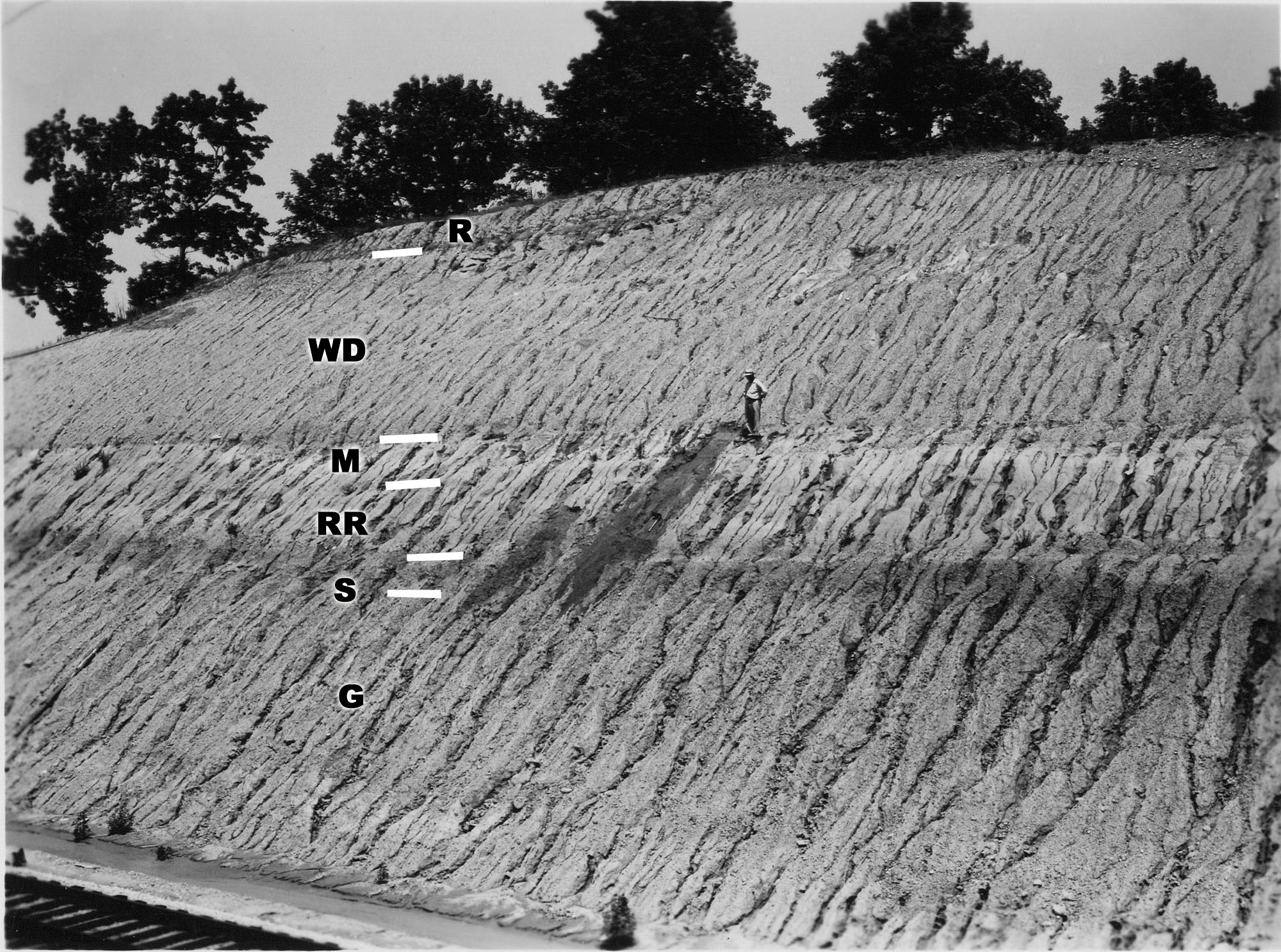
Fig. Q-1A -- Wisconsinan Richland Loess (R), Delavan Till Member of the Wedron Formation (Wd), Morton Loess(M), Robein and Roxana Silts (RR), and the Sangamon Soil (S) on till of the Illinoian Glasford Formation(G); in a railroad cut a mile east of Farmdale, Tazewell County, near the classic Farm Creek Section (Willman and Frye, 1970, p. 183).
File history
Click on a date/time to view the file as it appeared at that time.
| Date/Time | Thumbnail | Dimensions | User | Comment | |
|---|---|---|---|---|---|
| current | ★ Approved revision 16:02, 5 April 2016 | | 2,000 × 1,487 (735 KB) | Alan.Myers (talk | contribs) | Fig. Q-1A -- Wisconsinan Richland Loess (R), Delavan Till Member of the Wedron Formation (Wd), Morton Loess(M), Robein and Roxana Silts (RR), and the Sangamon Soil (S) on till of the Illinoian Glasford Formation(C); in a railroad cut a mile east of Far... |
| 20:25, 4 April 2016 |  | 2,000 × 1,487 (746 KB) | Alan.Myers (talk | contribs) | Fig. Q-1A -- Wisconsinan Richland Loess (R), Delavan Till Member of the Wedron Formation (Wd), Morton Loess(M), Robein and Roxana Silts (RR), and the Sangamon Soil (S) on till of the Illinoian Glasford Formation(C); in a railroad cut a mile east of Far... |
You cannot overwrite this file.
File usage
The following 2 pages use this file: