File:Figure P-3B.jpg: Difference between revisions
Jump to navigation
Jump to search
mNo edit summary |
(No difference)
|
Latest revision as of 22:47, 8 March 2016
Fig. P-3B -- Strata overlying the Herrin (No. 6) Coal Member of the Carbondale Formation (at the man's feet), including the Bankston Fork Limestone Member (BF), Conant Limestone Member (C), Jamestown Coal Member (J, 1 inch thick), gray calcareous shale (gs), Brereton Limestone Member (B); in a strip mine southwest of Belleville, St. Clair County.
File history
Click on a date/time to view the file as it appeared at that time.
| Date/Time | Thumbnail | Dimensions | User | Comment | |
|---|---|---|---|---|---|
| current | ★ Approved revision 18:30, 14 October 2015 | 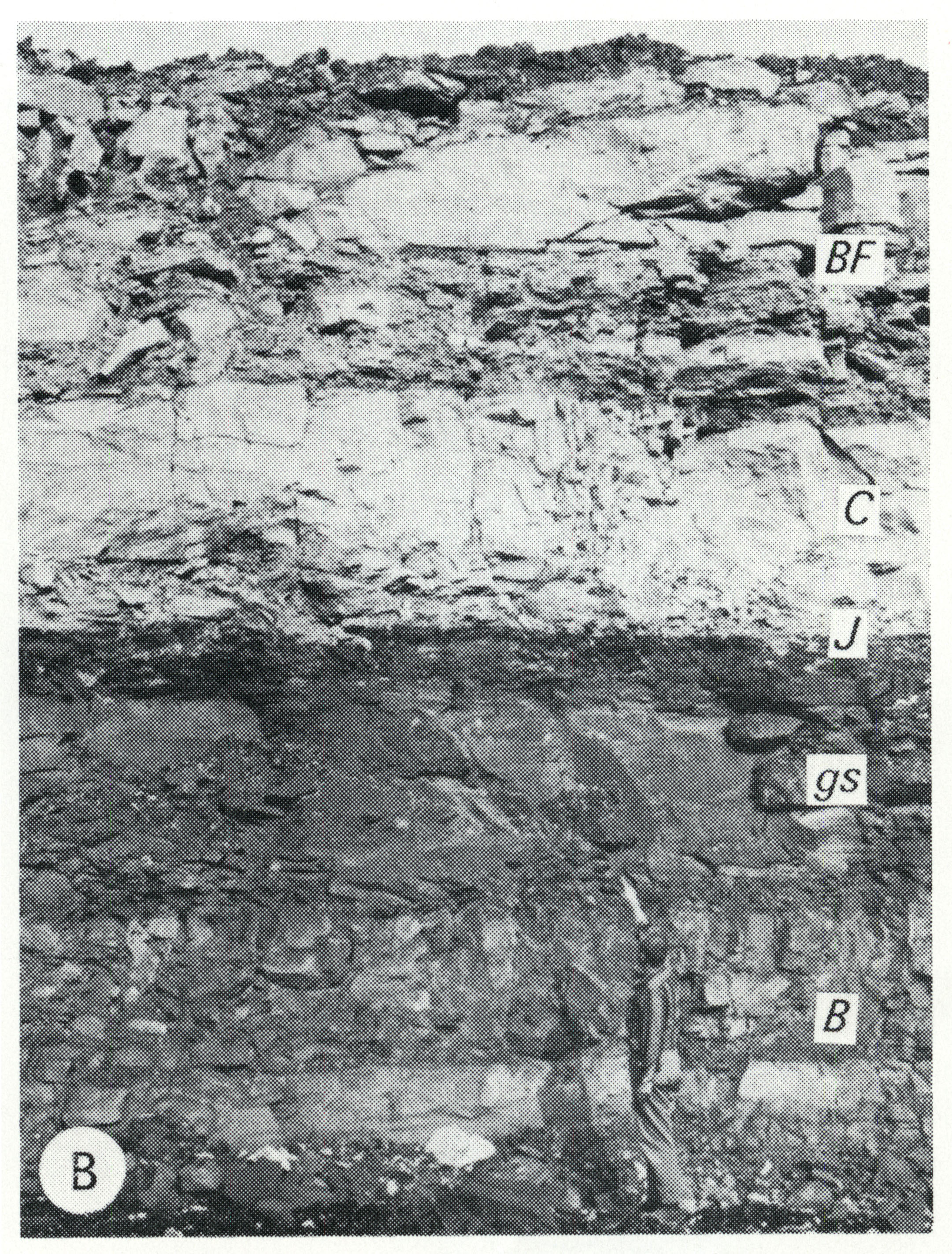 | 2,161 × 2,846 (2.11 MB) | Jennifer.Obrad (talk | contribs) | P-3B -- Strata overlying the Herrin (No. 6) Coal Member of the Carbondale Formation (at the man's feet), including the Bankston Fork Limestone Member (BF), Conant Limestone Member (C), Jamestown Coal Member (J, 1 inch thick), gray calcareous shale (gs)... |
You cannot overwrite this file.
File usage
The following 14 pages use this file:
- Bankston Fork Limestone Member
- Brereton Limestone Member
- Conant Limestone Member
- Jamestown Coal Member
- Pennsylvanian Subsystem
- Help:Images
- Help:Tutorial
- Historical:Bankston Fork Limestone Member
- Historical:Brereton Limestone Member
- Historical:Carbondale Formation
- Historical:Conant Limestone Member
- Historical:Jamestown Coal Member
- Historical:Pennsylvanian Subsystem
- Historical:Pennsylvanian System