File:Figure M-2.jpg
Revision as of 13:04, 4 April 2016 by Alan.Myers (talk | contribs) (Fig. M-2 -- Areal extent of the Mississippian System in Illinois. Thickness is shown where upper Chesterian strata are present.)
Size of this preview: 438 × 599 pixels. Other resolution: 2,234 × 3,054 pixels.
Original file (2,234 × 3,054 pixels, file size: 1.38 MB, MIME type: image/jpeg)
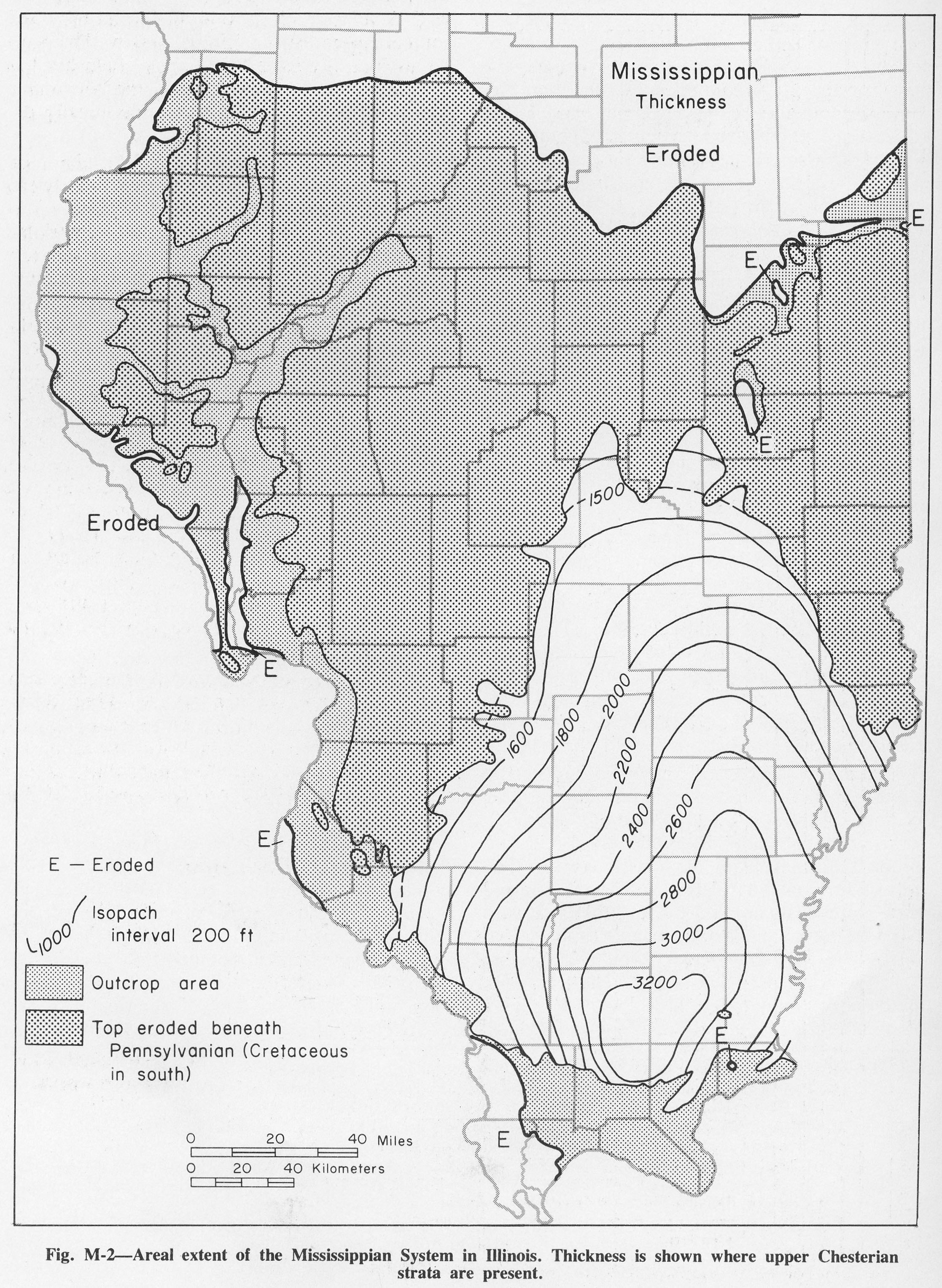
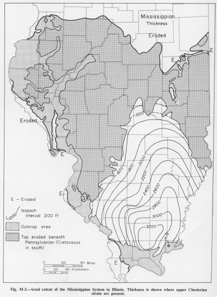
Fig. M-2 -- Areal extent of the Mississippian System in Illinois. Thickness is shown where upper Chesterian strata are present.
File history
Click on a date/time to view the file as it appeared at that time.
| Date/Time | Thumbnail | Dimensions | User | Comment | |
|---|---|---|---|---|---|
| current | ★ Approved revision 13:04, 4 April 2016 | | 2,234 × 3,054 (1.38 MB) | Alan.Myers (talk | contribs) | Fig. M-2 -- Areal extent of the Mississippian System in Illinois. Thickness is shown where upper Chesterian strata are present. |
You cannot overwrite this file.
File usage
The following 2 pages use this file: