File:Figure M-1A.jpg
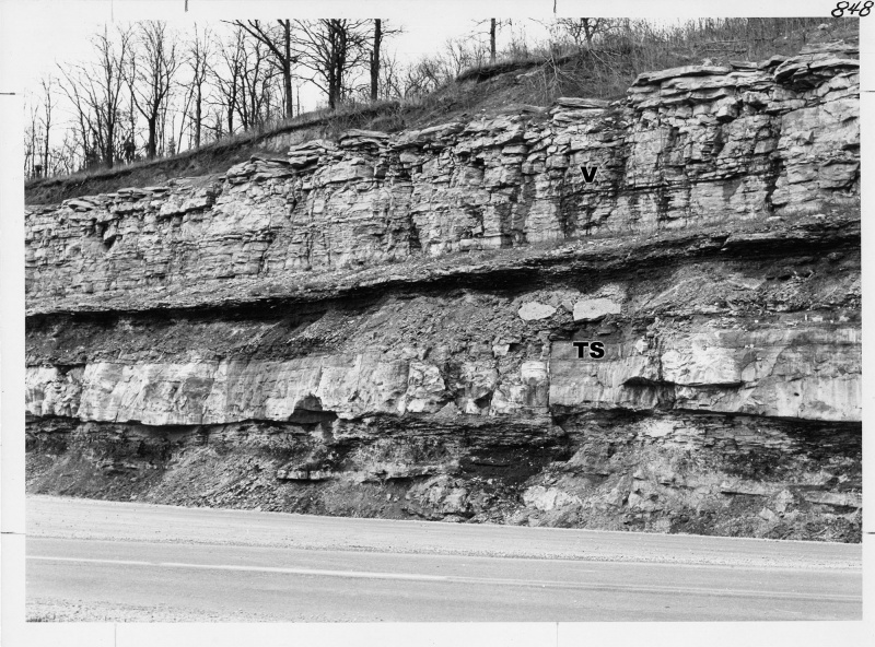
Revision as of 18:44, 4 April 2016 by Alan.Myers (talk | contribs) (Fig. M-1A -- Vienna Limestone overlying the sheet facies of the Tar Springs Sandstone in roadcut (about 40 feet high) of Illinois Highway 3 on southeast side of Chester, Randolph County.)

Size of this preview: 800 × 592 pixels. Other resolution: 2,000 × 1,481 pixels.
Original file (2,000 × 1,481 pixels, file size: 736 KB, MIME type: image/jpeg)
Fig. M-1A -- Vienna Limestone overlying the sheet facies of the Tar Springs Sandstone in roadcut (about 40 feet high) of Illinois Highway 3 on southeast side of Chester, Randolph County.
File history
Click on a date/time to view the file as it appeared at that time.
| Date/Time | Thumbnail | Dimensions | User | Comment | |
|---|---|---|---|---|---|
| current | ★ Approved revision 18:44, 4 April 2016 | | 2,000 × 1,481 (736 KB) | Alan.Myers (talk | contribs) | Fig. M-1A -- Vienna Limestone overlying the sheet facies of the Tar Springs Sandstone in roadcut (about 40 feet high) of Illinois Highway 3 on southeast side of Chester, Randolph County. |
You cannot overwrite this file.
File usage
The following 6 pages use this file: