File:Fig 0870 Photos 002.JPG: Difference between revisions
Jump to navigation
Jump to search
No edit summary |
No edit summary |
||
| Line 1: | Line 1: | ||
{{Image | |||
|File name=Fig 0870 Photos 002.JPG | |||
|Caption=Fig_0870_Photos_002. The Munie Pit in Madison County, Illinois. Pictured are David Grimley (ISGS) left and Gerry Berning (USDA-NRCS, Soil Scientist) on the right, for scale. Sangamon Geosol development is visible in the upper portion of the unit. This area contains fine sand beds, as well as areas with diamicton beds in the upper portion. It was therefore mapped as the mixed facies in some parts of the pit. Photograph by Andrew Philips, 2004. | |||
}} | |||
Latest revision as of 22:06, 15 September 2022
Fig_0870_Photos_002. The Munie Pit in Madison County, Illinois. Pictured are David Grimley (ISGS) left and Gerry Berning (USDA-NRCS, Soil Scientist) on the right, for scale. Sangamon Geosol development is visible in the upper portion of the unit. This area contains fine sand beds, as well as areas with diamicton beds in the upper portion. It was therefore mapped as the mixed facies in some parts of the pit. Photograph by Andrew Philips, 2004.
File history
Click on a date/time to view the file as it appeared at that time.
| Date/Time | Thumbnail | Dimensions | User | Comment | |
|---|---|---|---|---|---|
| current | ★ Approved revision 22:06, 15 September 2022 | 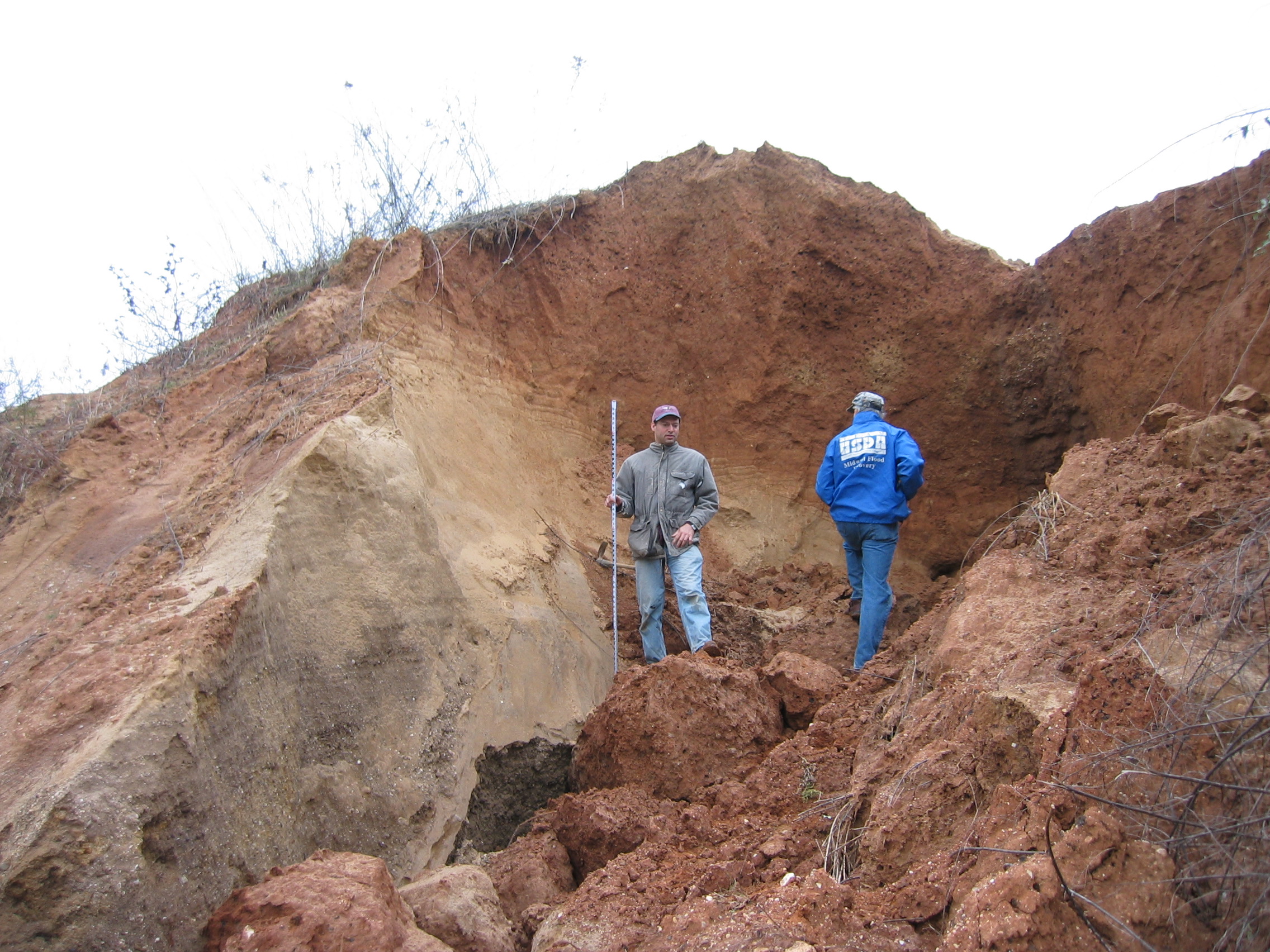 | 2,272 × 1,704 (1.15 MB) | Jennifer.Obrad (talk | contribs) |
You cannot overwrite this file.
File usage
The following page uses this file: