File:C605-Plate 2 - Galatia Channel Xsec Saline Co map.jpg
Revision as of 18:54, 9 July 2020 by Alan.Myers (talk | contribs)
Size of this preview: 441 × 599 pixels. Other resolution: 2,221 × 3,016 pixels.
Original file (2,221 × 3,016 pixels, file size: 607 KB, MIME type: image/jpeg)
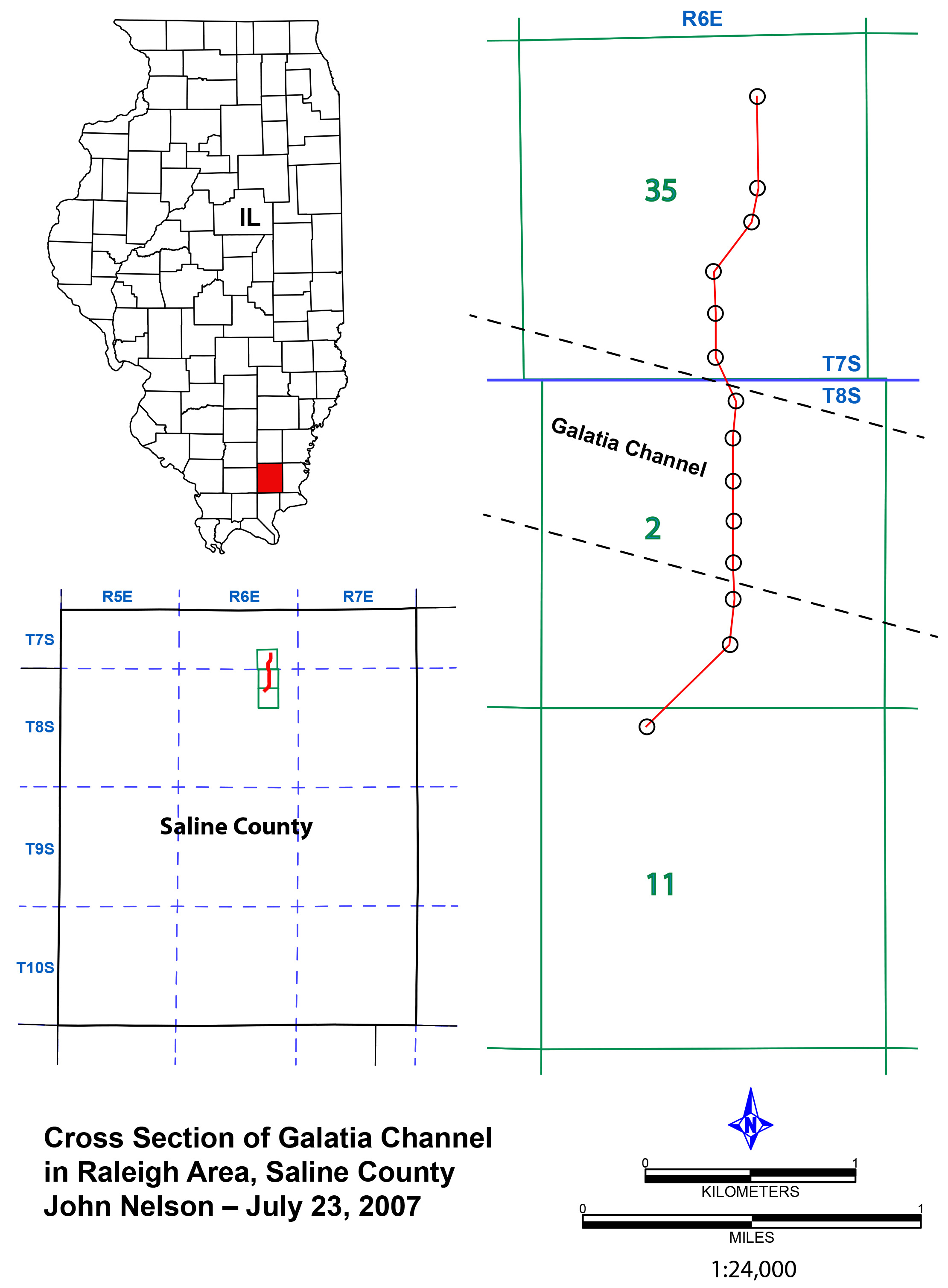
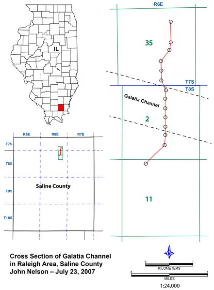
Plate 2 - Map overview Cross section of the Galatia channel near Raleigh in Saline County, Illinois
Download Full Resolution Image: _Salin_ Co_map.pdf HERE
File history
Click on a date/time to view the file as it appeared at that time.
| Date/Time | Thumbnail | Dimensions | User | Comment | |
|---|---|---|---|---|---|
| current | ★ Approved revision 18:35, 9 July 2020 | | 2,221 × 3,016 (607 KB) | Alan.Myers (talk | contribs) |
You cannot overwrite this file.
File usage
The following 3 pages use this file: