File:C605-Plate-01.jpg
Revision as of 20:54, 17 July 2020 by Alan.Myers (talk | contribs) (ILSTRAT uploaded a new version of File:C605-Plate-01.jpg)

Size of this preview: 459 × 599 pixels. Other resolution: 1,761 × 2,300 pixels.
Original file (1,761 × 2,300 pixels, file size: 1.04 MB, MIME type: image/jpeg)
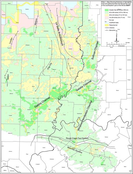
Plate 1 Map of the southeastern part of the Illinois Basin showing the thickness of the Springfield Coal, channels that affect the coal, and major structural features
File history
Click on a date/time to view the file as it appeared at that time.
| Date/Time | Thumbnail | Dimensions | User | Comment | |
|---|---|---|---|---|---|
| current | ★ Approved revision 21:03, 17 July 2020 | | 1,761 × 2,300 (1.04 MB) | Alan.Myers (talk | contribs) | |
| 18:45, 29 June 2020 | 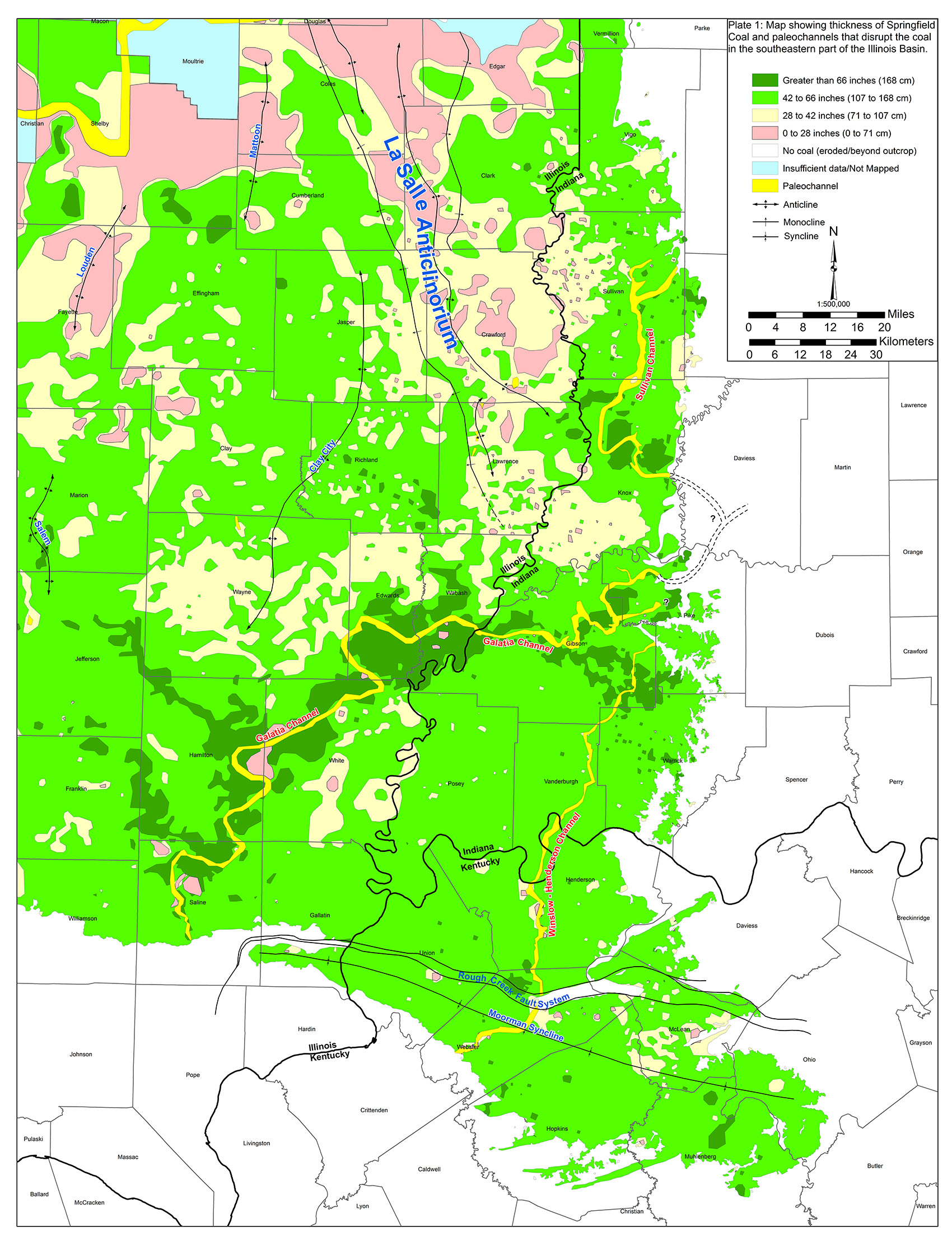 | 1,700 × 2,223 (1.2 MB) | Alan.Myers (talk | contribs) |
You cannot overwrite this file.
File usage
The following 5 pages use this file: