File:C605-Figure-38.jpg
Revision as of 20:11, 10 July 2020 by Alan.Myers (talk | contribs) (ILSTRAT moved page File:C592-Figure-38.jpg to File:C605-Figure-38.jpg: Text replacement - "C592-" to "C605-")
Size of this preview: 306 × 598 pixels. Other resolution: 1,300 × 2,541 pixels.
Original file (1,300 × 2,541 pixels, file size: 523 KB, MIME type: image/jpeg)
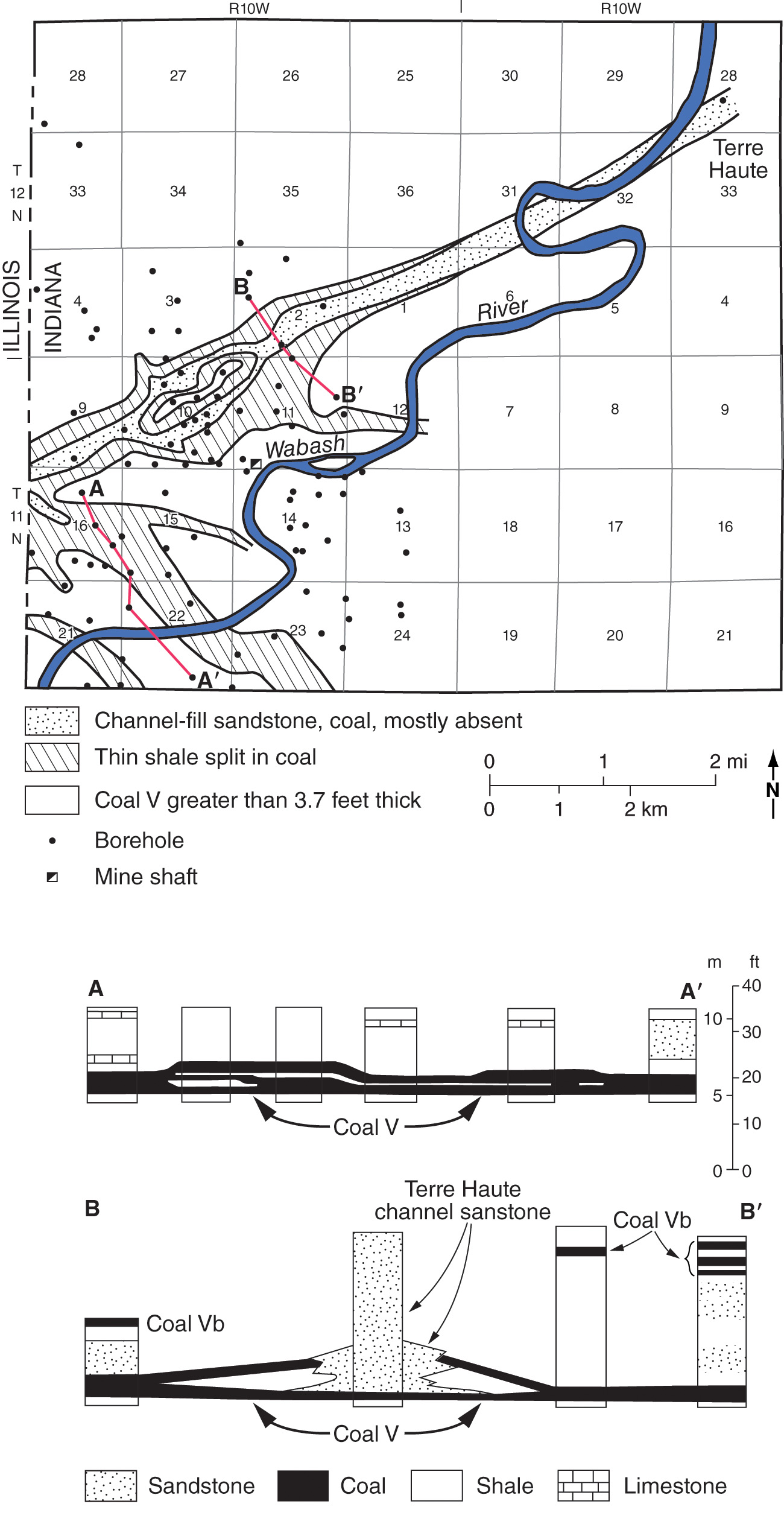
Figure 38 Map of the Illinois Basin showing channels and gray shale wedges affecting the Murphysboro, Colchester, Herrin, Baker, and Danville Coals.
File history
Click on a date/time to view the file as it appeared at that time.
| Date/Time | Thumbnail | Dimensions | User | Comment | |
|---|---|---|---|---|---|
| current | ★ Approved revision 19:41, 10 July 2020 | | 1,300 × 2,541 (523 KB) | Alan.Myers (talk | contribs) |
You cannot overwrite this file.
File usage
The following 3 pages use this file: