File:C605-Figure-38.jpg: Difference between revisions
Jump to navigation
Jump to search
Alan.Myers (talk | contribs) No edit summary |
Alan.Myers (talk | contribs) No edit summary |
||
| (6 intermediate revisions by the same user not shown) | |||
| Line 1: | Line 1: | ||
{{Galatia Channel Image | |||
|File name=C605-Figure-38.jpg | |||
|image_no=Figure 38 | |||
|caption=Map and cross section of the Terre Haute channel. From Friedman (1960)<ref>Friedman, S.A., 1960, Channel-fill sandstones in the Middle Pennsylvanian rocks of Indiana: Indiana Geological Survey, Report of Progress No. 23, 59 p.</ref>. Courtesy of the Indiana Geological and Water Survey. Lines of cross section are shown on the map. | |||
|references=Friedman, S.A., 1960, Channel-fill sandstones in the Middle Pennsylvanian rocks of Indiana: Indiana Geological Survey, Report of Progress No. 23, 59 p. <br> | |||
|page1=Other_Channels_Related_to_the_Galatia_Channel | |||
}} | |||
Latest revision as of 13:53, 23 August 2023
Figure 38 Map and cross section of the Terre Haute channel. From Friedman (1960)[1]. Courtesy of the Indiana Geological and Water Survey. Lines of cross section are shown on the map.
- ↑ Friedman, S.A., 1960, Channel-fill sandstones in the Middle Pennsylvanian rocks of Indiana: Indiana Geological Survey, Report of Progress No. 23, 59 p.
File history
Click on a date/time to view the file as it appeared at that time.
| Date/Time | Thumbnail | Dimensions | User | Comment | |
|---|---|---|---|---|---|
| current | ★ Approved revision 19:41, 10 July 2020 | 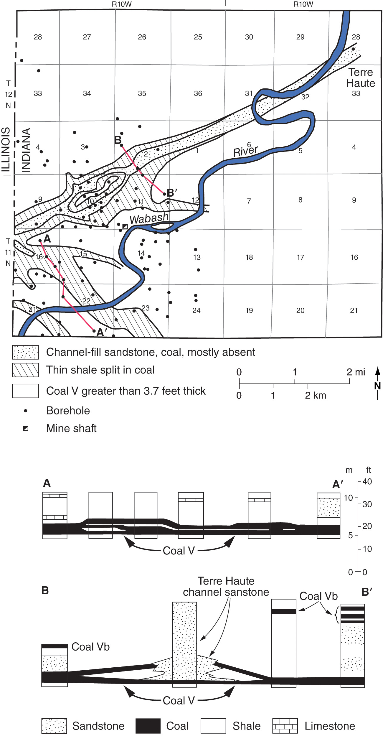 | 1,300 × 2,541 (523 KB) | Alan.Myers (talk | contribs) |
You cannot overwrite this file.
File usage
The following 3 pages use this file: