File:C605-Figure-37.jpg
Original file (1,535 × 1,872 pixels, file size: 579 KB, MIME type: image/jpeg)
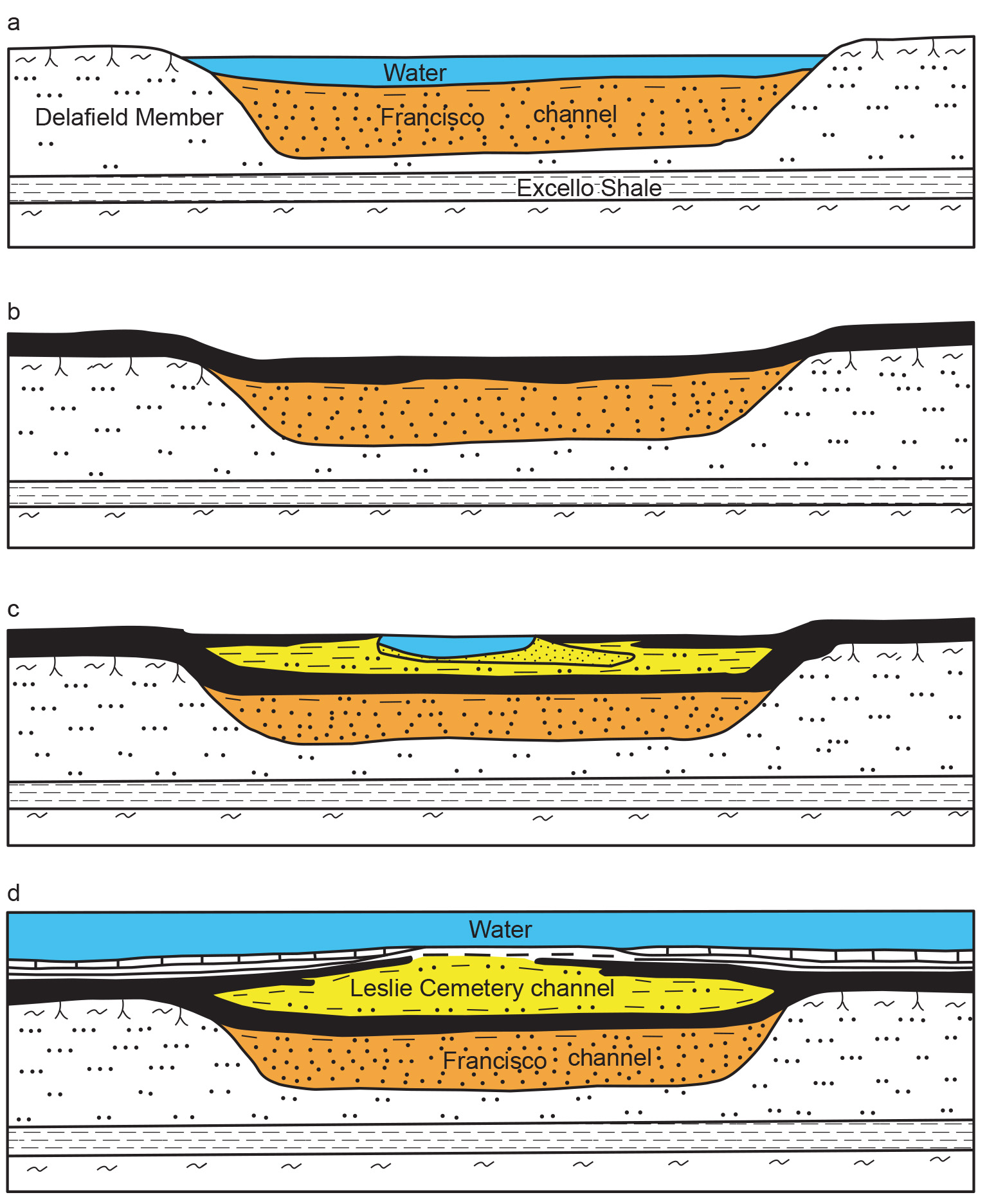
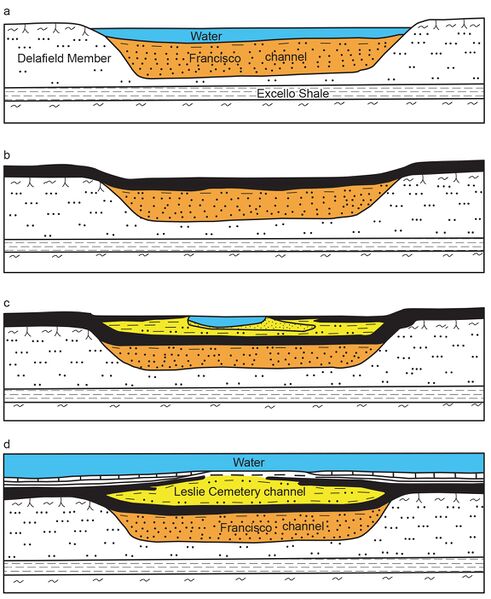
Figure 37 Interpretive diagram showing sequential development of the Leslie Cemetery channel. (a) The Francisco channel is eroded and filled with sediment, largely sand. (b) Springfield peat accumulates in swale left by the abandoned channel. (c) Flowing water reoccupies the channel during the later stages of peat accumulation. Peat encroaches from the margins as the channel migrates laterally. (d) A marine incursion drowns the region and deposits black shale and limestone. Channel filling inverts the topography because of differential compaction.
File history
Click on a date/time to view the file as it appeared at that time.
| Date/Time | Thumbnail | Dimensions | User | Comment | |
|---|---|---|---|---|---|
| current | ★ Approved revision 19:29, 23 August 2023 | | 1,535 × 1,872 (579 KB) | Alan.Myers (talk | contribs) |
You cannot overwrite this file.
File usage
The following 3 pages use this file: