File:C605-Figure-36.jpg: Difference between revisions
Jump to navigation
Jump to search
Alan.Myers (talk | contribs) No edit summary |
Alan.Myers (talk | contribs) m (ILSTRAT moved page File:C592-Figure-36.jpg to File:C605-Figure-36.jpg: Text replacement - "C592-" to "C605-") |
(No difference)
| |
Revision as of 20:11, 10 July 2020
Figure 36 Sketches illustrating opposite margins of the Leslie Cemetery channel, as exposed in surface mines. The southern drawing is from Peabody’s Eby Pit in June 1982. The northern view is from Peabody’s Lynnville Mine in July 1983. Approximate locations are indicated in Figure 27 NOT THE CORRECT FIGURE NO..
File history
Click on a date/time to view the file as it appeared at that time.
| Date/Time | Thumbnail | Dimensions | User | Comment | |
|---|---|---|---|---|---|
| current | ★ Approved revision 19:29, 10 July 2020 | 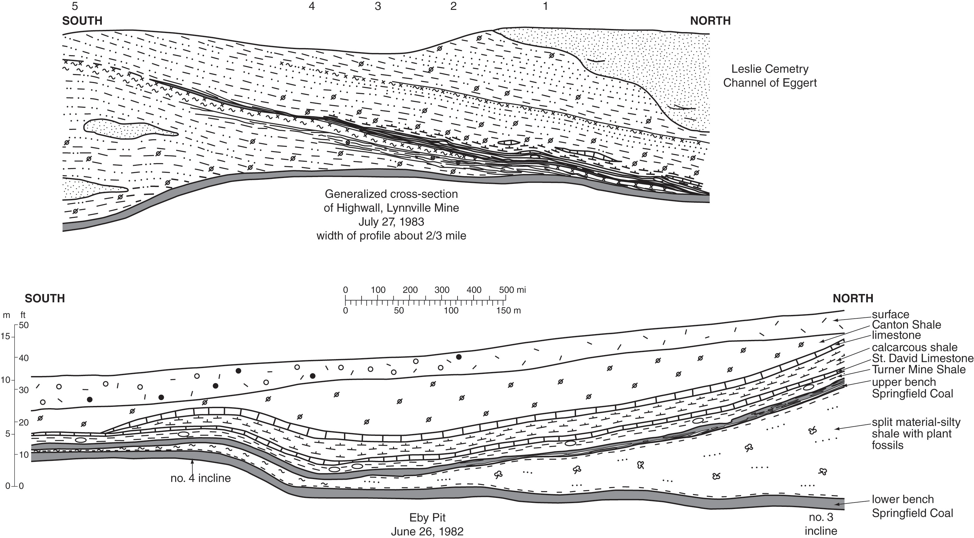 | 3,157 × 1,744 (956 KB) | Alan.Myers (talk | contribs) |
You cannot overwrite this file.
File usage
The following 3 pages use this file: