File:C605-Figure-35.jpg: Difference between revisions
Jump to navigation
Jump to search
Alan.Myers (talk | contribs) No edit summary |
Alan.Myers (talk | contribs) (ILSTRAT uploaded a new version of File:C592-Figure-35.jpg) |
(No difference)
| |
Revision as of 19:27, 10 July 2020
Figure 35 Map of the Leslie Cemetery channel prepared for this study, using information from boreholes and mines. Lines of section for Figure 28 and Plate 6 are shown.
File history
Click on a date/time to view the file as it appeared at that time.
| Date/Time | Thumbnail | Dimensions | User | Comment | |
|---|---|---|---|---|---|
| current | ★ Approved revision 19:27, 10 July 2020 | 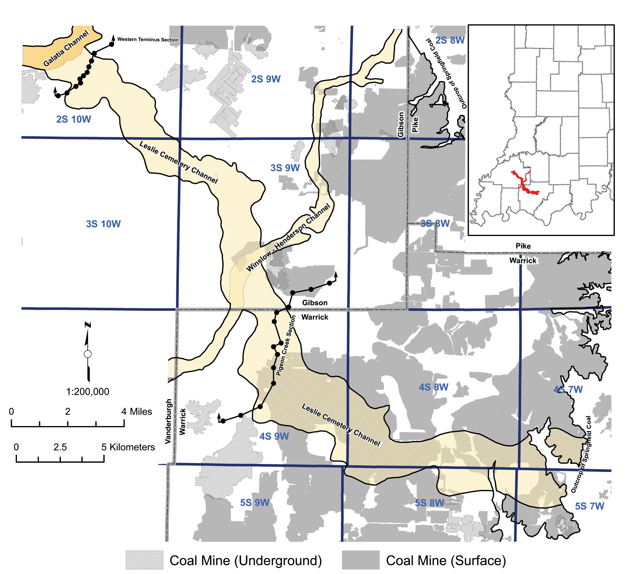 | 2,137 × 1,936 (900 KB) | Alan.Myers (talk | contribs) |
You cannot overwrite this file.
File usage
The following 3 pages use this file: