File:C605-Figure-34.jpg
Revision as of 15:54, 11 July 2020 by Alan.Myers (talk | contribs) (Text replacement - "C592-" to "C605-")

Size of this preview: 800 × 538 pixels. Other resolution: 2,164 × 1,455 pixels.
Original file (2,164 × 1,455 pixels, file size: 543 KB, MIME type: image/jpeg)
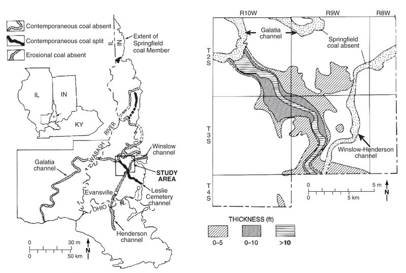
Figure 34 Maps of the Leslie Cemetery channel. From Eggert (1984). (a) Regional map showing the relationship to other channels. (b) Map of the northern part of the Leslie Cemetery channel, with the thickness of the Folsomville Member.
File history
Click on a date/time to view the file as it appeared at that time.
| Date/Time | Thumbnail | Dimensions | User | Comment | |
|---|---|---|---|---|---|
| current | ★ Approved revision 19:24, 10 July 2020 | | 2,164 × 1,455 (543 KB) | Alan.Myers (talk | contribs) |
You cannot overwrite this file.
File usage
The following 3 pages use this file: