File:C605-Figure-25.jpg: Difference between revisions
Jump to navigation
Jump to search
Alan.Myers (talk | contribs) m (ILSTRAT moved page File:C592-Figure-25.jpg to File:C605-Figure-25.jpg: Text replacement - "C592-" to "C605-") |
Alan.Myers (talk | contribs) No edit summary |
||
| Line 2: | Line 2: | ||
|File name=C605-Figure-25.jpg | |File name=C605-Figure-25.jpg | ||
|image_no=Figure 25 | |image_no=Figure 25 | ||
|caption=Map and cross section of the disturbance in the Dering Coal Company No. 2 Mine, Saline County, Illinois. | |caption=Map and cross section of the disturbance in the Dering Coal Company No. 2 Mine, Saline County, Illinois. Redrafted from field sketches by Rolf Roley and G.H. Cady in the ISGS archives. | ||
|page1=Stratigraphy | |page1=Stratigraphy | ||
|page2=Stratigraphy/Dykersburg_(Shale)_Member | |page2=Stratigraphy/Dykersburg_(Shale)_Member | ||
}} | }} | ||
Latest revision as of 15:58, 17 August 2023
Figure 25 Map and cross section of the disturbance in the Dering Coal Company No. 2 Mine, Saline County, Illinois. Redrafted from field sketches by Rolf Roley and G.H. Cady in the ISGS archives.
File history
Click on a date/time to view the file as it appeared at that time.
| Date/Time | Thumbnail | Dimensions | User | Comment | |
|---|---|---|---|---|---|
| current | ★ Approved revision 15:22, 9 July 2020 | 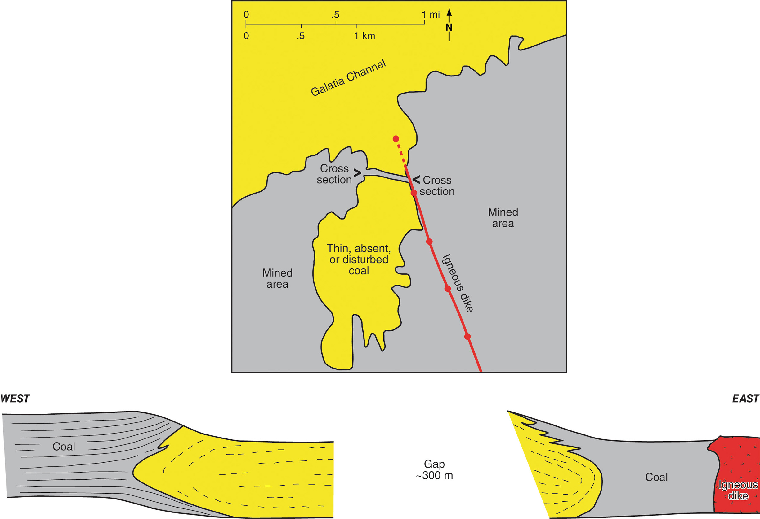 | 2,450 × 1,676 (375 KB) | Alan.Myers (talk | contribs) |
You cannot overwrite this file.
File usage
The following 3 pages use this file: