File:C605-Figure-10.jpg: Difference between revisions
Jump to navigation
Jump to search
Alan.Myers (talk | contribs) No edit summary |
Alan.Myers (talk | contribs) No edit summary |
||
| (6 intermediate revisions by the same user not shown) | |||
| Line 1: | Line 1: | ||
{{Galatia Channel Image | |||
|File name=C605-Figure-10.jpg | |||
|image_no=Figure 10 | |||
|caption=Map showing the thickness and mined areas of the Springfield Coal throughout Illinois. After Treworgy et al. (1999)<ref>Treworgy, C.G., C.P. Korose, C.A. Chenoweth, and D.L. North, 1999, Availability of the Springfield Coal for mining in Illinois: Illinois State Geological Survey, Illinois Minerals 118, 43 p.</ref>. Straight lines separating polygons are artifacts of mapping protocol in original. | |||
|references=Treworgy, C.G., C.P. Korose, C.A. Chenoweth, and D.L. North, 1999, Availability of the Springfield Coal for mining in Illinois: Illinois State Geological Survey, Illinois Minerals 118, 43 p. | |||
|page1=Stratigraphy | |||
|page2=Stratigraphy/Springfield_Coal | |||
}} | |||
Latest revision as of 13:46, 23 August 2023
Figure 10 Map showing the thickness and mined areas of the Springfield Coal throughout Illinois. After Treworgy et al. (1999)[1]. Straight lines separating polygons are artifacts of mapping protocol in original.
- ↑ Treworgy, C.G., C.P. Korose, C.A. Chenoweth, and D.L. North, 1999, Availability of the Springfield Coal for mining in Illinois: Illinois State Geological Survey, Illinois Minerals 118, 43 p.
File history
Click on a date/time to view the file as it appeared at that time.
| Date/Time | Thumbnail | Dimensions | User | Comment | |
|---|---|---|---|---|---|
| current | ★ Approved revision 15:50, 17 August 2023 | 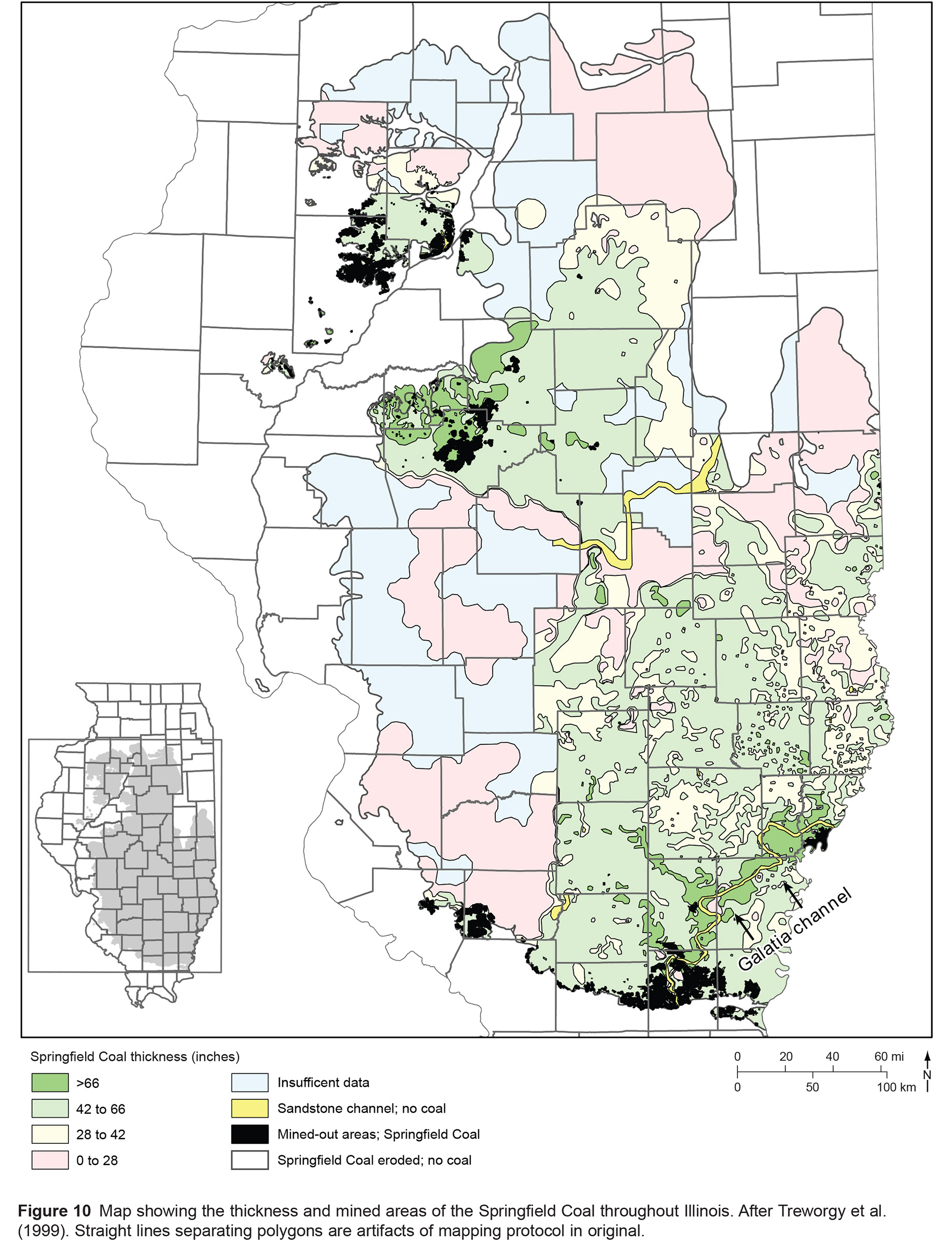 | 1,836 × 2,400 (859 KB) | Alan.Myers (talk | contribs) |
You cannot overwrite this file.
File usage
The following 3 pages use this file: