File:C605-Figure-03.jpg: Difference between revisions
Jump to navigation
Jump to search
Alan.Myers (talk | contribs) No edit summary |
Alan.Myers (talk | contribs) No edit summary |
||
| (One intermediate revision by the same user not shown) | |||
| Line 2: | Line 2: | ||
|File name=C605-Figure-03.jpg | |File name=C605-Figure-03.jpg | ||
|image_no=Figure 3 | |image_no=Figure 3 | ||
|caption=Satellite image of the mouth of the Mississippi River | |caption=Satellite image of the mouth of the Mississippi River showing natural levees and crevasse splays. Fron Earthstar Geographic SIO, © 2020. | ||
|page1=Introduction | |page1=Introduction | ||
}} | }} | ||
Latest revision as of 15:42, 17 August 2023
Figure 3 Satellite image of the mouth of the Mississippi River showing natural levees and crevasse splays. Fron Earthstar Geographic SIO, © 2020.
File history
Click on a date/time to view the file as it appeared at that time.
| Date/Time | Thumbnail | Dimensions | User | Comment | |
|---|---|---|---|---|---|
| current | ★ Approved revision 21:21, 17 July 2020 | 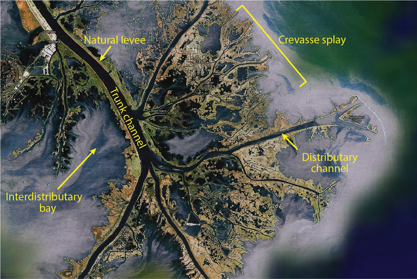 | 1,384 × 926 (1.29 MB) | Alan.Myers (talk | contribs) | |
| 18:42, 29 June 2020 | 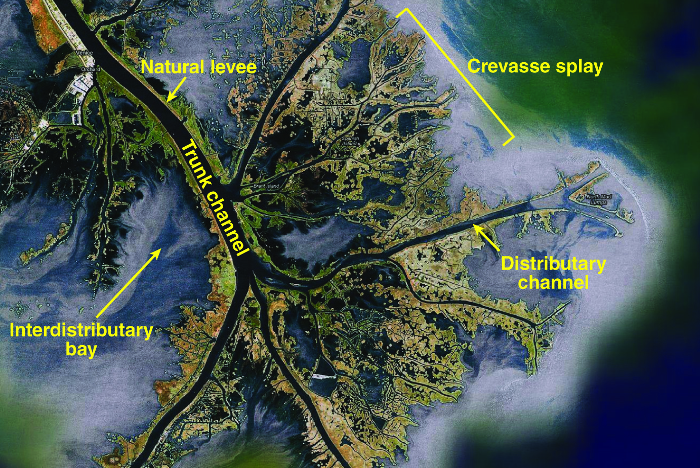 | 1,383 × 925 (1.59 MB) | Alan.Myers (talk | contribs) |
You cannot overwrite this file.
File usage
The following 2 pages use this file: