File:C605-Figure-01.jpg
Revision as of 20:48, 17 July 2020 by Alan.Myers (talk | contribs) (ILSTRAT uploaded a new version of File:C605-Figure-01.jpg)

Size of this preview: 426 × 600 pixels. Other resolution: 1,704 × 2,400 pixels.
Original file (1,704 × 2,400 pixels, file size: 727 KB, MIME type: image/jpeg)
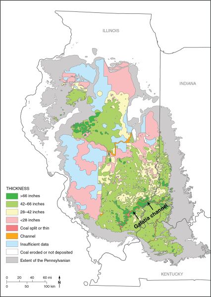
Figure 1 Map of the Illinois Basin, showing the extent of Pennsylvanian rocks, thickness of the Springfield Coal, and channels interrupting the coal. From Finley et al. (2005).
File history
Click on a date/time to view the file as it appeared at that time.
| Date/Time | Thumbnail | Dimensions | User | Comment | |
|---|---|---|---|---|---|
| current | ★ Approved revision 20:59, 17 July 2020 | | 1,704 × 2,400 (727 KB) | Alan.Myers (talk | contribs) |
You cannot overwrite this file.
File usage
The following 3 pages use this file: