File:104-Figure 4a.jpg
Revision as of 15:57, 19 April 2016 by Illex-gron (talk | contribs) (Figure 4a -- Lobe and sublobe boundaries in Illinois during the last glaciation (from Willman and Frye 1970). Locations of the ancient Mississippi and Iowa Rivers added.)
Size of this preview: 312 × 600 pixels. Other resolution: 1,040 × 2,000 pixels.
Original file (1,040 × 2,000 pixels, file size: 271 KB, MIME type: image/jpeg)
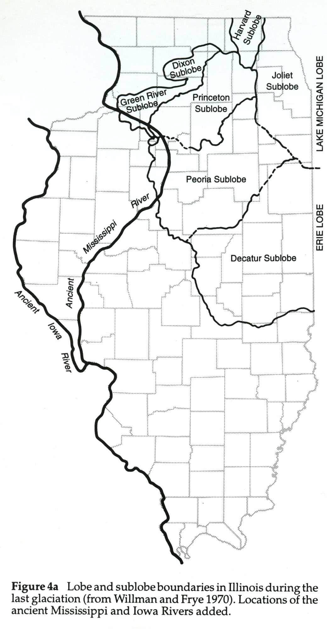
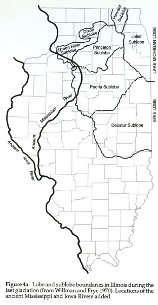
Figure 4a -- Lobe and sublobe boundaries in Illinois during the last glaciation (from Willman and Frye 1970). Locations of the ancient Mississippi and Iowa Rivers added.
File history
Click on a date/time to view the file as it appeared at that time.
| Date/Time | Thumbnail | Dimensions | User | Comment | |
|---|---|---|---|---|---|
| current | ★ Approved revision 15:57, 19 April 2016 | | 1,040 × 2,000 (271 KB) | Illex-gron (talk | contribs) | Figure 4a -- Lobe and sublobe boundaries in Illinois during the last glaciation (from Willman and Frye 1970). Locations of the ancient Mississippi and Iowa Rivers added. |
You cannot overwrite this file.
File usage
The following 8 pages use this file: