File:C605-Figure-47.jpg
Revision as of 16:33, 22 August 2023 by Alan.Myers (talk | contribs)
Size of this preview: 473 × 600 pixels. Other resolution: 2,093 × 2,653 pixels.
Original file (2,093 × 2,653 pixels, file size: 981 KB, MIME type: image/jpeg)
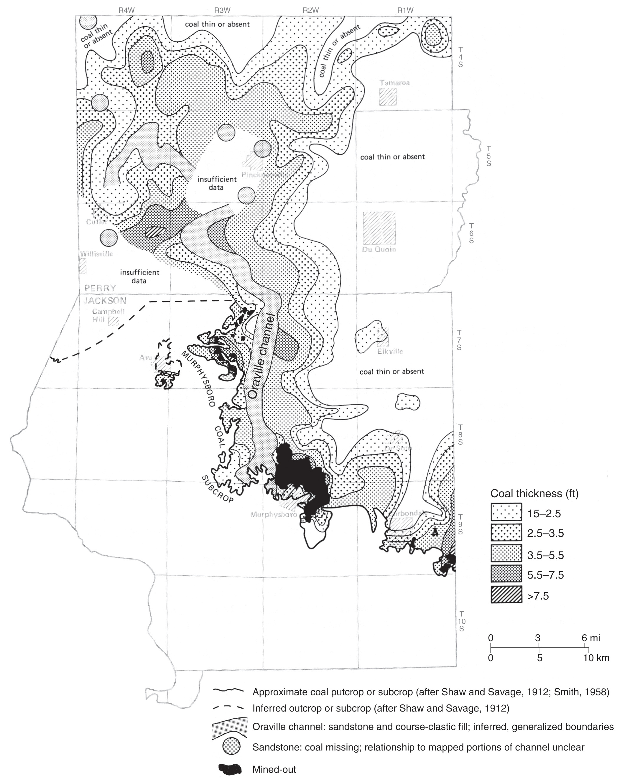
Figure 47 Map showing the thickness of the Murphysboro Coal near the Oraville channel in Jackson and Perry Counties, southwestern Illinois. From Jacobson (1983)[1]
- ↑ Jacobson, R.J., 1983, Murphysboro Coal, Jackson and Perry Counties: Resources with low to medium sulfur potential: Illinois State Geological Survey, Illinois Mineral Notes 85, 19 p.
File history
Click on a date/time to view the file as it appeared at that time.
| Date/Time | Thumbnail | Dimensions | User | Comment | |
|---|---|---|---|---|---|
| current | ★ Approved revision 15:41, 11 July 2020 | | 2,093 × 2,653 (981 KB) | Alan.Myers (talk | contribs) |
You cannot overwrite this file.
File usage
The following 2 pages use this file: