File:Figure Q-1E.jpg
Jump to navigation
Jump to search
Size of this preview: 784 × 599 pixels. Other resolution: 2,000 × 1,529 pixels.
Original file (2,000 × 1,529 pixels, file size: 1.16 MB, MIME type: image/jpeg)
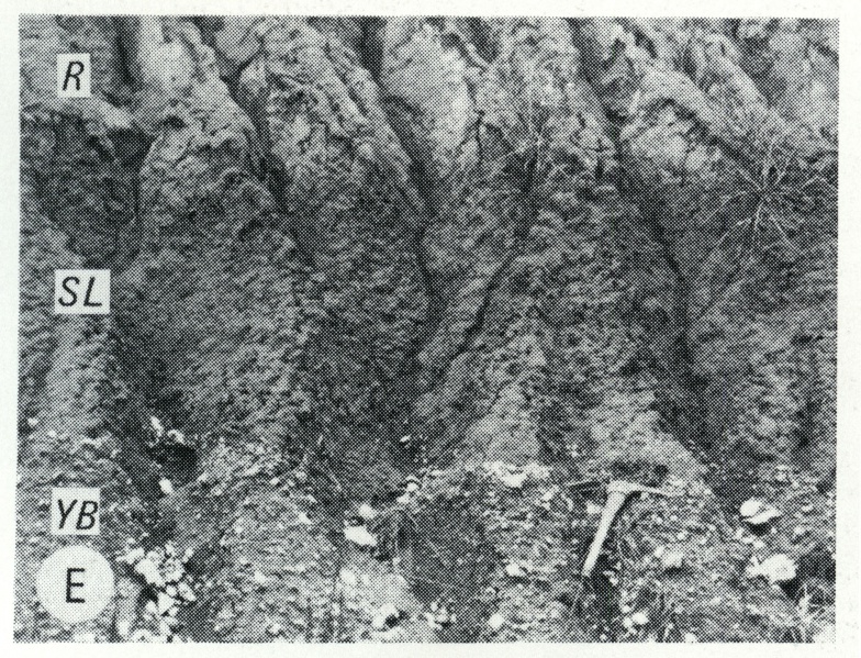
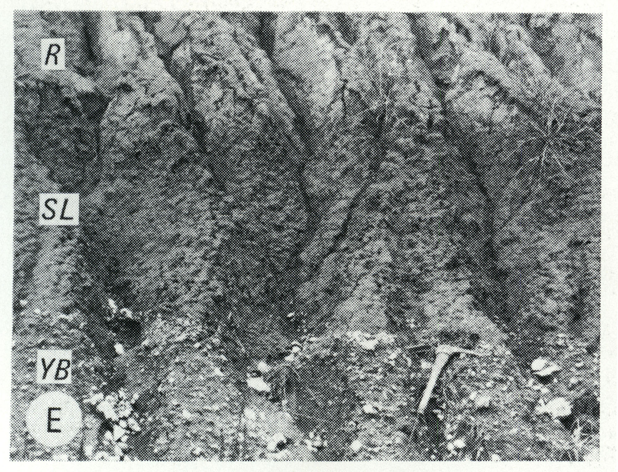
Fig. Q-1E -- Wisconsinan Roxana Silt (R), Sangamon Soil developed in the Illinoian Loveland Silt (SL) and Yarmouth Soil developed in till of the Kansan Banner Formation (YB); in a roadcut at Independence, 5 miles south of Pittsfield, Pike County (Frye et al., 1964, p. 27).
File history
Click on a date/time to view the file as it appeared at that time.
| Date/Time | Thumbnail | Dimensions | User | Comment | |
|---|---|---|---|---|---|
| current | ★ Approved revision 13:11, 5 April 2016 | | 2,000 × 1,529 (1.16 MB) | Alan.Myers (talk | contribs) | Fig. Q-1E -- Wisconsinan Roxana Silt (R), Sangamon Soil developed in the Illinoian Loveland Silt (SL) and Yarmouth Soil developed in till of the Kansan Banner Formation (YB); in a roadcut at Independence, 5 miles south of Pittsfield, Pike County (Frye... |
You cannot overwrite this file.
File usage
The following 2 pages use this file: