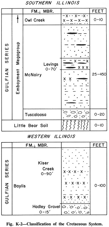
File:Figure K-2 imagemap.jpg
Original file (350 × 730 pixels, file size: 71 KB, MIME type: image/jpeg)
Image used for Cretaceous System imagepage
code for mapping: (remove breaks at the end of the lines)
image: Figure_K-2_imagemap.jpg
rect 38 387 4 45 Gulfian Series
rect 39 691 5 474 Gulfian Series
rect 74 45 341 79 Owl Creek Formation
rect 38 45 74 386 Embayment Megagroup
rect 4 386 343 420 Little_Bear_Soil
rect 74 350 343 385 Tuscaloosa_Formation
rect 142 79 343 349 Levings_Member
rect 75 81 141 350 McNairy_Formation
rect 39 475 117 692 Baylis_Formation
rect 112 474 343 657 Kiser_Creek_Member
rect 114 658 344 689 Hadley_Gravel_Member
File history
Click on a date/time to view the file as it appeared at that time.
| Date/Time | Thumbnail | Dimensions | User | Comment | |
|---|---|---|---|---|---|
| current | ★ Approved revision 19:49, 15 November 2016 | | 350 × 730 (71 KB) | Alan.Myers (talk | contribs) |
You cannot overwrite this file.
File usage
The following 3 pages use this file: