File:Figure Q-1F.jpg
Revision as of 19:04, 22 April 2016 by Alan.Myers (talk | contribs)
Size of this preview: 784 × 599 pixels. Other resolution: 2,000 × 1,529 pixels.
Original file (2,000 × 1,529 pixels, file size: 1.13 MB, MIME type: image/jpeg)
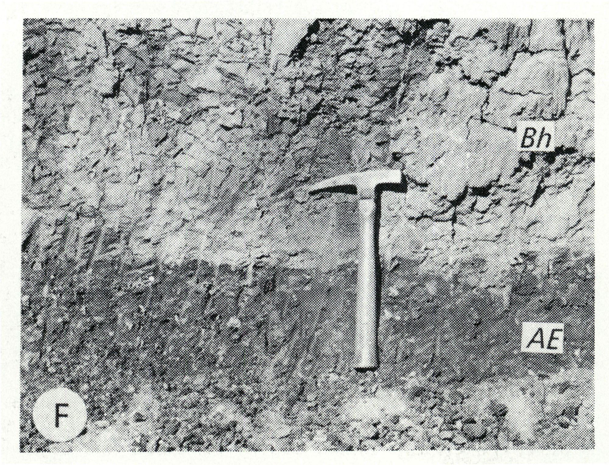
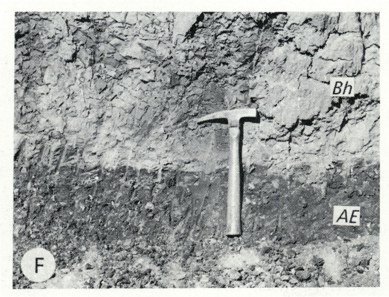
Fig. Q-1F -- Harkness Silt Member of the Kansan Banner Formation (Bh) overlying the Afton Soil developed on gravel of the Nebraskan Enion Formation (AE); in a roadcut at the Zion Church, 2 miles southeast of Marblehead, Adams County (Willman and Frye, 1970, p. 191).
File history
Click on a date/time to view the file as it appeared at that time.
| Date/Time | Thumbnail | Dimensions | User | Comment | |
|---|---|---|---|---|---|
| current | ★ Approved revision 13:12, 5 April 2016 | | 2,000 × 1,529 (1.13 MB) | Alan.Myers (talk | contribs) | Fig. Q-1F -- Harkness Silt Member of the ~ansan Banner Formation (Bh) overlying the Afton Soil developed on gravel of the Nebraskan Enion Formation (AE); in a roadcut at the Zion Church, 2 miles southeast of Marblehead, Adams County (Willman and Frye,... |
You cannot overwrite this file.
File usage
The following 2 pages use this file: